| Home | City Bus | Maps | Villages | Cities | Rail | Tourist Places | School | College | Pin Codes | Corona Cases Count |
| Distance Calculator Bus Services IFSC Codes Trace Mobile Number Weather Search Place Trace IP Available Cash ATM/Banks Locate Polling Booth Report an Error contact People |
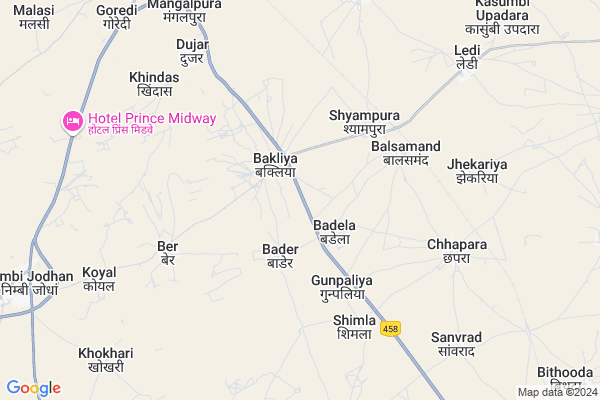
Dholiya Map
EDIT Map
Add Your House
 ..
..
Current Corona Virus Infected Patients Count in Nagaur District
| City Name | District Name | Total Covid cases |
|---|---|---|
| Nagaur District | Nagaur | 113 |
Locality Name :
Dholiya
( धोलिया )
Tehsil Name : Ladnu
District : Nagaur
State : Rajasthan
Division : Ajmer
Language : Marwari and Hindi, English, Urdu Rajasthani
Current Time 08:49 AM
Date: Wednesday , Apr 30,2025 (IST)
Time zone: IST (UTC+5:30)
Elevation / Altitude: 330 meters. Above Seal level
Telephone Code / Std Code: 01581
Assembly constituency : Ladnun assembly constituency
Assembly MLA : Mukesh Bhakar
Lok Sabha constituency : Nagaur parliamentary constituency
Parliament MP : HANUMAN BENIWAL
Serpanch Name :
Pin Code : 341304
Post Office Name : Jaswantgarh
Main Village Name : Dholiya
Commodities Prices : Deedwana(Choti Khatu) Market / Mandi
Dholiya Live Weather
Temperature: 27.6 °C
clear sky
Humidity: 25%
Wind : 6.38 mt/sec towards SE
StationName : "LÄ\u0081dnÅ«n"
observed on 2 Hours Back
Temperature: 27.6 °C
clear sky
Humidity: 25%
Wind : 6.38 mt/sec towards SE
StationName : "LÄ\u0081dnÅ«n"
observed on 2 Hours Back
Dholiya Weather Forecast for Next 5 days
01-05-2025
29.7°C to 41.9°C
clear sky
29.7°C to 41.9°C
clear sky
02-05-2025
27.6°C to 43.9°C
clear sky, overcast clouds, broken clouds, few clouds, light rain
27.6°C to 43.9°C
clear sky, overcast clouds, broken clouds, few clouds, light rain
03-05-2025
30.4°C to 43.3°C
broken clouds, overcast clouds, few clouds
30.4°C to 43.3°C
broken clouds, overcast clouds, few clouds
04-05-2025
27.8°C to 41.3°C
few clouds, scattered clouds, broken clouds, clear sky, overcast clouds
27.8°C to 41.3°C
few clouds, scattered clouds, broken clouds, clear sky, overcast clouds
05-05-2025
27.2°C to 39.3°C
overcast clouds, broken clouds, scattered clouds, light rain
27.2°C to 39.3°C
overcast clouds, broken clouds, scattered clouds, light rain
Edit below overview about Dholiya
Edit below overview about Dholiya
OverView of Dholiya
Dholiya situated near didwana .dholiya also famous for 200years old gad owned by Thakur sabh Padam Singh ji also famous for temples inside it we can view near by village from it .it is best example of modern forts.Dholiya village pound is beautiful as zenith. Alongside dholiya have beautiful ground .Edit below overview about Dholiya
About Dholiya
Dholiya is a small Village/hamlet in Ladnu Tehsil in Nagaur District of Rajasthan State, India. It comes under Dholiya Panchayath. It belongs to Ajmer Division . It is located 93 KM towards East from District head quarters Nagaur. 180 KM from State capital Jaipur
Dholiya Pin code is 341304 and postal head office is Jaswantgarh .
Dholiya is surrounded by Sujangarh Tehsil towards North , Didwana Tehsil towards South , Jayal Tehsil towards South , Makrana Tehsil towards South .
Ladnu , Sujangarh , Losal , Rajaldesar are the near by Cities to Dholiya.
This Place is in the border of the Nagaur District and Churu District. Churu District Sujangarh is North towards this place .
Dholiya 2011 Census Details
Dholiya Local Language is Marwari. Dholiya Village Total population is 3122 and number of houses are 553. Female Population is 48.7%. Village literacy rate is 59.4% and the Female Literacy rate is 21.2%.
Population
| Census Parameter | Census Data |
| Total Population | 3122 |
| Total No of Houses | 553 |
| Female Population % | 48.7 % ( 1519) |
| Total Literacy rate % | 59.4 % ( 1853) |
| Female Literacy rate | 21.2 % ( 661) |
| Scheduled Tribes Population % | 0.0 % ( 0) |
| Scheduled Caste Population % | 16.7 % ( 522) |
| Working Population % | 51.4 % |
| Child(0 -6) Population by 2011 | 398 |
| Girl Child(0 -6) Population % by 2011 | 45.0 % ( 179) |
Dholiya Census More Deatils.
Politics in Dholiya
Rashtriya Loktantrik Party , BJP , INC are the major political parties in this area.Polling Stations /Booths near Dholiya
1)Govt.higher Secondary School ( East Part) Rodu2)Govt.higher Secondary School ( Noth Part) Kasumbi Alipur
3)Govt.upper Primary School Asalsar
4)Govt.upper Primary School Titri
5)Govt. Upper Primary School Khichiya Basani
HOW TO REACH Dholiya
By Rail
Sanvrad Rail Way Station , Ladnun Rail Way Station are the very nearby railway stations to Dholiya.Colleges near Dholiya
Marudhar Industrial Training Centre Jayal [itc]
Address :
Govt Collage Jayal
Address :
Marwar College Parbatsar
Address :
Tagor Collage
Address :
Shree Pooja College Nagaur
Address :
Schools in Dholiya
Sarda Bal Vidya Mandir Ups
Address : dholiya , ladnun , nagaur , Rajasthan . PIN- 341304 , Post - Jaswantgarh
Gups Dholiya
Address : dholiya , ladnun , nagaur , Rajasthan . PIN- 341304 , Post - Jaswantgarh
Govt Health Centers near Dholiya
1) CHANDRAI , , Chandrai , CHANDRAI2) Lukas , , Lukas , Lukas
3) Nimbijodha , , Nimbijodha , Nimbijodha
Sub Villages in Dholiya
Petrol Bunks in Dholiya,Ladnu
HP PETROL PUMP - VEER TEJA HIGHWAY CENTRE
Nimbi Ladnu Rd;nimbi Nh-65;teh-ladnu; Rajasthan 341316; India
9.8 KM distance Detail
Hindustan Petroleum
Ladnu; Nagaur; NH-65; Nagaur Road; Ladnun; Ladnun; Rajasthan 341303; India
9.8 KM distance Detail
more ..
Colleges in Dholiya,Ladnu
Mega Industrial Training Institute; Badela
Didwana-Ladnun Rd; Rajasthan 341304; India
2.0 KM distance Detail
Sh.Bapuji College of Nursing
Dayanand Colony; Ladnun; Rajasthan 341306; India
10.4 KM distance Detail
more ..
Local Parks in Dholiya,Ladnu
Amar Shaheed Shri Dalip Singh Memorial Park; Dabri
Dabri; Rajasthan 341304; India
8.6 KM distance Detail
Amar Sahid Shree Shishupal Singh Memorial; Dabri
Dabri; Rajasthan 341304; India
8.6 KM distance Detail
Mangal Garden - Mangalchand Gaggar Foundation
Nagaur; Rajasthan 341304; India
12.2 KM distance Detail
About Dholiya &
History
How to reach Dholiya
Tourist Places Near By Dholiya
Schools in Dholiya
Colleges in Dholiya
Temperature & weather of Dholiya
places in Dholiya
Dholiya photos
More Information
How to reach Dholiya
Tourist Places Near By Dholiya
Schools in Dholiya
Colleges in Dholiya
Temperature & weather of Dholiya
places in Dholiya
Dholiya photos
More Information
Village Talk
Post News or Events about this Village
Near Cities
Ladnu 11 KM near
Sujangarh 18 KM near
Losal 56 KM near
Rajaldesar 58 KM near
Ladnu 11 KM near
Sujangarh 18 KM near
Losal 56 KM near
Rajaldesar 58 KM near
Near By Taluks
Ladnu 0 KM near
Sujangarh 24 KM near
Didwana 33 KM near
Jayal 57 KM near
Ladnu 0 KM near
Sujangarh 24 KM near
Didwana 33 KM near
Jayal 57 KM near
Near By Air Ports
Sanganeer Airport 176 KM near
Jodhpur Airport 223 KM near
Surat Gujarat Airport 224 KM near
Indira Gandhi International Airport 317 KM near
Sanganeer Airport 176 KM near
Jodhpur Airport 223 KM near
Surat Gujarat Airport 224 KM near
Indira Gandhi International Airport 317 KM near
Near By Tourist Places
Tal Chhapar Sanctuary 29 KM near
Kuchaman 69 KM near
Sikar 78 KM near
Nawalgarh 98 KM near
Mandawa 99 KM near
Tal Chhapar Sanctuary 29 KM near
Kuchaman 69 KM near
Sikar 78 KM near
Nawalgarh 98 KM near
Mandawa 99 KM near
Near By Districts
Sikar 79 KM near
Nagaur 90 KM near
Churu 109 KM near
Jhunjhunu 127 KM near
Sikar 79 KM near
Nagaur 90 KM near
Churu 109 KM near
Jhunjhunu 127 KM near
Near By RailWay Station
Ladnun Rail Way Station 11 KM near
Sujangarh Rail Way Station 18 KM near
Ladnun Rail Way Station 11 KM near
Sujangarh Rail Way Station 18 KM near