| Home | City Bus | Maps | Villages | Cities | Rail | Tourist Places | School | College | Pin Codes | Corona Cases Count |
| Distance Calculator Bus Services IFSC Codes Trace Mobile Number Weather Search Place Trace IP Available Cash ATM/Banks Locate Polling Booth Report an Error contact People |
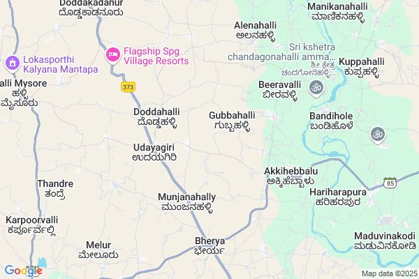
Matadakaval
Matadakaval Map
EDIT Map
Add Your House
 ..
..
Current Corona Virus Infected Patients Count in Mysore District
| City Name | District Name | Total Covid cases |
|---|---|---|
| Mysuru District | Mysuru | 45 |
| Nanjangud | Mysuru | 25 |
| Nanjanagudu | Mysuru | 15 |
| Nanjangudu | Mysuru | 1 |
| Mysuru | Mysuru | 1 |
Locality Name :
Matadakaval
( ಮಾತಡಕಾವಲ್ )
Taluk Name : Krishnarajanagara
District : Mysore
State : Karnataka
Division : Mysore
Language : Kannada and English
Current Time 11:36 AM
Date: Wednesday , Apr 30,2025 (IST)
Time zone: IST (UTC+5:30)
Elevation / Altitude: 788 meters. Above Seal level
Telephone Code / Std Code: 08223
Assembly constituency : Krishnarajanagara assembly constituency
Assembly MLA : Ravishankar.D.
Lok Sabha constituency : Mandya parliamentary constituency
Parliament MP : SUMALATHA AMBAREESH
Serpanch Name :
Pin Code : 571601
Post Office Name : Hampapura (K R Nagar)
Main Village Name : Matadakaval
Commodities Prices : K.R. Pet Market / Mandi
National Highways Reachable To Matadakaval
Nationa High Way :NH150A;NH275
Nationa High Way :NH275
Nationa High Way :NH150A;NH275
Nationa High Way :NH275
Rivers Near Matadakaval
Lakshmanatirtha :ಲಕ್ಷ್ಮಣತೀರ್ತ್ಹ
Kaveri :ಕಾವೇರಿ
Lakshmanatirtha :ಲಕ್ಷ್ಮಣತೀರ್ತ್ಹ
Kaveri :ಕಾವೇರಿ
About Matadakaval
Correct below Info and add more info about MatadakavalMatadakaval is a small Village/hamlet in Krishnarajanagara Taluk in Mysore District of Karnataka State, India. It comes under Matadakaval Panchayath. It belongs to Mysore Division . It is located 56 KM towards North from District head quarters Mysore. 13 KM from Krishnarajanagara. 163 KM from State capital Bangalore
Matadakaval Pin code is 571601 and postal head office is Hampapura (K R Nagar) .
Hosaagrahara ( 10 KM ) , Narachanahally ( 11 KM ) , Ankanahally ( 12 KM ) , Mirle ( 13 KM ) , Beechanahalli ( 13 KM ) are the nearby Villages to Matadakaval. Matadakaval is surrounded by Krishnarajpet Taluk towards East , Holenarsipur Taluk towards North , Arkalgud Taluk towards west , Pandavapura Taluk towards East .
Shrirangapattana , Mysore , Hassan , Mandya are the near by Cities to Matadakaval.
Matadakaval 2011 Census Details
Matadakaval Local Language is Kannada. Matadakaval Village Total population is and number of houses are . Female Population is -1.0%. Village literacy rate is -1.0% and the Female Literacy rate is -1.0%.
Population
| Census Parameter | Census Data |
| Total Population | |
| Total No of Houses | |
| Female Population % | -1.0 % ( ) |
| Total Literacy rate % | -1.0 % ( ) |
| Female Literacy rate | -1.0 % ( ) |
| Scheduled Tribes Population % | -1.0 % ( ) |
| Scheduled Caste Population % | -1.0 % ( ) |
| Working Population % | -1.0 % |
| Child(0 -6) Population by 2011 | |
| Girl Child(0 -6) Population % by 2011 | -1.0 % ( ) |
Matadakaval Census More Deatils.
Politics in Matadakaval
Independent , JD(S) , Janata Dal (Secular) (JD(S)) , INC are the major political parties in this area.Polling Stations /Booths near Matadakaval
1)Govt Higher Primary School Mudiguppe2)Govt Higher Primary School (room No-1) Thandre
3)Govt Higher Primary School Sheegavalu
4)Govt Lower Primary School (room No-2) Kalammana Koppalu
5)Govt Higher Primary School Maluganahalli
HOW TO REACH Matadakaval
By Rail
Akkihebbalu Rail Way Station , Hosa Agrahara Rail Way Station are the very nearby railway stations to Matadakaval. Krishnarajanagara Rail Way Station (near to Krishnarajanagara) , Hampapura Rail Way Station (near to Krishnarajanagara) are the Rail way stations reachable from near by towns.By Road
Krishnarajanagara are the nearby by towns to Matadakaval having road connectivity to MatadakavalColleges near Matadakaval
Govt.pu Collage Hanasoge
Address : Hanasoge
Govt.pu College Hebbalu
Address : Govt Pu College Hebbalu
Sree Nataraja Residential First Grade College
Address : Sree Hosa Mutt, Shankar Mutt Road, Lakshmipuram, M
Sri Jagadamba Pptt College
Address : Ns Rd, Lakshmipuram, Mysore - 570004
Vijaya E College
Address : Sree Hosa Mutt, Shankar Mutt Rd, Lakshmipuram, Mys
Schools near Matadakaval
Sri Morarjidesai Residentional
Address : saligrama , k.r.nagara , mysore , Karnataka . PIN- 571604 , Post - Saligrama (Mysore)
Sri Morarji Desai Res School Bherya
Address : bherya , k.r.nagara , mysore , Karnataka . PIN- 571601 , Post - Hampapura (K R Nagar)
Kgbv
Address : k r nagar-ward-17 , k.r.nagara , mysore , Karnataka . PIN- 571602 , Post - Krishna Raja Nagar
Sara Edu Cation Trust Saligrama
Address : saligrama , k.r.nagara , mysore , Karnataka . PIN- 571604 , Post - Saligrama (Mysore)
Govt Health Centers near Matadakaval
1) Biravalli , panchayathi Building , near school ,2) Juttnally , JUNIOR HEALTH ASSISTANT FEMALE , ,
3) Sanaba , , Sanaba village, Chinakurali Post ,
Sub Villages in Matadakaval
Petrol Bunks in Matadakaval,Krishnarajanagara
HP PETROL PUMP - SRI JAYALAKSHMI SS
HPC Dealer Jenjer NO 872&915;bheriya Village Hosaagrahara Hobli;k R Nagar Taluk;; Bengaluru; Karnataka 571602; India
6.0 KM distance Detail
Sai Jayalakshmi Service Station Hinduastan Petroleum
Bherya; Mysore; SH-57; Mysore Road; Mysore; Mysore; Karnataka 571617; India
6.0 KM distance Detail
more ..
Colleges in Matadakaval,Krishnarajanagara
Doddahalli Govt Junior College
Mysore Rd; Doddahalli; Karnataka 573210; India
3.5 KM distance Detail
Government Pre University College
Doddahally; Doddalli; Mysore; SH-57; Mysore Road; HN Pur; HN Pur; Karnataka 571617; India
3.5 KM distance Detail
Government Pre University College
Mysore; SH-85; Saligrama Bherya Road; Mysore; Mysore; Karnataka 571608; India
6.8 KM distance Detail
more ..
Schools in Matadakaval,Krishnarajanagara
Shanthi Nikethana Vidya Samsthe
Krishnarajanagar; Mysuru District; Munjanahalli; Karnataka 571601; India
1.9 KM distance Detail
Local Parks in Matadakaval,Krishnarajanagara
K T Ramachandra Thota
Bheyera Main Road; Near Gohalli; Kallahalli; Karnataka 573210; India
10.2 KM distance Detail
Governement Offices near Matadakaval,Krishnarajanagara
Revenue Department
Hosa Agrahara; Hosaagrahara; Mysore; SH-57; Mysore Road; Mysore; Mysore; Karnataka 571617; India
10.7 KM distance Detail
Irrigation Department Office
Dodda Kadanur; Mysore; SH-57; Mysore Road; HN Pur; HN Pur; Karnataka 575211; India
11.4 KM distance Detail
About Matadakaval &
History
How to reach Matadakaval
Tourist Places Near By Matadakaval
Schools in Matadakaval
Colleges in Matadakaval
Temperature & weather of Matadakaval
places in Matadakaval
Matadakaval photos
More Information
How to reach Matadakaval
Tourist Places Near By Matadakaval
Schools in Matadakaval
Colleges in Matadakaval
Temperature & weather of Matadakaval
places in Matadakaval
Matadakaval photos
More Information
Village Talk
Post News or Events about this Village
Near Cities
Shrirangapattana 49 KM near
Mysore 54 KM near
Hassan 59 KM near
Mandya 68 KM near
Shrirangapattana 49 KM near
Mysore 54 KM near
Hassan 59 KM near
Mandya 68 KM near
Near By Taluks
Krishnarajanagara 13 KM near
Krishnarajpet 16 KM near
Holenarsipur 19 KM near
Arkalgud 36 KM near
Krishnarajanagara 13 KM near
Krishnarajpet 16 KM near
Holenarsipur 19 KM near
Arkalgud 36 KM near
Near By Air Ports
Mysore Airport 55 KM near
Bengaluru International Airport 178 KM near
Bajpe Airport 181 KM near
Calicut Airport 193 KM near
Mysore Airport 55 KM near
Bengaluru International Airport 178 KM near
Bajpe Airport 181 KM near
Calicut Airport 193 KM near
Near By Tourist Places
Sravanabelagola 31 KM near
Srirangapatna 51 KM near
Hassan 54 KM near
Mysore 55 KM near
Dubare 61 KM near
Sravanabelagola 31 KM near
Srirangapatna 51 KM near
Hassan 54 KM near
Mysore 55 KM near
Dubare 61 KM near
Near By Districts
Hassan 54 KM near
Mysore 54 KM near
Mandya 68 KM near
Kodagu 79 KM near
Hassan 54 KM near
Mysore 54 KM near
Mandya 68 KM near
Kodagu 79 KM near
Near By RailWay Station
Akkihebbalu Rail Way Station 4.0 KM near
Hosa Agrahara Rail Way Station 9.2 KM near
Birahalli Rail Way Station 9.3 KM near
Hole Narsipur Rail Way Station 22 KM near
Krishnarajanagara Rail Way Station 24 KM near
Akkihebbalu Rail Way Station 4.0 KM near
Hosa Agrahara Rail Way Station 9.2 KM near
Birahalli Rail Way Station 9.3 KM near
Hole Narsipur Rail Way Station 22 KM near
Krishnarajanagara Rail Way Station 24 KM near