| Home | City Bus | Maps | Villages | Cities | Rail | Tourist Places | School | College | Pin Codes | Corona Cases Count |
| Distance Calculator Bus Services IFSC Codes Trace Mobile Number Weather Search Place Trace IP Available Cash ATM/Banks Locate Polling Booth Report an Error contact People |
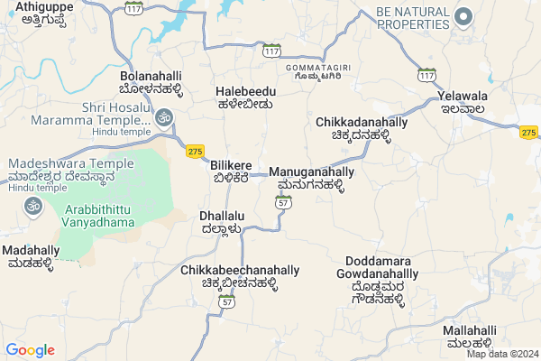
Bilikerekaval Map
EDIT Map
Add Your House
 ..
..
Current Corona Virus Infected Patients Count in Mysore District
| City Name | District Name | Total Covid cases |
|---|---|---|
| Mysuru District | Mysuru | 45 |
| Nanjangud | Mysuru | 25 |
| Nanjanagudu | Mysuru | 15 |
| Nanjangudu | Mysuru | 1 |
| Mysuru | Mysuru | 1 |
Locality Name :
Bilikerekaval
( ಬಿಳಿಕೆರೆಕಾವಲ್ )
Taluk Name : Hunsur
District : Mysore
State : Karnataka
Division : Mysore
Language : Kannada and English
Current Time 08:24 AM
Date: Wednesday , Apr 30,2025 (IST)
Time zone: IST (UTC+5:30)
Elevation / Altitude: 788 meters. Above Seal level
Telephone Code / Std Code: 08222
Assembly constituency : Hunsur assembly constituency
Assembly MLA : G.D. Harish Gowda
Lok Sabha constituency : Mysore parliamentary constituency
Parliament MP : PRATHAP SIMHA
Serpanch Name :
Pin Code : 571103
Post Office Name : Bilikere
Main Village Name : Bilikerekaval
Commodities Prices : K.R.Nagar Market / Mandi
National Highways Reachable To Bilikerekaval
Nationa High Way :NH766;NH150A
Nationa High Way :NH150A;NH275
Nationa High Way :NH766;NH150A
Nationa High Way :NH150A;NH275
Rivers Near Bilikerekaval
Kaveri :ಕಾವೇರಿ
Kaveri :ಕಾವೇರಿ
Kaveri :ಕಾವೇರಿ
Kaveri :ಕಾವೇರಿ
About Bilikerekaval
Correct below Info and add more info about BilikerekavalBilikerekaval is a small Village/hamlet in Hunsur Taluk in Mysore District of Karnataka State, India. It comes under Bilikerekaval Panchayath. It belongs to Mysore Division . It is located 23 KM towards west from District head quarters Mysore. 18 KM from Hunsur. 165 KM from State capital Bangalore
Bilikerekaval Pin code is 571103 and postal head office is Bilikere .
Halebeedu ( 4 KM ) , Doddamaragowdanahalli ( 6 KM ) , Bolanahalli ( 7 KM ) , Nagawala ( 7 KM ) , Gagenahalli ( 7 KM ) are the nearby Villages to Bilikerekaval. Bilikerekaval is surrounded by Mysore Taluk towards East , Krishnarajanagara Taluk towards North , Pandavapura Taluk towards North , Shrirangapattana Taluk towards East .
Mysore , Shrirangapattana , Nanjangud , Mandya are the near by Cities to Bilikerekaval.
Bilikerekaval 2011 Census Details
Bilikerekaval Local Language is Kannada. Bilikerekaval Village Total population is and number of houses are . Female Population is -1.0%. Village literacy rate is -1.0% and the Female Literacy rate is -1.0%.
Population
| Census Parameter | Census Data |
| Total Population | |
| Total No of Houses | |
| Female Population % | -1.0 % ( ) |
| Total Literacy rate % | -1.0 % ( ) |
| Female Literacy rate | -1.0 % ( ) |
| Scheduled Tribes Population % | -1.0 % ( ) |
| Scheduled Caste Population % | -1.0 % ( ) |
| Working Population % | -1.0 % |
| Child(0 -6) Population by 2011 | |
| Girl Child(0 -6) Population % by 2011 | -1.0 % ( ) |
Bilikerekaval Census More Deatils.
Politics in Bilikerekaval
Bharatiya Janata Party , JD(S) , BJP , Janata Dal (Secular) (JD(S)) , INC are the major political parties in this area.Polling Stations /Booths near Bilikerekaval
1)Govt Higher Primary School (new Building Right Side) Handanahalli2)Govt Lower Primary School Chowdikatte
3)Govt Higher Primary School Rcc Building (northwing) Ranganatha Extension Kalkunike Hunsur Town
4)Govt Higher Primary School (new Building) Hullenahalli
5)Govt Higher Primary School (left Side) Bilikere
HOW TO REACH Bilikerekaval
By Rail
There is no railway station near to Bilikerekaval in less than 10 km. Chamarajapuram Rail Way Station (near to Mysore) , Mysuru Junction Rail Way Station (near to Mysore) , Krishnarajanagara Rail Way Station (near to Krishnarajanagara) , Hampapura Rail Way Station (near to Krishnarajanagara) are the Rail way stations reachable from near by towns.By Road
Hunsur , Krishnarajanagara , Mysore are the nearby by towns to Bilikerekaval having road connectivity to BilikerekavalColleges near Bilikerekaval
Govt Pu Collage
Address : Bannikuppe Gate
Schools near Bilikerekaval
Lps & Hs Adulam, Vinobha Colony
Address : vinobha colony , hunsur , mysore , Karnataka . PIN- 571189 , Post - Rathnapuri Colony
Sri Manjunata High School
Address : hosa ramana halli , hunsur , mysore , Karnataka . PIN- 571103 , Post - Bilikere
Moorarji Resi Shale
Address : hunsur ward-18 , hunsur , mysore , Karnataka . PIN- 571105 , Post - Hunsur
Murarjidesayi, Bilikere
Address : belekere , hunsur , mysore , Karnataka . PIN- 571103 , Post - Bilikere
Govt Health Centers near Bilikerekaval
1) Bettadabeedu , , ,2) All India Institute of Speech and Hearing, Mysore , Naimisham Campus, Road No.3, T K Layout, Manasagangothri, , Mysuru, Karnataka ,
3) A.I.W.C.(ALLINDIAWOMENCONFERENCE) , , ,
Sub Villages in Bilikerekaval
Hospitals in Bilikerekaval,Hunsur
Suchetana Rehabilitation
Khatha No. 87; Chikkanahalli Road; Ilavala Hobli; Karnataka 571130; India
11.6 KM distance Detail
more ..
Petrol Bunks in Bilikerekaval,Hunsur
HP PETROL PUMP - GSR HIGHWAY SERVICE STATION BILIK
Hulenahalli Village Bilikere Hobli; Hunsur Taluk; Bengaluru; Karnataka 571103; India
0.4 KM distance Detail
JSR Highway Petrol Bunk Hindustan Petroleum
Hullenahalli; Mysore; SH-119; Mangolore Mysore Road; Mysore; Mysore; Karnataka 571103; India
0.5 KM distance Detail
Indian Oil Petrol Pump
Mysore - Madikeri Rd; Mallinathapura; Karnataka 571103; India
5.1 KM distance Detail
more ..
Schools in Bilikerekaval,Hunsur
Government High School
Manugana Halli; Mysore; SH-119; Mangolore Mysore Road; Mysore; Mysore; Karnataka 571103; India
2.1 KM distance Detail
Government Lower Primary School
Mallinatha Pure; Mysore; SH-57; Mysore Road; Mysore; Mysore; Karnataka 571602; India
4.1 KM distance Detail
Sneha Bhavan; Home and School For Specially Abled Girls
Sabbanahalli; Karnataka 571103; India
4.8 KM distance Detail
Electronic Shops in Bilikerekaval,Hunsur
Sri Ragavendra Krupa Automobiles & Home Appliances
Bilikere; Karnataka 571103; India
2.0 KM distance Detail
Super Markets in Bilikerekaval,Hunsur
Reliance Market
Hunsur Main Road; Behind Grand Maurya Hotel; Hootagalli; Ilavala Hobli; Mysuru; Karnataka 570017; India
15.8 KM distance Detail
Local Parks in Bilikerekaval,Hunsur
Aloka Tree Park; Yelwal; Mysore
Huyilalu Rd; Nagawala; Karnataka 571130; India
8.4 KM distance Detail
Police Stations near Bilikerekaval,Hunsur
Vijayanagar Police Check Post
Plot No 11; 570018; Hunsur Rd; koppal; Hebbal Industrial Area; Ilavala Hobli; Karnataka 570018; India
12.1 KM distance Detail
Governement Offices near Bilikerekaval,Hunsur
CGTERE Nisarga Enclave; Mysuru
Hunsur Rd; Ankanahalli; Karnataka 571103; India
3.3 KM distance Detail
About Bilikerekaval &
History
How to reach Bilikerekaval
Tourist Places Near By Bilikerekaval
Schools in Bilikerekaval
Colleges in Bilikerekaval
Temperature & weather of Bilikerekaval
places in Bilikerekaval
Bilikerekaval photos
More Information
How to reach Bilikerekaval
Tourist Places Near By Bilikerekaval
Schools in Bilikerekaval
Colleges in Bilikerekaval
Temperature & weather of Bilikerekaval
places in Bilikerekaval
Bilikerekaval photos
More Information
Village Talk
Post News or Events about this Village
Near Cities
Mysore 20 KM near
Shrirangapattana 28 KM near
Nanjangud 36 KM near
Mandya 57 KM near
Mysore 20 KM near
Shrirangapattana 28 KM near
Nanjangud 36 KM near
Mandya 57 KM near
Near By Taluks
Hunsur 18 KM near
Mysore 20 KM near
Krishnarajanagara 30 KM near
Pandavapura 32 KM near
Hunsur 18 KM near
Mysore 20 KM near
Krishnarajanagara 30 KM near
Pandavapura 32 KM near
Near By Air Ports
Mysore Airport 22 KM near
Calicut Airport 161 KM near
Peelamedu Airport 176 KM near
Bengaluru International Airport 185 KM near
Mysore Airport 22 KM near
Calicut Airport 161 KM near
Peelamedu Airport 176 KM near
Bengaluru International Airport 185 KM near
Near By Tourist Places
Mysore 21 KM near
Srirangapatna 29 KM near
Nanjangud 36 KM near
Nagarhole 54 KM near
Kabini 57 KM near
Mysore 21 KM near
Srirangapatna 29 KM near
Nanjangud 36 KM near
Nagarhole 54 KM near
Kabini 57 KM near
Near By Districts
Mysore 21 KM near
Mandya 57 KM near
Chamarajanagar 75 KM near
Kodagu 89 KM near
Mysore 21 KM near
Mandya 57 KM near
Chamarajanagar 75 KM near
Kodagu 89 KM near
Near By RailWay Station
Krishnarajanagara Rail Way Station 17 KM near
Mysuru Junction Rail Way Station 21 KM near
Krishnarajanagara Rail Way Station 17 KM near
Mysuru Junction Rail Way Station 21 KM near