| Home | City Bus | Maps | Villages | Cities | Rail | Tourist Places | School | College | Pin Codes | Corona Cases Count |
| Distance Calculator Bus Services IFSC Codes Trace Mobile Number Weather Search Place Trace IP Available Cash ATM/Banks Locate Polling Booth Report an Error contact People |
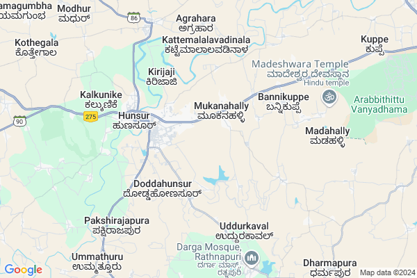
Agrahara Map
EDIT Map
Add Your House
 ..
..
Current Corona Virus Infected Patients Count in Mysore District
| City Name | District Name | Total Covid cases |
|---|---|---|
| Mysuru District | Mysuru | 45 |
| Nanjangud | Mysuru | 25 |
| Nanjanagudu | Mysuru | 15 |
| Mysuru | Mysuru | 1 |
| Nanjangudu | Mysuru | 1 |
Locality Name :
Agrahara
( ಅಗ್ರಹಾರ )
Taluk Name : Hunsur
District : Mysore
State : Karnataka
Division : Mysore
Language : Kannada and English
Current Time 12:36 PM
Date: Friday , Apr 25,2025 (IST)
Time zone: IST (UTC+5:30)
Elevation / Altitude: 788 meters. Above Seal level
Telephone Code / Std Code: 08222
Assembly constituency : Hunsur assembly constituency
Assembly MLA : G.D. Harish Gowda
Lok Sabha constituency : Mysore parliamentary constituency
Parliament MP : PRATHAP SIMHA
Serpanch Name :
Pin Code : 571134
Post Office Name : Kattemalalavadi
Main Village Name : Agrahara
Commodities Prices : Hunsur Market / Mandi
Agrahara Live Weather
Temperature: 34.5 °C
broken clouds
Humidity: 29%
Wind : 3.11 mt/sec towards E
StationName : "Hunsūr"
observed on Now
Temperature: 34.5 °C
broken clouds
Humidity: 29%
Wind : 3.11 mt/sec towards E
StationName : "Hunsūr"
observed on Now
Agrahara Weather Forecast for Next 5 days
26-04-2025
23.8°C to 36.9°C
broken clouds, light rain
23.8°C to 36.9°C
broken clouds, light rain
27-04-2025
22.7°C to 36.6°C
overcast clouds, broken clouds
22.7°C to 36.6°C
overcast clouds, broken clouds
28-04-2025
22.3°C to 35.5°C
overcast clouds, light rain
22.3°C to 35.5°C
overcast clouds, light rain
29-04-2025
23.6°C to 35.1°C
overcast clouds, few clouds, broken clouds, light rain
23.6°C to 35.1°C
overcast clouds, few clouds, broken clouds, light rain
30-04-2025
22.3°C to 33.9°C
scattered clouds, few clouds, moderate rain, light rain, overcast clouds
22.3°C to 33.9°C
scattered clouds, few clouds, moderate rain, light rain, overcast clouds
National Highways Reachable To Agrahara
Nationa High Way :NH766;NH150A
Nationa High Way :NH150A;NH275
Nationa High Way :NH766;NH150A
Nationa High Way :NH150A;NH275
Rivers Near Agrahara
Kaveri :ಕಾವೇರಿ
Kaveri :ಕಾವೇರಿ
Kaveri :ಕಾವೇರಿ
Kaveri :ಕಾವೇರಿ
About Agrahara
Correct below Info and add more info about AgraharaAgrahara is a small Village/hamlet in Hunsur Taluk in Mysore District of Karnataka State, India. It comes under Agrahara Panchayath. It belongs to Mysore Division . It is located 41 KM towards west from District head quarters Mysore. 183 KM from State capital Bangalore
Agrahara Pin code is 571134 and postal head office is Kattemalalavadi .
Agrahara is surrounded by Krishnarajanagara Taluk towards North , Heggadadevankote Taluk towards South , Piriyapatna Taluk towards west , Mysore Taluk towards East .
Mysore , Shrirangapattana , Nanjangud , Madikeri are the near by Cities to Agrahara.
Agrahara 2011 Census Details
Agrahara Local Language is Kannada. Agrahara Village Total population is 856 and number of houses are 230. Female Population is 48.0%. Village literacy rate is 59.1% and the Female Literacy rate is 25.1%.
Population
| Census Parameter | Census Data |
| Total Population | 856 |
| Total No of Houses | 230 |
| Female Population % | 48.0 % ( 411) |
| Total Literacy rate % | 59.1 % ( 506) |
| Female Literacy rate | 25.1 % ( 215) |
| Scheduled Tribes Population % | 0.8 % ( 7) |
| Scheduled Caste Population % | 33.8 % ( 289) |
| Working Population % | 66.6 % |
| Child(0 -6) Population by 2011 | 85 |
| Girl Child(0 -6) Population % by 2011 | 40.0 % ( 34) |
Agrahara Census More Deatils.
Politics in Agrahara
Bharatiya Janata Party , JD(S) , BJP , Janata Dal (Secular) (JD(S)) , INC are the major political parties in this area.Polling Stations /Booths near Agrahara
1)Govt Higher Primery School New Building (west Wing) Left Side Karigowda Street Hunasuru Town2)Govt Higher Primery School Manuganahalli
3)Govt Higher Primary School [east Wing] Vontipalyabore Hunsur Town
4)Govt Higher Primary School [north Wing Right Side] Beejaganahalli
5)Govt Higher Primary School [southwing Left Side] Beejaganahalli
HOW TO REACH Agrahara
By Rail
There is no railway station near to Agrahara in less than 10 km. Chamarajapuram Rail Way Station (near to Mysore) , Mysuru Junction Rail Way Station (near to Mysore) , Krishnarajanagara Rail Way Station (near to Krishnarajanagara) , Hampapura Rail Way Station (near to Krishnarajanagara) are the Rail way stations reachable from near by towns.By Road
Hunsur , Krishnarajanagara , Mysore are the nearby by towns to Agrahara having road connectivity to AgraharaColleges near Agrahara
Govt Pu Collage
Address : Bannikuppe Gate
Schools in Agrahara
Ghps
Address : agrahara , hunsur , mysore , Karnataka . PIN- 571134 , Post - Kattemalalavadi
Govt Health Centers near Agrahara
1) Mullur , building No 6-99/1 , banglagudde , gurupura panchayat2) Bettadabeedu , , ,
3) All India Institute of Speech and Hearing, Mysore , Naimisham Campus, Road No.3, T K Layout, Manasagangothri, , Mysuru, Karnataka ,
Sub Villages in Agrahara
Hospitals in Agrahara,Hunsur
Governament Frist Aid Center; Reddy Koppalu
Beejaganahalli; Karnataka 571105; India
1.8 KM distance Detail
more ..
Petrol Bunks in Agrahara,Hunsur
Shree Mylaralingeshwara Service Station Indian Oil Petrol Pump
Mangalore - Mysore Hwy; Mysore; Karnataka 571105; India
1.8 KM distance Detail
more ..
Colleges in Agrahara,Hunsur
Bahusar Vikram Nursing College
Mysore - Madikeri Rd; Hunsur; Karnataka 571105; India
1.8 KM distance Detail
Government Degree College
Mysore - Madikeri Rd; Mookanahalli; Karnataka 571105; India
2.0 KM distance Detail
Govt ITI College
Hunsur Rd; Hebbal Industrial Area; Doddahunsur; Karnataka 571105; India
2.1 KM distance Detail
Government First Grade College
Mangalore Mysor; Mysore; SH-88; BM Road; Mysore; Mysore; Karnataka 571105; India
2.2 KM distance Detail
more ..
Schools in Agrahara,Hunsur
Government Primary School; Mookanahalli ; Karnataka
Beejaganahalli; Karnataka 571105; India
2.2 KM distance Detail
Electronic Shops in Agrahara,Hunsur
Sree Balaji Home Appliances
jlb Road opposite SRK store; Hunsur; Karnataka; India
3.3 KM distance Detail
Local Parks in Agrahara,Hunsur
Public Park
New Rathnapuri Rd; Maruthi Extension; Hunsur; Karnataka 571105; India
2.4 KM distance Detail
Police Stations near Agrahara,Hunsur
DySP Office
Old BM Road; Muthumariyamman Kovil; Hunsur; Karnataka 571105; India
3.4 KM distance Detail
Office of Deputy Superintendent
Muthumariyamman Kovil; Hunsur; Karnataka 571105; India
3.4 KM distance Detail
Hunsur Rural Police Station
Muthumariyamman Kovil; Hunsur; Karnataka 571105; India
3.4 KM distance Detail
Governement Offices near Agrahara,Hunsur
Assistant Director Office
Mangalore - Mysore Hwy; Mysore; Karnataka 571105; India
1.4 KM distance Detail
Industrial Development Office
Mangalore - Mysore Hwy; Mysore; Karnataka 571105; India
2.1 KM distance Detail
Professional;income And Sales Taxes Office
BM Road; Hunsur; Karnataka 571105; India
2.6 KM distance Detail
About Agrahara &
History
How to reach Agrahara
Tourist Places Near By Agrahara
Schools in Agrahara
Colleges in Agrahara
Temperature & weather of Agrahara
places in Agrahara
Agrahara photos
More Information
How to reach Agrahara
Tourist Places Near By Agrahara
Schools in Agrahara
Colleges in Agrahara
Temperature & weather of Agrahara
places in Agrahara
Agrahara photos
More Information
Village Talk
Post News or Events about this Village
Near Cities
Mysore 38 KM near
Shrirangapattana 47 KM near
Nanjangud 49 KM near
Madikeri 71 KM near
Mysore 38 KM near
Shrirangapattana 47 KM near
Nanjangud 49 KM near
Madikeri 71 KM near
Near By Taluks
Hunsur 0 KM near
Krishnarajanagara 29 KM near
Heggadadevankote 33 KM near
Piriyapatna 33 KM near
Hunsur 0 KM near
Krishnarajanagara 29 KM near
Heggadadevankote 33 KM near
Piriyapatna 33 KM near
Near By Air Ports
Mysore Airport 40 KM near
Calicut Airport 151 KM near
Peelamedu Airport 180 KM near
Bajpe Airport 192 KM near
Mysore Airport 40 KM near
Calicut Airport 151 KM near
Peelamedu Airport 180 KM near
Bajpe Airport 192 KM near
Near By Tourist Places
Nagarhole 39 KM near
Mysore 39 KM near
Kabini 46 KM near
Srirangapatna 48 KM near
Nanjangud 49 KM near
Nagarhole 39 KM near
Mysore 39 KM near
Kabini 46 KM near
Srirangapatna 48 KM near
Nanjangud 49 KM near
Near By Districts
Mysore 40 KM near
Kodagu 72 KM near
Mandya 75 KM near
Chamarajanagar 88 KM near
Mysore 40 KM near
Kodagu 72 KM near
Mandya 75 KM near
Chamarajanagar 88 KM near
Near By RailWay Station
Krishnarajanagara Rail Way Station 19 KM near
Mysuru Junction Rail Way Station 39 KM near
Krishnarajanagara Rail Way Station 19 KM near
Mysuru Junction Rail Way Station 39 KM near