| Home | City Bus | Maps | Villages | Cities | Rail | Tourist Places | School | College | Pin Codes | Corona Cases Count |
| Distance Calculator Bus Services IFSC Codes Trace Mobile Number Weather Search Place Trace IP Available Cash ATM/Banks Locate Polling Booth Report an Error contact People |
Sindenahalli
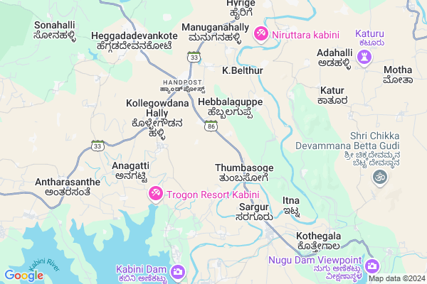
Sindenahalli Map
EDIT Map
Add Your House
 ..
..
Current Corona Virus Infected Patients Count in Mysore District
| City Name | District Name | Total Covid cases |
|---|---|---|
| Mysuru District | Mysuru | 45 |
| Nanjangud | Mysuru | 25 |
| Nanjanagudu | Mysuru | 15 |
| Nanjangudu | Mysuru | 1 |
| Mysuru | Mysuru | 1 |
Locality Name :
Sindenahalli
( ಸಿಂದೇನಹಳ್ಳಿ )
Taluk Name : Heggadadevankote
District : Mysore
State : Karnataka
Division : Mysore
Language : Kannada and English
Current Time 12:38 AM
Date: Thursday , Feb 06,2025 (IST)
Time zone: IST (UTC+5:30)
Elevation / Altitude: 660 meters. Above Seal level
Telephone Code / Std Code: 08228
Assembly constituency : Heggadadevankote assembly constituency
Assembly MLA : Anil Chikkamadhu
Lok Sabha constituency : Chamarajanagar parliamentary constituency
Parliament MP : V. SRINIVAS PRASAD
Serpanch Name :
Main Village Name : Sindenahalli
Commodities Prices : Santhesargur Market / Mandi
Sindenahalli Live Weather
Temperature: 18.9 °C
clear sky
Humidity: 54%
Wind : 1.66 mt/sec towards E
StationName : "Sargūr"
observed on 11 Mins Back
Temperature: 18.9 °C
clear sky
Humidity: 54%
Wind : 1.66 mt/sec towards E
StationName : "Sargūr"
observed on 11 Mins Back
Sindenahalli Weather Forecast for Next 5 days
06-02-2025
17.5°C to 19.2°C
clear sky
17.5°C to 19.2°C
clear sky
07-02-2025
15.9°C to 31.8°C
clear sky, few clouds, scattered clouds
15.9°C to 31.8°C
clear sky, few clouds, scattered clouds
08-02-2025
15.7°C to 32.1°C
few clouds, scattered clouds, broken clouds
15.7°C to 32.1°C
few clouds, scattered clouds, broken clouds
09-02-2025
15.6°C to 32.4°C
scattered clouds, clear sky
15.6°C to 32.4°C
scattered clouds, clear sky
10-02-2025
16.5°C to 32.6°C
clear sky, scattered clouds, few clouds
16.5°C to 32.6°C
clear sky, scattered clouds, few clouds
National Highways Reachable To Sindenahalli
Nationa High Way :NH766
Nationa High Way :NH766;NH150A
Nationa High Way :NH766
Nationa High Way :NH766;NH150A
Rivers Near Sindenahalli
Chikannipuzha
Gundlu :ಗುಂಡ್ಲು
Chikannipuzha
Gundlu :ಗುಂಡ್ಲು
About Sindenahalli
Correct below Info and add more info about SindenahalliSindenahalli is a small Village/hamlet in Heggadadevankote Taluk in Mysore District of Karnataka State, India. It comes under Sindenahalli Panchayath. It belongs to Mysore Division . It is located 50 KM towards South from District head quarters Mysore. 197 KM from State capital Bangalore
Sindenahalli is surrounded by Hunsur Taluk towards North , Nanjangud Taluk towards East , Mysore Taluk towards East , Gundlupet Taluk towards East .
Nanjangud , Mysore , Gundlupet , Shrirangapattana are the near by Cities to Sindenahalli.
Sindenahalli 2011 Census Details
Sindenahalli Local Language is Kannada. Sindenahalli Village Total population is 1202 and number of houses are 238. Female Population is 48.1%. Village literacy rate is 53.2% and the Female Literacy rate is 20.6%.
Population
| Census Parameter | Census Data |
| Total Population | 1202 |
| Total No of Houses | 238 |
| Female Population % | 48.1 % ( 578) |
| Total Literacy rate % | 53.2 % ( 639) |
| Female Literacy rate | 20.6 % ( 248) |
| Scheduled Tribes Population % | 2.7 % ( 32) |
| Scheduled Caste Population % | 3.9 % ( 47) |
| Working Population % | 52.6 % |
| Child(0 -6) Population by 2011 | 186 |
| Girl Child(0 -6) Population % by 2011 | 50.5 % ( 94) |
Sindenahalli Census More Deatils.
Politics in Sindenahalli
Indian National Congress (INC) is the major political party in this area.Polling Stations /Booths near Sindenahalli
1)"government Higher Primary School Chamanahalli "2)"government Lower Primary School Dasanapura
3)"government Higher Primary School Belaganahalli"
4)Government Higher Primary School (west Side) Magge
5)Government Higher Primary School Hyrige- (north Side) New Building.
HOW TO REACH Sindenahalli
By Rail
There is no railway station near to Sindenahalli in less than 10 km. Nanjangud Town Rail Way Station (near to Nanjangud) , Chamarajapuram Rail Way Station (near to Mysore) , Sujata Puram Halt Rail Way Station (near to Nanjangud) , Mysuru Junction Rail Way Station (near to Mysore) are the Rail way stations reachable from near by towns.By Road
Nanjangud , Mysore are the nearby by towns to Sindenahalli having road connectivity to SindenahalliPincodes near Sindenahalli
571125 ( Hampapura (H D Kote) ) , 571114 ( Heggadedevana Kote ) , 571116 ( Kabini Colony )Colleges near Sindenahalli
Govt.pu Collage Hanasoge
Address : Hanasoge
Sri Jayachamarajendra College Of Engineering
Address :
Government Cpc Polytechnic
Address :
Govt Pu Collage
Address : Bannikuppe Gate
Govt.pu College Hebbalu
Address : Govt Pu College Hebbalu
Schools near Sindenahalli
Morarji Antharsante
Address : antharasanthe , h.d.kote , mysore , Karnataka . PIN- 571114 , Post - Heggadedevana Kote
Morarji K Belthur
Address : k.belthur , h.d.kote , mysore , Karnataka . PIN- 571125 , Post - Hampapura (H D Kote)
Viveka School Of Excellance
Address : saragur ward-1 , h.d.kote , mysore , Karnataka . PIN- 571121 , Post - Sargur
Saintthomos Lps, Nisana ( A )
Address : nisna , h.d.kote , mysore , Karnataka . PIN- 571114 , Post - Heggadedevana Kote
Govt Health Centers near Sindenahalli
1) Bettadabeedu , , ,2) HOREYALA , SC Horeyala , Beguru Horeyla Main Road , PACC socitey
3) Mullur , building No 6-99/1 , banglagudde , gurupura panchayat
Sub Villages in Sindenahalli
Hospitals in Sindenahalli,Heggadadevankote
Community Health Center
Sargur; Mysore; SH-86; Hunsur Bengru Road; Mysore; Mysore; Karnataka 571121; India
6.2 KM distance Detail
more ..
Petrol Bunks in Sindenahalli,Heggadadevankote
Sanmathi Service Station Indian Oil Petrol Pump
Sargur; Mysore; SH-86; Hunsur Bengru Road; Mysore; Mysore; Karnataka 571121; India
6.0 KM distance Detail
HP PETROL PUMP - VIJAYA FUEL OUTLET
HPC Dealer Municipal Khatta NO 1675(SY NO 125/1) HD Kote-nanjungud Road;sargur; Bengaluru; Karnataka 571121; India
6.9 KM distance Detail
more ..
Colleges in Sindenahalli,Heggadadevankote
Government First Grade College
Sargur; Mysore; SH-86; Hunsur Bengru Road; Mysore; Mysore; Karnataka 571121; India
6.1 KM distance Detail
more ..
Governement Offices near Sindenahalli,Heggadadevankote
Assistant Executive Engineer Office
Sargur; Mysore; SH-86; Hunsur Bengru Road; Mysore; Mysore; Karnataka 571121; India
4.9 KM distance Detail
Revenue Office
Sargur; Mysore; SH-86; Hunsur Bengru Road; Mysore; Mysore; Karnataka 571121; India
5.3 KM distance Detail
About Sindenahalli &
History
How to reach Sindenahalli
Tourist Places Near By Sindenahalli
Schools in Sindenahalli
Colleges in Sindenahalli
Temperature & weather of Sindenahalli
places in Sindenahalli
Sindenahalli photos
More Information
How to reach Sindenahalli
Tourist Places Near By Sindenahalli
Schools in Sindenahalli
Colleges in Sindenahalli
Temperature & weather of Sindenahalli
places in Sindenahalli
Sindenahalli photos
More Information
Village Talk
Post News or Events about this Village
Near Cities
Nanjangud 39 KM near
Mysore 46 KM near
Gundlupet 49 KM near
Shrirangapattana 60 KM near
Nanjangud 39 KM near
Mysore 46 KM near
Gundlupet 49 KM near
Shrirangapattana 60 KM near
Near By Taluks
Heggadadevankote 0 KM near
Hunsur 32 KM near
Nanjangud 38 KM near
Mysore 45 KM near
Heggadadevankote 0 KM near
Hunsur 32 KM near
Nanjangud 38 KM near
Mysore 45 KM near
Near By Air Ports
Mysore Airport 47 KM near
Calicut Airport 123 KM near
Peelamedu Airport 149 KM near
Bajpe Airport 213 KM near
Mysore Airport 47 KM near
Calicut Airport 123 KM near
Peelamedu Airport 149 KM near
Bajpe Airport 213 KM near
Near By Tourist Places
Kabini 21 KM near
Nagarhole 28 KM near
Bandipur National Park 34 KM near
Nanjangud 39 KM near
Tholpetty 39 KM near
Kabini 21 KM near
Nagarhole 28 KM near
Bandipur National Park 34 KM near
Nanjangud 39 KM near
Tholpetty 39 KM near
Near By Districts
Mysore 48 KM near
Wayanad 63 KM near
Chamarajanagar 71 KM near
The Nilgiris 87 KM near
Mysore 48 KM near
Wayanad 63 KM near
Chamarajanagar 71 KM near
The Nilgiris 87 KM near
Near By RailWay Station
Mysuru Junction Rail Way Station 48 KM near
Krishnarajanagara Rail Way Station 50 KM near
Mysuru Junction Rail Way Station 48 KM near
Krishnarajanagara Rail Way Station 50 KM near