| Home | City Bus | Maps | Villages | Cities | Rail | Tourist Places | School | College | Pin Codes | Corona Cases Count |
| Distance Calculator Bus Services IFSC Codes Trace Mobile Number Weather Search Place Trace IP Available Cash ATM/Banks Locate Polling Booth Report an Error contact People |
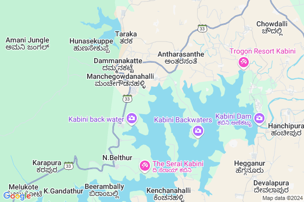
Badanakuppe
Badanakuppe Map
EDIT Map
Add Your House
 ..
..
Current Corona Virus Infected Patients Count in Mysore District
| City Name | District Name | Total Covid cases |
|---|---|---|
| Mysuru District | Mysuru | 45 |
| Nanjangud | Mysuru | 25 |
| Nanjanagudu | Mysuru | 15 |
| Nanjangudu | Mysuru | 1 |
| Mysuru | Mysuru | 1 |
Locality Name :
Badanakuppe
( ಬದನಕುಪ್ಪೆ )
Taluk Name : Heggadadevankote
District : Mysore
State : Karnataka
Division : Mysore
Language : Kannada and English
Current Time 08:20 AM
Date: Wednesday , Apr 30,2025 (IST)
Time zone: IST (UTC+5:30)
Elevation / Altitude: 660 meters. Above Seal level
Telephone Code / Std Code: 08228
Assembly constituency : Heggadadevankote assembly constituency
Assembly MLA : Anil Chikkamadhu
Lok Sabha constituency : Chamarajanagar parliamentary constituency
Parliament MP : V. SRINIVAS PRASAD
Serpanch Name :
Pin Code : 571116
Post Office Name : Kabini Colony
Main Village Name : Badanakuppe
Commodities Prices : Santhesargur Market / Mandi
National Highways Reachable To Badanakuppe
Nationa High Way :NH766
Nationa High Way :NH766;NH150A
Nationa High Way :NH766
Nationa High Way :NH766;NH150A
Rivers Near Badanakuppe
Chikannipuzha
Gundlu :ಗುಂಡ್ಲು
Chikannipuzha
Gundlu :ಗುಂಡ್ಲು
About Badanakuppe
Correct below Info and add more info about BadanakuppeBadanakuppe is a small Village/hamlet in Heggadadevankote Taluk in Mysore District of Karnataka State, India. It comes under Badanakuppe Panchayath. It belongs to Mysore Division . It is located 62 KM towards west from District head quarters Mysore. 12 KM from Heggadadevankote. 209 KM from State capital Bangalore
Badanakuppe Pin code is 571116 and postal head office is Kabini Colony .
Bidarahalli ( 9 KM ) , Hegganur ( 10 KM ) , Sagare ( 11 KM ) , Hanchipura ( 11 KM ) , Thumbasoge ( 11 KM ) are the nearby Villages to Badanakuppe. Badanakuppe is surrounded by Hunsur Taluk towards North , Sulthan Bathery Taluk towards South , Mananthavady Taluk towards west , Nanjangud Taluk towards East .
Nanjangud , Kalpetta , Gundlupet , Mysore are the near by Cities to Badanakuppe.
Badanakuppe 2011 Census Details
Badanakuppe Local Language is Kannada. Badanakuppe Village Total population is 87 and number of houses are 22. Female Population is 48.3%. Village literacy rate is 48.3% and the Female Literacy rate is 19.5%.
Population
| Census Parameter | Census Data |
| Total Population | 87 |
| Total No of Houses | 22 |
| Female Population % | 48.3 % ( 42) |
| Total Literacy rate % | 48.3 % ( 42) |
| Female Literacy rate | 19.5 % ( 17) |
| Scheduled Tribes Population % | 3.4 % ( 3) |
| Scheduled Caste Population % | 50.6 % ( 44) |
| Working Population % | 36.8 % |
| Child(0 -6) Population by 2011 | 11 |
| Girl Child(0 -6) Population % by 2011 | 45.5 % ( 5) |
Badanakuppe Census More Deatils.
Politics in Badanakuppe
Indian National Congress (INC) is the major political party in this area.Polling Stations /Booths near Badanakuppe
1)"government Higher Primary School Basapura Mala"2)"government Lower Primary School Hirehalli"
3)"range Forest Office Kakanakote"
4)"government Lower Primary School Yelamathur"
5)"government Higher Primary School Hirehalli
HOW TO REACH Badanakuppe
By Rail
There is no railway station near to Badanakuppe in less than 10 km. Nanjangud Town Rail Way Station (near to Nanjangud) , Chamarajapuram Rail Way Station (near to Mysore) , Sujata Puram Halt Rail Way Station (near to Nanjangud) , Mysuru Junction Rail Way Station (near to Mysore) are the Rail way stations reachable from near by towns.By Road
Nanjangud , Mysore are the nearby by towns to Badanakuppe having road connectivity to BadanakuppeColleges near Badanakuppe
Govt.pu Collage Hanasoge
Address : Hanasoge
Sri Jayachamarajendra College Of Engineering
Address :
Government Cpc Polytechnic
Address :
Govt Pu Collage
Address : Bannikuppe Gate
Govt.pu College Hebbalu
Address : Govt Pu College Hebbalu
Schools in Badanakuppe
Glps Badanakuppe
Address : badanakuppe , h.d.kote , mysore , Karnataka . PIN- 571714
Glps Mosarahalla
Address : badanakuppe , h.d.kote , mysore , Karnataka . PIN- 571116 , Post - Kabini Colony
Govt Health Centers near Badanakuppe
1) Bettadabeedu , , ,2) Mullur , building No 6-99/1 , banglagudde , gurupura panchayat
3) ATTAGULIPURA , sub centre Attugulipura , ,
Sub Villages in Badanakuppe
Hospitals in Badanakuppe,Heggadadevankote
Sri Parvathi Health Care
H B Road; Heggadadevankote; Karnataka 571114; India
13.9 KM distance Detail
more ..
Petrol Bunks in Badanakuppe,Heggadadevankote
Sanmathi Service Station Indian Oil Petrol Pump
Sargur; Mysore; SH-86; Hunsur Bengru Road; Mysore; Mysore; Karnataka 571121; India
14.9 KM distance Detail
more ..
Schools in Badanakuppe,Heggadadevankote
Kittur Rani Chennamma Residential School
Mysore; Antharasanthe; Karnataka 571114; India
5.5 KM distance Detail
Government Lower Primary School Kanakanahalli
Kanakanahalli; H D Kote TQ; Mysore; Siddapura; Karnataka 571114; India
6.4 KM distance Detail
GLPS Hosakere Sunda
Hosakere sunda; H D Kote TQ ;Mysuru; Bidarahalli; Karnataka 571116; India
7.1 KM distance Detail
Governement Offices near Badanakuppe,Heggadadevankote
Minority Taluk information center
; Heggadadevankote; Karnataka 571114; India
13.7 KM distance Detail
Assistant Executive Engineer Office
Sargur; Mysore; SH-86; Hunsur Bengru Road; Mysore; Mysore; Karnataka 571121; India
14.2 KM distance Detail
About Badanakuppe &
History
How to reach Badanakuppe
Tourist Places Near By Badanakuppe
Schools in Badanakuppe
Colleges in Badanakuppe
Temperature & weather of Badanakuppe
places in Badanakuppe
Badanakuppe photos
More Information
How to reach Badanakuppe
Tourist Places Near By Badanakuppe
Schools in Badanakuppe
Colleges in Badanakuppe
Temperature & weather of Badanakuppe
places in Badanakuppe
Badanakuppe photos
More Information
Village Talk
Post News or Events about this Village
Near Cities
Nanjangud 51 KM near
Kalpetta 51 KM near
Gundlupet 55 KM near
Mysore 58 KM near
Nanjangud 51 KM near
Kalpetta 51 KM near
Gundlupet 55 KM near
Mysore 58 KM near
Near By Taluks
Heggadadevankote 12 KM near
Hunsur 38 KM near
Sulthan Bathery 41 KM near
Mananthavady 43 KM near
Heggadadevankote 12 KM near
Hunsur 38 KM near
Sulthan Bathery 41 KM near
Mananthavady 43 KM near
Near By Air Ports
Mysore Airport 59 KM near
Calicut Airport 113 KM near
Peelamedu Airport 151 KM near
Bajpe Airport 207 KM near
Mysore Airport 59 KM near
Calicut Airport 113 KM near
Peelamedu Airport 151 KM near
Bajpe Airport 207 KM near
Near By Tourist Places
Kabini 9 KM near
Nagarhole 19 KM near
Tholpetty 26 KM near
Muthanga Wildlife Sanctuary 32 KM near
Bandipur National Park 32 KM near
Kabini 9 KM near
Nagarhole 19 KM near
Tholpetty 26 KM near
Muthanga Wildlife Sanctuary 32 KM near
Bandipur National Park 32 KM near
Near By Districts
Wayanad 52 KM near
Mysore 60 KM near
Chamarajanagar 81 KM near
Kodagu 85 KM near
Wayanad 52 KM near
Mysore 60 KM near
Chamarajanagar 81 KM near
Kodagu 85 KM near
Near By RailWay Station
Krishnarajanagara Rail Way Station 58 KM near
Mysuru Junction Rail Way Station 60 KM near
Krishnarajanagara Rail Way Station 58 KM near
Mysuru Junction Rail Way Station 60 KM near