| Home | City Bus | Maps | Villages | Cities | Rail | Tourist Places | School | College | Pin Codes | Corona Cases Count |
| Distance Calculator Bus Services IFSC Codes Trace Mobile Number Weather Search Place Trace IP Available Cash ATM/Banks Locate Polling Booth Report an Error contact People |
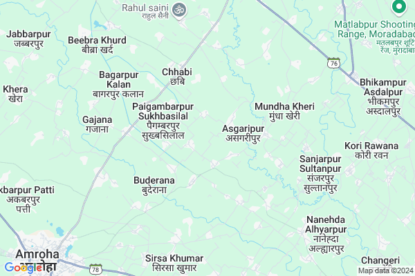
Mankua
Mankua Map
EDIT Map
Add Your House
 ..
..
Current Corona Virus Infected Patients Count in Moradabad District
| City Name | District Name | Total Covid cases |
|---|---|---|
| Moradabad District | Moradabad | 104 |
| Moradabad | Moradabad | 1 |
Locality Name :
Mankua
( मनकुआ )
Block Name : Chhajlet
District : Moradabad
State : Uttar Pradesh
Division : Moradabad
Language : Hindi and Urdu, English, Khariboli, Haryanvi, Punjabi, Kumaoni
Current Time 10:04 AM
Date: Sunday , Apr 27,2025 (IST)
Time zone: IST (UTC+5:30)
Elevation / Altitude: 216 meters. Above Seal level
Telephone Code / Std Code: 05922
Assembly constituency : Kanth assembly constituency
Assembly MLA : Kamal Akhtar
Lok Sabha constituency : Moradabad parliamentary constituency
Parliament MP : Dr. S.T. HASAN
Serpanch Name :
Pin Code : 244501
Post Office Name : Kanth
Main Village Name : Mankua
Commodities Prices : Amroha Market / Mandi
Mankua Live Weather
Temperature: 33.5 °C
overcast clouds
Humidity: 10%
Wind : 1.68 mt/sec towards SE
StationName : "Amroha"
observed on 1 Hours Back
Temperature: 33.5 °C
overcast clouds
Humidity: 10%
Wind : 1.68 mt/sec towards SE
StationName : "Amroha"
observed on 1 Hours Back
Mankua Weather Forecast for Next 5 days
28-04-2025
27.5°C to 41.6°C
overcast clouds, broken clouds, few clouds
27.5°C to 41.6°C
overcast clouds, broken clouds, few clouds
29-04-2025
26.9°C to 42.6°C
overcast clouds, clear sky, broken clouds
26.9°C to 42.6°C
overcast clouds, clear sky, broken clouds
30-04-2025
26.1°C to 41.2°C
scattered clouds, clear sky, broken clouds, overcast clouds
26.1°C to 41.2°C
scattered clouds, clear sky, broken clouds, overcast clouds
01-05-2025
27.8°C to 41.4°C
overcast clouds, broken clouds, scattered clouds, clear sky
27.8°C to 41.4°C
overcast clouds, broken clouds, scattered clouds, clear sky
02-05-2025
28.7°C to 40.0°C
overcast clouds, few clouds, clear sky, scattered clouds, broken clouds
28.7°C to 40.0°C
overcast clouds, few clouds, clear sky, scattered clouds, broken clouds
Rivers Near Mankua
Baur
Ramganga
Baur
Ramganga
About Mankua
Correct below Info and add more info about MankuaMankua is a small Village/hamlet in Chhajlet Block in Moradabad District of Uttar Pradesh State, India. It comes under Mankua Panchayath. It belongs to Moradabad Division . It is located 31 KM towards west from District head quarters Moradabad. 9 KM from Chhajlet. 389 KM from State capital Lucknow
Mankua Pin code is 244501 and postal head office is Kanth .
Sahpur Abbadulbari ( 1 KM ) , Khan Khanpur Urf Bichpuri ( 2 KM ) , Sunderpurchaupura ( 2 KM ) , Paigambarpur Sukhbasilal ( 2 KM ) , Sndauli ( 2 KM ) are the nearby Villages to Mankua. Mankua is surrounded by Chhajlet Block towards East , Joya Block towards South , Budhanpur Seohara Block towards North , Asmauli Block towards South .
Amroha , Naugawan Sadat , Moradabad , Sahaspur are the near by Cities to Mankua.
This Place is in the border of the Moradabad District and Jyotiba Phule Nagar District. Jyotiba Phule Nagar District Amroha is west towards this place .
Demographics of Mankua
Hindi is the Local Language here.Politics in Mankua
PECP , BJP , RLD , BSP are the major political parties in this area.Polling Stations /Booths near Mankua
1)Ps Anyari Alias Alinagar Room 12)Ps Akbarpur Chedri Room 3
3)Ps Mundala Mou Jamapur Room 2
4)Ps Nazrana Room 1
5)Ps Shahpur Mubarkpur Room 1
HOW TO REACH Mankua
By Rail
Kaialsa Rail Way Station , Chak Kali Lait Rail Way Station are the very nearby railway stations to Mankua.Colleges near Mankua
Shri Ram Gopal Singh Degree College Sultan Pur Dost
Address :
R.s.m. Inter College Rampur Ghogar
Address :
Rajkiya Mahavidhylaya, Sambhal , Moradabad ( Uttar Pradesh )
Address :
Ram Rakshpal Memorial Inter College
Address :
Azad Public Inter College Bilari Moradabad
Address : Mohalla Ansariyan Bilari Moradabad Uttar Pradesh
Schools near Mankua
H.s. Bandhu Kanya Sen Sec Sch
Address : kanth , chajlet , moradabad , Uttar Pradesh . PIN- 244501 , Post - Kanth
Kailesh Wati Inter College
Address : fatehpur vishnoi , chajlet , moradabad , Uttar Pradesh . PIN- 244224
Dayanand Inter College, Moda P
Address : kanth , chajlet , moradabad , Uttar Pradesh . PIN- 244501 , Post - Kanth
Rishi Bal Vid Inter Coll Moda
Address : kanth , chajlet , moradabad , Uttar Pradesh . PIN- 244501 , Post - Kanth
Govt Health Centers near Mankua
1) PaigambarPur , PaigambarPur , PaigambarPur ,2) Kothi , Kothi , Kothi ,
3) APHC Kothi Khidmatpur , APHC Kothi Khidmatpur , APHC Kothi Khidmatpur ,
Sub Villages in Mankua
Schools in Mankua,Chhajlet
Electronic Shops in Mankua,Chhajlet
Super Markets in Mankua,Chhajlet
Local Parks in Mankua,Chhajlet
Police Stations near Mankua,Chhajlet
Governement Offices near Mankua,Chhajlet
About Mankua &
History
How to reach Mankua
Tourist Places Near By Mankua
Schools in Mankua
Colleges in Mankua
Temperature & weather of Mankua
places in Mankua
Mankua photos
More Information
How to reach Mankua
Tourist Places Near By Mankua
Schools in Mankua
Colleges in Mankua
Temperature & weather of Mankua
places in Mankua
Mankua photos
More Information
Village Talk
Post News or Events about this Village
Near Cities
Amroha 10 KM near
Naugawan Sadat 16 KM near
Moradabad 21 KM near
Sahaspur 22 KM near
Amroha 10 KM near
Naugawan Sadat 16 KM near
Moradabad 21 KM near
Sahaspur 22 KM near
Near By Taluks
Amroha 9 KM near
Chhajlet 9 KM near
Joya 15 KM near
Budhanpur Seohara 25 KM near
Amroha 9 KM near
Chhajlet 9 KM near
Joya 15 KM near
Budhanpur Seohara 25 KM near
Near By Air Ports
Pantnagar Airport 100 KM near
Muzaffarnagar Airport 112 KM near
Indira Gandhi International Airport 165 KM near
Dehra Dun Airport 177 KM near
Pantnagar Airport 100 KM near
Muzaffarnagar Airport 112 KM near
Indira Gandhi International Airport 165 KM near
Dehra Dun Airport 177 KM near
Near By Tourist Places
Moradabad 29 KM near
Kashipur 54 KM near
Hastinapur 65 KM near
Ramnagar 82 KM near
Corbett National Park 82 KM near
Moradabad 29 KM near
Kashipur 54 KM near
Hastinapur 65 KM near
Ramnagar 82 KM near
Corbett National Park 82 KM near
Near By Districts
Jyotiba Phule Nagar 11 KM near
Moradabad 29 KM near
Rampur 55 KM near
Bijnor 68 KM near
Jyotiba Phule Nagar 11 KM near
Moradabad 29 KM near
Rampur 55 KM near
Bijnor 68 KM near
Near By RailWay Station
Amroha Rail Way Station 11 KM near
Moradabad Junction Rail Way Station 28 KM near
Amroha Rail Way Station 11 KM near
Moradabad Junction Rail Way Station 28 KM near