| Home | City Bus | Maps | Villages | Cities | Rail | Tourist Places | School | College | Pin Codes | Corona Cases Count |
| Distance Calculator Bus Services IFSC Codes Trace Mobile Number Weather Search Place Trace IP Available Cash ATM/Banks Locate Polling Booth Report an Error contact People |
Mudel
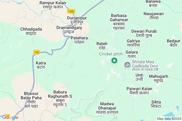
Mudel Map
EDIT Map
Add Your House
 ..
..
Current Corona Virus Infected Patients Count in Mirzapur District
| City Name | District Name | Total Covid cases |
|---|---|---|
| Mirzapur District | Mirzapur | 5 |
Locality Name :
Mudel
( मुडेल )
Block Name : Hallia
District : Mirzapur
State : Uttar Pradesh
Division : Mirzapur
Language : Hindi and Urdu, Agariya, Awadhi
Current Time 04:55 PM
Date: Thursday , Apr 24,2025 (IST)
Time zone: IST (UTC+5:30)
Elevation / Altitude: 94 meters. Above Seal level
Telephone Code / Std Code: 05334
Assembly constituency : Chhanbey assembly constituency
Assembly MLA : Rahul Prakash Kol
Lok Sabha constituency : Mirzapur parliamentary constituency
Parliament MP : Anupriya Singh Patel
Serpanch Name :
Pin Code : 231211
Post Office Name : Lalganj (Mirzapur)
Main Village Name : Mudel
Commodities Prices : Sirsa Market / Mandi
Mudel Live Weather
Temperature: 42.4 °C
clear sky
Humidity: 3%
Wind : 6.23 mt/sec towards NW
StationName : "Mauganj"
observed on Now
Temperature: 42.4 °C
clear sky
Humidity: 3%
Wind : 6.23 mt/sec towards NW
StationName : "Mauganj"
observed on Now
Mudel Weather Forecast for Next 5 days
25-04-2025
30.6°C to 41.4°C
clear sky
30.6°C to 41.4°C
clear sky
26-04-2025
28.8°C to 44.4°C
clear sky
28.8°C to 44.4°C
clear sky
27-04-2025
30.5°C to 45.2°C
clear sky, overcast clouds, broken clouds
30.5°C to 45.2°C
clear sky, overcast clouds, broken clouds
28-04-2025
26.1°C to 43.3°C
light rain, scattered clouds, broken clouds
26.1°C to 43.3°C
light rain, scattered clouds, broken clouds
29-04-2025
25.8°C to 40.7°C
broken clouds, overcast clouds, clear sky, light rain
25.8°C to 40.7°C
broken clouds, overcast clouds, clear sky, light rain
Rivers Near Mudel
Tudiyari Nadi
Belan
Tudiyari Nadi
Belan
About Mudel
Correct below Info and add more info about MudelMudel is a small Village/hamlet in Hallia Block in Mirzapur District of Uttar Pradesh State, India. It comes under Mudel Panchayath. It belongs to Mirzapur Division . It is located 58 KM towards west from District head quarters Mirzapur. 13 KM from Hallia. 297 KM from State capital Lucknow
Mudel Pin code is 231211 and postal head office is Lalganj (Mirzapur) .
Nadauli Patehara ( 3 KM ) , Patehara ( 4 KM ) , Garbara Gokul ( Shanarpuri ) ( 4 KM ) , Babura Raghunath Singh ( 5 KM ) , Galara ( 5 KM ) are the nearby Villages to Mudel. Mudel is surrounded by Koraon Block towards North , Hanumana Block towards west , Lalganj Block towards East , Manda Block towards North .
Mauganj , Mirzapur , Sidhi , Allahabad are the near by Cities to Mudel.
Mudel 2011 Census Details
Mudel Local Language is Hindi. Mudel Village Total population is 1317 and number of houses are 183. Female Population is 47.1%. Village literacy rate is 54.1% and the Female Literacy rate is 21.9%.
Population
| Census Parameter | Census Data |
| Total Population | 1317 |
| Total No of Houses | 183 |
| Female Population % | 47.1 % ( 620) |
| Total Literacy rate % | 54.1 % ( 713) |
| Female Literacy rate | 21.9 % ( 288) |
| Scheduled Tribes Population % | 0.0 % ( 0) |
| Scheduled Caste Population % | 36.0 % ( 474) |
| Working Population % | 33.1 % |
| Child(0 -6) Population by 2011 | 259 |
| Girl Child(0 -6) Population % by 2011 | 45.2 % ( 117) |
Mudel Census More Deatils.
Politics in Mudel
BJP , SP , BSP are the major political parties in this area.Polling Stations /Booths near Mudel
1)P.s. Baburakala2)P.s. Baburaraghunath Singh
3)J.h.c. Kamapur Kalan
4)J.h.c. Madawadhanaval
5)P.s. Bhatada
HOW TO REACH Mudel
By Rail
There is no railway station near to Mudel in less than 10 km.Colleges near Mudel
Kansi Ram Dasai Ram Polytenic College Mahuat Layan Baurndha Mirzapur
Address :
Maitri Net
Address : Mlg Road, Haliya, Anumula, Nalgonda, Telangana
Schools near Mudel
U.p.s. Basuhara
Address : basuhara , halia , mirzapur , Uttar Pradesh . PIN- 231211 , Post - Lalganj (Mirzapur)
K.g.b.v. Mahugarh
Address : kanokhar , halia , mirzapur , Uttar Pradesh . PIN- 231309 , Post - Kubari Patehara
U.p.s. Majhiyar
Address : majhiyar , halia , mirzapur , Uttar Pradesh . PIN- 231211 , Post - Lalganj (Mirzapur)
U.p.s. Ninwar Dagdagpur
Address : ninwar dagdagpur , halia , mirzapur , Uttar Pradesh . PIN- 231211 , Post - Lalganj (Mirzapur)
Govt Health Centers near Mudel
1) Ramgarh , , ,2) Ramgarh , , ,
3) Dohtha , , ,
Sub Villages in Mudel
Hospitals in Mudel,Hallia
सेहत हास्पिटल
Mahuat thana Lalganj zila mirzapur; Lalganj; Uttar Pradesh 231211; India
13.1 KM distance Detail
more ..
Colleges in Mudel,Hallia
Ramanuj Pratap PG College-Drumandganj
Durjanipur; Uttar Pradesh 231211; India
5.3 KM distance Detail
more ..
Electronic Shops in Mudel,Hallia
Amit mobile repairing senter
shitala maa gadbada dev ihanuman ji rod haliya lal ganj; Uttar Pradesh; India
4.9 KM distance Detail
Amit Mobile Repairing Senter Garbara Raja Hanuman Ji Rod Haliya Lal Ganj Mirzapur
Garbara Raja; Uttar Pradesh 231211; India
5.0 KM distance Detail
About Mudel &
History
How to reach Mudel
Tourist Places Near By Mudel
Schools in Mudel
Colleges in Mudel
Temperature & weather of Mudel
places in Mudel
Mudel photos
More Information
How to reach Mudel
Tourist Places Near By Mudel
Schools in Mudel
Colleges in Mudel
Temperature & weather of Mudel
places in Mudel
Mudel photos
More Information
Village Talk
Post News or Events about this Village
Near Cities
Mauganj 42 KM near
Mirzapur 55 KM near
Sidhi 66 KM near
Allahabad 84 KM near
Mauganj 42 KM near
Mirzapur 55 KM near
Sidhi 66 KM near
Allahabad 84 KM near
Near By Taluks
Hallia 12 KM near
Koraon 25 KM near
Hanumana 26 KM near
Lalganj 28 KM near
Hallia 12 KM near
Koraon 25 KM near
Hanumana 26 KM near
Lalganj 28 KM near
Near By Air Ports
Bamrauli Airport 89 KM near
Varanasi Airport 105 KM near
Khajuraho Airport 256 KM near
Gorakhpur Airport 274 KM near
Bamrauli Airport 89 KM near
Varanasi Airport 105 KM near
Khajuraho Airport 256 KM near
Gorakhpur Airport 274 KM near
Near By Tourist Places
Vindhyachal 52 KM near
Allahabad 84 KM near
Varanasi 105 KM near
Rewa 108 KM near
Kaushambi 109 KM near
Vindhyachal 52 KM near
Allahabad 84 KM near
Varanasi 105 KM near
Rewa 108 KM near
Kaushambi 109 KM near
Near By Districts
Mirzapur 55 KM near
Sidhi 65 KM near
Sant Ravidas Nagar 69 KM near
Allahabad 84 KM near
Mirzapur 55 KM near
Sidhi 65 KM near
Sant Ravidas Nagar 69 KM near
Allahabad 84 KM near
Near By RailWay Station
Meja Road Rail Way Station 47 KM near
Vindhyachal Rail Way Station 52 KM near
Meja Road Rail Way Station 47 KM near
Vindhyachal Rail Way Station 52 KM near