| Home | City Bus | Maps | Villages | Cities | Rail | Tourist Places | School | College | Pin Codes | Corona Cases Count |
| Distance Calculator Bus Services IFSC Codes Trace Mobile Number Weather Search Place Trace IP Available Cash ATM/Banks Locate Polling Booth Report an Error contact People |
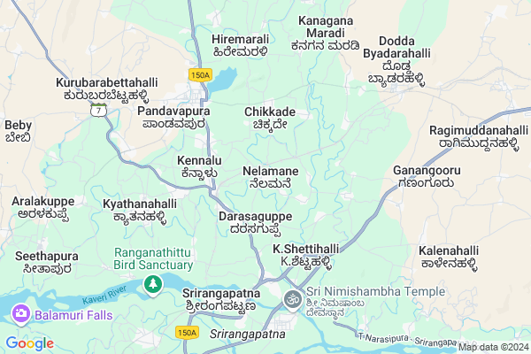
Nelamane
Nelamane Map
EDIT Map
Add Your House
 ..
..
Current Corona Virus Infected Patients Count in Mandya District
| City Name | District Name | Total Covid cases |
|---|---|---|
| Mandya District | Mandya | 8 |
| Malavalli | Mandya | 7 |
| Malvalli | Mandya | 1 |
Locality Name :
Nelamane
( ನೆಲಮನೆ )
Taluk Name : Shrirangapattana
District : Mandya
State : Karnataka
Division : Mysore
Language : Kannada and Hindi And English
Current Time 02:19 PM
Date: Monday , Apr 28,2025 (IST)
Time zone: IST (UTC+5:30)
Elevation / Altitude: 692 meters. Above Seal level
Telephone Code / Std Code: 08236
Assembly constituency : Srirangapatna assembly constituency
Assembly MLA : A.B. Ramesha Bandisiddegowda
Lok Sabha constituency : Mandya parliamentary constituency
Parliament MP : SUMALATHA AMBAREESH
Serpanch Name :
Pin Code : 571435
Post Office Name : Pandavapura R S
Main Village Name : Nelamane
Commodities Prices : Pandavapura Market / Mandi
National Highways Reachable To Nelamane
Nationa High Way :NH275
Nationa High Way :NH150A;NH275
Nationa High Way :NH275
Nationa High Way :NH150A;NH275
Rivers Near Nelamane
Kaveri :ಕಾವೇರಿ
Kaveri :ಕಾವೇರಿ
About Nelamane
Correct below Info and add more info about NelamaneNelamane is a small Village/hamlet in Shrirangapattana Taluk in Mandya District of Karnataka State, India. It comes under Nelamane Panchayath. It belongs to Mysore Division . It is located 26 KM towards west from District head quarters Mandya. 7 KM from Shrirangapattana. 130 KM from State capital Bangalore
Nelamane Pin code is 571435 and postal head office is Pandavapura R S .
Chikkade ( 2 KM ) , Kennalu ( 3 KM ) , Sabbanakuppe ( 3 KM ) , Kirangur ( 4 KM ) , Pandavapura ( 5 KM ) are the nearby Villages to Nelamane. Nelamane is surrounded by Pandavapura Taluk towards North , Mysore Taluk towards South , Mandya Taluk towards East , Krishnarajpet Taluk towards west .
Shrirangapattana , Mysore , Mandya , Nanjangud are the near by Cities to Nelamane.
Nelamane 2011 Census Details
Nelamane Local Language is Kannada. Nelamane Village Total population is 2894 and number of houses are 740. Female Population is 51.2%. Village literacy rate is 66.5% and the Female Literacy rate is 31.4%.
Population
| Census Parameter | Census Data |
| Total Population | 2894 |
| Total No of Houses | 740 |
| Female Population % | 51.2 % ( 1483) |
| Total Literacy rate % | 66.5 % ( 1925) |
| Female Literacy rate | 31.4 % ( 908) |
| Scheduled Tribes Population % | 6.3 % ( 182) |
| Scheduled Caste Population % | 6.0 % ( 175) |
| Working Population % | 51.5 % |
| Child(0 -6) Population by 2011 | 257 |
| Girl Child(0 -6) Population % by 2011 | 45.5 % ( 117) |
Nelamane Census More Deatils.
Politics in Nelamane
Independent , JD(S) , Janata Dal (Secular) (JD(S)) , INC are the major political parties in this area.Polling Stations /Booths near Nelamane
1)Government Higher Primary School. (north Wing) T.m. Hosur-22)Government Higher Primary School
3)Government Lower Primary School Doddaharohalli
4)Government Higher Primary School
5)Government Higher Primary School
HOW TO REACH Nelamane
By Rail
Pandavapura Rail Way Station , Chandragiri Koppal Rail Way Station are the very nearby railway stations to Nelamane. Chamarajapuram Rail Way Station (near to Mysore) , Shrirangapattana Rail Way Station (near to Shrirangapattana) , Mandya Rail Way Station (near to Mandya) , Pandavapura Rail Way Station (near to Shrirangapattana) , Mysuru Junction Rail Way Station (near to Mysore) , Yeliyur Rail Way Station (near to Mandya) are the Rail way stations reachable from near by towns.By Road
Shrirangapattana , Mysore , Mandya , Bannur are the nearby by towns to Nelamane having road connectivity to NelamaneColleges near Nelamane
Sri Vidya Ganapati Iti
Address :
Kadamba Pu College
Address : Kadamba P U College
main Road, Akshaya Plaza.
Govt Pu Collage Mallanakuppe
Address :
Sarvodaya Pre University College
Address :
Govt Collage
Address : K R S Pandavapuramain Rode
Schools in Nelamane
Ghps Nelamane
Address : nelamane , sriranga patna , mandya , Karnataka . PIN- 571435 , Post - Pandavapura R S
Govt Health Centers near Nelamane
1) Mahadeshwarapura , , Mahadeshwarapura subcentre ,2) Sanaba , , Sanaba village, Chinakurali Post ,
3) Bevinahalli , , Bevinahalli ,
Sub Villages in Nelamane
Hospitals in Nelamane,Shrirangapattana
Primary Health Centre
Mandya; SH-17; BM Road; K Shehi Halli; K Shehi Halli; Karnataka 571807; India
4.4 KM distance Detail
more ..
Petrol Bunks in Nelamane,Shrirangapattana
SHREE KALICHEAHRO FUELS
PANDAVAPURA; NEAR RLY STN; Mandya; Karnataka 571425; India
2.6 KM distance Detail
Sri Kalichearo Fuel Station Bharat Petroleum
Kennalu; Mandya; SH-7; KR Pete Road; Srirangapatna; Srirangapatna; Karnataka 571435; India
2.7 KM distance Detail
Kirangoor Fuel Station Indian Oil Petrol Pump
Kirangoor; Mandya; NH-150A; Jevagri Chamarajnagar Road; Srirangapatna; Srirangapatna; Karnataka 571438; India
3.7 KM distance Detail
more ..
Colleges in Nelamane,Shrirangapattana
Seshadripuram Composite Pre University College
Kennalu; Mandya; SH-19; Srirangapatna Jevargi Road; Pandavapura; Pandavapura; Karnataka 571435; India
2.7 KM distance Detail
more ..
Schools in Nelamane,Shrirangapattana
Government High Primary School
Darasaguppe; Mandya; NH-150A; Jevagri Chamarajnagar Road; Srirangapatna; Srirangapatna; Karnataka 571435; India
2.4 KM distance Detail
Electronic Shops in Nelamane,Shrirangapattana
sri venkateswara auto electricals batterys
Pandavapura Hirode Rural; Karnataka 571434; India
4.7 KM distance Detail
Super Markets in Nelamane,Shrirangapattana
Annapoorneshwari Industries; Haralahalli
Pandavapura Taluk; Haralahalli; Mandya District; New Extension; Kennalu; Karnataka 751434; India
3.6 KM distance Detail
Governement Offices near Nelamane,Shrirangapattana
Village Panchayat
Mandya; SH-17; BM Road; K Shehi Halli; K Shehi Halli; Karnataka 571807; India
4.4 KM distance Detail
Director of Sub Agriculture
Pandavapura Main Rd; Pandavapura; Karnataka 571434; India
4.6 KM distance Detail
Women and Child Development Department
Pandavapura Main Rd; Pandavapura; Karnataka 571434; India
4.7 KM distance Detail
About Nelamane &
History
How to reach Nelamane
Tourist Places Near By Nelamane
Schools in Nelamane
Colleges in Nelamane
Temperature & weather of Nelamane
places in Nelamane
Nelamane photos
More Information
How to reach Nelamane
Tourist Places Near By Nelamane
Schools in Nelamane
Colleges in Nelamane
Temperature & weather of Nelamane
places in Nelamane
Nelamane photos
More Information
Village Talk
Post News or Events about this Village
Near Cities
Shrirangapattana 6 KM near
Mysore 21 KM near
Mandya 25 KM near
Nanjangud 43 KM near
Shrirangapattana 6 KM near
Mysore 21 KM near
Mandya 25 KM near
Nanjangud 43 KM near
Near By Taluks
Shrirangapattana 7 KM near
Pandavapura 9 KM near
Mysore 23 KM near
Mandya 25 KM near
Shrirangapattana 7 KM near
Pandavapura 9 KM near
Mysore 23 KM near
Mandya 25 KM near
Near By Air Ports
Mysore Airport 22 KM near
Bengaluru International Airport 152 KM near
Peelamedu Airport 183 KM near
Calicut Airport 189 KM near
Mysore Airport 22 KM near
Bengaluru International Airport 152 KM near
Peelamedu Airport 183 KM near
Calicut Airport 189 KM near
Near By Tourist Places
Srirangapatna 7 KM near
Mysore 21 KM near
Nanjangud 43 KM near
Sravanabelagola 54 KM near
Shivanasamundram 60 KM near
Srirangapatna 7 KM near
Mysore 21 KM near
Nanjangud 43 KM near
Sravanabelagola 54 KM near
Shivanasamundram 60 KM near
Near By Districts
Mysore 20 KM near
Mandya 25 KM near
Chamarajanagar 72 KM near
Ramanagara 77 KM near
Mysore 20 KM near
Mandya 25 KM near
Chamarajanagar 72 KM near
Ramanagara 77 KM near
Near By RailWay Station
Pandavapura Rail Way Station 2.6 KM near
Chandragiri Koppal Rail Way Station 4.4 KM near
Shrirangapattana Rail Way Station 6.5 KM near
Pandavapura Rail Way Station 2.6 KM near
Chandragiri Koppal Rail Way Station 4.4 KM near
Shrirangapattana Rail Way Station 6.5 KM near