| Home | City Bus | Maps | Villages | Cities | Rail | Tourist Places | School | College | Pin Codes | Corona Cases Count |
| Distance Calculator Bus Services IFSC Codes Trace Mobile Number Weather Search Place Trace IP Available Cash ATM/Banks Locate Polling Booth Report an Error contact People |
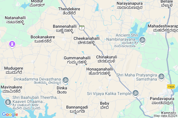
Kumbarakoppalu
Kumbarakoppalu Map
EDIT Map
Add Your House
 ..
..
Current Corona Virus Infected Patients Count in Mandya District
| City Name | District Name | Total Covid cases |
|---|---|---|
| Mandya District | Mandya | 8 |
| Malavalli | Mandya | 7 |
| Malvalli | Mandya | 1 |
Locality Name :
Kumbarakoppalu
( ಕುಂಬಾರಕೊಪ್ಪಲು )
Taluk Name : Pandavapura
District : Mandya
State : Karnataka
Division : Mysore
Language : Kannada and Hindi And English
Current Time 04:13 AM
Date: Saturday , Apr 26,2025 (IST)
Time zone: IST (UTC+5:30)
Elevation / Altitude: 718 meters. Above Seal level
Telephone Code / Std Code: 08236
Assembly constituency : Melukote assembly constituency
Assembly MLA : Dharshan Puttannaiah
Lok Sabha constituency : Mandya parliamentary constituency
Parliament MP : SUMALATHA AMBAREESH
Serpanch Name :
Pin Code : 571455
Post Office Name : Chinakurali
Main Village Name : Kumbarakoppalu
Commodities Prices : Pandavapura Market / Mandi
Kumbarakoppalu Live Weather
Temperature: 23.9 °C
overcast clouds
Humidity: 76%
Wind : 2.6 mt/sec towards W
StationName : "French Rocks"
observed on 1 Hours Back
Temperature: 23.9 °C
overcast clouds
Humidity: 76%
Wind : 2.6 mt/sec towards W
StationName : "French Rocks"
observed on 1 Hours Back
Kumbarakoppalu Weather Forecast for Next 5 days
27-04-2025
23.2°C to 36.2°C
overcast clouds, broken clouds
23.2°C to 36.2°C
overcast clouds, broken clouds
28-04-2025
22.9°C to 36.8°C
overcast clouds, broken clouds
22.9°C to 36.8°C
overcast clouds, broken clouds
29-04-2025
22.9°C to 35.9°C
broken clouds, few clouds, scattered clouds, light rain, overcast clouds
22.9°C to 35.9°C
broken clouds, few clouds, scattered clouds, light rain, overcast clouds
30-04-2025
23.4°C to 33.7°C
overcast clouds, scattered clouds, light rain
23.4°C to 33.7°C
overcast clouds, scattered clouds, light rain
National Highways Reachable To Kumbarakoppalu
Nationa High Way :NH275
Nationa High Way :NH150A;NH275
Nationa High Way :NH275
Nationa High Way :NH150A;NH275
Rivers Near Kumbarakoppalu
Hebballa :ಹೆಬ್ಬಳ್ಳ
Hemavati :ಹೇಮಾವತಿ
Hebballa :ಹೆಬ್ಬಳ್ಳ
Hemavati :ಹೇಮಾವತಿ
About Kumbarakoppalu
Correct below Info and add more info about KumbarakoppaluKumbarakoppalu is a small Village/hamlet in Pandavapura Taluk in Mandya District of Karnataka State, India. It comes under Kumbarakoppalu Panchayath. It belongs to Mysore Division . It is located 39 KM towards west from District head quarters Mandya. 8 KM from Pandavapura. 139 KM from State capital Bangalore
Kumbarakoppalu Pin code is 571455 and postal head office is Chinakurali .
Ichanahalli ( 5 KM ) , Dinka ( 6 KM ) , Bookanakere ( 7 KM ) , Bannangadi ( 8 KM ) , Narayanapura ( 9 KM ) are the nearby Villages to Kumbarakoppalu. Kumbarakoppalu is surrounded by Krishnarajpet Taluk towards North , Shrirangapattana Taluk towards East , Krishnarajanagara Taluk towards west , Mysore Taluk towards South .
Shrirangapattana , Mysore , Mandya , Nanjangud are the near by Cities to Kumbarakoppalu.
Demographics of Kumbarakoppalu
Kannada is the Local Language here.Politics in Kumbarakoppalu
Independent , JD(S) , Janata Dal (Secular) (JD(S)) , INC are the major political parties in this area.Polling Stations /Booths near Kumbarakoppalu
1)Govt Lower Primary School Kanaganahalli2)Govt Higher Primary School Goravale-1
3)Govt Composite Higher Primary School (primary Wing) Holalu-5
4)Govt Higher Primary School (north Wing) Cinakurali-2
5)Govt Higher Primary School (south Wing) Kennalu-2
HOW TO REACH Kumbarakoppalu
By Rail
There is no railway station near to Kumbarakoppalu in less than 10 km. Chandragiri Koppal Rail Way Station (near to Pandavapura) , Mandya Rail Way Station (near to Mandya) , Pandavapura Rail Way Station (near to Pandavapura) , Yeliyur Rail Way Station (near to Mandya) are the Rail way stations reachable from near by towns.By Road
Pandavapura , Krishnarajapet , Mandya are the nearby by towns to Kumbarakoppalu having road connectivity to KumbarakoppaluColleges near Kumbarakoppalu
Govt Collage
Address : K R S Pandavapuramain Rode
Vijaya Pu & First Grade Collage
Address :
Schools near Kumbarakoppalu
Kitturu Rani Channama R.school
Address : halebeedu , pandavapura , mandya , Karnataka . PIN- 571434 , Post - Pandavapura
B.capital School
Address : manikana hally , pandavapura , mandya , Karnataka . PIN- 571434 , Post - Pandavapura
Morarji Hps Baby(new School)
Address : baby , pandavapura , mandya , Karnataka . PIN- 571434 , Post - Pandavapura
Vidyanikethana H.s. Y.hkoppalu
Address : yenne hole koppalu , pandavapura , mandya , Karnataka . PIN- 571427 , Post - Kyathanahalli
Govt Health Centers near Kumbarakoppalu
1) Sanaba , , Sanaba village, Chinakurali Post ,2) Mahadeshwarapura , , Mahadeshwarapura subcentre ,
3) Hunaganahalli , , Hunaganahalli ,
Sub Villages in Kumbarakoppalu
Hospitals in Kumbarakoppalu,Pandavapura
Community Health Center
Chinakuruli; Mandya; SH-7; KR Pete Road; Pandavapura; Pandavapura; Karnataka 571455; India
2.4 KM distance Detail
more ..
Petrol Bunks in Kumbarakoppalu,Pandavapura
HP PETROL PUMP - TALUK AGRI.PROD.CO OP. MKTG.SOCTY
Kennalu Gram Panchayath OF V.V. Nagar Area; Pandavapura Taluq; Bengaluru; Karnataka 571434; India
2.6 KM distance Detail
Co and Co Clinakurali Indian Oil Petrol Pump
Chinakuruli; Mandya; SH-7; KR Pete Road; Pandavapura; Pandavapura; Karnataka 571455; India
2.7 KM distance Detail
more ..
Schools in Kumbarakoppalu,Pandavapura
ಸರ್ಕಾರಿ ಕಿರಿಯ ಪ್ರಾಥಮಿಕ ಶಾಲೆ. ಕುಂಬಾರ ಕೊಪ್ಪಲು
Kumbarakoppalu; Karnataka 571455; India
0.7 KM distance Detail
Government Lower Primary School Gummanahalli
Doddaballapura Block; Bengaluru; Gummanahalli; Karnataka 561203; India
1.8 KM distance Detail
Government Lower Primary School
Kanagana Halli; Mandya; SH-7; KR Pete Road; Pandavapura; Pandavapura; Karnataka 571455; India
2.0 KM distance Detail
Electronic Shops in Kumbarakoppalu,Pandavapura
Shri Lakshmi Fancy & Mobiles
Arsikere - Mysore Road; Chinakuruli; Karnataka 571455; India
2.4 KM distance Detail
Super Markets in Kumbarakoppalu,Pandavapura
Annapoorneshwari Industries; Haralahalli
Pandavapura Taluk; Haralahalli; Mandya District; New Extension; Kennalu; Karnataka 751434; India
14.2 KM distance Detail
Police Stations near Kumbarakoppalu,Pandavapura
Police Station Chinakuruli
Chinakuruli; Mandya; SH-7; KR Pete Road; Pandavapura; Pandavapura; Karnataka 571455; India
2.5 KM distance Detail
Governement Offices near Kumbarakoppalu,Pandavapura
Government Profession Education Department
Chinakuruli; Mandya; SH-7; KR Pete Road; Pandavapura; Pandavapura; Karnataka 571455; India
2.2 KM distance Detail
Executive Engineer Office KNN
Chinakuruli; Mandya; SH-7; KR Pete Road; Pandavapura; Pandavapura; Karnataka 571455; India
2.6 KM distance Detail
About Kumbarakoppalu &
History
How to reach Kumbarakoppalu
Tourist Places Near By Kumbarakoppalu
Schools in Kumbarakoppalu
Colleges in Kumbarakoppalu
Temperature & weather of Kumbarakoppalu
places in Kumbarakoppalu
Kumbarakoppalu photos
More Information
How to reach Kumbarakoppalu
Tourist Places Near By Kumbarakoppalu
Schools in Kumbarakoppalu
Colleges in Kumbarakoppalu
Temperature & weather of Kumbarakoppalu
places in Kumbarakoppalu
Kumbarakoppalu photos
More Information
Village Talk
Post News or Events about this Village
Near Cities
Shrirangapattana 20 KM near
Mysore 29 KM near
Mandya 38 KM near
Nanjangud 53 KM near
Shrirangapattana 20 KM near
Mysore 29 KM near
Mandya 38 KM near
Nanjangud 53 KM near
Near By Taluks
Pandavapura 8 KM near
Krishnarajpet 19 KM near
Shrirangapattana 23 KM near
Krishnarajanagara 30 KM near
Pandavapura 8 KM near
Krishnarajpet 19 KM near
Shrirangapattana 23 KM near
Krishnarajanagara 30 KM near
Near By Air Ports
Mysore Airport 31 KM near
Bengaluru International Airport 159 KM near
Calicut Airport 190 KM near
Peelamedu Airport 196 KM near
Mysore Airport 31 KM near
Bengaluru International Airport 159 KM near
Calicut Airport 190 KM near
Peelamedu Airport 196 KM near
Near By Tourist Places
Srirangapatna 21 KM near
Mysore 30 KM near
Sravanabelagola 41 KM near
Nanjangud 53 KM near
Shivanasamundram 77 KM near
Srirangapatna 21 KM near
Mysore 30 KM near
Sravanabelagola 41 KM near
Nanjangud 53 KM near
Shivanasamundram 77 KM near
Near By Districts
Mysore 29 KM near
Mandya 38 KM near
Hassan 81 KM near
Chamarajanagar 86 KM near
Mysore 29 KM near
Mandya 38 KM near
Hassan 81 KM near
Chamarajanagar 86 KM near
Near By RailWay Station
Pandavapura Rail Way Station 15 KM near
Shrirangapattana Rail Way Station 18 KM near
Pandavapura Rail Way Station 15 KM near
Shrirangapattana Rail Way Station 18 KM near