| Home | City Bus | Maps | Villages | Cities | Rail | Tourist Places | School | College | Pin Codes | Corona Cases Count |
| Distance Calculator Bus Services IFSC Codes Trace Mobile Number Weather Search Place Trace IP Available Cash ATM/Banks Locate Polling Booth Report an Error contact People |
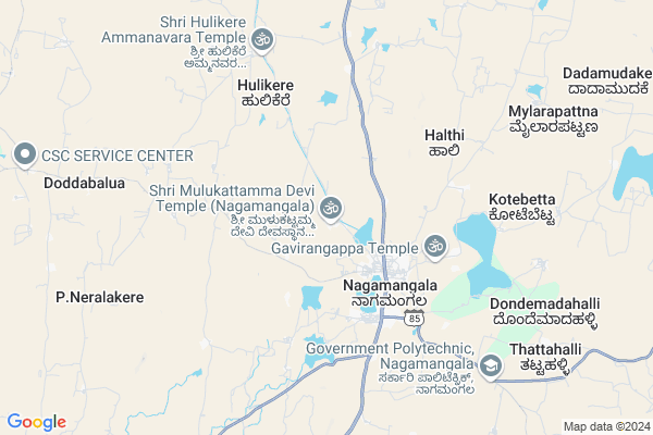
Mulkatte
Mulkatte Map
EDIT Map
Add Your House
 ..
..
Current Corona Virus Infected Patients Count in Mandya District
| City Name | District Name | Total Covid cases |
|---|---|---|
| Mandya District | Mandya | 8 |
| Malavalli | Mandya | 7 |
| Malvalli | Mandya | 1 |
Locality Name :
Mulkatte
( ಮುಲ್ಕತ್ತೆ )
Taluk Name : Nagamangala
District : Mandya
State : Karnataka
Division : Mysore
Language : Kannada and Hindi And English
Current Time 11:30 AM
Date: Thursday , Feb 06,2025 (IST)
Time zone: IST (UTC+5:30)
Elevation / Altitude: 724 meters. Above Seal level
Telephone Code / Std Code: 08234
Assembly constituency : Nagamangala assembly constituency
Assembly MLA : N. Chaluvarayaswamy
Lok Sabha constituency : Mandya parliamentary constituency
Parliament MP : SUMALATHA AMBAREESH
Serpanch Name :
Pin Code : 571432
Post Office Name : Nagamangala
Main Village Name : Mulkatte
Alternate Village Name : Mulakatte
Commodities Prices : Nagamangala Market / Mandi
Mulkatte Live Weather
Temperature: 22.3 °C
scattered clouds
Humidity: 39%
Wind : 4.62 mt/sec towards E
StationName : "NÄ\u0081gamangala"
observed on 1 Hours Back
Temperature: 22.3 °C
scattered clouds
Humidity: 39%
Wind : 4.62 mt/sec towards E
StationName : "NÄ\u0081gamangala"
observed on 1 Hours Back
Mulkatte Weather Forecast for Next 5 days
07-02-2025
16.9°C to 29.6°C
scattered clouds, clear sky
16.9°C to 29.6°C
scattered clouds, clear sky
08-02-2025
15.6°C to 30.5°C
clear sky, broken clouds, scattered clouds
15.6°C to 30.5°C
clear sky, broken clouds, scattered clouds
09-02-2025
16.4°C to 31.1°C
few clouds, clear sky
16.4°C to 31.1°C
few clouds, clear sky
10-02-2025
16.9°C to 31.4°C
clear sky, few clouds, broken clouds, scattered clouds
16.9°C to 31.4°C
clear sky, few clouds, broken clouds, scattered clouds
11-02-2025
16.9°C to 31.0°C
few clouds, clear sky
16.9°C to 31.0°C
few clouds, clear sky
National Highways Reachable To Mulkatte
Nationa High Way :NH275
Nationa High Way :NH75
Nationa High Way :NH275
Nationa High Way :NH75
Rivers Near Mulkatte
Hemavati :ಹೇಮಾವತಿ
Hemavati :ಹೇಮಾವತಿ
Hemavati :ಹೇಮಾವತಿ
Hemavati :ಹೇಮಾವತಿ
About Mulkatte
Correct below Info and add more info about MulkatteMulkatte is a small Village/hamlet in Nagamangala Taluk in Mandya District of Karnataka State, India. It comes under Mulkatte Panchayath. It belongs to Mysore Division . It is located 46 KM towards North from District head quarters Mandya. 2 KM from Nagamangala. 109 KM from State capital Bangalore
Mulkatte Pin code is 571432 and postal head office is Nagamangala .
Nagamangala ( 3 KM ) , Badri Koppalu ( 3 KM ) , Kasuvanahalli ( 4 KM ) , Palagrahara ( 4 KM ) , Nagamangala Rural ( 5 KM ) are the nearby Villages to Mulkatte. Mulkatte is surrounded by Kunigal Taluk towards East , Mandya Taluk towards South , Turuvekere Taluk towards North , Krishnarajpet Taluk towards west .
Mandya , Maddur , Shrirangapattana , Tiptur are the near by Cities to Mulkatte.
Mulkatte 2011 Census Details
Mulkatte Local Language is Kannada. Mulkatte Village Total population is 2253 and number of houses are 575. Female Population is 49.2%. Village literacy rate is 69.0% and the Female Literacy rate is 30.1%.
Population
| Census Parameter | Census Data |
| Total Population | 2253 |
| Total No of Houses | 575 |
| Female Population % | 49.2 % ( 1108) |
| Total Literacy rate % | 69.0 % ( 1554) |
| Female Literacy rate | 30.1 % ( 679) |
| Scheduled Tribes Population % | 1.9 % ( 42) |
| Scheduled Caste Population % | 19.1 % ( 431) |
| Working Population % | 35.2 % |
| Child(0 -6) Population by 2011 | 213 |
| Girl Child(0 -6) Population % by 2011 | 47.9 % ( 102) |
Mulkatte Census More Deatils.
Politics in Mulkatte
Independent , JD(S) , Janata Dal (Secular) (JD(S)) , INC are the major political parties in this area.Polling Stations /Booths near Mulkatte
1)Govt Girls Higher Primary School (east Wing) Opposite Marigudi Nagamangala-102)Govt Higher Primary School Ramenahally
3)Govt Higher Primary School Thoremallanayakanahally
4)Govt Higher Primary School Thuppadamadu-1
5)Govt Higher Primary School (north Wing) Lalanakere-1
HOW TO REACH Mulkatte
By Rail
There is no railway station near to Mulkatte in less than 10 km. are the Rail way stations reachable from near by towns.By Road
Nagamangala , Krishnarajapet , Nelamangala are the nearby by towns to Mulkatte having road connectivity to MulkatteColleges near Mulkatte
Government Junior College And High School
Address :
Govt Polytechnic
Address : Devalapura Hand Post
Schools in Mulkatte
Ghps Mullakatte
Address : mulakatte , nagamangala , mandya , Karnataka . PIN- 571432 , Post - Nagamangala
Govt Health Centers near Mulkatte
1) Chalya , JUNIOR HEALTH ASSISTANT FEMALE , ,2) Hunaganahalli , , Hunaganahalli ,
3) D.Hosahally , JUNIOR HEALTH ASSISTANT FEMALE , ,
Sub Villages in Mulkatte
Hospitals in Mulkatte,Nagamangala
Taluk Public Hospital
Mandya; SH-19; Srirangapatna Jevargi Road; Nagamangala; Nagamangala; Karnataka 571432; India
3.5 KM distance Detail
Karnataka Clinic
Makkah Masjid Road; Shikaripalya; Electronic City; Nagamangala; Karnataka 560100; India
4.4 KM distance Detail
more ..
Petrol Bunks in Mulkatte,Nagamangala
HP PETROL PUMP - NAGAMANGALA TAPCMS LTD
HPC Dealers Upparahalli Village;kasaba Hobli Nagamangala Town;tb Extension; Bengaluru; Karnataka 571432; India
2.9 KM distance Detail
Sapthagiri Filling Station Indian Oil Petrol Pump
Mandya; SH-19; Srirangapatna Jevargi Road; Nagamangala; Nagamangala; Karnataka 571432; India
3.8 KM distance Detail
more ..
Colleges in Mulkatte,Nagamangala
Sri Adichunchanagiri College of Arts; Commerce & Science
Mandya District; Nagamangala; Karnataka 571432; India
2.9 KM distance Detail
PU College Nagamangala
Old Post Office Rd; Nagamangala; Karnataka 571432; India
3.5 KM distance Detail
more ..
Schools in Mulkatte,Nagamangala
SAC arts Commerce And Science College
TB extension; Nagamangala; 571432; India
2.9 KM distance Detail
Electronic Shops in Mulkatte,Nagamangala
Colourz Cyber Center
T B circle; Opp; KEB St; Nagamangala; Karnataka 571432; India
3.1 KM distance Detail
Chamundeshwari Telecom
Old Post Office Rd; Nagamangala; Karnataka 571432; India
3.4 KM distance Detail
Police Stations near Mulkatte,Nagamangala
Police Station Nagamangala
Mandya; SH-19; Srirangapatna Jevargi Road; Nagamangala; Nagamangala; Karnataka 571432; India
3.5 KM distance Detail
Governement Offices near Mulkatte,Nagamangala
Grama Panchayat Nagamangala
Mandya; SH-19; Srirangapatna Jevargi Road; Nagamangala; Nagamangala; Karnataka 571432; India
3.3 KM distance Detail
Senior Assistant Director of Agriculture
Mandya; SH-19; Srirangapatna Jevargi Road; Nagamangala; Nagamangala; Karnataka 571432; India
3.3 KM distance Detail
About Mulkatte &
History
How to reach Mulkatte
Tourist Places Near By Mulkatte
Schools in Mulkatte
Colleges in Mulkatte
Temperature & weather of Mulkatte
places in Mulkatte
Mulkatte photos
More Information
How to reach Mulkatte
Tourist Places Near By Mulkatte
Schools in Mulkatte
Colleges in Mulkatte
Temperature & weather of Mulkatte
places in Mulkatte
Mulkatte photos
More Information
Village Talk
Post News or Events about this Village
Near Cities
Mandya 44 KM near
Maddur 50 KM near
Shrirangapattana 54 KM near
Tiptur 60 KM near
Mandya 44 KM near
Maddur 50 KM near
Shrirangapattana 54 KM near
Tiptur 60 KM near
Near By Taluks
Nagamangala 1 KM near
Kunigal 35 KM near
Turuvekere 36 KM near
Mandya 36 KM near
Nagamangala 1 KM near
Kunigal 35 KM near
Turuvekere 36 KM near
Mandya 36 KM near
Near By Air Ports
Mysore Airport 69 KM near
Bengaluru International Airport 124 KM near
Bajpe Airport 224 KM near
Salem Airport 229 KM near
Mysore Airport 69 KM near
Bengaluru International Airport 124 KM near
Bajpe Airport 224 KM near
Salem Airport 229 KM near
Near By Tourist Places
Sravanabelagola 31 KM near
Srirangapatna 55 KM near
Savandurga 68 KM near
Mysore 69 KM near
Shivagange 71 KM near
Sravanabelagola 31 KM near
Srirangapatna 55 KM near
Savandurga 68 KM near
Mysore 69 KM near
Shivagange 71 KM near
Near By Districts
Mandya 44 KM near
Ramanagara 67 KM near
Mysore 67 KM near
Tumkur 74 KM near
Mandya 44 KM near
Ramanagara 67 KM near
Mysore 67 KM near
Tumkur 74 KM near
Near By RailWay Station
Mandya Rail Way Station 44 KM near
Maddur Rail Way Station 48 KM near
Mandya Rail Way Station 44 KM near
Maddur Rail Way Station 48 KM near