| Home | City Bus | Maps | Villages | Cities | Rail | Tourist Places | School | College | Pin Codes | Corona Cases Count |
| Distance Calculator Bus Services IFSC Codes Trace Mobile Number Weather Search Place Trace IP Available Cash ATM/Banks Locate Polling Booth Report an Error contact People |
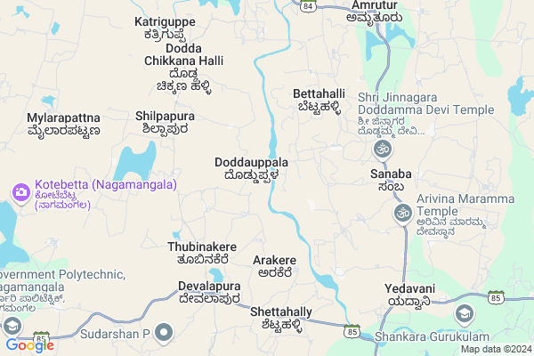
Doddauppla
Doddauppla Map
EDIT Map
Add Your House
 ..
..
Current Corona Virus Infected Patients Count in Mandya District
| City Name | District Name | Total Covid cases |
|---|---|---|
| Mandya District | Mandya | 8 |
| Malavalli | Mandya | 7 |
| Malvalli | Mandya | 1 |
Locality Name :
Doddauppla
( ದೊಡ್ಡಉಪ್ಪಳ )
Taluk Name : Nagamangala
District : Mandya
State : Karnataka
Division : Mysore
Language : Kannada and Hindi And English
Current Time 11:18 AM
Date: Thursday , Feb 06,2025 (IST)
Time zone: IST (UTC+5:30)
Elevation / Altitude: 724 meters. Above Seal level
Telephone Code / Std Code: 08234
Assembly constituency : Nagamangala assembly constituency
Assembly MLA : N. Chaluvarayaswamy
Lok Sabha constituency : Mandya parliamentary constituency
Parliament MP : SUMALATHA AMBAREESH
Serpanch Name :
Main Village Name : Doddauppla
Alternate Village Name : Doddauppala
Commodities Prices : Nagamangala Market / Mandi
Doddauppla Live Weather
Temperature: 26.5 °C
scattered clouds
Humidity: 28%
Wind : 5.07 mt/sec towards SE
StationName : "NÄ\u0081gamangala"
observed on 42 Mins Back
Temperature: 26.5 °C
scattered clouds
Humidity: 28%
Wind : 5.07 mt/sec towards SE
StationName : "NÄ\u0081gamangala"
observed on 42 Mins Back
Doddauppla Weather Forecast for Next 5 days
07-02-2025
18.0°C to 31.4°C
scattered clouds, clear sky
18.0°C to 31.4°C
scattered clouds, clear sky
08-02-2025
16.6°C to 32.3°C
clear sky, broken clouds, scattered clouds, few clouds
16.6°C to 32.3°C
clear sky, broken clouds, scattered clouds, few clouds
09-02-2025
17.4°C to 32.6°C
few clouds, clear sky
17.4°C to 32.6°C
few clouds, clear sky
10-02-2025
17.9°C to 33.0°C
clear sky, few clouds, scattered clouds
17.9°C to 33.0°C
clear sky, few clouds, scattered clouds
11-02-2025
17.8°C to 32.8°C
clear sky, few clouds
17.8°C to 32.8°C
clear sky, few clouds
National Highways Reachable To Doddauppla
Nationa High Way :NH275
Nationa High Way :NH75
Nationa High Way :NH275
Nationa High Way :NH75
Rivers Near Doddauppla
Hemavati :ಹೇಮಾವತಿ
Hemavati :ಹೇಮಾವತಿ
Hemavati :ಹೇಮಾವತಿ
Hemavati :ಹೇಮಾವತಿ
About Doddauppla
Correct below Info and add more info about DoddaupplaDoddauppla is a small Village/hamlet in Nagamangala Taluk in Mandya District of Karnataka State, India. It comes under Doddauppla Panchayath. It belongs to Mysore Division . It is located 42 KM towards North from District head quarters Mandya. 20 KM from Nagamangala. 91 KM from State capital Bangalore
Haradanahalli ( 7 KM ) , Koudle ( 10 KM ) , Bhimanahalli ( 10 KM ) , Palagrahara ( 13 KM ) , Bekkalale ( 13 KM ) are the nearby Villages to Doddauppla. Doddauppla is surrounded by Kunigal Taluk towards North , Mandya Taluk towards South , Maddur Taluk towards South , Turuvekere Taluk towards North .
Maddur , Mandya , Magadi , Ramanagaram are the near by Cities to Doddauppla.
Doddauppla 2011 Census Details
Doddauppla Local Language is Kannada. Doddauppla Village Total population is 418 and number of houses are 97. Female Population is 50.0%. Village literacy rate is 66.0% and the Female Literacy rate is 28.7%.
Population
| Census Parameter | Census Data |
| Total Population | 418 |
| Total No of Houses | 97 |
| Female Population % | 50.0 % ( 209) |
| Total Literacy rate % | 66.0 % ( 276) |
| Female Literacy rate | 28.7 % ( 120) |
| Scheduled Tribes Population % | 0.0 % ( 0) |
| Scheduled Caste Population % | 20.1 % ( 84) |
| Working Population % | 56.9 % |
| Child(0 -6) Population by 2011 | 40 |
| Girl Child(0 -6) Population % by 2011 | 55.0 % ( 22) |
Doddauppla Census More Deatils.
Politics in Doddauppla
Independent , JD(S) , Janata Dal (Secular) (JD(S)) , INC are the major political parties in this area.Polling Stations /Booths near Doddauppla
1)Govt Higher Primary School Doddajataka2)Govt Higher Primary School (south Wing) R No 1 Maraliga3 -
3)Govt Lower Primary School Chikkonahally
4)Govt Higher Primary School Shivanahally
5)Govt Higher Primary School Palagrahara
HOW TO REACH Doddauppla
By Rail
There is no railway station near to Doddauppla in less than 10 km. are the Rail way stations reachable from near by towns.By Road
Nagamangala , Krishnarajapet , Nelamangala are the nearby by towns to Doddauppla having road connectivity to DoddaupplaPincodes near Doddauppla
571445 ( Devalapura (Mandya) ) , 572111 ( Amruthur ) , 572142 ( Yediyur (Tumkur) )Colleges near Doddauppla
Government Junior College And High School
Address :
Govt Polytechnic
Address : Devalapura Hand Post
Schools near Doddauppla
Kitturu Rani Channama R School
Address : bellur (rural) , nagamangala , mandya , Karnataka . PIN- 571448 , Post - Balagangadaranathnagar
Ghs Morarji (r) Somanahalli
Address : somana hally2 , nagamangala , mandya , Karnataka . PIN- 571810
Murargi R.school Kotebetta
Address : kot betta , nagamangala , mandya , Karnataka . PIN- 571802 , Post - Bindiganavile
Morarji (r) School Kambadahalli
Address : kambada hally , nagamangala , mandya , Karnataka . PIN- 571432 , Post - Nagamangala
Govt Health Centers near Doddauppla
1) Hunaganahalli , , Hunaganahalli ,2) HOSAKERE , , Sub Center Hosakere, PHC Besagarahalli Koppa Hobli, ,
3) Chalya , JUNIOR HEALTH ASSISTANT FEMALE , ,
Sub Villages in Doddauppla
Petrol Bunks in Doddauppla,Nagamangala
Sapthagiri Filling Station Indian Oil Petrol Pump
Mandya; SH-19; Srirangapatna Jevargi Road; Nagamangala; Nagamangala; Karnataka 571432; India
17.3 KM distance Detail
HP PETROL PUMP - NAGAMANGALA TAPCMS LTD
HPC Dealers Upparahalli Village;kasaba Hobli Nagamangala Town;tb Extension; Bengaluru; Karnataka 571432; India
17.3 KM distance Detail
more ..
Colleges in Doddauppla,Nagamangala
Government Pre University College
Devalapura; Mandya; SH-85; Koudle Road; Nagamangala; Nagamangala; Karnataka 571445; India
6.5 KM distance Detail
Government Industrial Training Institute
Nagamangala; Karnataka 571432; India
14.7 KM distance Detail
Government Polytechnic; Nagamangala
Devalapura Handpost; Mandya; Nagamangala Rural; Karnataka 571432; India
14.7 KM distance Detail
more ..
Schools in Doddauppla,Nagamangala
Bapauji Rural High School
Ramenahalli; Devalapura Hobli; Nagamanagala Taluk; Karnataka; India
4.6 KM distance Detail
Government Lower Primary School Devalapura
Devalapura Hosakote Block; Bangalore; Karnataka 560067; India
6.0 KM distance Detail
Electronic Shops in Doddauppla,Nagamangala
Chamundeshwari Telecom
Old Post Office Rd; Nagamangala; Karnataka 571432; India
16.9 KM distance Detail
Police Stations near Doddauppla,Nagamangala
Police Station Nagamangala
Mandya; SH-19; Srirangapatna Jevargi Road; Nagamangala; Nagamangala; Karnataka 571432; India
17.1 KM distance Detail
Governement Offices near Doddauppla,Nagamangala
Senior Assistant Director of Agriculture
Mandya; SH-19; Srirangapatna Jevargi Road; Nagamangala; Nagamangala; Karnataka 571432; India
16.9 KM distance Detail
About Doddauppla &
History
How to reach Doddauppla
Tourist Places Near By Doddauppla
Schools in Doddauppla
Colleges in Doddauppla
Temperature & weather of Doddauppla
places in Doddauppla
Doddauppla photos
More Information
How to reach Doddauppla
Tourist Places Near By Doddauppla
Schools in Doddauppla
Colleges in Doddauppla
Temperature & weather of Doddauppla
places in Doddauppla
Doddauppla photos
More Information
Village Talk
Post News or Events about this Village
Near Cities
Maddur 39 KM near
Mandya 41 KM near
Magadi 43 KM near
Ramanagaram 50 KM near
Maddur 39 KM near
Mandya 41 KM near
Magadi 43 KM near
Ramanagaram 50 KM near
Near By Taluks
Nagamangala 19 KM near
Kunigal 19 KM near
Mandya 34 KM near
Maddur 37 KM near
Nagamangala 19 KM near
Kunigal 19 KM near
Mandya 34 KM near
Maddur 37 KM near
Near By Air Ports
Mysore Airport 75 KM near
Bengaluru International Airport 107 KM near
Salem Airport 216 KM near
Peelamedu Airport 228 KM near
Mysore Airport 75 KM near
Bengaluru International Airport 107 KM near
Salem Airport 216 KM near
Peelamedu Airport 228 KM near
Near By Tourist Places
Sravanabelagola 49 KM near
Savandurga 50 KM near
Shivagange 56 KM near
Srirangapatna 60 KM near
Mysore 75 KM near
Sravanabelagola 49 KM near
Savandurga 50 KM near
Shivagange 56 KM near
Srirangapatna 60 KM near
Mysore 75 KM near
Near By Districts
Mandya 41 KM near
Ramanagara 50 KM near
Tumkur 64 KM near
Mysore 74 KM near
Mandya 41 KM near
Ramanagara 50 KM near
Tumkur 64 KM near
Mysore 74 KM near
Near By RailWay Station
Maddur Rail Way Station 37 KM near
Mandya Rail Way Station 41 KM near
Maddur Rail Way Station 37 KM near
Mandya Rail Way Station 41 KM near