| Home | City Bus | Maps | Villages | Cities | Rail | Tourist Places | School | College | Pin Codes | Corona Cases Count |
| Distance Calculator Bus Services IFSC Codes Trace Mobile Number Weather Search Place Trace IP Available Cash ATM/Banks Locate Polling Booth Report an Error contact People |
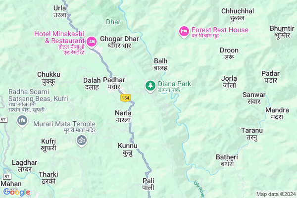
Panchjan
Panchjan Map
EDIT Map
Add Your House
 ..
..
Current Corona Virus Infected Patients Count in Mandi District
| City Name | District Name | Total Covid cases |
|---|
Locality Name :
Panchjan
( पंचजन )
Tehsil Name : Drang
District : Mandi
State : Himachal Pradesh
Language : Hindi and English, Pahari And Mandyali
Current Time 09:51 AM
Date: Thursday , Apr 24,2025 (IST)
Time zone: IST (UTC+5:30)
Elevation / Altitude: 1189 meters. Above Seal level
Telephone Code / Std Code: 01902
Assembly constituency : Darang assembly constituency
Assembly MLA : Puran Chand
Lok Sabha constituency : Mandi parliamentary constituency
Parliament MP : RAM SWAROOP SHARMA
Serpanch Name :
Main Village Name : Panchjan
Commodities Prices : Kullu Market / Mandi
National Highways Reachable To Panchjan
Nationa High Way :NH5
Nationa High Way :NH3
Nationa High Way :NH5
Nationa High Way :NH3
Rivers Near Panchjan
Sutlej :Sutlej River :सतलुज नदी :ਸਤਲੁਜ :ستلج
Phu Lungpa
Sutlej :Sutlej River :सतलुज नदी :ਸਤਲੁਜ :ستلج
Phu Lungpa
About Panchjan
Correct below Info and add more info about PanchjanPanchjan is a small Village/hamlet in Drang Tehsil in Mandi District of Himachal Pradesh State, India. It comes under Panchjan Panchayath. It is located 20 KM towards North from District head quarters Mandi. 102 KM from State capital Shimla
Panchjan is surrounded by Mandi Tehsil towards South , Kullu Tehsil towards East , Chauntra Tehsil towards west , Dharmpur Tehsil towards west .
Mandi , Sundarnagar , Hamirpur , Dharamsala are the near by Cities to Panchjan.
Panchjan 2011 Census Details
Panchjan Local Language is Hindi. Panchjan Village Total population is 491 and number of houses are 92. Female Population is 51.5%. Village literacy rate is 70.9% and the Female Literacy rate is 31.8%.
Population
| Census Parameter | Census Data |
| Total Population | 491 |
| Total No of Houses | 92 |
| Female Population % | 51.5 % ( 253) |
| Total Literacy rate % | 70.9 % ( 348) |
| Female Literacy rate | 31.8 % ( 156) |
| Scheduled Tribes Population % | 0.0 % ( 0) |
| Scheduled Caste Population % | 6.5 % ( 32) |
| Working Population % | 66.6 % |
| Child(0 -6) Population by 2011 | 59 |
| Girl Child(0 -6) Population % by 2011 | 52.5 % ( 31) |
Panchjan Census More Deatils.
Politics in Panchjan
HVC , BJP , INC are the major political parties in this area.Polling Stations /Booths near Panchjan
1)Gps Shialg2)Gms Jalkhini
3)Gps Tikker
4)Gps Kundakh
5)Gps Nalan(at Kuthachi)
HOW TO REACH Panchjan
By Rail
There is no railway station near to Panchjan in less than 10 km.Pincodes near Panchjan
175003 ( Kotli ) , 175005 ( Kataula ) , 175126 ( Shamshi )Colleges near Panchjan
Govt. Degree College Ladbharol
Address :
Mlsm College
Address :
Govt. Degree College
Address :
Karsog
Address : Gdc Karsog Near Govt.school Karsog
Abhilashi College Of Education
Address : Village & Post Office Nerchowk, Mandi, Himachal Pr
Schools near Panchjan
Gurulul Pub Sss Jhalwan
Address : jhalwan , drang-1 , mandi , Himachal Pradesh . PIN- 175015
Gsss Bassi
Address : kunduni , drang-1 , mandi , Himachal Pradesh . PIN- 175015
Gsss Bihun
Address : bihun , drang-1 , mandi , Himachal Pradesh . PIN- 175015
Ascent Pub Sen Sec Sch.
Address : ward-7 joginder nagar , drang-1 , mandi , Himachal Pradesh . PIN- 175015
Govt Health Centers near Panchjan
1) Utpur PHC , VPO Utpur Tehsil Tauni Devi Distt. Hamirpur H.P. , Utpur ,2) Chauri PHC , VPO Chauri Tehsil Sujanpur Distt. Hamirpur H.P. , Chauri ,
3) Dhaned Seribaloni PHC , VPO Dhaned Tehsil &Distt. Hamirpur H.P. , Dhaned ,
Sub Villages in Panchjan
Hospitals in Panchjan,Drang
Veterinary Hospital Taryambali
Bhanwar Rd; Taryambali; Himachal Pradesh 175012; India
11.5 KM distance Detail
Prinary Health Centre
Mandi-Bajaura Rd; Kataula; Himachal Pradesh 175005; India
13.0 KM distance Detail
Veterinary Hospital Kataula
Mandi-Bajaura Rd; Kataula; Himachal Pradesh 175005; India
13.1 KM distance Detail
more ..
Petrol Bunks in Panchjan,Drang
Indian Oil Petrol Pump Kamand
Mandi-Bajaura Rd; Khanahr; Himachal Pradesh 175005; India
12.9 KM distance Detail
Indian Oil Pump
National Highway 20; Khaliar; Himachal Pradesh 175001; India
18.4 KM distance Detail
Dr Rk Puri Filling Station Khaliyar Mandi
Mandi - Pathankot Rd; Chhipnu; Himachal Pradesh 175001; India
18.5 KM distance Detail
Kuldeep Chand and Sons Bharat Petroleum
Mandi; Palace Colony; Mandi; Himachal Pradesh 175001; India
21.0 KM distance Detail
more ..
Colleges in Panchjan,Drang
Beas Kund Hostel; IIT Mandi North Campus
Salgi Village; Himachal Pradesh 175005; India
13.1 KM distance Detail
Indian Institute of Technology; Mandi
Parashar Road; Tehsil Sadar; Near Kataula; Kamand; Himachal Pradesh 175005; India
13.3 KM distance Detail
more ..
Schools in Panchjan,Drang
Government Primary School
Katindhi - Drang Rd; Holu; Himachal Pradesh 175012; India
9.0 KM distance Detail
Government Primary School
Mandi - Pathankot Rd; Bhatog; Himachal Pradesh 175012; India
9.1 KM distance Detail
Electronic Shops in Panchjan,Drang
Getway Computer Store
Samkhetar Road; Samkhetar; Mandi; Himachal Pradesh 175001; India
20.6 KM distance Detail
Suraj Enterpriaes
Mandi-Bajaura Rd; Samkhetar; Mandi; Himachal Pradesh 175001; India
20.6 KM distance Detail
Super Markets in Panchjan,Drang
Nitish Daily Need Corner & Genral Store
Bhararu; Himachal Pradesh 175014; India
16.1 KM distance Detail
Boby Hair Saloon
Mandi - Pathankot Rd; Khaliar; Mandi; Himachal Pradesh 175001; India
20.3 KM distance Detail
Local Parks in Panchjan,Drang
Durang Salt Resourse
National Highway 20; Drang; Nagrota; Himachal Pradesh 175012; India
8.6 KM distance Detail
Police Stations near Panchjan,Drang
Superintendent of Police
Samkhetar Road; Bangala Muhalla; Bhagwan Muhalla; Samkhetar; Mandi; Himachal Pradesh 175001; India
21.0 KM distance Detail
Police Superintendent Office
Samkhetar Road; Bangala Muhalla; Bhagwan Muhalla; Samkhetar; Mandi; Himachal Pradesh 175001; India
21.0 KM distance Detail
Governement Offices near Panchjan,Drang
Gram Panchayat Bhavan Bhararu
Padhar-Nohali Rd; Bhararu; Himachal Pradesh 175014; India
15.9 KM distance Detail
Public Works Dep Store
Padhar-Nohali Rd; Kas; Himachal Pradesh 176120; India
16.6 KM distance Detail
About Panchjan &
History
How to reach Panchjan
Tourist Places Near By Panchjan
Schools in Panchjan
Colleges in Panchjan
Temperature & weather of Panchjan
places in Panchjan
Panchjan photos
More Information
How to reach Panchjan
Tourist Places Near By Panchjan
Schools in Panchjan
Colleges in Panchjan
Temperature & weather of Panchjan
places in Panchjan
Panchjan photos
More Information
Village Talk
Post News or Events about this Village
Near Cities
Mandi 19 KM near
Sundarnagar 43 KM near
Hamirpur 50 KM near
Dharamsala 78 KM near
Mandi 19 KM near
Sundarnagar 43 KM near
Hamirpur 50 KM near
Dharamsala 78 KM near
Near By Taluks
Drang 0 KM near
Mandi 16 KM near
Kullu 20 KM near
Chauntra 22 KM near
Drang 0 KM near
Mandi 16 KM near
Kullu 20 KM near
Chauntra 22 KM near
Near By Air Ports
Bhuntar Airport 22 KM near
Gaggal Airport 88 KM near
Simla Airport 96 KM near
Pathankot Airport 144 KM near
Bhuntar Airport 22 KM near
Gaggal Airport 88 KM near
Simla Airport 96 KM near
Pathankot Airport 144 KM near
Near By Tourist Places
Mandi 19 KM near
Kullu 21 KM near
Bhuntar 22 KM near
Rewalsar 31 KM near
Bir 33 KM near
Mandi 19 KM near
Kullu 21 KM near
Bhuntar 22 KM near
Rewalsar 31 KM near
Bir 33 KM near
Near By Districts
Mandi 20 KM near
Kullu 21 KM near
Hamirpur 49 KM near
Bilaspur District 68 KM near
Mandi 20 KM near
Kullu 21 KM near
Hamirpur 49 KM near
Bilaspur District 68 KM near
Near By RailWay Station
Nangal Dam Rail Way Station 86 KM near
Anandpur Sahib Rail Way Station 92 KM near
Nangal Dam Rail Way Station 86 KM near
Anandpur Sahib Rail Way Station 92 KM near