| Home | City Bus | Maps | Villages | Cities | Rail | Tourist Places | School | College | Pin Codes | Corona Cases Count |
| Distance Calculator Bus Services IFSC Codes Trace Mobile Number Weather Search Place Trace IP Available Cash ATM/Banks Locate Polling Booth Report an Error contact People |
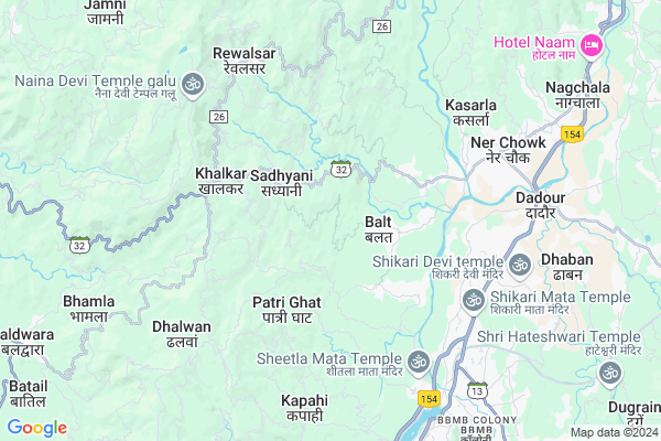
Rathol
Rathol Map
EDIT Map
Add Your House
 ..
..
Current Corona Virus Infected Patients Count in Mandi District
| City Name | District Name | Total Covid cases |
|---|
Locality Name :
Rathol
( राठोल )
Tehsil Name : Balh
District : Mandi
State : Himachal Pradesh
Language : Hindi and English, Pahari And Mandyali
Current Time 04:21 AM
Date: Saturday , Apr 26,2025 (IST)
Time zone: IST (UTC+5:30)
Elevation / Altitude: 1189 meters. Above Seal level
Telephone Code / Std Code: 01907
Assembly constituency : Balh assembly constituency
Assembly MLA : Inder Singh
Lok Sabha constituency : Mandi parliamentary constituency
Parliament MP : RAM SWAROOP SHARMA
Serpanch Name :
Pin Code : 175008
Post Office Name : Ner Chowk
Main Village Name : Rathol
Commodities Prices : Mandi(Mandi) Market / Mandi
Rathol Live Weather
Temperature: 17.8 °C
clear sky
Humidity: 29%
Wind : 3.82 mt/sec towards E
StationName : "Sundarnagar"
observed on 1 Hours Back
Temperature: 17.8 °C
clear sky
Humidity: 29%
Wind : 3.82 mt/sec towards E
StationName : "Sundarnagar"
observed on 1 Hours Back
Rathol Weather Forecast for Next 5 days
27-04-2025
17.8°C to 34.0°C
clear sky
17.8°C to 34.0°C
clear sky
28-04-2025
19.0°C to 35.7°C
clear sky, few clouds
19.0°C to 35.7°C
clear sky, few clouds
29-04-2025
19.6°C to 36.7°C
clear sky, few clouds, scattered clouds
19.6°C to 36.7°C
clear sky, few clouds, scattered clouds
30-04-2025
20.4°C to 37.5°C
clear sky, scattered clouds
20.4°C to 37.5°C
clear sky, scattered clouds
National Highways Reachable To Rathol
Nationa High Way :NH44
Nationa High Way :NH3
Nationa High Way :NH44
Nationa High Way :NH3
Rivers Near Rathol
Lingti Chu
Tos Nal
Lingti Chu
Tos Nal
About Rathol
Correct below Info and add more info about RatholRathol is a small Village/hamlet in Balh Tehsil in Mandi District of Himachal Pradesh State, India. It comes under Rathol Panchayath. It is located 17 KM towards South from District head quarters Mandi. 6 KM from Balh. 71 KM from State capital Shimla
Rathol Pin code is 175008 and postal head office is Ner Chowk .
Dadaur (sdr) ( 5 KM ) , Kasarla ( 6 KM ) , Ner (sdr) ( 6 KM ) , Lower Rewalsar ( 6 KM ) , Bhangrotu (sdr) ( 7 KM ) are the nearby Villages to Rathol. Rathol is surrounded by Gohar Tehsil towards East , Sundarnagar Tehsil towards South , Mandi Tehsil towards North , Bhoranj Tehsil towards west .
Sundarnagar , Mandi , Hamirpur , Nangal are the near by Cities to Rathol.
Rathol 2011 Census Details
Rathol Local Language is Hindi. Rathol Village Total population is 497 and number of houses are 117. Female Population is 54.5%. Village literacy rate is 71.6% and the Female Literacy rate is 36.0%.
Population
| Census Parameter | Census Data |
| Total Population | 497 |
| Total No of Houses | 117 |
| Female Population % | 54.5 % ( 271) |
| Total Literacy rate % | 71.6 % ( 356) |
| Female Literacy rate | 36.0 % ( 179) |
| Scheduled Tribes Population % | 0.2 % ( 1) |
| Scheduled Caste Population % | 60.6 % ( 301) |
| Working Population % | 63.4 % |
| Child(0 -6) Population by 2011 | 71 |
| Girl Child(0 -6) Population % by 2011 | 60.6 % ( 43) |
Rathol Census More Deatils.
Politics in Rathol
HVC , BJP , INC are the major political parties in this area.Polling Stations /Booths near Rathol
1)Gps Bagla2)Gps Pairi
3)Ghs Balt (ground Floor)
4)Patwarkhana Gharyatar
5)Gps Khiyuri
HOW TO REACH Rathol
By Rail
There is no railway station near to Rathol in less than 10 km.Colleges near Rathol
Govt. Degree College Ladbharol
Address :
Mlsm College
Address :
Govt. Degree College
Address :
Karsog
Address : Gdc Karsog Near Govt.school Karsog
Abhilashi College Of Education
Address : Village & Post Office Nerchowk, Mandi, Himachal Pr
Schools in Rathol
Gps Rathol
Address : rathol , balh , mandi , Himachal Pradesh . PIN- 175008 , Post - Ner Chowk
Govt Health Centers near Rathol
1) Battal PHC , NA , NA , Near GDC2) Karer SC , VPO Karer Tehsil Barsar Distt. Hamirpur H.P. , Karer ,
3) Utpur PHC , VPO Utpur Tehsil Tauni Devi Distt. Hamirpur H.P. , Utpur ,
Sub Villages in Rathol
Hospitals in Rathol,Balh
Ayurvedic Dispensary
रोहित गुलेरिया मार्ग; Sayora; Himachal Pradesh 175008; India
2.9 KM distance Detail
Government Hospital Ratti
Ratti Bridge; Ner Chowk; Himachal Pradesh 175008; India
5.0 KM distance Detail
Pranav Dharmarth Chikitsalaya
Vill.Dhangu;Po.Ratti ;Distt; Himachal Pradesh 175008; India
5.2 KM distance Detail
Patanjali Chikitsalaya
Una - Jahu - Nerchowk Rd; Ner Chowk; Himachal Pradesh 175008; India
6.2 KM distance Detail
more ..
Petrol Bunks in Rathol,Balh
Indian Oli Petrol Pump
Una - Jahu - Nerchowk Rd; Ner; Himachal Pradesh 175008; India
5.7 KM distance Detail
Dogra Hindustan Petroleum
KANAID; Tatrot; Mandi; NH-21; Shimla Tatapani Mandi Road; Sundernagar; Sundernagar; Himachal Pradesh 175001; India
5.9 KM distance Detail
Indian Oil Pump
National Highway 21; Tatrot; Kanaid; Himachal Pradesh 175027; India
5.9 KM distance Detail
more ..
Colleges in Rathol,Balh
Sameer Institute of IT and Management
Una - Jahu - Nerchowk Rd; Nalwari; Himachal Pradesh 175008; India
3.7 KM distance Detail
Shanti Niketan College of Pharmacy
Una - Jahu - Nerchowk Rd; Tanda; Himachal Pradesh 175008; India
3.9 KM distance Detail
more ..
Schools in Rathol,Balh
Government Primary/Elementary School ; Kandhi Village
Kotlu; Himachal Pradesh 175008; India
3.3 KM distance Detail
Rajeev Jyoti Public Sen.sec.school Soyera
Dolgi; Himachal Pradesh 175008; India
3.4 KM distance Detail
Electronic Shops in Rathol,Balh
Guru kripa electronics
Una - Jahu - Nerchowk Rd; Ner Chowk; Himachal Pradesh 175008; India
4.8 KM distance Detail
Super Markets in Rathol,Balh
Amarjeet Aalu Dukan India
Sabji Mandi; Village - Kitapur ( Iashadhi Bajar; Himachal Pradesh; India
6.5 KM distance Detail
Police Stations near Rathol,Balh
Ratti Police station
Una - Jahu - Nerchowk Rd; Ratti; Himachal Pradesh 175008; India
5.0 KM distance Detail
Governement Offices near Rathol,Balh
Gram Panchayat Chhatter
vill.Chhatter PO; teh; Jugahan; Sundernagar; Himachal Pradesh; India
5.1 KM distance Detail
About Rathol &
History
How to reach Rathol
Tourist Places Near By Rathol
Schools in Rathol
Colleges in Rathol
Temperature & weather of Rathol
places in Rathol
Rathol photos
More Information
How to reach Rathol
Tourist Places Near By Rathol
Schools in Rathol
Colleges in Rathol
Temperature & weather of Rathol
places in Rathol
Rathol photos
More Information
Village Talk
Post News or Events about this Village
Near Cities
Sundarnagar 8 KM near
Mandi 17 KM near
Hamirpur 37 KM near
Nangal 57 KM near
Sundarnagar 8 KM near
Mandi 17 KM near
Hamirpur 37 KM near
Nangal 57 KM near
Near By Taluks
Balh 6 KM near
Gohar 20 KM near
Sundarnagar 21 KM near
Bhoranj 21 KM near
Balh 6 KM near
Gohar 20 KM near
Sundarnagar 21 KM near
Bhoranj 21 KM near
Near By Air Ports
Bhuntar Airport 55 KM near
Simla Airport 66 KM near
Gaggal Airport 108 KM near
Chandigarh Airport 114 KM near
Bhuntar Airport 55 KM near
Simla Airport 66 KM near
Gaggal Airport 108 KM near
Chandigarh Airport 114 KM near
Near By Tourist Places
Rewalsar 6 KM near
Mandi 17 KM near
Chindi 43 KM near
Bhuntar 47 KM near
Kullu 53 KM near
Rewalsar 6 KM near
Mandi 17 KM near
Chindi 43 KM near
Bhuntar 47 KM near
Kullu 53 KM near
Near By Districts
Mandi 16 KM near
Bilaspur District 32 KM near
Hamirpur 37 KM near
Kullu 53 KM near
Mandi 16 KM near
Bilaspur District 32 KM near
Hamirpur 37 KM near
Kullu 53 KM near
Near By RailWay Station
Nangal Dam Rail Way Station 58 KM near
Anandpur Sahib Rail Way Station 58 KM near
Nangal Dam Rail Way Station 58 KM near
Anandpur Sahib Rail Way Station 58 KM near