| Home | City Bus | Maps | Villages | Cities | Rail | Tourist Places | School | College | Pin Codes | Corona Cases Count |
| Distance Calculator Bus Services IFSC Codes Trace Mobile Number Weather Search Place Trace IP Available Cash ATM/Banks Locate Polling Booth Report an Error contact People |
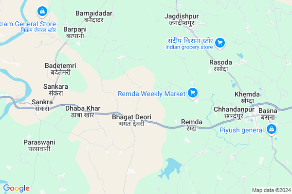
Sankara
Sankara Map
EDIT Map
Add Your House
 ..
..
Current Corona Virus Infected Patients Count in Mahasamund District
| City Name | District Name | Total Covid cases |
|---|
Locality Name :
Sankara
( संकरा )
Tehsil Name : Pithora
District : Mahasamund
State : Chattisgarh
Language : Chhattisgarhi and Hindi, Oriya
Current Time 09:44 AM
Date: Thursday , Apr 24,2025 (IST)
Time zone: IST (UTC+5:30)
Elevation / Altitude: 358 meters. Above Seal level
Telephone Code / Std Code: 07707
Assembly constituency : Basna assembly constituency
Assembly MLA : Sampat Agrawal
Lok Sabha constituency : Mahasamund parliamentary constituency
Parliament MP : CHUNNI LAL SAHU
Serpanch Name :
Pin Code : 493112
Post Office Name :
Main Village Name : Sankara
Commodities Prices : Sakra Market / Mandi
Rivers Near Sankara
Chirnāli Nadi :Chirnali Nadi
Kolār Nadi :Kolar Nadi
Chirnāli Nadi :Chirnali Nadi
Kolār Nadi :Kolar Nadi
About Sankara
Correct below Info and add more info about SankaraSankara is a small Village/hamlet in Pithora Tehsil in Mahasamund District of Chattisgarh State, India. It comes under Sankara Panchayath. It is located 80 KM towards East from District head quarters Mahasamund. 12 KM from Pithora. 134 KM from State capital Raipur
Sankara Pin code is 493112 and postal head office is .
Bijemal ( 4 KM ) , Khursipahar ( 5 KM ) , Kanchanpur ( 5 KM ) , Bamdadih ( 5 KM ) , Sankara (jonk) ( 5 KM ) are the nearby Villages to Sankara. Sankara is surrounded by Basna Tehsil towards East , Jharbandh Tehsil towards South , Saraipali Tehsil towards East , Paikmal Tehsil towards South .
Basna , Mahasamund , Baloda Bazar , Naila Janjgir are the near by Cities to Sankara.
Sankara 2011 Census Details
Sankara Local Language is Chhattisgarhi. Sankara Village Total population is 2851 and number of houses are 651. Female Population is 49.4%. Village literacy rate is 68.6% and the Female Literacy rate is 30.3%.
Population
| Census Parameter | Census Data |
| Total Population | 2851 |
| Total No of Houses | 651 |
| Female Population % | 49.4 % ( 1407) |
| Total Literacy rate % | 68.6 % ( 1956) |
| Female Literacy rate | 30.3 % ( 864) |
| Scheduled Tribes Population % | 13.6 % ( 389) |
| Scheduled Caste Population % | 6.2 % ( 178) |
| Working Population % | 41.0 % |
| Child(0 -6) Population by 2011 | 345 |
| Girl Child(0 -6) Population % by 2011 | 47.8 % ( 165) |
Sankara Census More Deatils.
Politics in Sankara
Bharatiya Janata Party , BJP , INC are the major political parties in this area.Polling Stations /Booths near Sankara
1)Bhadarpali2)Devri
3)Nanksagar
4)Devsral
5)Sarkanda
HOW TO REACH Sankara
By Rail
There is no railway station near to Sankara in less than 10 km.Colleges near Sankara
Chandrapal Dadsena Government College
Address : Pithora, Raipur
Schools near Sankara
Govt. Upper Primary School
Address : khedigaon , pithora , mahasamund , Chattisgarh . PIN- 493551 , Post - Pithora
Govt. Upper Priamry School
Address : kachanpur , pithora , mahasamund , Chattisgarh . PIN- 492112 , Post - Sankra (Mahasamund)
Govt. M S Dongajhar
Address : birajpali , pithora , mahasamund , Chattisgarh . PIN- 493449 , Post - Bagbahra
Govt. M S Jamjuda
Address : jamjuda , pithora , mahasamund , Chattisgarh . PIN- 492112 , Post - Sankra (Mahasamund)
Govt Health Centers near Sankara
1) SHC Dhabakhar , Dhabakhar , Dhabakhar , Dhabakhar2) Bhagatdeori , SHC Bhagatdeori , Bhagatdeori , NH 53 Bhagatdeori
3) Sawitripur , SHC-Sawitripur , ,
Sub Villages in Sankara
Hospitals in Sankara,Pithora
Sewa Bhawan Hospital
Dr. Vinod Joshua John; SAO Jagdeeshpur; Via Basna; Mahasamund; Chhattisgarh 493555; India
7.0 KM distance Detail
Patel Chikitshalya
Main Road; Near NH 53; Mahasamund; Basna; Chhattisgarh 493554; India
9.8 KM distance Detail
more ..
Petrol Bunks in Sankara,Pithora
Bharat Petroleum
Mahasamund; NH-6; Raipur Highway; Basna; Basna; Chhattisgarh 493554; India
8.4 KM distance Detail
more ..
Colleges in Sankara,Pithora
Late Jaidev Satpathi Government College; Basna
Channat Rd; Basna; Chhattisgarh 493555; India
12.5 KM distance Detail
Govt. College Of ITI Pithora Dongaripali
Dongaripali po distt.; Pithora; Chhattisgarh 493551; India
22.7 KM distance Detail
more ..
Schools in Sankara,Pithora
middile school
Mumbai - Kolkata Hwy; Lohrin Dongari; Chhattisgarh 493112; India
2.4 KM distance Detail
phuljher higher secondary school bhagat deori
Lohrin Dongari; Chhattisgarh 493112; India
2.5 KM distance Detail
Govenment Senior Secondary School
Saskeriya; Lohrin Dongari; Mahasamund; NH-6; Raipur Highway; Fhulbhar; Fhulbhar; Chhattisgarh 493554; India
2.5 KM distance Detail
About Sankara &
History
How to reach Sankara
Tourist Places Near By Sankara
Schools in Sankara
Colleges in Sankara
Temperature & weather of Sankara
places in Sankara
Sankara photos
More Information
How to reach Sankara
Tourist Places Near By Sankara
Schools in Sankara
Colleges in Sankara
Temperature & weather of Sankara
places in Sankara
Sankara photos
More Information
Village Talk
Post News or Events about this Village
Near Cities
Basna 12 KM near
Mahasamund 78 KM near
Baloda Bazar 81 KM near
Naila Janjgir 92 KM near
Basna 12 KM near
Mahasamund 78 KM near
Baloda Bazar 81 KM near
Naila Janjgir 92 KM near
Near By Taluks
Pithora 12 KM near
Basna 16 KM near
Jharbandh 24 KM near
Saraipali 39 KM near
Pithora 12 KM near
Basna 16 KM near
Jharbandh 24 KM near
Saraipali 39 KM near
Near By Air Ports
Raipur Airport 116 KM near
Jabalpur Airport 367 KM near
Bhubaneswar Airport 380 KM near
Ranchi Airport 390 KM near
Raipur Airport 116 KM near
Jabalpur Airport 367 KM near
Bhubaneswar Airport 380 KM near
Ranchi Airport 390 KM near
Near By Tourist Places
Mahasamund 77 KM near
Janjgir 90 KM near
Raigarh 107 KM near
Janjgir-Champa 109 KM near
Bilaspur 120 KM near
Mahasamund 77 KM near
Janjgir 90 KM near
Raigarh 107 KM near
Janjgir-Champa 109 KM near
Bilaspur 120 KM near
Near By Districts
Nuapada 63 KM near
Mahasamund 77 KM near
Janjgir-Champa 85 KM near
Bargarh 103 KM near
Nuapada 63 KM near
Mahasamund 77 KM near
Janjgir-Champa 85 KM near
Bargarh 103 KM near
Near By RailWay Station
Bagbahra Rail Way Station 51 KM near
Khariar Road Rail Way Station 54 KM near
Bagbahra Rail Way Station 51 KM near
Khariar Road Rail Way Station 54 KM near