| Home | City Bus | Maps | Villages | Cities | Rail | Tourist Places | School | College | Pin Codes | Corona Cases Count |
| Distance Calculator Bus Services IFSC Codes Trace Mobile Number Weather Search Place Trace IP Available Cash ATM/Banks Locate Polling Booth Report an Error contact People |
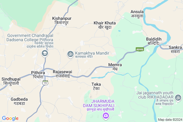
Rampur
Rampur Map
EDIT Map
Add Your House
 ..
..
Current Corona Virus Infected Patients Count in Mahasamund District
| City Name | District Name | Total Covid cases |
|---|
Locality Name :
Rampur
( रामपुर )
Tehsil Name : Pithora
District : Mahasamund
State : Chattisgarh
Language : Chhattisgarhi and Hindi, Oriya
Current Time 04:12 PM
Date: Wednesday , Feb 05,2025 (IST)
Time zone: IST (UTC+5:30)
Elevation / Altitude: 358 meters. Above Seal level
Telephone Code / Std Code: 07707
Assembly constituency : Basna assembly constituency
Assembly MLA : Sampat Agrawal
Lok Sabha constituency : Mahasamund parliamentary constituency
Parliament MP : CHUNNI LAL SAHU
Serpanch Name :
Main Village Name : Rampur
Commodities Prices : Pithoura Market / Mandi
Rivers Near Rampur
Chirnāli Nadi :Chirnali Nadi
Kolār Nadi :Kolar Nadi
Chirnāli Nadi :Chirnali Nadi
Kolār Nadi :Kolar Nadi
About Rampur
Correct below Info and add more info about RampurRampur is a small Village/hamlet in Pithora Tehsil in Mahasamund District of Chattisgarh State, India. It comes under Rampur Panchayath. It is located 60 KM towards East from District head quarters Mahasamund. 9 KM from Pithora. 113 KM from State capital Raipur
Teka ( 3 KM ) , Khairkhuta ( 3 KM ) , Kishanpur ( 4 KM ) , Memra ( 4 KM ) , Lakhagarh ( 5 KM ) are the nearby Villages to Rampur. Rampur is surrounded by Jharbandh Tehsil towards East , Bagbahara Tehsil towards South , Basna Tehsil towards East , Kasdol Tehsil towards North .
Basna , Mahasamund , Baloda Bazar , Bhatapara are the near by Cities to Rampur.
Rampur 2011 Census Details
Rampur Local Language is Chhattisgarhi. Rampur Village Total population is 988 and number of houses are 262. Female Population is 50.1%. Village literacy rate is 61.8% and the Female Literacy rate is 26.1%.
Population
| Census Parameter | Census Data |
| Total Population | 988 |
| Total No of Houses | 262 |
| Female Population % | 50.1 % ( 495) |
| Total Literacy rate % | 61.8 % ( 611) |
| Female Literacy rate | 26.1 % ( 258) |
| Scheduled Tribes Population % | 42.2 % ( 417) |
| Scheduled Caste Population % | 3.8 % ( 38) |
| Working Population % | 55.8 % |
| Child(0 -6) Population by 2011 | 131 |
| Girl Child(0 -6) Population % by 2011 | 51.9 % ( 68) |
Rampur Census More Deatils.
Politics in Rampur
Bharatiya Janata Party , BJP , INC are the major political parties in this area.Polling Stations /Booths near Rampur
1)Tarekela2)Dongaripali
3)Gohedadar
4)Gopalpur
5)Kishnpur
HOW TO REACH Rampur
By Rail
There is no railway station near to Rampur in less than 10 km.Pincodes near Rampur
492112 ( Sankra (Mahasamund) ) , 493551 ( Pithora ) , 493229 ( Watgan )Colleges near Rampur
Chandrapal Dadsena Government College
Address : Pithora, Raipur
Schools in Rampur
Primary School Rampur Tukda
Address : rampur , pithora , mahasamund , Chattisgarh . PIN- 493555 , Post - Jagdishpur (Mahasamund)
Primary School Bijhavardipa
Address : rampur , pithora , mahasamund , Chattisgarh . PIN- 493555 , Post - Jagdishpur (Mahasamund)
Adarsh Primary School
Address : rampur , pithora , mahasamund , Chattisgarh . PIN- 493551 , Post - Pithora
Primary School
Address : rampur , pithora , mahasamund , Chattisgarh . PIN- 493551 , Post - Pithora
Govt Health Centers near Rampur
1) Gopalpur , Sub Health Center Gopalpur , School Para , Beside Panchyat Bhavan2) Teka , Sub Health Center Teka , School Para WARD No.3 , Beside NH53
3) Memra , Sub Health Center Memara , Ward No 12 Memaradih Para , Beside NH53
Sub Villages in Rampur
Petrol Bunks in Rampur,Pithora
Bharat Petroleum
Pithora; Mahasamund; NH-6; Raipur Highway; Pethara; Pethara; Chhattisgarh 493551; India
5.3 KM distance Detail
Indian Oil Petrol Pump
Pithora; Mahasamund; NH-6; Raipur Highway; Pethara; Pethara; Chhattisgarh 493551; India
6.2 KM distance Detail
more ..
Colleges in Rampur,Pithora
Govt. College Of ITI Pithora Dongaripali
Dongaripali po distt.; Pithora; Chhattisgarh 493551; India
2.1 KM distance Detail
Government Chandrapal Dadsena College Pithora
Atharagudi; Chhattisgarh 493551; India
6.4 KM distance Detail
Ramdarshan Institute of Education;Pithora
SH 19; BAGBAHARA ROAD; JANGHORA POST-PITHORA; Mahasamund District;; Pithora; Chhattisgarh 493551; India
7.0 KM distance Detail
more ..
Schools in Rampur,Pithora
KGBV(kasturba gandhi balika vidhyala) lakhagarh
Nawaparakhurd; Chhattisgarh 493551; India
6.2 KM distance Detail
Electronic Shops in Rampur,Pithora
Cullcutta Supar Moter Garage; Tappa; Pithora
Mahasamund; Chhattisgarh 493551; India
5.0 KM distance Detail
About Rampur &
History
How to reach Rampur
Tourist Places Near By Rampur
Schools in Rampur
Colleges in Rampur
Temperature & weather of Rampur
places in Rampur
Rampur photos
More Information
How to reach Rampur
Tourist Places Near By Rampur
Schools in Rampur
Colleges in Rampur
Temperature & weather of Rampur
places in Rampur
Rampur photos
More Information
Village Talk
Post News or Events about this Village
Near Cities
Basna 31 KM near
Mahasamund 58 KM near
Baloda Bazar 68 KM near
Bhatapara 92 KM near
Basna 31 KM near
Mahasamund 58 KM near
Baloda Bazar 68 KM near
Bhatapara 92 KM near
Near By Taluks
Pithora 8 KM near
Jharbandh 33 KM near
Bagbahara 34 KM near
Basna 36 KM near
Pithora 8 KM near
Jharbandh 33 KM near
Bagbahara 34 KM near
Basna 36 KM near
Near By Air Ports
Raipur Airport 96 KM near
Jabalpur Airport 351 KM near
Bhubaneswar Airport 398 KM near
Ranchi Airport 407 KM near
Raipur Airport 96 KM near
Jabalpur Airport 351 KM near
Bhubaneswar Airport 398 KM near
Ranchi Airport 407 KM near
Near By Tourist Places
Mahasamund 58 KM near
Janjgir 91 KM near
Janjgir-Champa 108 KM near
Raipur 109 KM near
Bilaspur 112 KM near
Mahasamund 58 KM near
Janjgir 91 KM near
Janjgir-Champa 108 KM near
Raipur 109 KM near
Bilaspur 112 KM near
Near By Districts
Nuapada 56 KM near
Mahasamund 58 KM near
Janjgir-Champa 91 KM near
Raipur 108 KM near
Nuapada 56 KM near
Mahasamund 58 KM near
Janjgir-Champa 91 KM near
Raipur 108 KM near
Near By RailWay Station
Bagbahra Rail Way Station 35 KM near
Khariar Road Rail Way Station 46 KM near
Bagbahra Rail Way Station 35 KM near
Khariar Road Rail Way Station 46 KM near