| Home | City Bus | Maps | Villages | Cities | Rail | Tourist Places | School | College | Pin Codes | Corona Cases Count |
| Distance Calculator Bus Services IFSC Codes Trace Mobile Number Weather Search Place Trace IP Available Cash ATM/Banks Locate Polling Booth Report an Error contact People |
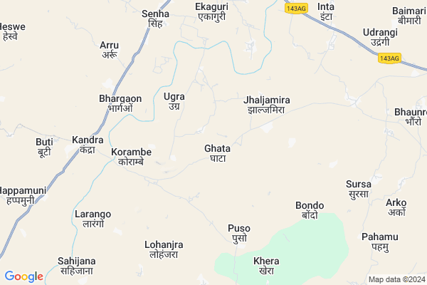
Ghata Map
EDIT Map
Add Your House
 ..
..
Current Corona Virus Infected Patients Count in Lohardaga District
| City Name | District Name | Total Covid cases |
|---|
Locality Name :
Ghata
( घटा )
Block Name : Senha
District : Lohardaga
State : Jharkhand
Language : Hindi and Santali, Asuri
Current Time 11:52 AM
Date: Wednesday , Apr 30,2025 (IST)
Time zone: IST (UTC+5:30)
Elevation / Altitude: 643 meters. Above Seal level
Telephone Code / Std Code: 06526
Assembly constituency : Lohardaga assembly constituency
Assembly MLA : RAMESHWAR ORAON
Lok Sabha constituency : Lohardaga parliamentary constituency
Parliament MP : SUDARSHAN BHAGAT
Serpanch Name :
Pin Code : 835302
Post Office Name : Lohardaga
Main Village Name : Ghata
Commodities Prices : Lohardaga Market / Mandi
Ghata Live Weather
Temperature: 28.8 °C
clear sky
Humidity: 35%
Wind : 3.62 mt/sec towards SW
StationName : "LohÄ\u0081rdagÄ\u0081"
observed on 2 Hours Back
Temperature: 28.8 °C
clear sky
Humidity: 35%
Wind : 3.62 mt/sec towards SW
StationName : "LohÄ\u0081rdagÄ\u0081"
observed on 2 Hours Back
Ghata Weather Forecast for Next 5 days
01-05-2025
21.3°C to 33.6°C
clear sky, light rain, moderate rain, broken clouds
21.3°C to 33.6°C
clear sky, light rain, moderate rain, broken clouds
02-05-2025
20.5°C to 33.3°C
clear sky, moderate rain, light rain, scattered clouds
20.5°C to 33.3°C
clear sky, moderate rain, light rain, scattered clouds
03-05-2025
20.7°C to 33.8°C
broken clouds, clear sky, scattered clouds, light rain, overcast clouds
20.7°C to 33.8°C
broken clouds, clear sky, scattered clouds, light rain, overcast clouds
04-05-2025
23.1°C to 35.4°C
broken clouds, few clouds, light rain, overcast clouds
23.1°C to 35.4°C
broken clouds, few clouds, light rain, overcast clouds
05-05-2025
23.2°C to 36.7°C
few clouds, clear sky, light rain, overcast clouds, scattered clouds
23.2°C to 36.7°C
few clouds, clear sky, light rain, overcast clouds, scattered clouds
National Highways Reachable To Ghata
Nationa High Way :NH39
Nationa High Way :NH39
Rivers Near Ghata
Bambhani
Sankh River :Sankh River
Bambhani
Sankh River :Sankh River
About Ghata
Correct below Info and add more info about GhataGhata is a small Village/hamlet in Senha Block in Lohardaga District of Jharkhand State, India. It comes under Ghata Panchayath. It is located 14 KM towards South from District head quarters Lohardaga. 12 KM from Senha. 75 KM from State capital Ranchi
Ghata Pin code is 835302 and postal head office is Lohardaga .
Danru ( 6 KM ) , Bhargaon ( 6 KM ) , Senha ( 8 KM ) , Arru ( 8 KM ) , Buti ( 10 KM ) are the nearby Villages to Ghata. Ghata is surrounded by Sisai Block towards South , Lohardaga Block towards North , Bhandra Block towards East , Ghaghra Block towards west .
Lohardaga , Gumla , Churi , Ranchi are the near by Cities to Ghata.
This Place is in the border of the Lohardaga District and Gumla District. Gumla District Ghaghra is west towards this place .
Ghata 2011 Census Details
Ghata Local Language is Hindi. Ghata Village Total population is 992 and number of houses are 172. Female Population is 51.4%. Village literacy rate is 57.3% and the Female Literacy rate is 25.0%.
Population
| Census Parameter | Census Data |
| Total Population | 992 |
| Total No of Houses | 172 |
| Female Population % | 51.4 % ( 510) |
| Total Literacy rate % | 57.3 % ( 568) |
| Female Literacy rate | 25.0 % ( 248) |
| Scheduled Tribes Population % | 64.3 % ( 638) |
| Scheduled Caste Population % | 0.0 % ( 0) |
| Working Population % | 58.8 % |
| Child(0 -6) Population by 2011 | 186 |
| Girl Child(0 -6) Population % by 2011 | 46.8 % ( 87) |
Ghata Census More Deatils.
Politics in Ghata
Bharatiya Janata Party , AJSU , BJP , INC are the major political parties in this area.Polling Stations /Booths near Ghata
1)Upgreded Middle School Huddu2)Primary School Bakarni
3)Basic School Lawagain (south Wing)
4)Primary School Jido
5)Primary School Hurhad
HOW TO REACH Ghata
By Rail
There is no railway station near to Ghata in less than 10 km.Schools near Ghata
Govt Health Centers near Ghata
1) HSC GAGEYA , HSC Building Gageya , Govt. Building ,2) HSC GARHWALI , , ,
3) Ugra , Govt. Building , Ugra ,
Sub Villages in Ghata
Petrol Bunks in Ghata,Senha
HP PETROL PUMP - MITRA FUEL CENTRE
HP Petrol Pump Village -badla Thana-senha; Ranchi; Jharkhand 835302; India
10.3 KM distance Detail
more ..
Colleges in Ghata,Senha
Mnoharlal Agarwal Saraswati Vidya Mandir; Lohardaga
Lohardaga; Jharkhand 835302; India
11.1 KM distance Detail
more ..
Schools in Ghata,Senha
Jawahar Navodaya Vidyalaya
JognaPo Senha; Via Kuru; Lohardaga; Jharkhand; Lohardaga; Jharkhand 835304; India
5.2 KM distance Detail
Electronic Shops in Ghata,Senha
HERO MOBILE $ STUDIO KALHEPAT
Bhusar - Ghaghara Rd; Bhargaon; Jharkhand 835302; India
6.4 KM distance Detail
Super Markets in Ghata,Senha
MICROCARE COMPUTER TRAINING CENTRE
Ajay udhyan; Lohardaga; Jharkhand 835302; India
13.0 KM distance Detail
Police Stations near Ghata,Senha
New Police Line ; Bakshidipa
New police line; Ekaguri; Jharkhand 835302; India
10.0 KM distance Detail
Governement Offices near Ghata,Senha
Main Road Shashtri Chowk
Main Rd; shashtri chowk; Lohardaga; Jharkhand 835302; India
13.6 KM distance Detail
About Ghata &
History
How to reach Ghata
Tourist Places Near By Ghata
Schools in Ghata
Colleges in Ghata
Temperature & weather of Ghata
places in Ghata
Ghata photos
More Information
How to reach Ghata
Tourist Places Near By Ghata
Schools in Ghata
Colleges in Ghata
Temperature & weather of Ghata
places in Ghata
Ghata photos
More Information
Village Talk
Post News or Events about this Village
Near Cities
Lohardaga 12 KM near
Gumla 38 KM near
Churi 59 KM near
Ranchi 72 KM near
Lohardaga 12 KM near
Gumla 38 KM near
Churi 59 KM near
Ranchi 72 KM near
Near By Taluks
Senha 11 KM near
Sisai 14 KM near
Lohardaga 15 KM near
Bhandra 17 KM near
Senha 11 KM near
Sisai 14 KM near
Lohardaga 15 KM near
Bhandra 17 KM near
Near By Air Ports
Ranchi Airport 73 KM near
Gaya Airport 178 KM near
Patna Airport 285 KM near
Varanasi Airport 335 KM near
Ranchi Airport 73 KM near
Gaya Airport 178 KM near
Patna Airport 285 KM near
Varanasi Airport 335 KM near
Near By Tourist Places
Lohardaga 12 KM near
Gumla 39 KM near
Netarhat 49 KM near
Chotanagpur 55 KM near
Latehar 55 KM near
Lohardaga 12 KM near
Gumla 39 KM near
Netarhat 49 KM near
Chotanagpur 55 KM near
Latehar 55 KM near
Near By Districts
Lohardaga 12 KM near
Gumla 38 KM near
Latehar 55 KM near
Ranchi 72 KM near
Lohardaga 12 KM near
Gumla 38 KM near
Latehar 55 KM near
Ranchi 72 KM near
Near By RailWay Station
Tori Junction Rail Way Station 44 KM near
Khalari Rail Way Station 54 KM near
Tori Junction Rail Way Station 44 KM near
Khalari Rail Way Station 54 KM near