| Home | City Bus | Maps | Villages | Cities | Rail | Tourist Places | School | College | Pin Codes | Corona Cases Count |
| Distance Calculator Bus Services IFSC Codes Trace Mobile Number Weather Search Place Trace IP Available Cash ATM/Banks Locate Polling Booth Report an Error contact People |
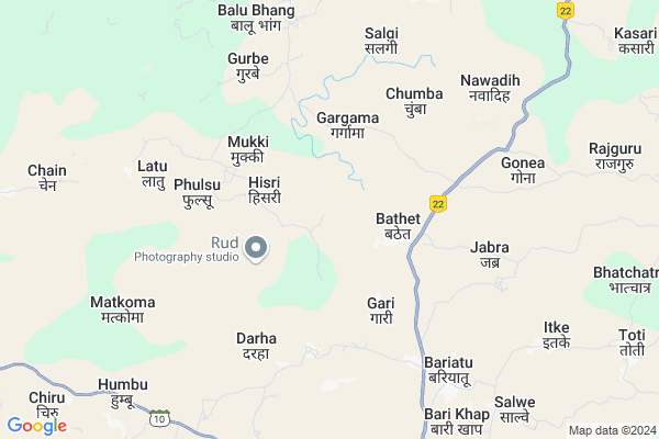
Karma Map
EDIT Map
Add Your House
 ..
..
Current Corona Virus Infected Patients Count in Latehar District
| City Name | District Name | Total Covid cases |
|---|
Locality Name :
Karma
( कर्मा )
Block Name : Balumath
District : Latehar
State : Jharkhand
Language : Hindi and Santali
Current Time 03:24 PM
Date: Wednesday , Feb 05,2025 (IST)
Time zone: IST (UTC+5:30)
Elevation / Altitude: 515 meters. Above Seal level
Telephone Code / Std Code: 06568
Assembly constituency : Latehar assembly constituency
Assembly MLA : BAIDYANATH RAM
Lok Sabha constituency : Chatra parliamentary constituency
Parliament MP : SUNIL KUMAR SINGH
Serpanch Name :
Pin Code : 829202
Post Office Name : Balumath
Main Village Name : Karma
Commodities Prices : Lohardaga Market / Mandi
Karma Live Weather
Temperature: 31.5 °C
overcast clouds
Humidity: 21%
Wind : 4.87 mt/sec towards NW
StationName : "LÄ\u0081tehÄ\u0081r"
observed on 2 Hours Back
Temperature: 31.5 °C
overcast clouds
Humidity: 21%
Wind : 4.87 mt/sec towards NW
StationName : "LÄ\u0081tehÄ\u0081r"
observed on 2 Hours Back
Karma Weather Forecast for Next 5 days
06-02-2025
15.4°C to 32.1°C
scattered clouds, clear sky
15.4°C to 32.1°C
scattered clouds, clear sky
07-02-2025
11.9°C to 28.8°C
clear sky
11.9°C to 28.8°C
clear sky
08-02-2025
9.7°C to 27.8°C
clear sky
9.7°C to 27.8°C
clear sky
09-02-2025
9.8°C to 27.7°C
clear sky, broken clouds
9.8°C to 27.7°C
clear sky, broken clouds
10-02-2025
11.5°C to 29.9°C
clear sky
11.5°C to 29.9°C
clear sky
Rivers Near Karma
Ekchatia Nadi
Auranga River
Ekchatia Nadi
Auranga River
About Karma
Correct below Info and add more info about KarmaKarma is a small Village/hamlet in Balumath Block in Latehar District of Jharkhand State, India. It comes under Karma Panchayath. It is located 40 KM towards East from District head quarters Latehar. 8 KM from Balumath. 99 KM from State capital Ranchi
Karma Pin code is 829202 and postal head office is Balumath .
Balubhang ( 8 KM ) , Salaiya ( 9 KM ) , Jhabar ( 10 KM ) , Chiru ( 12 KM ) , Balumath ( 13 KM ) are the nearby Villages to Karma. Karma is surrounded by Lawalong Block towards North , Simaria Block towards East , Tandwa Block towards East , Chandwa Block towards South .
Chatra , Churi , Lohardaga , Hazaribag are the near by Cities to Karma.
Demographics of Karma
Hindi is the Local Language here.Politics in Karma
Bharatiya Janata Party , BJP , JMM , JVMP , RJD , INC are the major political parties in this area.Polling Stations /Booths near Karma
1)P.s. Gadi2)Girls Middle School Chandwa
3)U.m.s. Bhatchatra
4)M.s . Humbu
5)M.s. Nawadih
HOW TO REACH Karma
By Rail
There is no railway station near to Karma in less than 10 km.Colleges near Karma
Jagat Mohan Jagdhatri Nath Mahavidaylya
Address :
St. Xavier's College,mahuadanr
Address :
Schools near Karma
Govt Health Centers near Karma
1) HSC FULSU , HSC BUILDING , ,2) HSC SALGI , , Salgi ,
3) HSC BARIYATU , HSC BUILDING , ,
Sub Villages in Karma
Petrol Bunks in Karma,Balumath
Bharat Petroleum
Basukinath; Latehar; NH-99; Balumath; Balumath; Jharkhand 829202; India
12.0 KM distance Detail
more ..
Colleges in Karma,Balumath
shiksha Inter College Balumath
Medininagar - Balumath Rd; Balumath; Jharkhand 829202; India
11.8 KM distance Detail
more ..
Schools in Karma,Balumath
Utkramit Primary School
Banio; Latehar; SH-10; Balumath Panki Road; Balumath; Balumath; Jharkhand 829202; India
10.0 KM distance Detail
Anusuchit Jati Awasiya Primary School
Banio; Latehar; SH-10; Balumath Panki Road; Balumath; Balumath; Jharkhand 829202; India
10.9 KM distance Detail
Vision Public School
Latehar; SH-10; Balumath Panki Road; Balumath; Balumath; Jharkhand 829202; India
12.2 KM distance Detail
Super Markets in Karma,Balumath
Zainul Complex Main Road Balumath
NH22; Basukinath; Balumath; Jharkhand 829202; India
13.0 KM distance Detail
old Mhabir Mandir Raju Kirana Stor
NH22; Basukinath; Balumath; Jharkhand 829202; India
13.4 KM distance Detail
Local Parks in Karma,Balumath
Police Stations near Karma,Balumath
Balumath Police Station
National Highway 99; Basukinath; Balumath; Jharkhand 829202; India
13.3 KM distance Detail
Governement Offices near Karma,Balumath
Forest and Environment Department
Latehar; NH-99; Balumath; Balumath; Jharkhand 829202; India
13.5 KM distance Detail
About Karma &
History
How to reach Karma
Tourist Places Near By Karma
Schools in Karma
Colleges in Karma
Temperature & weather of Karma
places in Karma
Karma photos
More Information
How to reach Karma
Tourist Places Near By Karma
Schools in Karma
Colleges in Karma
Temperature & weather of Karma
places in Karma
Karma photos
More Information
Village Talk
Post News or Events about this Village
Near Cities
Chatra 36 KM near
Churi 43 KM near
Lohardaga 62 KM near
Hazaribag 66 KM near
Chatra 36 KM near
Churi 43 KM near
Lohardaga 62 KM near
Hazaribag 66 KM near
Near By Taluks
Balumath 8 KM near
Lawalong 18 KM near
Simaria 25 KM near
Tandwa 28 KM near
Balumath 8 KM near
Lawalong 18 KM near
Simaria 25 KM near
Tandwa 28 KM near
Near By Air Ports
Ranchi Airport 98 KM near
Gaya Airport 103 KM near
Patna Airport 210 KM near
Varanasi Airport 287 KM near
Ranchi Airport 98 KM near
Gaya Airport 103 KM near
Patna Airport 210 KM near
Varanasi Airport 287 KM near
Near By Tourist Places
Chatra 36 KM near
Latehar 39 KM near
Palamu 54 KM near
Lohardaga 63 KM near
Betla National Park 63 KM near
Chatra 36 KM near
Latehar 39 KM near
Palamu 54 KM near
Lohardaga 63 KM near
Betla National Park 63 KM near
Near By Districts
Chatra 36 KM near
Latehar 39 KM near
Lohardaga 62 KM near
Hazaribagh 68 KM near
Chatra 36 KM near
Latehar 39 KM near
Lohardaga 62 KM near
Hazaribagh 68 KM near
Near By RailWay Station
Tori Junction Rail Way Station 31 KM near
Latehar Rail Way Station 42 KM near
Tori Junction Rail Way Station 31 KM near
Latehar Rail Way Station 42 KM near