| Home | City Bus | Maps | Villages | Cities | Rail | Tourist Places | School | College | Pin Codes | Corona Cases Count |
| Distance Calculator Bus Services IFSC Codes Trace Mobile Number Weather Search Place Trace IP Available Cash ATM/Banks Locate Polling Booth Report an Error contact People |
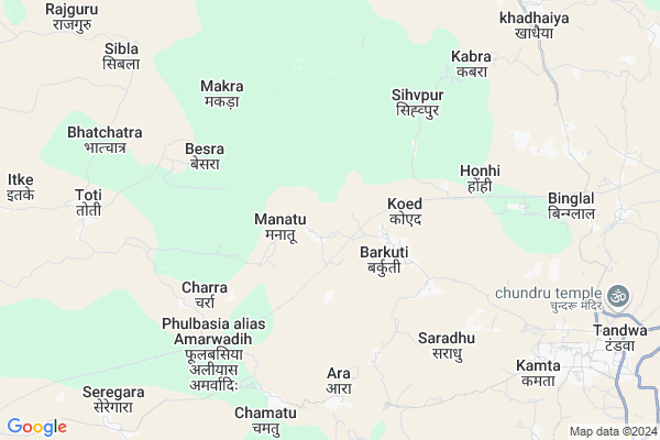
Banalat Map
EDIT Map
Add Your House
 ..
..
Current Corona Virus Infected Patients Count in Latehar District
| City Name | District Name | Total Covid cases |
|---|
Locality Name :
Banalat
( बनालात )
Block Name : Balumath
District : Latehar
State : Jharkhand
Language : Hindi and Santali
Current Time 03:21 PM
Date: Wednesday , Feb 05,2025 (IST)
Time zone: IST (UTC+5:30)
Elevation / Altitude: 515 meters. Above Seal level
Telephone Code / Std Code: 06568
Assembly constituency : Latehar assembly constituency
Assembly MLA : BAIDYANATH RAM
Lok Sabha constituency : Chatra parliamentary constituency
Parliament MP : SUNIL KUMAR SINGH
Serpanch Name :
Main Village Name : Banalat
Commodities Prices : Lohardaga Market / Mandi
Rivers Near Banalat
Ekchatia Nadi
Auranga River
Ekchatia Nadi
Auranga River
About Banalat
Correct below Info and add more info about BanalatBanalat is a small Village/hamlet in Balumath Block in Latehar District of Jharkhand State, India. It comes under Banalat Panchayath. It is located 56 KM towards East from District head quarters Latehar. 22 KM from Balumath. 83 KM from State capital Ranchi
Banalat is surrounded by Simaria Block towards North , Keredari Block towards East , Balumath Block towards west , Pathalgada Block towards North .
Churi , Chatra , Hazaribag , Patratu are the near by Cities to Banalat.
Demographics of Banalat
Hindi is the Local Language here.Politics in Banalat
Bharatiya Janata Party , BJP , JMM , JVMP , RJD , INC are the major political parties in this area.Polling Stations /Booths near Banalat
1)M.s. Bariyatu (s.)2)U.m.s. Mantu
3)M.s. Matkoma
4)P.s. Tuwed
5)U.m.s. Bidir
HOW TO REACH Banalat
By Rail
There is no railway station near to Banalat in less than 10 km.Pincodes near Banalat
825321 ( Tandwa (Chatra) ) , 825103 ( Simaria ) , 829202 ( Balumath )Colleges near Banalat
Jagat Mohan Jagdhatri Nath Mahavidaylya
Address :
St. Xavier's College,mahuadanr
Address :
Schools near Banalat
Govt Health Centers near Banalat
1) HSC BUSKUTTE , , Baskutte ,2) HSC MANATU , HSC BUILDING , ,
3) HSC DEWALGADDA , , Dewalgadda ,
Sub Villages in Banalat
Hospitals in Banalat,Balumath
Hindustan Medical Hall
Hazaribagh Tandwa Tangar Rd; Tandwa; Jharkhand 825321; India
11.4 KM distance Detail
more ..
Petrol Bunks in Banalat,Balumath
Sampan Petrol Pump
Hazaribagh Tandwa Tangar Rd; Tandwa; Jharkhand 825321; India
10.7 KM distance Detail
Bharat Petroleum
Basukinath; Latehar; NH-99; Balumath; Balumath; Jharkhand 829202; India
18.4 KM distance Detail
more ..
Colleges in Banalat,Balumath
softech institute of computer; tandwa
Neem chowk; Tandwa; Jharkhand 825321; India
12.0 KM distance Detail
more ..
Schools in Banalat,Balumath
Dr.Aslam Ansari (RCM)& IQRA PUBLIC SCHOOL
kamta; Tandwa; Jharkhand 825321; India
9.5 KM distance Detail
Electronic Shops in Banalat,Balumath
Nayak Electronics And Mobile
Hazaribagh Tandwa Tangar Rd; Tandwa; Jharkhand 825321; India
11.3 KM distance Detail
Super Markets in Banalat,Balumath
Geeta Enterprises Authorised Dealer:- Exide Battery
Tandwa; Jharkhand 825321; India
10.8 KM distance Detail
Police Stations near Banalat,Balumath
Balumath Police Station
National Highway 99; Basukinath; Balumath; Jharkhand 829202; India
19.7 KM distance Detail
Governement Offices near Banalat,Balumath
Block Development Office
Hazaribagh Tandwa Tangar Rd; Tandwa; Jharkhand 825321; India
13.3 KM distance Detail
Forest and Environment Department
Latehar; NH-99; Balumath; Balumath; Jharkhand 829202; India
19.6 KM distance Detail
About Banalat &
History
How to reach Banalat
Tourist Places Near By Banalat
Schools in Banalat
Colleges in Banalat
Temperature & weather of Banalat
places in Banalat
Banalat photos
More Information
How to reach Banalat
Tourist Places Near By Banalat
Schools in Banalat
Colleges in Banalat
Temperature & weather of Banalat
places in Banalat
Banalat photos
More Information
Village Talk
Post News or Events about this Village
Near Cities
Churi 28 KM near
Chatra 39 KM near
Hazaribag 47 KM near
Patratu 48 KM near
Churi 28 KM near
Chatra 39 KM near
Hazaribag 47 KM near
Patratu 48 KM near
Near By Taluks
Tandwa 8 KM near
Simaria 18 KM near
Keredari 19 KM near
Balumath 21 KM near
Tandwa 8 KM near
Simaria 18 KM near
Keredari 19 KM near
Balumath 21 KM near
Near By Air Ports
Ranchi Airport 83 KM near
Gaya Airport 106 KM near
Patna Airport 212 KM near
Varanasi Airport 305 KM near
Ranchi Airport 83 KM near
Gaya Airport 106 KM near
Patna Airport 212 KM near
Varanasi Airport 305 KM near
Near By Tourist Places
Chatra 39 KM near
Latehar 54 KM near
Lohardaga 64 KM near
Palamu 73 KM near
Ranchi 79 KM near
Chatra 39 KM near
Latehar 54 KM near
Lohardaga 64 KM near
Palamu 73 KM near
Ranchi 79 KM near
Near By Districts
Chatra 39 KM near
Hazaribagh 50 KM near
Latehar 54 KM near
Lohardaga 63 KM near
Chatra 39 KM near
Hazaribagh 50 KM near
Latehar 54 KM near
Lohardaga 63 KM near
Near By RailWay Station
Ray Rail Way Station 29 KM near
Khalari Rail Way Station 30 KM near
Ray Rail Way Station 29 KM near
Khalari Rail Way Station 30 KM near