| Home | City Bus | Maps | Villages | Cities | Rail | Tourist Places | School | College | Pin Codes | Corona Cases Count |
| Distance Calculator Bus Services IFSC Codes Trace Mobile Number Weather Search Place Trace IP Available Cash ATM/Banks Locate Polling Booth Report an Error contact People |
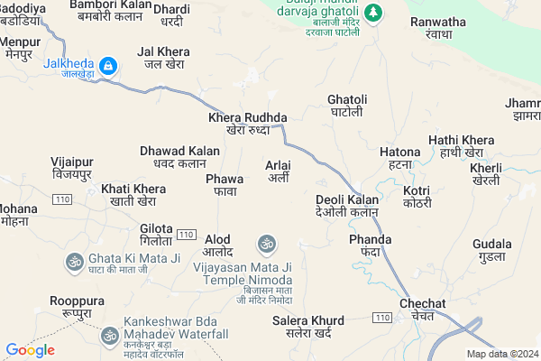
Arlai Map
EDIT Map
Add Your House
 ..
..
Current Corona Virus Infected Patients Count in Kota District
| City Name | District Name | Total Covid cases |
|---|---|---|
| Kota District | Kota | 158 |
Locality Name :
Arlai
( अर्ली )
Tehsil Name : Khairabad
District : Kota
State : Rajasthan
Division : Kota
Language : Rajasthani
Current Time 01:11 PM
Date: Tuesday , Apr 29,2025 (IST)
Time zone: IST (UTC+5:30)
Elevation / Altitude: 358 meters. Above Seal level
Telephone Code / Std Code: 07432
Assembly constituency : Ramganj Mandi assembly constituency
Assembly MLA : Madan Dilawar
Lok Sabha constituency : Kota parliamentary constituency
Parliament MP : OM BIRLA
Serpanch Name :
Pin Code : 326518
Post Office Name : Chechat
Main Village Name : Arlai
Commodities Prices : Ramgang Mandi(Bapawarkala) Market / Mandi
Rivers Near Arlai
Chambal River :चम्बल
Ahu
Chambal River :चम्बल
Ahu
About Arlai
Correct below Info and add more info about ArlaiArlai is a small Village/hamlet in Khairabad Tehsil in Kota District of Rajasthan State, India. It comes under Arlai Panchayath. It belongs to Kota Division . It is located 50 KM towards South from District head quarters Kota. 19 KM from Khairabad. 273 KM from State capital Jaipur
Arlai Pin code is 326518 and postal head office is Chechat .
Kherli ( 8 KM ) , Chechat ( 8 KM ) , Madanpura ( 13 KM ) , Barodiya Kalan ( 14 KM ) , Budhkhan ( 16 KM ) are the nearby Villages to Arlai. Arlai is surrounded by Bhainsrorgarh Tehsil towards west , Ladpura Tehsil towards North , Bhanpura Tehsil towards South , Kota Tehsil towards North .
Ramganj Mandi , Rawatbhata , Jhalawar , Kota are the near by Cities to Arlai.
Arlai 2011 Census Details
Arlai Local Language is Rajasthani. Arlai Village Total population is 959 and number of houses are 205. Female Population is 48.3%. Village literacy rate is 61.9% and the Female Literacy rate is 22.4%.
Population
| Census Parameter | Census Data |
| Total Population | 959 |
| Total No of Houses | 205 |
| Female Population % | 48.3 % ( 463) |
| Total Literacy rate % | 61.9 % ( 594) |
| Female Literacy rate | 22.4 % ( 215) |
| Scheduled Tribes Population % | 1.6 % ( 15) |
| Scheduled Caste Population % | 27.6 % ( 265) |
| Working Population % | 49.0 % |
| Child(0 -6) Population by 2011 | 102 |
| Girl Child(0 -6) Population % by 2011 | 47.1 % ( 48) |
Arlai Census More Deatils.
Politics in Arlai
BJP , INC are the major political parties in this area.Polling Stations /Booths near Arlai
1)Govt. Upper Primary School Fanda Room N.12)Govt. Upper Primary School Bholu Room N.1
3)Govt. Upper Primary School Anwali Room N. 1
4)Govt. Upper Primary Gudala Room N.1
5)Govt. Secondary School Nimana Room No. 1
HOW TO REACH Arlai
By Rail
There is no railway station near to Arlai in less than 10 km.Colleges near Arlai
Sanskrit Shiksha Shastri College
Address :
Schools in Arlai
G.u.p.s. Arlai
Address : arlai , kherabad , kota , Rajasthan . PIN- 326518 , Post - Chechat
Govt Health Centers near Arlai
1) Kherarudha , PHC KHERARUDDHA , NEAR RAWAT BHATA ROAD ,2) Saleda khurd , , ,
3) Chechat , CHC CHECHAT , NEAR BRAHMINO KI CHOKI , RAWAT BHATA ROAD
Sub Villages in Arlai
Petrol Bunks in Arlai,Khairabad
Indian Oil Petrol Pump
Morak Bypass Rd; Shiv Nagar; Modak; Rajasthan 326517; India
18.7 KM distance Detail
Bharat petrol pump
Morak Bypass Rd; Shiv Nagar; Modak; Rajasthan 326517; India
19.6 KM distance Detail
more ..
Colleges in Arlai,Khairabad
Shri Tirupati Balaji Polytechnic College
Morak station ke pass modi kunj ; Dhaba deh road; Ramganj Mandi; Kota; Rajasthan 326517; India
19.5 KM distance Detail
more ..
Schools in Arlai,Khairabad
Govt. Senior Secondary School Salera Khurd
Salera Khurd; Rajasthan 326518; India
6.8 KM distance Detail
Govt. Upper Primary Sanskrit School
Sunaro Ka Mohalla; Chechat; Rajasthan 326518; India
7.8 KM distance Detail
Police Stations near Arlai,Khairabad
Chechat Police Station
Bhilwara to Modak via Mandalgarh Salawatia Bhensrogarh; Chechat; Rajasthan 326518; India
10.9 KM distance Detail
About Arlai &
History
How to reach Arlai
Tourist Places Near By Arlai
Schools in Arlai
Colleges in Arlai
Temperature & weather of Arlai
places in Arlai
Arlai photos
More Information
How to reach Arlai
Tourist Places Near By Arlai
Schools in Arlai
Colleges in Arlai
Temperature & weather of Arlai
places in Arlai
Arlai photos
More Information
Village Talk
Post News or Events about this Village
Near Cities
Ramganj Mandi 23 KM near
Rawatbhata 31 KM near
Jhalawar 46 KM near
Kota 48 KM near
Ramganj Mandi 23 KM near
Rawatbhata 31 KM near
Jhalawar 46 KM near
Kota 48 KM near
Near By Taluks
Khairabad 18 KM near
Bhainsrorgarh 35 KM near
Ladpura 36 KM near
Bhanpura 39 KM near
Khairabad 18 KM near
Bhainsrorgarh 35 KM near
Ladpura 36 KM near
Bhanpura 39 KM near
Near By Air Ports
Dabok Airport 220 KM near
Sanganeer Airport 250 KM near
Bhopal Airport 256 KM near
Indore Airport 259 KM near
Dabok Airport 220 KM near
Sanganeer Airport 250 KM near
Bhopal Airport 256 KM near
Indore Airport 259 KM near
Near By Tourist Places
Jhalawar 32 KM near
Kota 45 KM near
Bijolia 71 KM near
Bundi 81 KM near
Neemuch 116 KM near
Jhalawar 32 KM near
Kota 45 KM near
Bijolia 71 KM near
Bundi 81 KM near
Neemuch 116 KM near
Near By Districts
Jhalawar 45 KM near
Kota 48 KM near
Bundi 79 KM near
Baran 85 KM near
Jhalawar 45 KM near
Kota 48 KM near
Bundi 79 KM near
Baran 85 KM near
Near By RailWay Station
Ramganj Mandi Junction Rail Way Station 23 KM near
Bhawani Mandi Rail Way Station 48 KM near
Ramganj Mandi Junction Rail Way Station 23 KM near
Bhawani Mandi Rail Way Station 48 KM near