| Home | City Bus | Maps | Villages | Cities | Rail | Tourist Places | School | College | Pin Codes | Corona Cases Count |
| Distance Calculator Bus Services IFSC Codes Trace Mobile Number Weather Search Place Trace IP Available Cash ATM/Banks Locate Polling Booth Report an Error contact People |
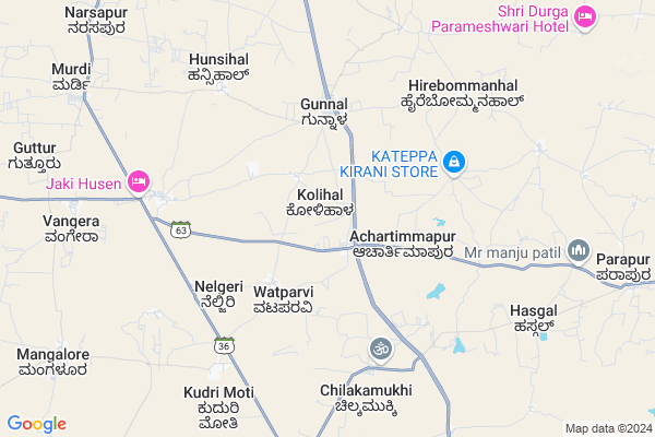
Kolihal Map
EDIT Map
Add Your House
 ..
..
Current Corona Virus Infected Patients Count in Koppal District
| City Name | District Name | Total Covid cases |
|---|
Locality Name :
Kolihal
( ಕೋಳಿಹಾಳ್ )
Taluk Name : Yelburga
District : Koppal
State : Karnataka
Division : Gulbarga
Language : Kannada
Current Time 04:41 AM
Date: Saturday , Apr 26,2025 (IST)
Time zone: IST (UTC+5:30)
Elevation / Altitude: 601 meters. Above Seal level
Telephone Code / Std Code: 08534
Assembly constituency : Yelburga assembly constituency
Assembly MLA : Basavaraj Rayareddi
Lok Sabha constituency : Koppal parliamentary constituency
Parliament MP : KARADI SANGANNA AMARAPPA
Serpanch Name :
Pin Code : 583237
Post Office Name : Bewoor
Main Village Name : Kolihal
Alternate Village Name : Kolihal Tanda
Commodities Prices : Kustagi Market / Mandi
Kolihal Live Weather
Temperature: 29.1 °C
overcast clouds
Humidity: 37%
Wind : 2.09 mt/sec towards E
StationName : "Kushtagi"
observed on Now
Temperature: 29.1 °C
overcast clouds
Humidity: 37%
Wind : 2.09 mt/sec towards E
StationName : "Kushtagi"
observed on Now
Kolihal Weather Forecast for Next 5 days
27-04-2025
28.1°C to 37.4°C
broken clouds, light rain
28.1°C to 37.4°C
broken clouds, light rain
28-04-2025
26.9°C to 36.1°C
overcast clouds, broken clouds, scattered clouds, few clouds
26.9°C to 36.1°C
overcast clouds, broken clouds, scattered clouds, few clouds
29-04-2025
26.6°C to 38.6°C
broken clouds, few clouds, scattered clouds, clear sky
26.6°C to 38.6°C
broken clouds, few clouds, scattered clouds, clear sky
30-04-2025
25.6°C to 39.3°C
clear sky, scattered clouds, broken clouds, few clouds
25.6°C to 39.3°C
clear sky, scattered clouds, broken clouds, few clouds
Edit below overview about Kolihal
Edit below overview about Kolihal
OverView of Kolihal
This is small village and cleanness village.This village main gods are Shree Sharanubasaveswara temple and Shree Eswara temple.Edit below overview about Kolihal
National Highways Reachable To Kolihal
Nationa High Way :NH50
Nationa High Way :NH367
Nationa High Way :NH50
Nationa High Way :NH367
Rivers Near Kolihal
Handigana Halla :ಹಂದಿಗನ ಹಳ್ಳ
Hirehalla :ಹಿರೆಹಳ್ಳ
Handigana Halla :ಹಂದಿಗನ ಹಳ್ಳ
Hirehalla :ಹಿರೆಹಳ್ಳ
About Kolihal
Kolihal is a small Village/hamlet in Yelburga Taluk in Koppal District of Karnataka State, India. It comes under Kolihal Panchayath. It belongs to Gulbarga Division . It is located 30 KM towards North from District head quarters Koppal. 25 KM from Yelburga. 378 KM from State capital Bangalore
Kolihal Pin code is 583237 and postal head office is Bewoor .
Mangalur ( 11 KM ) , Irakalgada ( 13 KM ) , Kukanoor ( 16 KM ) , Gouripur ( 17 KM ) are the nearby Villages to Kolihal. Kolihal is surrounded by Koppal Taluk towards South , Kushtagi Taluk towards North , Gangavathi Taluk towards East , Hospet Taluk towards South .
Hospet , Mundargi , Ron , Sindhnur are the near by Cities to Kolihal.
Kolihal 2011 Census Details
Kolihal Local Language is Kannada. Kolihal Village Total population is 1458 and number of houses are 264. Female Population is 48.6%. Village literacy rate is 59.2% and the Female Literacy rate is 22.1%.
Population
| Census Parameter | Census Data |
| Total Population | 1458 |
| Total No of Houses | 264 |
| Female Population % | 48.6 % ( 708) |
| Total Literacy rate % | 59.2 % ( 863) |
| Female Literacy rate | 22.1 % ( 322) |
| Scheduled Tribes Population % | 1.0 % ( 14) |
| Scheduled Caste Population % | 31.8 % ( 464) |
| Working Population % | 58.7 % |
| Child(0 -6) Population by 2011 | 195 |
| Girl Child(0 -6) Population % by 2011 | 59.0 % ( 115) |
Kolihal Census More Deatils.
Politics in Kolihal
Bharatiya Janata Party , BJP , Bharatiya Janata Party (BJP) , INC are the major political parties in this area.Polling Stations /Booths near Kolihal
1)Muttal2)Kavalakeri
3)Gule
4)Gunnal-1
5)Vangeri-2
HOW TO REACH Kolihal
By Rail
There is no railway station near to Kolihal in less than 10 km. Koppal Rail Way Station (near to Koppal) , Gadag Junction Rail Way Station (near to Gadag) , Kanginhal Rail Way Station (near to Gadag) are the Rail way stations reachable from near by towns.By Road
Yelburga , Gajendragarh , Naregal , Koppal , Kushtagi , Mundargi , Gadag are the nearby by towns to Kolihal having road connectivity to KolihalColleges near Kolihal
Govt. Pre University College
Address :
Polytechnic
Address : Gunnal Polytechnic
Schools in Kolihal
Ghps Kolihal
Address : kolihal , yelburga , koppal , Karnataka . PIN- 583237 , Post - Bewoor
Govt Health Centers near Kolihal
1) FRU KOPPAL DISTRICT HOSPITAL , , ,2) KOPPAL UPHC , Urban health center , Ashoke circle , SBI opp
3) FRU Kushtagi Taluka Hospital , , ,
Sub Villages in Kolihal
Hospitals in Kolihal,Yelburga
Primary Health Center
Bevoor; Yelburga; Koppal; SH-63; Yelaburga Sankallur Sudi Rajur Belur Road; Koppal; Koppal; Karnataka 583237; India
7.4 KM distance Detail
more ..
Petrol Bunks in Kolihal,Yelburga
Hindustan Petroleum
Gunnal; Koppal; NH-13; Solapur Mangalore Highway; Koppal; Koppal; Karnataka 583277; India
6.2 KM distance Detail
more ..
Governement Offices near Kolihal,Yelburga
Town Hall Office
Bevoor; Bewoor; Koppal; SH-63; Yelaburga Sankallur Sudi Rajur Belur Road; Koppal; Koppal; Karnataka 583237; India
7.6 KM distance Detail
About Kolihal &
History
How to reach Kolihal
Tourist Places Near By Kolihal
Schools in Kolihal
Colleges in Kolihal
Temperature & weather of Kolihal
places in Kolihal
Kolihal photos
More Information
How to reach Kolihal
Tourist Places Near By Kolihal
Schools in Kolihal
Colleges in Kolihal
Temperature & weather of Kolihal
places in Kolihal
Kolihal photos
More Information
Village Talk
Post News or Events about this Village
Near Cities
Hospet 38 KM near
Mundargi 57 KM near
Ron 61 KM near
Sindhnur 67 KM near
Hospet 38 KM near
Mundargi 57 KM near
Ron 61 KM near
Sindhnur 67 KM near
Near By Taluks
Yelburga 24 KM near
Koppal 27 KM near
Kushtagi 34 KM near
Gangavathi 36 KM near
Yelburga 24 KM near
Koppal 27 KM near
Kushtagi 34 KM near
Gangavathi 36 KM near
Near By Air Ports
Hubli Airport 139 KM near
Sambre Airport 196 KM near
Sholapur Airport 260 KM near
Kolhapur Airport 265 KM near
Hubli Airport 139 KM near
Sambre Airport 196 KM near
Sholapur Airport 260 KM near
Kolhapur Airport 265 KM near
Near By Tourist Places
Hampi 40 KM near
Hospet 40 KM near
Pattadakkal 69 KM near
Aihole 70 KM near
Badami 79 KM near
Hampi 40 KM near
Hospet 40 KM near
Pattadakkal 69 KM near
Aihole 70 KM near
Badami 79 KM near
Near By Districts
Koppal 28 KM near
Gadag 73 KM near
Bellary 97 KM near
Bagalkot 101 KM near
Koppal 28 KM near
Gadag 73 KM near
Bellary 97 KM near
Bagalkot 101 KM near
Near By RailWay Station
Koppal Rail Way Station 27 KM near
Munirabad Rail Way Station 34 KM near
Koppal Rail Way Station 27 KM near
Munirabad Rail Way Station 34 KM near