| Home | City Bus | Maps | Villages | Cities | Rail | Tourist Places | School | College | Pin Codes | Corona Cases Count |
| Distance Calculator Bus Services IFSC Codes Trace Mobile Number Weather Search Place Trace IP Available Cash ATM/Banks Locate Polling Booth Report an Error contact People |
Pathur
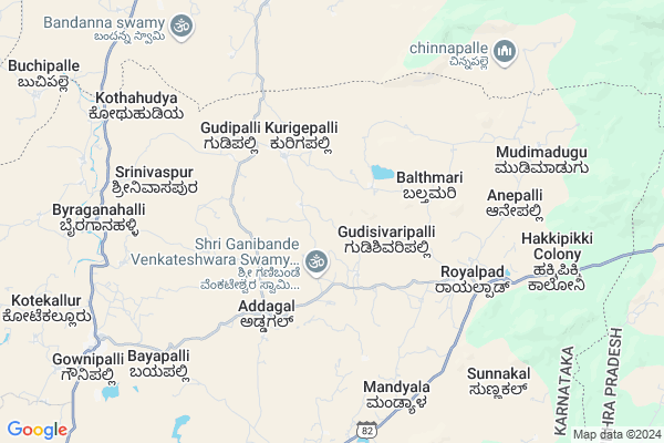
Pathur Map
EDIT Map
Add Your House
 ..
..
Current Corona Virus Infected Patients Count in Kolar District
| City Name | District Name | Total Covid cases |
|---|
Locality Name :
Pathur
( ಪಾತುರ್ )
Taluk Name : Srinivaspur
District : Kolar
State : Karnataka
Division : Bangalore
Language : Kannada and Urdu, Telugu, Tamil
Current Time 03:47 PM
Date: Wednesday , Apr 30,2025 (IST)
Time zone: IST (UTC+5:30)
Elevation / Altitude: 821 meters. Above Seal level
Telephone Code / Std Code: 08157
Assembly constituency : Srinivaspur assembly constituency
Assembly MLA : G.K. Venkatashivareddy
Lok Sabha constituency : Kolar parliamentary constituency
Parliament MP : S. MUNISWAMY
Serpanch Name :
Pin Code : 563134
Post Office Name : Rayalpadu
Main Village Name : Pathur
Alternate Village Name : K Pathur
Commodities Prices : Srinivasapur Market / Mandi
National Highways Reachable To Pathur
Nationa High Way :NH44
Nationa High Way :NH42
Nationa High Way :NH44
Nationa High Way :NH42
Rivers Near Pathur
Uttara Pinakini :ಉತ್ತರ ಪಿನಾಕಿನಿ
Uttara Pinakini :ಉತ್ತರ ಪಿನಾಕಿನಿ
Uttara Pinakini :ಉತ್ತರ ಪಿನಾಕಿನಿ
Uttara Pinakini :ಉತ್ತರ ಪಿನಾಕಿನಿ
About Pathur
Correct below Info and add more info about PathurPathur is a small Village/hamlet in Srinivaspur Taluk in Kolar District of Karnataka State, India. It comes under Pathur Panchayath. It belongs to Bangalore Division . It is located 58 KM towards North from District head quarters Kolar. 19 KM from Srinivaspur. 116 KM from State capital Bangalore
Pathur Pin code is 563134 and postal head office is Rayalpadu .
Rayalpad ( 5 KM ) , Gownipalli ( 10 KM ) , Kodipalli ( 11 KM ) , Nelavanki ( 12 KM ) , Lakshmipura ( 13 KM ) are the nearby Villages to Pathur. Pathur is surrounded by Srinivaspur Taluk towards South , Peddathippasamudram Taluk towards North , Mulakalacheruvu Taluk towards North , Madanapalle Taluk towards East .
Madanapalle , Srinivaspur , Chintamani , Punganur are the near by Cities to Pathur.
Pathur 2011 Census Details
Pathur Local Language is Kannada. Pathur Village Total population is 752 and number of houses are 172. Female Population is 50.9%. Village literacy rate is 61.3% and the Female Literacy rate is 27.0%.
Population
| Census Parameter | Census Data |
| Total Population | 752 |
| Total No of Houses | 172 |
| Female Population % | 50.9 % ( 383) |
| Total Literacy rate % | 61.3 % ( 461) |
| Female Literacy rate | 27.0 % ( 203) |
| Scheduled Tribes Population % | 0.0 % ( 0) |
| Scheduled Caste Population % | 44.3 % ( 333) |
| Working Population % | 59.3 % |
| Child(0 -6) Population by 2011 | 58 |
| Girl Child(0 -6) Population % by 2011 | 48.3 % ( 28) |
Pathur Census More Deatils.
Politics in Pathur
Bharatiya Janata Party , JD(S) , BJP , Indian National Congress (INC) , INC are the major political parties in this area.Polling Stations /Booths near Pathur
1)Government Higher Primary School Jannappanahalli2)Government Lower Primary School Tantharlapalli
3)Government Lower Primary School Jonnapalli
4)Government Higher Primary School Yerramvaripalli
5)Government Lower Primary School Gowdahalli
HOW TO REACH Pathur
By Rail
There is no railway station near to Pathur in less than 10 km. Srinivasapur Halt Rail Way Station (near to Srinivaspur) , Kolar Rail Way Station (near to Kolar) are the Rail way stations reachable from near by towns.By Road
Srinivaspur , Mulbagal , Madanapalle , Kolar , Punganur are the nearby by towns to Pathur having road connectivity to PathurColleges near Pathur
Reddy's College
Address :
Schools in Pathur
Glps K Pathur
Address : pathur , srinivasapur , kolar , Karnataka . PIN- 563134 , Post - Rayalpadu
Govt Health Centers near Pathur
1) Byarakur (24X7) , phc byrakur , temple street , near hostel2) Mulbagal Town-F , ramsandra main road , noogala bande , noogala bande main roade
3) Mulbagal Town-B , Ambedkar nagar , m.n halli main road , near anganawadi center
Sub Villages in Pathur
Hospitals in Pathur,Srinivaspur
Dr.G.N.Shivaram
Gownipalli Srinivaspur Taluk Kolar District Karnataka; India
10.4 KM distance Detail
more ..
Petrol Bunks in Pathur,Srinivaspur
indian oil petrol pump
Chinthamani Road; Beerangi; Andhra Pradesh 517370; India
13.3 KM distance Detail
more ..
Colleges in Pathur,Srinivaspur
Government PU College
Rayalpadu; Srinivaspur(t); SH 99; Rayalpadu; Karnataka 563134; India
6.0 KM distance Detail
Government High School & PU College
SH 99; Gownipalli; Karnataka 563161; India
10.6 KM distance Detail
Kumara Sambhava P.U.College
CSI Hospital Road; Srinivaspur; Kolar; Gownipalli; Karnataka 563161; India
10.6 KM distance Detail
Sunku Usha Gowthami College
bangalor road;near; BC Colony; B.Kothakota; Andhra Pradesh; India
13.8 KM distance Detail
more ..
Schools in Pathur,Srinivaspur
Govt.Higher Primary School
Gownipalli-Rayalpad road; Addagal; Karnataka 563134; India
4.6 KM distance Detail
Electronic Shops in Pathur,Srinivaspur
Saddam Mobile Sales&Service
Gownipalli-Rayalpadu Rd; Addagal; Karnataka 563161; India
4.4 KM distance Detail
Local Parks in Pathur,Srinivaspur
Gangotri seasonal Lake and Freak out point
Horsley Hills Rd; Horsley Hills; Andhra Pradesh 517352; India
18.4 KM distance Detail
Police Stations near Pathur,Srinivaspur
Rayalpad Police Station
Rayalpad; Srinivaspur(t); SH 99; Rayalpadu; Karnataka 563134; India
6.2 KM distance Detail
Governement Offices near Pathur,Srinivaspur
MeeSeva Center
Gattu(V); B Kothakota(M); Chittoor(D);517370; Gattu village; Andhra Pradesh 517352; India
15.0 KM distance Detail
About Pathur &
History
How to reach Pathur
Tourist Places Near By Pathur
Schools in Pathur
Colleges in Pathur
Temperature & weather of Pathur
places in Pathur
Pathur photos
More Information
How to reach Pathur
Tourist Places Near By Pathur
Schools in Pathur
Colleges in Pathur
Temperature & weather of Pathur
places in Pathur
Pathur photos
More Information
Village Talk
Post News or Events about this Village
Near Cities
Madanapalle 24 KM near
Srinivaspur 28 KM near
Chintamani 34 KM near
Punganur 40 KM near
Madanapalle 24 KM near
Srinivaspur 28 KM near
Chintamani 34 KM near
Punganur 40 KM near
Near By Taluks
B.Kothakota 15 KM near
Srinivaspur 18 KM near
Peddathippasamudram 22 KM near
Madanapalle 25 KM near
B.Kothakota 15 KM near
Srinivaspur 18 KM near
Peddathippasamudram 22 KM near
Madanapalle 25 KM near
Near By Air Ports
Bengaluru International Airport 84 KM near
Tirupati Airport 150 KM near
Chennai Airport 236 KM near
Salem Airport 237 KM near
Bengaluru International Airport 84 KM near
Tirupati Airport 150 KM near
Chennai Airport 236 KM near
Salem Airport 237 KM near
Near By Tourist Places
Horsley Hills 17 KM near
Nandi Hills 79 KM near
Lepakshi 89 KM near
Puttaparthi 98 KM near
Chittoor 105 KM near
Horsley Hills 17 KM near
Nandi Hills 79 KM near
Lepakshi 89 KM near
Puttaparthi 98 KM near
Chittoor 105 KM near
Near By Districts
Kolar 55 KM near
Chikballapur 70 KM near
Bangalore Rural 80 KM near
Chittoor 104 KM near
Kolar 55 KM near
Chikballapur 70 KM near
Bangalore Rural 80 KM near
Chittoor 104 KM near
Near By RailWay Station
Madanapalle Road Rail Way Station 32 KM near
Bangarapet Junction Rail Way Station 71 KM near
Madanapalle Road Rail Way Station 32 KM near
Bangarapet Junction Rail Way Station 71 KM near