| Home | City Bus | Maps | Villages | Cities | Rail | Tourist Places | School | College | Pin Codes | Corona Cases Count |
| Distance Calculator Bus Services IFSC Codes Trace Mobile Number Weather Search Place Trace IP Available Cash ATM/Banks Locate Polling Booth Report an Error contact People |
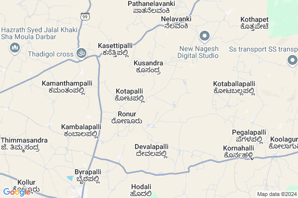
Lingapura
Lingapura Map
EDIT Map
Add Your House
 ..
..
Current Corona Virus Infected Patients Count in Kolar District
| City Name | District Name | Total Covid cases |
|---|
Locality Name :
Lingapura
( ಲಿಂಗಪುರ )
Taluk Name : Srinivaspur
District : Kolar
State : Karnataka
Division : Bangalore
Language : Kannada and Urdu, Telugu, Tamil
Current Time 11:15 PM
Date: Thursday , Mar 13,2025 (IST)
Time zone: IST (UTC+5:30)
Elevation / Altitude: 821 meters. Above Seal level
Telephone Code / Std Code: 08157
Assembly constituency : Srinivaspur assembly constituency
Assembly MLA : G.K. Venkatashivareddy
Lok Sabha constituency : Kolar parliamentary constituency
Parliament MP : S. MUNISWAMY
Serpanch Name :
Pin Code : 563135
Post Office Name : Srinivaspur
Main Village Name : Lingapura
Commodities Prices : Srinivasapur Market / Mandi
Lingapura Live Weather
Temperature: 24.0 °C
broken clouds
Humidity: 45%
Wind : 3.85 mt/sec towards SE
StationName : "SrÄ«nivÄ\u0081spur"
observed on 1 Hours Back
Temperature: 24.0 °C
broken clouds
Humidity: 45%
Wind : 3.85 mt/sec towards SE
StationName : "SrÄ«nivÄ\u0081spur"
observed on 1 Hours Back
Lingapura Weather Forecast for Next 5 days
14-03-2025
20.5°C to 24.0°C
broken clouds, overcast clouds
20.5°C to 24.0°C
broken clouds, overcast clouds
15-03-2025
20.4°C to 34.6°C
overcast clouds, scattered clouds, few clouds, clear sky, broken clouds
20.4°C to 34.6°C
overcast clouds, scattered clouds, few clouds, clear sky, broken clouds
16-03-2025
20.6°C to 34.8°C
clear sky, few clouds, overcast clouds, scattered clouds
20.6°C to 34.8°C
clear sky, few clouds, overcast clouds, scattered clouds
17-03-2025
20.0°C to 35.1°C
overcast clouds, broken clouds, scattered clouds, clear sky
20.0°C to 35.1°C
overcast clouds, broken clouds, scattered clouds, clear sky
18-03-2025
19.9°C to 35.8°C
scattered clouds, broken clouds, clear sky, few clouds
19.9°C to 35.8°C
scattered clouds, broken clouds, clear sky, few clouds
National Highways Reachable To Lingapura
Nationa High Way :NH44
Nationa High Way :NH42
Nationa High Way :NH44
Nationa High Way :NH42
Rivers Near Lingapura
Uttara Pinakini :ಉತ್ತರ ಪಿನಾಕಿನಿ
Uttara Pinakini :ಉತ್ತರ ಪಿನಾಕಿನಿ
Uttara Pinakini :ಉತ್ತರ ಪಿನಾಕಿನಿ
Uttara Pinakini :ಉತ್ತರ ಪಿನಾಕಿನಿ
About Lingapura
Correct below Info and add more info about LingapuraLingapura is a small Village/hamlet in Srinivaspur Taluk in Kolar District of Karnataka State, India. It comes under Lingapura Panchayath. It belongs to Bangalore Division . It is located 39 KM towards North from District head quarters Kolar. 101 KM from State capital Bangalore
Lingapura Pin code is 563135 and postal head office is Srinivaspur .
Lingapura is surrounded by Ramasamudram Taluk towards East , Chintamani Taluk towards west , B.Kothakota Taluk towards North , Madanapalle Taluk towards East .
Srinivaspur , Chintamani , Mulbagal , Madanapalle are the near by Cities to Lingapura.
Lingapura 2011 Census Details
Lingapura Local Language is Kannada. Lingapura Village Total population is 168 and number of houses are 23. Female Population is 48.8%. Village literacy rate is 52.4% and the Female Literacy rate is 25.0%.
Population
| Census Parameter | Census Data |
| Total Population | 168 |
| Total No of Houses | 23 |
| Female Population % | 48.8 % ( 82) |
| Total Literacy rate % | 52.4 % ( 88) |
| Female Literacy rate | 25.0 % ( 42) |
| Scheduled Tribes Population % | 4.8 % ( 8) |
| Scheduled Caste Population % | 22.0 % ( 37) |
| Working Population % | 56.0 % |
| Child(0 -6) Population by 2011 | 27 |
| Girl Child(0 -6) Population % by 2011 | 37.0 % ( 10) |
Lingapura Census More Deatils.
Politics in Lingapura
Bharatiya Janata Party , JD(S) , BJP , Indian National Congress (INC) , INC are the major political parties in this area.Polling Stations /Booths near Lingapura
1)Government Lower Primary School Chitnahalli2)Government Higher Primary School Koornahalli
3)Government Higher Primary School Nambihalli
4)Government Higher Primary School Devalapalli
5)Government Lower Primary School C.hosur
HOW TO REACH Lingapura
By Rail
There is no railway station near to Lingapura in less than 10 km. Srinivasapur Halt Rail Way Station (near to Srinivaspur) , Kolar Rail Way Station (near to Kolar) are the Rail way stations reachable from near by towns.By Road
Srinivaspur , Mulbagal , Madanapalle , Kolar , Punganur are the nearby by towns to Lingapura having road connectivity to LingapuraColleges near Lingapura
Reddy's College
Address :
Schools in Lingapura
Glps Lingapura
Address : lingapura , srinivasapur , kolar , Karnataka . PIN- 563135 , Post - Srinivaspur
Govt Health Centers near Lingapura
1) Mulbagal Town-F , ramsandra main road , noogala bande , noogala bande main roade2) Mulbagal Town-B , Ambedkar nagar , m.n halli main road , near anganawadi center
3) Mulbagal Town-E , mujar mohala , urdu school , near maseed
Sub Villages in Lingapura
Petrol Bunks in Lingapura,Srinivaspur
Old Petrol Station
National Highway 234; Gaffar Khan Mohalla; Srinivaspur; Karnataka 563135; India
11.4 KM distance Detail
IOC - Sha & Sons Filling Station
Gaffar Khan Mohalla; Srinivaspur; Karnataka 563135; India
11.4 KM distance Detail
more ..
Colleges in Lingapura,Srinivaspur
Shathashrunga P.U College
Kadapa Bangalore Highway; Srinivaspur Tehsil; Kolar District; Thadigol; Karnataka 563135; India
6.6 KM distance Detail
Government Boys Junior College
SH 99; Maruti Nagar; Srinivaspur; Karnataka 563135; India
10.2 KM distance Detail
more ..
Schools in Lingapura,Srinivaspur
Government Higher Primary School; Ronur
Ronour - Emarakunte Rd; Ronur; Karnataka 563135; India
2.8 KM distance Detail
Government High School; Ronur
Ronour - Emarakunte Rd; Ronur; Karnataka 563135; India
2.8 KM distance Detail
Government Lower Primary School
Doddapalli; Srinivasapur-Ronur Rd; Ronur; Karnataka 563135; India
3.4 KM distance Detail
Electronic Shops in Lingapura,Srinivaspur
Pranav Electronics
Lakshmipura - Chembakur Rd; Lakshmipura; Karnataka 563135; India
6.9 KM distance Detail
Super Markets in Lingapura,Srinivaspur
Hks Provisions Store
Hyder Ali Mohalla; Srinivaspur; Karnataka 563135; India
11.3 KM distance Detail
Police Stations near Lingapura,Srinivaspur
Rayalpad Police Station
Rayalpad; Srinivaspur(t); SH 99; Rayalpadu; Karnataka 563134; India
19.1 KM distance Detail
Governement Offices near Lingapura,Srinivaspur
Srinivasapur Taluk municipal council
Opp; KEB BESCOM office;Srinivasapur; Karnataka 563135; India
10.2 KM distance Detail
About Lingapura &
History
How to reach Lingapura
Tourist Places Near By Lingapura
Schools in Lingapura
Colleges in Lingapura
Temperature & weather of Lingapura
places in Lingapura
Lingapura photos
More Information
How to reach Lingapura
Tourist Places Near By Lingapura
Schools in Lingapura
Colleges in Lingapura
Temperature & weather of Lingapura
places in Lingapura
Lingapura photos
More Information
Village Talk
Post News or Events about this Village
Near Cities
Srinivaspur 10 KM near
Chintamani 24 KM near
Mulbagal 34 KM near
Madanapalle 34 KM near
Srinivaspur 10 KM near
Chintamani 24 KM near
Mulbagal 34 KM near
Madanapalle 34 KM near
Near By Taluks
Srinivaspur 0 KM near
Ramasamudram 20 KM near
Chintamani 24 KM near
B.Kothakota 33 KM near
Srinivaspur 0 KM near
Ramasamudram 20 KM near
Chintamani 24 KM near
B.Kothakota 33 KM near
Near By Air Ports
Bengaluru International Airport 72 KM near
Tirupati Airport 157 KM near
Salem Airport 219 KM near
Chennai Airport 236 KM near
Bengaluru International Airport 72 KM near
Tirupati Airport 157 KM near
Salem Airport 219 KM near
Chennai Airport 236 KM near
Near By Tourist Places
Horsley Hills 34 KM near
Nandi Hills 71 KM near
Lepakshi 92 KM near
Bangalore 97 KM near
Chittoor 104 KM near
Horsley Hills 34 KM near
Nandi Hills 71 KM near
Lepakshi 92 KM near
Bangalore 97 KM near
Chittoor 104 KM near
Near By Districts
Kolar 37 KM near
Chikballapur 64 KM near
Bangalore Rural 69 KM near
Bangalore 96 KM near
Kolar 37 KM near
Chikballapur 64 KM near
Bangalore Rural 69 KM near
Bangalore 96 KM near
Near By RailWay Station
Madanapalle Road Rail Way Station 46 KM near
Bangarapet Junction Rail Way Station 53 KM near
Madanapalle Road Rail Way Station 46 KM near
Bangarapet Junction Rail Way Station 53 KM near