| Home | City Bus | Maps | Villages | Cities | Rail | Tourist Places | School | College | Pin Codes | Corona Cases Count |
| Distance Calculator Bus Services IFSC Codes Trace Mobile Number Weather Search Place Trace IP Available Cash ATM/Banks Locate Polling Booth Report an Error contact People |
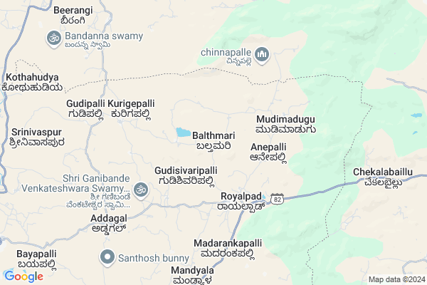
Balthmari
Balthmari Map
EDIT Map
Add Your House
 ..
..
Current Corona Virus Infected Patients Count in Kolar District
| City Name | District Name | Total Covid cases |
|---|
Locality Name :
Balthmari
( ಬಾಲ್ತ್ಮರಿ )
Taluk Name : Srinivaspur
District : Kolar
State : Karnataka
Division : Bangalore
Language : Kannada and Urdu, Telugu, Tamil
Current Time 03:48 PM
Date: Wednesday , Apr 30,2025 (IST)
Time zone: IST (UTC+5:30)
Elevation / Altitude: 821 meters. Above Seal level
Telephone Code / Std Code: 08157
Assembly constituency : Srinivaspur assembly constituency
Assembly MLA : G.K. Venkatashivareddy
Lok Sabha constituency : Kolar parliamentary constituency
Parliament MP : S. MUNISWAMY
Serpanch Name :
Pin Code : 563134
Post Office Name : Rayalpadu
Main Village Name : Balthmari
Alternate Village Name : Balthamari
Commodities Prices : Mulakalacheruvu Market / Mandi
Balthmari Live Weather
Temperature: 36.6 °C
scattered clouds
Humidity: 19%
Wind : 4.87 mt/sec towards NE
StationName : "Madanapalle"
observed on Now
Temperature: 36.6 °C
scattered clouds
Humidity: 19%
Wind : 4.87 mt/sec towards NE
StationName : "Madanapalle"
observed on Now
Balthmari Weather Forecast for Next 5 days
01-05-2025
24.5°C to 35.6°C
scattered clouds, broken clouds, overcast clouds
24.5°C to 35.6°C
scattered clouds, broken clouds, overcast clouds
02-05-2025
25.0°C to 37.1°C
light rain, broken clouds, scattered clouds, overcast clouds
25.0°C to 37.1°C
light rain, broken clouds, scattered clouds, overcast clouds
03-05-2025
24.4°C to 37.0°C
overcast clouds, broken clouds, scattered clouds
24.4°C to 37.0°C
overcast clouds, broken clouds, scattered clouds
04-05-2025
25.1°C to 36.8°C
overcast clouds, broken clouds, light rain
25.1°C to 36.8°C
overcast clouds, broken clouds, light rain
05-05-2025
23.9°C to 35.7°C
overcast clouds, broken clouds, scattered clouds, light rain
23.9°C to 35.7°C
overcast clouds, broken clouds, scattered clouds, light rain
National Highways Reachable To Balthmari
Nationa High Way :NH44
Nationa High Way :NH42
Nationa High Way :NH44
Nationa High Way :NH42
Rivers Near Balthmari
Uttara Pinakini :ಉತ್ತರ ಪಿನಾಕಿನಿ
Uttara Pinakini :ಉತ್ತರ ಪಿನಾಕಿನಿ
Uttara Pinakini :ಉತ್ತರ ಪಿನಾಕಿನಿ
Uttara Pinakini :ಉತ್ತರ ಪಿನಾಕಿನಿ
About Balthmari
Correct below Info and add more info about BalthmariBalthmari is a small Village/hamlet in Srinivaspur Taluk in Kolar District of Karnataka State, India. It comes under Balthmari Panchayath. It belongs to Bangalore Division . It is located 60 KM towards North from District head quarters Kolar. 21 KM from Srinivaspur. 120 KM from State capital Bangalore
Balthmari Pin code is 563134 and postal head office is Rayalpadu .
Addagal ( 8 KM ) , Nelavanki ( 14 KM ) , Gownipalli ( 14 KM ) , Lakshmipura ( 15 KM ) , Kodipalli ( 15 KM ) are the nearby Villages to Balthmari. Balthmari is surrounded by Srinivaspur Taluk towards South , Madanapalle Taluk towards East , Kurabalakota Taluk towards East , Peddathippasamudram Taluk towards North .
Madanapalle , Srinivaspur , Punganur , Chintamani are the near by Cities to Balthmari.
Balthmari 2011 Census Details
Balthmari Local Language is Kannada. Balthmari Village Total population is 624 and number of houses are 134. Female Population is 51.1%. Village literacy rate is 61.4% and the Female Literacy rate is 24.7%.
Population
| Census Parameter | Census Data |
| Total Population | 624 |
| Total No of Houses | 134 |
| Female Population % | 51.1 % ( 319) |
| Total Literacy rate % | 61.4 % ( 383) |
| Female Literacy rate | 24.7 % ( 154) |
| Scheduled Tribes Population % | 5.0 % ( 31) |
| Scheduled Caste Population % | 47.3 % ( 295) |
| Working Population % | 90.4 % |
| Child(0 -6) Population by 2011 | 50 |
| Girl Child(0 -6) Population % by 2011 | 52.0 % ( 26) |
Balthmari Census More Deatils.
Politics in Balthmari
Bharatiya Janata Party , JD(S) , BJP , Indian National Congress (INC) , INC are the major political parties in this area.Polling Stations /Booths near Balthmari
1)Government Lower Primary School Balevaripalli2)Government Lower Primary School Jonnapalli
3)Government Lower Primary School Gudipalli
4)Government Lower Primary School Kummagunte
5)Government Lower Primary School Manjalanagara
HOW TO REACH Balthmari
By Rail
There is no railway station near to Balthmari in less than 10 km. Srinivasapur Halt Rail Way Station (near to Srinivaspur) , Kolar Rail Way Station (near to Kolar) are the Rail way stations reachable from near by towns.By Road
Srinivaspur , Mulbagal , Madanapalle , Kolar , Punganur are the nearby by towns to Balthmari having road connectivity to BalthmariColleges near Balthmari
Reddy's College
Address :
Schools near Balthmari
Venu Venkatadri Vidya Samsthe
Address : unikili , srinivasapur , kolar , Karnataka . PIN- 563126 , Post - Dalasanur
Gg Venu Gramina Vidya Samsthe
Address : unikili , srinivasapur , kolar , Karnataka . PIN- 563135 , Post - Srinivaspur
Vsr Educational Society Hps
Address : lakshmipura , srinivasapur , kolar , Karnataka . PIN- 563135 , Post - Srinivaspur
Venu Cental School
Address : unikili , srinivasapur , kolar , Karnataka . PIN- 563135 , Post - Srinivaspur
Govt Health Centers near Balthmari
1) Byarakur (24X7) , phc byrakur , temple street , near hostel2) Mulbagal Town-F , ramsandra main road , noogala bande , noogala bande main roade
3) Mulbagal Town-B , Ambedkar nagar , m.n halli main road , near anganawadi center
Sub Villages in Balthmari
Hospitals in Balthmari,Srinivaspur
Dr.G.N.Shivaram
Gownipalli Srinivaspur Taluk Kolar District Karnataka; India
14.4 KM distance Detail
more ..
Petrol Bunks in Balthmari,Srinivaspur
indian oil petrol pump
Chinthamani Road; Beerangi; Andhra Pradesh 517370; India
14.2 KM distance Detail
more ..
Colleges in Balthmari,Srinivaspur
Government PU College
Rayalpadu; Srinivaspur(t); SH 99; Rayalpadu; Karnataka 563134; India
4.1 KM distance Detail
Kumara Sambhava P.U.College
CSI Hospital Road; Srinivaspur; Kolar; Gownipalli; Karnataka 563161; India
14.5 KM distance Detail
Government High School & PU College
SH 99; Gownipalli; Karnataka 563161; India
14.5 KM distance Detail
Sunku Usha Gowthami College
bangalor road;near; BC Colony; B.Kothakota; Andhra Pradesh; India
14.6 KM distance Detail
more ..
Electronic Shops in Balthmari,Srinivaspur
Saddam Mobile Sales&Service
Gownipalli-Rayalpadu Rd; Addagal; Karnataka 563161; India
8.0 KM distance Detail
Local Parks in Balthmari,Srinivaspur
Gangotri seasonal Lake and Freak out point
Horsley Hills Rd; Horsley Hills; Andhra Pradesh 517352; India
14.8 KM distance Detail
Police Stations near Balthmari,Srinivaspur
Rayalpad Police Station
Rayalpad; Srinivaspur(t); SH 99; Rayalpadu; Karnataka 563134; India
4.2 KM distance Detail
Governement Offices near Balthmari,Srinivaspur
MeeSeva Center
Gattu(V); B Kothakota(M); Chittoor(D);517370; Gattu village; Andhra Pradesh 517352; India
13.2 KM distance Detail
About Balthmari &
History
How to reach Balthmari
Tourist Places Near By Balthmari
Schools in Balthmari
Colleges in Balthmari
Temperature & weather of Balthmari
places in Balthmari
Balthmari photos
More Information
How to reach Balthmari
Tourist Places Near By Balthmari
Schools in Balthmari
Colleges in Balthmari
Temperature & weather of Balthmari
places in Balthmari
Balthmari photos
More Information
Village Talk
Post News or Events about this Village
Near Cities
Madanapalle 20 KM near
Srinivaspur 30 KM near
Punganur 38 KM near
Chintamani 38 KM near
Madanapalle 20 KM near
Srinivaspur 30 KM near
Punganur 38 KM near
Chintamani 38 KM near
Near By Taluks
B.Kothakota 14 KM near
Srinivaspur 20 KM near
Madanapalle 21 KM near
Kurabalakota 22 KM near
B.Kothakota 14 KM near
Srinivaspur 20 KM near
Madanapalle 21 KM near
Kurabalakota 22 KM near
Near By Air Ports
Bengaluru International Airport 88 KM near
Tirupati Airport 147 KM near
Chennai Airport 233 KM near
Salem Airport 238 KM near
Bengaluru International Airport 88 KM near
Tirupati Airport 147 KM near
Chennai Airport 233 KM near
Salem Airport 238 KM near
Near By Tourist Places
Horsley Hills 13 KM near
Nandi Hills 83 KM near
Lepakshi 92 KM near
Puttaparthi 100 KM near
Chittoor 102 KM near
Horsley Hills 13 KM near
Nandi Hills 83 KM near
Lepakshi 92 KM near
Puttaparthi 100 KM near
Chittoor 102 KM near
Near By Districts
Kolar 57 KM near
Chikballapur 74 KM near
Bangalore Rural 84 KM near
Chittoor 101 KM near
Kolar 57 KM near
Chikballapur 74 KM near
Bangalore Rural 84 KM near
Chittoor 101 KM near
Near By RailWay Station
Madanapalle Road Rail Way Station 29 KM near
Kadiri Rail Way Station 71 KM near
Madanapalle Road Rail Way Station 29 KM near
Kadiri Rail Way Station 71 KM near