| Home | City Bus | Maps | Villages | Cities | Rail | Tourist Places | School | College | Pin Codes | Corona Cases Count |
| Distance Calculator Bus Services IFSC Codes Trace Mobile Number Weather Search Place Trace IP Available Cash ATM/Banks Locate Polling Booth Report an Error contact People |
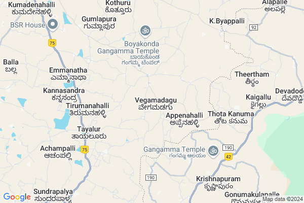
Vegamadagu Map
EDIT Map
Add Your House
 ..
..
Current Corona Virus Infected Patients Count in Kolar District
| City Name | District Name | Total Covid cases |
|---|
Locality Name :
Vegamadagu
( ವೇಗಮಾಡಗು )
Taluk Name : Mulbagal
District : Kolar
State : Karnataka
Division : Bangalore
Language : Kannada and Urdu, Telugu, Tamil
Current Time 11:27 PM
Date: Thursday , Mar 13,2025 (IST)
Time zone: IST (UTC+5:30)
Elevation / Altitude: 864 meters. Above Seal level
Telephone Code / Std Code: 08159
Assembly constituency : Mulbagal assembly constituency
Assembly MLA : Samruddhi V. Manjunath
Lok Sabha constituency : Kolar parliamentary constituency
Parliament MP : S. MUNISWAMY
Serpanch Name :
Pin Code : 563136
Post Office Name : Tayalur
Main Village Name : Vegamadagu
Alternate Village Name : Vegamodagu
Commodities Prices : Mulabagilu Market / Mandi
Vegamadagu Live Weather
Temperature: 22.2 °C
scattered clouds
Humidity: 69%
Wind : 3.08 mt/sec towards E
StationName : "MulbÄ\u0081gal"
observed on 1 Hours Back
Temperature: 22.2 °C
scattered clouds
Humidity: 69%
Wind : 3.08 mt/sec towards E
StationName : "MulbÄ\u0081gal"
observed on 1 Hours Back
Vegamadagu Weather Forecast for Next 5 days
14-03-2025
20.3°C to 21.6°C
scattered clouds, broken clouds
20.3°C to 21.6°C
scattered clouds, broken clouds
15-03-2025
20.5°C to 34.7°C
broken clouds, overcast clouds, clear sky
20.5°C to 34.7°C
broken clouds, overcast clouds, clear sky
16-03-2025
20.6°C to 34.7°C
clear sky, few clouds, scattered clouds, broken clouds, overcast clouds
20.6°C to 34.7°C
clear sky, few clouds, scattered clouds, broken clouds, overcast clouds
17-03-2025
19.9°C to 35.1°C
overcast clouds, broken clouds, scattered clouds
19.9°C to 35.1°C
overcast clouds, broken clouds, scattered clouds
18-03-2025
19.8°C to 36.1°C
broken clouds, clear sky, few clouds, scattered clouds
19.8°C to 36.1°C
broken clouds, clear sky, few clouds, scattered clouds
Edit below overview about Vegamadagu
Edit below overview about Vegamadagu
OverView of Vegamadagu
Vegamadagu is village with approximately 2000 population.VEGAMADAGU is well connected by Road can be easily reached through Mulbagal taluk head quarter on the NH4 (Bombay-Bangalore-Madras Highway) (10 KMs from Mulbagal).IT IS ALSO ON THE WAY OF BANGALORE TO THIRUPATHI BY ROAD . village is surrounded by mango gardens and there is one tank.normaly hot weather and it is part of the draught area of KOLAR DISTRICT.There is a government school- from Primary to Middle school. This tiny village school has produced many inteligent students who are well educated and occupying good positions in the governmentEdit below overview about Vegamadagu
National Highways Reachable To Vegamadagu
Nationa High Way :NH69
Nationa High Way :NH42;NH69
Nationa High Way :NH69
Nationa High Way :NH42;NH69
Rivers Near Vegamadagu
Palar :ಪಾಲಾರ್ :பாலா
Palar :ಪಾಲಾರ್ :பாலா
About Vegamadagu
Vegamadagu is a small Village/hamlet in Mulbagal Taluk in Kolar District of Karnataka State, India. It comes under Vegamadagu Panchayath. It belongs to Bangalore Division . It is located 43 KM towards East from District head quarters Kolar. 12 KM from Mulbagal. 112 KM from State capital Bangalore
Vegamadagu Pin code is 563136 and postal head office is Tayalur .
Tayalur ( 6 KM ) , Vengasandra ( 11 KM ) , Alangur ( 11 KM ) , Gummakal ( 12 KM ) , Thordi ( 12 KM ) are the nearby Villages to Vegamadagu. Vegamadagu is surrounded by Venkatagirikota Taluk towards South , Baireddipalle Taluk towards East , Ramakuppam Taluk towards South , Santhipuram Ho Arimuthanapalle Taluk towards South .
Mulbagal , Robertson Pet , Pernampattu , Punganur are the near by Cities to Vegamadagu.
This Place is in the border of the Kolar District and Chittoor District. Chittoor District Baireddipalle is East towards this place . It is near to the Andhra Pradesh State Border.
Vegamadagu 2011 Census Details
Vegamadagu Local Language is Kannada. Vegamadagu Village Total population is 919 and number of houses are 196. Female Population is 48.4%. Village literacy rate is 52.0% and the Female Literacy rate is 22.3%.
Population
| Census Parameter | Census Data |
| Total Population | 919 |
| Total No of Houses | 196 |
| Female Population % | 48.4 % ( 445) |
| Total Literacy rate % | 52.0 % ( 478) |
| Female Literacy rate | 22.3 % ( 205) |
| Scheduled Tribes Population % | 18.7 % ( 172) |
| Scheduled Caste Population % | 44.4 % ( 408) |
| Working Population % | 59.2 % |
| Child(0 -6) Population by 2011 | 102 |
| Girl Child(0 -6) Population % by 2011 | 45.1 % ( 46) |
Vegamadagu Census More Deatils.
Politics in Vegamadagu
Bharatiya Janata Party , JD(S) , BJP , Independent (IND) , INC are the major political parties in this area.Polling Stations /Booths near Vegamadagu
1)Governament Lower Primary School Kempapura2)Governament Higher Primary School V. Hosahalli
3)Governament Lower Primary School S.ananthapura
4)Governament Higher Primary School Majara Yaluvahalli
5)Governament Higher Primary School Thavarekere
HOW TO REACH Vegamadagu
By Rail
There is no railway station near to Vegamadagu in less than 10 km. are the Rail way stations reachable from near by towns.By Road
Mulbagal , Punganur are the nearby by towns to Vegamadagu having road connectivity to VegamadaguColleges near Vegamadagu
Jj Para Medical College Mulbagal
Address : Mc Road Mbs Building Mulbagal
Jj Para Medical College
Address : Mc Road Mbs Building Mulbagal
Sri Varasiddhi Vinayaka College
Address :
Schools in Vegamadagu
Ghps Vegamadagu
Address : vegamadagu , mulbagal , kolar , Karnataka . PIN- 563136 , Post - Tayalur
Govt Health Centers near Vegamadagu
1) Mulbagal Rural , phc kurudumale , kurudumale , near ganapathi temple2) Kurudumale (24X7) , phc kurudumale , main road , near ganapathi temple
3) Mulbagal Town-A , Muthyalapete , Alangoor main road , Bjane mane
Sub Villages in Vegamadagu
Hospitals in Vegamadagu,Mulbagal
Veterans Hospital
Mulbagal - V Kota Rd; Bescom Quarters; Tayalur; Karnataka 563136; India
6.3 KM distance Detail
Primary Health Centre
Tayalar; Tayalur; Kolar; NH-234; Villpuram Mangalore Road; Mulbagal; Mulbagal; Karnataka 563136; India
6.3 KM distance Detail
Government Hospital
National Highway 234; Bescom Quarters; Tayalur; Karnataka 563136; India
6.4 KM distance Detail
TAYALUR GOVT HOSPITAL.
Mulbagal - V Kota Rd; Bescom Quarters; Tayalur; Karnataka 563136; India
6.4 KM distance Detail
more ..
Petrol Bunks in Vegamadagu,Mulbagal
Balaji Garrage And Two Wheeler Servising
Mulbagal - V Kota Rd; Tayalur; Karnataka 563136; India
6.2 KM distance Detail
Sri Padmavathi Agencies-Bharat Petroleum
Nernipalli; Chittoor; NH-219; Krishnagiri Palamaner Highway; Venkatagirikota; Venkatagirikota; Andhra Pradesh 517424; India
9.2 KM distance Detail
more ..
Colleges in Vegamadagu,Mulbagal
Darul Uloom Syed Ali Peeran Arabic College
Krishnapuram; Andhra Pradesh 517415; India
8.5 KM distance Detail
V.Kota Government Junior College
SH 95; Pipepalli; Andhra Pradesh 517424; India
10.1 KM distance Detail
more ..
Electronic Shops in Vegamadagu,Mulbagal
sr enterprise
Tayalur - Nangali Rd; Gurralvanka; Tayalur; Karnataka 563136; India
3.8 KM distance Detail
Pallavi Digital Studio
NH75; Bescom Quarters; Tayalur; Karnataka 563136; India
6.3 KM distance Detail
Sri Manjunatha Motors Tayalur
Near; Govt Hospital; Tayalur; Karnataka 563136; India
6.4 KM distance Detail
Super Markets in Vegamadagu,Mulbagal
S S Vegetable Mundy
Patrapalli; Venkatagirikota; Andhra Pradesh 517424; India
9.9 KM distance Detail
Police Stations near Vegamadagu,Mulbagal
Venkatagiri Kota Police Station
Venkatagirikota; Andhra Pradesh 517424; India
10.5 KM distance Detail
Mulbagal Police Station
National Highway 234; Mulbagal; Karnataka 563131; India
14.3 KM distance Detail
Governement Offices near Vegamadagu,Mulbagal
MeeSeva Center
Jownipalli; Jownipalli; 0; Jownipalli(V); Venkatagiri Kota(M); Chittoor(D);517424; Andhra Pradesh 517415; India
6.1 KM distance Detail
sapthagiri auto finance
Basappa St; Venkatagirikota; Andhra Pradesh 517424; India
10.2 KM distance Detail
MeeSeva Center
#5-551; D C C Complex; Bazaar Street; National Highway 219; Venkatagirikota; Andhra Pradesh 517424; India
10.3 KM distance Detail
About Vegamadagu &
History
How to reach Vegamadagu
Tourist Places Near By Vegamadagu
Schools in Vegamadagu
Colleges in Vegamadagu
Temperature & weather of Vegamadagu
places in Vegamadagu
Vegamadagu photos
More Information
How to reach Vegamadagu
Tourist Places Near By Vegamadagu
Schools in Vegamadagu
Colleges in Vegamadagu
Temperature & weather of Vegamadagu
places in Vegamadagu
Vegamadagu photos
More Information
Village Talk
Post News or Events about this Village
Near Cities
Mulbagal 14 KM near
Robertson Pet 28 KM near
Pernampattu 36 KM near
Punganur 37 KM near
Mulbagal 14 KM near
Robertson Pet 28 KM near
Pernampattu 36 KM near
Punganur 37 KM near
Near By Taluks
Mulbagal 11 KM near
Venkatagirikota 15 KM near
Baireddipalle 15 KM near
Ramakuppam 27 KM near
Mulbagal 11 KM near
Venkatagirikota 15 KM near
Baireddipalle 15 KM near
Ramakuppam 27 KM near
Near By Air Ports
Bengaluru International Airport 93 KM near
Tirupati Airport 147 KM near
Salem Airport 181 KM near
Chennai Airport 205 KM near
Bengaluru International Airport 93 KM near
Tirupati Airport 147 KM near
Salem Airport 181 KM near
Chennai Airport 205 KM near
Near By Tourist Places
Yelagiri 66 KM near
Horsley Hills 71 KM near
Chittoor 78 KM near
vellore 82 KM near
Nandi Hills 102 KM near
Yelagiri 66 KM near
Horsley Hills 71 KM near
Chittoor 78 KM near
vellore 82 KM near
Nandi Hills 102 KM near
Near By Districts
Kolar 41 KM near
Krishnagiri 74 KM near
Chittoor 76 KM near
Vellore 83 KM near
Kolar 41 KM near
Krishnagiri 74 KM near
Chittoor 76 KM near
Vellore 83 KM near
Near By RailWay Station
Bangarapet Junction Rail Way Station 37 KM near
Kuppam Rail Way Station 44 KM near
Bangarapet Junction Rail Way Station 37 KM near
Kuppam Rail Way Station 44 KM near