| Home | City Bus | Maps | Villages | Cities | Rail | Tourist Places | School | College | Pin Codes | Corona Cases Count |
| Distance Calculator Bus Services IFSC Codes Trace Mobile Number Weather Search Place Trace IP Available Cash ATM/Banks Locate Polling Booth Report an Error contact People |
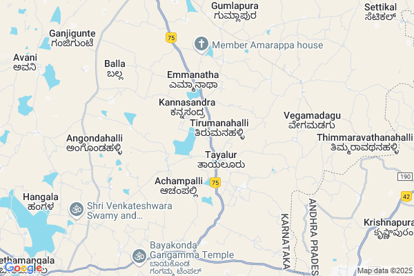
Tayalur Amanikere Map
EDIT Map
Add Your House
 ..
..
Current Corona Virus Infected Patients Count in Kolar District
| City Name | District Name | Total Covid cases |
|---|
Locality Name :
Tayalur Amanikere
( ತಾಯಲೂರ್ ಅಮಾನಿಕೆರೆ )
Taluk Name : Mulbagal
District : Kolar
State : Karnataka
Division : Bangalore
Language : Kannada and Urdu, Telugu, Tamil
Current Time 04:46 AM
Date: Saturday , Apr 26,2025 (IST)
Time zone: IST (UTC+5:30)
Elevation / Altitude: 864 meters. Above Seal level
Telephone Code / Std Code: 08159
Assembly constituency : Mulbagal assembly constituency
Assembly MLA : Samruddhi V. Manjunath
Lok Sabha constituency : Kolar parliamentary constituency
Parliament MP : S. MUNISWAMY
Serpanch Name :
Pin Code : 563136
Post Office Name : Tayalur
Main Village Name : Tayalur Amanikere
Commodities Prices : Mulabagilu Market / Mandi
Tayalur Amanikere Live Weather
Temperature: 22.2 °C
overcast clouds
Humidity: 87%
Wind : 2.01 mt/sec towards SE
StationName : "MulbÄ\u0081gal"
observed on 17 Mins Back
Temperature: 22.2 °C
overcast clouds
Humidity: 87%
Wind : 2.01 mt/sec towards SE
StationName : "MulbÄ\u0081gal"
observed on 17 Mins Back
Tayalur Amanikere Weather Forecast for Next 5 days
27-04-2025
22.0°C to 34.7°C
overcast clouds, broken clouds
22.0°C to 34.7°C
overcast clouds, broken clouds
28-04-2025
21.4°C to 35.8°C
scattered clouds, broken clouds, overcast clouds
21.4°C to 35.8°C
scattered clouds, broken clouds, overcast clouds
29-04-2025
22.2°C to 36.1°C
scattered clouds, few clouds, clear sky, broken clouds, light rain
22.2°C to 36.1°C
scattered clouds, few clouds, clear sky, broken clouds, light rain
30-04-2025
23.3°C to 35.0°C
scattered clouds, clear sky, broken clouds, overcast clouds, light rain
23.3°C to 35.0°C
scattered clouds, clear sky, broken clouds, overcast clouds, light rain
National Highways Reachable To Tayalur Amanikere
Nationa High Way :NH69
Nationa High Way :NH42;NH69
Nationa High Way :NH69
Nationa High Way :NH42;NH69
Rivers Near Tayalur Amanikere
Palar :ಪಾಲಾರ್ :பாலா
Palar :ಪಾಲಾರ್ :பாலா
About Tayalur Amanikere
Correct below Info and add more info about Tayalur AmanikereTayalur Amanikere is a small Village/hamlet in Mulbagal Taluk in Kolar District of Karnataka State, India. It comes under Tayalur Amanikere Panchayath. It belongs to Bangalore Division . It is located 37 KM towards East from District head quarters Kolar. 13 KM from Mulbagal. 105 KM from State capital Bangalore
Tayalur Amanikere Pin code is 563136 and postal head office is Tayalur .
Angondahalli ( 6 KM ) , Balla ( 7 KM ) , Vengasandra ( 8 KM ) , Thordi ( 9 KM ) , Thimmaravuthanahalli ( 10 KM ) are the nearby Villages to Tayalur Amanikere. Tayalur Amanikere is surrounded by Venkatagirikota Taluk towards South , Baireddipalle Taluk towards East , Santhipuram Ho Arimuthanapalle Taluk towards South , Bangarapet Taluk towards west .
Mulbagal , Robertson Pet , Kolar , Srinivaspur are the near by Cities to Tayalur Amanikere.
This Place is in the border of the Kolar District and Chittoor District. Chittoor District Baireddipalle is East towards this place . It is near to the Andhra Pradesh State Border.
Tayalur Amanikere 2011 Census Details
Tayalur Amanikere Local Language is Kannada. Tayalur Amanikere Village Total population is and number of houses are . Female Population is -1.0%. Village literacy rate is -1.0% and the Female Literacy rate is -1.0%.
Population
| Census Parameter | Census Data |
| Total Population | |
| Total No of Houses | |
| Female Population % | -1.0 % ( ) |
| Total Literacy rate % | -1.0 % ( ) |
| Female Literacy rate | -1.0 % ( ) |
| Scheduled Tribes Population % | -1.0 % ( ) |
| Scheduled Caste Population % | -1.0 % ( ) |
| Working Population % | -1.0 % |
| Child(0 -6) Population by 2011 | |
| Girl Child(0 -6) Population % by 2011 | -1.0 % ( ) |
Tayalur Amanikere Census More Deatils.
Politics in Tayalur Amanikere
Bharatiya Janata Party , JD(S) , BJP , Independent (IND) , INC are the major political parties in this area.Polling Stations /Booths near Tayalur Amanikere
1)Governament Junior College Tayaluru (block 2)2)Governament Higher Primary School Bevahalli
3)Governament Model Higher Primary School Avani - 1
4)Governament Lower Primary School Kunibande
5)Governament Urdu Lower Primary School Sonnavadi
HOW TO REACH Tayalur Amanikere
By Rail
There is no railway station near to Tayalur Amanikere in less than 10 km. are the Rail way stations reachable from near by towns.By Road
Mulbagal , Punganur are the nearby by towns to Tayalur Amanikere having road connectivity to Tayalur AmanikereColleges near Tayalur Amanikere
Jj Para Medical College Mulbagal
Address : Mc Road Mbs Building Mulbagal
Jj Para Medical College
Address : Mc Road Mbs Building Mulbagal
Sri Varasiddhi Vinayaka College
Address :
Schools near Tayalur Amanikere
Janaa Jyothi Hps
Address : avani , mulbagal , kolar , Karnataka . PIN- 563131 , Post - Mulbagal
Muraji Desai Recidencial Sch
Address : bettagerahalli , mulbagal , kolar , Karnataka . PIN- 563132 , Post - Nangli
Murarji Rsid Mulbagal
Address : mulbagal , mulbagal , kolar , Karnataka . PIN- 563131 , Post - Mulbagal
Jnana Jyothi Hps
Address : yalagondahalli , mulbagal , kolar , Karnataka . PIN- 563131 , Post - Mulbagal
Govt Health Centers near Tayalur Amanikere
1) Mulbagal Rural , phc kurudumale , kurudumale , near ganapathi temple2) Kurudumale (24X7) , phc kurudumale , main road , near ganapathi temple
3) Mulbagal Town-A , Muthyalapete , Alangoor main road , Bjane mane
Sub Villages in Tayalur Amanikere
Hospitals in Tayalur Amanikere,Mulbagal
Veterans Hospital
Mulbagal - V Kota Rd; Bescom Quarters; Tayalur; Karnataka 563136; India
1.8 KM distance Detail
TAYALUR GOVT HOSPITAL.
Mulbagal - V Kota Rd; Bescom Quarters; Tayalur; Karnataka 563136; India
1.8 KM distance Detail
Primary Health Centre
Tayalar; Tayalur; Kolar; NH-234; Villpuram Mangalore Road; Mulbagal; Mulbagal; Karnataka 563136; India
1.8 KM distance Detail
Government Hospital
National Highway 234; Bescom Quarters; Tayalur; Karnataka 563136; India
1.8 KM distance Detail
more ..
Petrol Bunks in Tayalur Amanikere,Mulbagal
Balaji Garrage And Two Wheeler Servising
Mulbagal - V Kota Rd; Tayalur; Karnataka 563136; India
1.7 KM distance Detail
Nawaz Service Station BPCL
KGF Rd; Shameer Mohalla; Audugodi; Karnataka 563131; India
11.4 KM distance Detail
more ..
Colleges in Tayalur Amanikere,Mulbagal
Government College
Sundarapalya; Kolar; SH-95; Villpuram Mangalore Road; Bangarupet; Bangarupet; Karnataka 563116; India
8.2 KM distance Detail
more ..
Electronic Shops in Tayalur Amanikere,Mulbagal
Pallavi Digital Studio
NH75; Bescom Quarters; Tayalur; Karnataka 563136; India
1.7 KM distance Detail
Sri Manjunatha Motors Tayalur
Near; Govt Hospital; Tayalur; Karnataka 563136; India
1.9 KM distance Detail
Super Markets in Tayalur Amanikere,Mulbagal
Sarkari nyayabele angadi
Bangaru Tirupathi Road; Nernahalli; Karnataka 563116; India
9.1 KM distance Detail
Police Stations near Tayalur Amanikere,Mulbagal
Mulbagal Police Station
National Highway 234; Mulbagal; Karnataka 563131; India
12.2 KM distance Detail
Venkatagiri Kota Police Station
Venkatagirikota; Andhra Pradesh 517424; India
12.4 KM distance Detail
Governement Offices near Tayalur Amanikere,Mulbagal
MeeSeva Center
Jownipalli; Jownipalli; 0; Jownipalli(V); Venkatagiri Kota(M); Chittoor(D);517424; Andhra Pradesh 517415; India
10.4 KM distance Detail
Ration Shop
Ration shop; c.hintamakulapalli; Venkatagirikota; Andhra Pradesh; India
11.7 KM distance Detail
Deputy Executive Engineers Office Panchayat Raj
Chittoor; NH-219; Krishnagiri Palamaner Highway; Venkatagirikota; Venkatagirikota; Andhra Pradesh 517424; India
11.8 KM distance Detail
About Tayalur Amanikere &
History
How to reach Tayalur Amanikere
Tourist Places Near By Tayalur Amanikere
Schools in Tayalur Amanikere
Colleges in Tayalur Amanikere
Temperature & weather of Tayalur Amanikere
places in Tayalur Amanikere
Tayalur Amanikere photos
More Information
How to reach Tayalur Amanikere
Tourist Places Near By Tayalur Amanikere
Schools in Tayalur Amanikere
Colleges in Tayalur Amanikere
Temperature & weather of Tayalur Amanikere
places in Tayalur Amanikere
Tayalur Amanikere photos
More Information
Village Talk
Post News or Events about this Village
Near Cities
Mulbagal 12 KM near
Robertson Pet 22 KM near
Kolar 35 KM near
Srinivaspur 39 KM near
Mulbagal 12 KM near
Robertson Pet 22 KM near
Kolar 35 KM near
Srinivaspur 39 KM near
Near By Taluks
Mulbagal 12 KM near
Venkatagirikota 17 KM near
Baireddipalle 21 KM near
Santhipuram Ho Arimuthanapalle 26 KM near
Mulbagal 12 KM near
Venkatagirikota 17 KM near
Baireddipalle 21 KM near
Santhipuram Ho Arimuthanapalle 26 KM near
Near By Air Ports
Bengaluru International Airport 88 KM near
Tirupati Airport 153 KM near
Salem Airport 179 KM near
Chennai Airport 211 KM near
Bengaluru International Airport 88 KM near
Tirupati Airport 153 KM near
Salem Airport 179 KM near
Chennai Airport 211 KM near
Near By Tourist Places
Yelagiri 67 KM near
Horsley Hills 72 KM near
Chittoor 84 KM near
vellore 88 KM near
Nandi Hills 97 KM near
Yelagiri 67 KM near
Horsley Hills 72 KM near
Chittoor 84 KM near
vellore 88 KM near
Nandi Hills 97 KM near
Near By Districts
Kolar 35 KM near
Krishnagiri 71 KM near
Chittoor 82 KM near
Bangalore Rural 88 KM near
Kolar 35 KM near
Krishnagiri 71 KM near
Chittoor 82 KM near
Bangalore Rural 88 KM near
Near By RailWay Station
Bangarapet Junction Rail Way Station 31 KM near
Kuppam Rail Way Station 41 KM near
Bangarapet Junction Rail Way Station 31 KM near
Kuppam Rail Way Station 41 KM near