| Home | City Bus | Maps | Villages | Cities | Rail | Tourist Places | School | College | Pin Codes | Corona Cases Count |
| Distance Calculator Bus Services IFSC Codes Trace Mobile Number Weather Search Place Trace IP Available Cash ATM/Banks Locate Polling Booth Report an Error contact People |
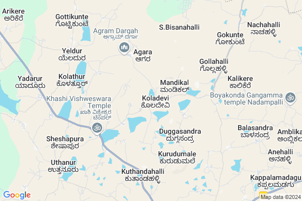
Koladevi Map
EDIT Map
Add Your House
 ..
..
Current Corona Virus Infected Patients Count in Kolar District
| City Name | District Name | Total Covid cases |
|---|
Locality Name :
Koladevi
( ಕೊಳದೇವಿ )
Taluk Name : Mulbagal
District : Kolar
State : Karnataka
Division : Bangalore
Language : Kannada and Urdu, Telugu, Tamil
Current Time 10:50 AM
Date: Tuesday , Apr 29,2025 (IST)
Time zone: IST (UTC+5:30)
Elevation / Altitude: 864 meters. Above Seal level
Telephone Code / Std Code: 08159
Assembly constituency : Mulbagal assembly constituency
Assembly MLA : Samruddhi V. Manjunath
Lok Sabha constituency : Kolar parliamentary constituency
Parliament MP : S. MUNISWAMY
Serpanch Name :
Pin Code : 563131
Post Office Name : Mulbagal
Main Village Name : Koladevi
Commodities Prices : Mulabagilu Market / Mandi
Koladevi Live Weather
Temperature: 26.8 °C
overcast clouds
Humidity: 59%
Wind : 2.12 mt/sec towards S
StationName : "MulbÄ\u0081gal"
observed on 2 Hours Back
Temperature: 26.8 °C
overcast clouds
Humidity: 59%
Wind : 2.12 mt/sec towards S
StationName : "MulbÄ\u0081gal"
observed on 2 Hours Back
Koladevi Weather Forecast for Next 5 days
30-04-2025
22.2°C to 35.0°C
overcast clouds, broken clouds
22.2°C to 35.0°C
overcast clouds, broken clouds
01-05-2025
22.1°C to 36.7°C
broken clouds, overcast clouds, few clouds, light rain
22.1°C to 36.7°C
broken clouds, overcast clouds, few clouds, light rain
02-05-2025
24.4°C to 36.6°C
light rain, scattered clouds, broken clouds, overcast clouds
24.4°C to 36.6°C
light rain, scattered clouds, broken clouds, overcast clouds
03-05-2025
23.7°C to 37.3°C
overcast clouds, broken clouds, scattered clouds, few clouds
23.7°C to 37.3°C
overcast clouds, broken clouds, scattered clouds, few clouds
04-05-2025
24.1°C to 34.8°C
broken clouds, clear sky, light rain, overcast clouds
24.1°C to 34.8°C
broken clouds, clear sky, light rain, overcast clouds
National Highways Reachable To Koladevi
Nationa High Way :NH69
Nationa High Way :NH42;NH69
Nationa High Way :NH69
Nationa High Way :NH42;NH69
Rivers Near Koladevi
Palar :ಪಾಲಾರ್ :பாலா
Palar :ಪಾಲಾರ್ :பாலா
About Koladevi
Correct below Info and add more info about KoladeviKoladevi is a small Village/hamlet in Mulbagal Taluk in Kolar District of Karnataka State, India. It comes under Koladevi Panchayath. It belongs to Bangalore Division . It is located 31 KM towards East from District head quarters Kolar. 15 KM from Mulbagal. 102 KM from State capital Bangalore
Koladevi Pin code is 563131 and postal head office is Mulbagal .
Mudiyanur ( 5 KM ) , Kolathur ( 7 KM ) , Yeldur ( 8 KM ) , Lakshmisagara ( 9 KM ) , Uttanur ( 9 KM ) are the nearby Villages to Koladevi. Koladevi is surrounded by Ramasamudram Taluk towards North , Srinivaspur Taluk towards North , Punganur Taluk towards East , Kolar Taluk towards west .
Mulbagal , Srinivaspur , Kolar , Punganur are the near by Cities to Koladevi.
This Place is in the border of the Kolar District and Chittoor District. Chittoor District Baireddipalle is East towards this place . It is near to the Andhra Pradesh State Border.
Koladevi 2011 Census Details
Koladevi Local Language is Kannada. Koladevi Village Total population is 1478 and number of houses are 283. Female Population is 49.3%. Village literacy rate is 68.5% and the Female Literacy rate is 29.2%.
Population
| Census Parameter | Census Data |
| Total Population | 1478 |
| Total No of Houses | 283 |
| Female Population % | 49.3 % ( 729) |
| Total Literacy rate % | 68.5 % ( 1012) |
| Female Literacy rate | 29.2 % ( 432) |
| Scheduled Tribes Population % | 0.0 % ( 0) |
| Scheduled Caste Population % | 19.9 % ( 294) |
| Working Population % | 37.6 % |
| Child(0 -6) Population by 2011 | 146 |
| Girl Child(0 -6) Population % by 2011 | 51.4 % ( 75) |
Koladevi Census More Deatils.
Politics in Koladevi
Bharatiya Janata Party , JD(S) , BJP , Independent (IND) , INC are the major political parties in this area.Polling Stations /Booths near Koladevi
1)Governament Higher Primary School Kirumani2)Governament Higher Primary School Manchiganahalli
3)Governament Higher Primary School Dommasandra
4)Governament Lower Primary School Nernahalli
5)Governament Higher Primary School Tathikal
HOW TO REACH Koladevi
By Rail
There is no railway station near to Koladevi in less than 10 km. are the Rail way stations reachable from near by towns.By Road
Mulbagal , Punganur are the nearby by towns to Koladevi having road connectivity to KoladeviColleges near Koladevi
Jj Para Medical College Mulbagal
Address : Mc Road Mbs Building Mulbagal
Jj Para Medical College
Address : Mc Road Mbs Building Mulbagal
Sri Varasiddhi Vinayaka College
Address :
Schools in Koladevi
Ghps Koladevi
Address : koladevi , mulbagal , kolar , Karnataka . PIN- 563138 , Post - Yeldur
Govt Health Centers near Koladevi
1) Mulbagal Town-F , ramsandra main road , noogala bande , noogala bande main roade2) Mulbagal Town-B , Ambedkar nagar , m.n halli main road , near anganawadi center
3) Mulbagal Town-E , mujar mohala , urdu school , near maseed
Sub Villages in Koladevi
Hospitals in Koladevi,Mulbagal
Poornima Hospital & maternity centre
Near bus stand Mulabagal; Banglore; Karnataka 563131; India
5.8 KM distance Detail
more ..
Colleges in Koladevi,Mulbagal
Government Junior College
Kolar; NH-234; Villpuram Mangalore Road; Mulbagal; Mulbagal; Karnataka 563131; India
12.5 KM distance Detail
more ..
Electronic Shops in Koladevi,Mulbagal
Sri Balaji Enterprises
Court Complex; Bus Stand Road; Mulbagal.; Bangalore; Karnataka 563131; India
12.2 KM distance Detail
Local Parks in Koladevi,Mulbagal
S M Mango Garden
Bangalore-Tirupati Hwy; Chikkamadenahalli; Karnataka 563131; India
11.7 KM distance Detail
Police Stations near Koladevi,Mulbagal
Mulbagal Police Station
National Highway 234; Mulbagal; Karnataka 563131; India
12.9 KM distance Detail
About Koladevi &
History
How to reach Koladevi
Tourist Places Near By Koladevi
Schools in Koladevi
Colleges in Koladevi
Temperature & weather of Koladevi
places in Koladevi
Koladevi photos
More Information
How to reach Koladevi
Tourist Places Near By Koladevi
Schools in Koladevi
Colleges in Koladevi
Temperature & weather of Koladevi
places in Koladevi
Koladevi photos
More Information
Village Talk
Post News or Events about this Village
Near Cities
Mulbagal 11 KM near
Srinivaspur 17 KM near
Kolar 30 KM near
Punganur 30 KM near
Mulbagal 11 KM near
Srinivaspur 17 KM near
Kolar 30 KM near
Punganur 30 KM near
Near By Taluks
Mulbagal 15 KM near
Ramasamudram 18 KM near
Srinivaspur 22 KM near
Punganur 29 KM near
Mulbagal 15 KM near
Ramasamudram 18 KM near
Srinivaspur 22 KM near
Punganur 29 KM near
Near By Air Ports
Bengaluru International Airport 78 KM near
Tirupati Airport 152 KM near
Salem Airport 200 KM near
Chennai Airport 222 KM near
Bengaluru International Airport 78 KM near
Tirupati Airport 152 KM near
Salem Airport 200 KM near
Chennai Airport 222 KM near
Near By Tourist Places
Horsley Hills 50 KM near
Nandi Hills 83 KM near
Chittoor 91 KM near
Yelagiri 91 KM near
Bangalore 98 KM near
Horsley Hills 50 KM near
Nandi Hills 83 KM near
Chittoor 91 KM near
Yelagiri 91 KM near
Bangalore 98 KM near
Near By Districts
Kolar 29 KM near
Bangalore Rural 77 KM near
Chikballapur 78 KM near
Chittoor 89 KM near
Kolar 29 KM near
Bangalore Rural 77 KM near
Chikballapur 78 KM near
Chittoor 89 KM near
Near By RailWay Station
Bangarapet Junction Rail Way Station 39 KM near
Madanapalle Road Rail Way Station 54 KM near
Bangarapet Junction Rail Way Station 39 KM near
Madanapalle Road Rail Way Station 54 KM near