| Home | City Bus | Maps | Villages | Cities | Rail | Tourist Places | School | College | Pin Codes | Corona Cases Count |
| Distance Calculator Bus Services IFSC Codes Trace Mobile Number Weather Search Place Trace IP Available Cash ATM/Banks Locate Polling Booth Report an Error contact People |
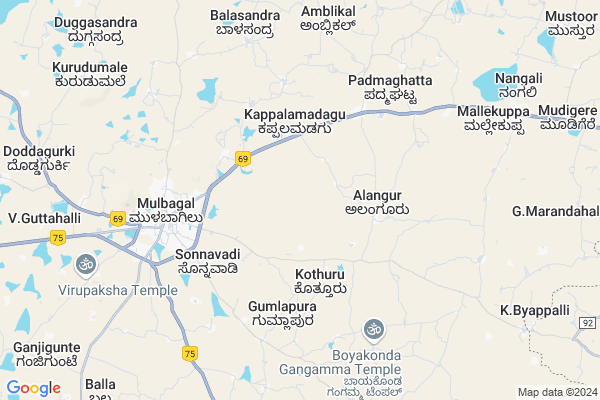
Hosahalli Map
EDIT Map
Add Your House
 ..
..
Current Corona Virus Infected Patients Count in Kolar District
| City Name | District Name | Total Covid cases |
|---|
Locality Name :
Hosahalli
( ಹೊಸಹಳ್ಳಿ )
Taluk Name : Mulbagal
District : Kolar
State : Karnataka
Division : Bangalore
Language : Kannada and Urdu, Telugu, Tamil
Current Time 11:01 AM
Date: Monday , Apr 28,2025 (IST)
Time zone: IST (UTC+5:30)
Elevation / Altitude: 864 meters. Above Seal level
Telephone Code / Std Code: 08159
Assembly constituency : Mulbagal assembly constituency
Assembly MLA : Samruddhi V. Manjunath
Lok Sabha constituency : Kolar parliamentary constituency
Parliament MP : S. MUNISWAMY
Serpanch Name :
Main Village Name : Hosahalli
Commodities Prices : Mulabagilu Market / Mandi
Hosahalli Live Weather
Temperature: 29.9 °C
broken clouds
Humidity: 42%
Wind : 2.88 mt/sec towards SE
StationName : "MulbÄ\u0081gal"
observed on 45 Mins Back
Temperature: 29.9 °C
broken clouds
Humidity: 42%
Wind : 2.88 mt/sec towards SE
StationName : "MulbÄ\u0081gal"
observed on 45 Mins Back
Hosahalli Weather Forecast for Next 5 days
29-04-2025
22.0°C to 34.5°C
broken clouds, overcast clouds
22.0°C to 34.5°C
broken clouds, overcast clouds
30-04-2025
21.7°C to 36.1°C
overcast clouds, broken clouds, scattered clouds
21.7°C to 36.1°C
overcast clouds, broken clouds, scattered clouds
01-05-2025
23.0°C to 37.1°C
scattered clouds, few clouds, broken clouds, light rain
23.0°C to 37.1°C
scattered clouds, few clouds, broken clouds, light rain
02-05-2025
24.8°C to 37.6°C
light rain, broken clouds, scattered clouds, clear sky
24.8°C to 37.6°C
light rain, broken clouds, scattered clouds, clear sky
03-05-2025
23.9°C to 37.2°C
scattered clouds, clear sky, light rain, overcast clouds
23.9°C to 37.2°C
scattered clouds, clear sky, light rain, overcast clouds
National Highways Reachable To Hosahalli
Nationa High Way :NH69
Nationa High Way :NH42;NH69
Nationa High Way :NH69
Nationa High Way :NH42;NH69
Rivers Near Hosahalli
Palar :ಪಾಲಾರ್ :பாலா
Palar :ಪಾಲಾರ್ :பாலா
About Hosahalli
Correct below Info and add more info about HosahalliHosahalli is a small Village/hamlet in Mulbagal Taluk in Kolar District of Karnataka State, India. It comes under Hosahalli Panchayath. It belongs to Bangalore Division . It is located 39 KM towards East from District head quarters Kolar. 110 KM from State capital Bangalore
Hosahalli is surrounded by Baireddipalle Taluk towards East , Ramasamudram Taluk towards North , Venkatagirikota Taluk towards South , Punganur Taluk towards North .
Mulbagal , Punganur , Srinivaspur , Robertson Pet are the near by Cities to Hosahalli.
This Place is in the border of the Kolar District and Chittoor District. Chittoor District Baireddipalle is East towards this place . It is near to the Andhra Pradesh State Border.
Hosahalli 2011 Census Details
Hosahalli Local Language is Kannada. Hosahalli Village Total population is 305 and number of houses are 64. Female Population is 53.1%. Village literacy rate is 52.1% and the Female Literacy rate is 23.9%.
Population
| Census Parameter | Census Data |
| Total Population | 305 |
| Total No of Houses | 64 |
| Female Population % | 53.1 % ( 162) |
| Total Literacy rate % | 52.1 % ( 159) |
| Female Literacy rate | 23.9 % ( 73) |
| Scheduled Tribes Population % | 0.0 % ( 0) |
| Scheduled Caste Population % | 23.9 % ( 73) |
| Working Population % | 60.0 % |
| Child(0 -6) Population by 2011 | 57 |
| Girl Child(0 -6) Population % by 2011 | 54.4 % ( 31) |
Hosahalli Census More Deatils.
Politics in Hosahalli
Bharatiya Janata Party , JD(S) , BJP , Independent (IND) , INC are the major political parties in this area.Polling Stations /Booths near Hosahalli
1)Governament Higher Primary School East Wing Agara-12)Governament Lower Primary School Mallappanahalli
3)Governament Lower Primary School Batlabhavanahalli
4)Governament Lower Primary School Vommasandra
5)Governament Lower Primary School Doddamadenhalli
HOW TO REACH Hosahalli
By Rail
There is no railway station near to Hosahalli in less than 10 km. are the Rail way stations reachable from near by towns.By Road
Mulbagal , Punganur are the nearby by towns to Hosahalli having road connectivity to HosahalliPincodes near Hosahalli
563132 ( Nangli ) , 563131 ( Mulbagal ) , 563136 ( Tayalur )Colleges near Hosahalli
Jj Para Medical College Mulbagal
Address : Mc Road Mbs Building Mulbagal
Jj Para Medical College
Address : Mc Road Mbs Building Mulbagal
Sri Varasiddhi Vinayaka College
Address :
Schools near Hosahalli
Janaa Jyothi Hps
Address : avani , mulbagal , kolar , Karnataka . PIN- 563131 , Post - Mulbagal
Muraji Desai Recidencial Sch
Address : bettagerahalli , mulbagal , kolar , Karnataka . PIN- 563132 , Post - Nangli
Murarji Rsid Mulbagal
Address : mulbagal , mulbagal , kolar , Karnataka . PIN- 563131 , Post - Mulbagal
Jnana Jyothi Hps
Address : yalagondahalli , mulbagal , kolar , Karnataka . PIN- 563131 , Post - Mulbagal
Govt Health Centers near Hosahalli
1) Mulbagal Town-A , Muthyalapete , Alangoor main road , Bjane mane2) Mulbagal Town-B , Ambedkar nagar , m.n halli main road , near anganawadi center
3) Mulbagal Town-D , shyamir mohalla , srinivaspura main road , anganawadi center
Sub Villages in Hosahalli
Hospitals in Hosahalli,Mulbagal
Sri Sai Viharika Nursing Home
reddy complex k.b.p. mulbagal; KBP Rd; Bangalore; Karnataka 563131; India
5.2 KM distance Detail
Sri Venkateshwara Orthopaedic &Maternity Surgical Specility Hospital
K.B.P. Road;Opp Gangamma Temple;; Muthyalpet Mulbagal; Banglore; Karnataka 563131; India
5.2 KM distance Detail
Dhodda Badre Gowda Hospital
National Highway 4; Mulbagal; Karnataka 563131; India
5.5 KM distance Detail
more ..
Colleges in Hosahalli,Mulbagal
K J T E T Polytechnic
NH 4; Narasimhatheertha; Kolar District; Mulbagal; Karnataka 563131; India
3.7 KM distance Detail
MIT Computer Institute
KBP Rd; Muthyalpete; Mulbagal; Karnataka 563131; India
5.4 KM distance Detail
more ..
Schools in Hosahalli,Mulbagal
Lokesh Pani Puri Chaat Centre
Bengaluru - Tirupati Hwy; Batrahalli; Karnataka 563132; India
4.6 KM distance Detail
Electronic Shops in Hosahalli,Mulbagal
SEET Computer Education Center
Mulbagal Taluk.; KBP Rd; Bangalore; Karnataka 563131; India
5.2 KM distance Detail
Local Parks in Hosahalli,Mulbagal
S M Mango Garden
Bangalore-Tirupati Hwy; Chikkamadenahalli; Karnataka 563131; India
9.9 KM distance Detail
Police Stations near Hosahalli,Mulbagal
Mulbagal Police Station
National Highway 234; Mulbagal; Karnataka 563131; India
6.1 KM distance Detail
About Hosahalli &
History
How to reach Hosahalli
Tourist Places Near By Hosahalli
Schools in Hosahalli
Colleges in Hosahalli
Temperature & weather of Hosahalli
places in Hosahalli
Hosahalli photos
More Information
How to reach Hosahalli
Tourist Places Near By Hosahalli
Schools in Hosahalli
Colleges in Hosahalli
Temperature & weather of Hosahalli
places in Hosahalli
Hosahalli photos
More Information
Village Talk
Post News or Events about this Village
Near Cities
Mulbagal 5 KM near
Punganur 29 KM near
Srinivaspur 32 KM near
Robertson Pet 33 KM near
Mulbagal 5 KM near
Punganur 29 KM near
Srinivaspur 32 KM near
Robertson Pet 33 KM near
Near By Taluks
Mulbagal 0 KM near
Baireddipalle 21 KM near
Ramasamudram 25 KM near
Venkatagirikota 27 KM near
Mulbagal 0 KM near
Baireddipalle 21 KM near
Ramasamudram 25 KM near
Venkatagirikota 27 KM near
Near By Air Ports
Bengaluru International Airport 89 KM near
Tirupati Airport 145 KM near
Salem Airport 192 KM near
Chennai Airport 210 KM near
Bengaluru International Airport 89 KM near
Tirupati Airport 145 KM near
Salem Airport 192 KM near
Chennai Airport 210 KM near
Near By Tourist Places
Horsley Hills 60 KM near
Yelagiri 78 KM near
Chittoor 80 KM near
vellore 89 KM near
Nandi Hills 96 KM near
Horsley Hills 60 KM near
Yelagiri 78 KM near
Chittoor 80 KM near
vellore 89 KM near
Nandi Hills 96 KM near
Near By Districts
Kolar 37 KM near
Chittoor 78 KM near
Krishnagiri 84 KM near
Bangalore Rural 88 KM near
Kolar 37 KM near
Chittoor 78 KM near
Krishnagiri 84 KM near
Bangalore Rural 88 KM near
Near By RailWay Station
Bangarapet Junction Rail Way Station 39 KM near
Kuppam Rail Way Station 54 KM near
Bangarapet Junction Rail Way Station 39 KM near
Kuppam Rail Way Station 54 KM near