| Home | City Bus | Maps | Villages | Cities | Rail | Tourist Places | School | College | Pin Codes | Corona Cases Count |
| Distance Calculator Bus Services IFSC Codes Trace Mobile Number Weather Search Place Trace IP Available Cash ATM/Banks Locate Polling Booth Report an Error contact People |
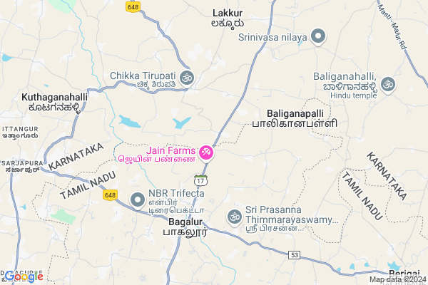
Sampangere Map
EDIT Map
Add Your House
 ..
..
Current Corona Virus Infected Patients Count in Kolar District
| City Name | District Name | Total Covid cases |
|---|
Locality Name :
Sampangere
( ಸಂಪಂಗೆರೆ )
Taluk Name : Malur
District : Kolar
State : Karnataka
Division : Bangalore
Language : Kannada and Urdu, Telugu, Tamil
Current Time 04:54 PM
Date: Monday , Apr 28,2025 (IST)
Time zone: IST (UTC+5:30)
Elevation / Altitude: 905 meters. Above Seal level
Telephone Code / Std Code: 08151
Assembly constituency : Malur assembly constituency
Assembly MLA : K.Y.Nanjegowda
Lok Sabha constituency : Kolar parliamentary constituency
Parliament MP : S. MUNISWAMY
Serpanch Name :
Pin Code : 563160
Post Office Name : Malur Railway Station
Main Village Name : Sampangere
Alternate Village Name : Sampanagere
Commodities Prices : Malur Market / Mandi
Sampangere Live Weather
Temperature: 33.4 °C
overcast clouds
Humidity: 33%
Wind : 5.72 mt/sec towards E
StationName : "BÄ\u0081galÅ«r"
observed on 8 Mins Back
Temperature: 33.4 °C
overcast clouds
Humidity: 33%
Wind : 5.72 mt/sec towards E
StationName : "BÄ\u0081galÅ«r"
observed on 8 Mins Back
Sampangere Weather Forecast for Next 5 days
29-04-2025
24.3°C to 33.3°C
overcast clouds, light rain
24.3°C to 33.3°C
overcast clouds, light rain
30-04-2025
22.3°C to 35.5°C
broken clouds, overcast clouds, light rain
22.3°C to 35.5°C
broken clouds, overcast clouds, light rain
01-05-2025
23.7°C to 36.4°C
overcast clouds, broken clouds, scattered clouds, light rain
23.7°C to 36.4°C
overcast clouds, broken clouds, scattered clouds, light rain
02-05-2025
25.0°C to 36.2°C
overcast clouds, scattered clouds, broken clouds, light rain
25.0°C to 36.2°C
overcast clouds, scattered clouds, broken clouds, light rain
03-05-2025
24.1°C to 36.2°C
broken clouds, clear sky, few clouds, light rain, overcast clouds
24.1°C to 36.2°C
broken clouds, clear sky, few clouds, light rain, overcast clouds
Edit below overview about Sampangere
Edit below overview about Sampangere
OverView of Sampangere
In sampangere a bank is available and many shops are available and government school is available till 8th grade and it's lockted in the main road of malur.....Edit below overview about Sampangere
National Highways Reachable To Sampangere
Nationa High Way :NH44;NH48
Nationa High Way :NH648
Nationa High Way :NH44;NH48
Nationa High Way :NH648
About Sampangere
Sampangere is a small Village/hamlet in Malur Taluk in Kolar District of Karnataka State, India. It comes under Sampangere Panchayath. It belongs to Bangalore Division . It is located 46 KM towards South from District head quarters Kolar. 16 KM from Malur. 38 KM from State capital Bangalore
Sampangere Pin code is 563160 and postal head office is Malur Railway Station .
Lakkur ( 7 KM ) , Dadinaikanahallidoddi ( 7 KM ) , Hulimangala Hosakote (h.hosakote) ( 11 KM ) , Kudiyanur ( 13 KM ) , Masthi ( 14 KM ) are the nearby Villages to Sampangere. Sampangere is surrounded by Malur Taluk towards East , Hosur Taluk towards South , Shoolagiri Taluk towards South , Hoskote Taluk towards North .
Malur , Bangalore , Kolar , Robertson Pet are the near by Cities to Sampangere.
This Place is in the border of the Kolar District and Bangalore Rural District. Bangalore Rural District Bangalore Rural is west towards this place .
Sampangere 2011 Census Details
Sampangere Local Language is Kannada. Sampangere Village Total population is 1853 and number of houses are 428. Female Population is 50.8%. Village literacy rate is 59.0% and the Female Literacy rate is 26.6%.
Population
| Census Parameter | Census Data |
| Total Population | 1853 |
| Total No of Houses | 428 |
| Female Population % | 50.8 % ( 941) |
| Total Literacy rate % | 59.0 % ( 1094) |
| Female Literacy rate | 26.6 % ( 492) |
| Scheduled Tribes Population % | 1.8 % ( 34) |
| Scheduled Caste Population % | 23.3 % ( 432) |
| Working Population % | 49.4 % |
| Child(0 -6) Population by 2011 | 174 |
| Girl Child(0 -6) Population % by 2011 | 56.9 % ( 99) |
Sampangere Census More Deatils.
Politics in Sampangere
Bharatiya Janata Party , JD(S) , BJP , Indian National Congress (INC) , INC are the major political parties in this area.Polling Stations /Booths near Sampangere
1)Government Higher Primary School Room No 2 Madivala 22)Government Higher Primary School Room No 1 Madivala 1
3)Government Higher Primary School Agrahara
4)Government Lower Primary School Panamakanahalli.
5)Government Higher Primary School Hasandahalli.
HOW TO REACH Sampangere
By Rail
There is no railway station near to Sampangere in less than 10 km. Varadapura Rail Way Station (near to Bangarapet) , Malur Rail Way Station (near to Malur) , Byatrayanhalli Rail Way Station (near to Malur) , Kolar Rail Way Station (near to Kolar) , Bangarapet Junction Rail Way Station (near to Bangarapet) are the Rail way stations reachable from near by towns.By Road
Malur , Bangarapet , Kolar are the nearby by towns to Sampangere having road connectivity to SampangereColleges near Sampangere
Govt. Junior College,lakkur
Address :
Ananda Marga Polytechnic
Address : Veerappanagar, Kudiyanur Post, Malur Taluk, Kolar,
Schools in Sampangere
Ghps Sampangere
Address : sampangere , malur , kolar , Karnataka . PIN- 563160 , Post - Malur Railway Station
Govt Health Centers near Sampangere
1) KUTHAGANAHALLI , SUBCENTRE KUTHAGANAHALLI , SARJAPURA TO KAMANAHALLI ROAD , NEAR BUSSTAND2) Kalkunte Agrahara , , ,
3) Kattigenahally , , Kattigenahally ,
Sub Villages in Sampangere
Hospitals in Sampangere,Malur
Vanaprashta Hospital
Malur-Masti-Berigai Rd; Mirupanahalli; Karnataka 563139; India
13.1 KM distance Detail
more ..
Petrol Bunks in Sampangere,Malur
Indian Oil
Masthi/ Malur Road; Near Buttappa Swami Temple; 635015; Berigai; Tamil Nadu; India
13.5 KM distance Detail
more ..
Super Markets in Sampangere,Malur
STAR engineers
plot no 251; 3rd Phase; JP Nagar; Bengaluru; Karnataka; India
16.6 KM distance Detail
Stone World Granites Marbles
Hosur Rd; railway station; Malur; Karnataka 563130; India
16.8 KM distance Detail
Police Stations near Sampangere,Malur
Malur POLICE Circle Inspector and Sub Inspector Office
Maruthi Extension; Malur; Karnataka 563130; India
18.8 KM distance Detail
About Sampangere &
History
How to reach Sampangere
Tourist Places Near By Sampangere
Schools in Sampangere
Colleges in Sampangere
Temperature & weather of Sampangere
places in Sampangere
Sampangere photos
More Information
How to reach Sampangere
Tourist Places Near By Sampangere
Schools in Sampangere
Colleges in Sampangere
Temperature & weather of Sampangere
places in Sampangere
Sampangere photos
More Information
Village Talk
Post News or Events about this Village
Near Cities
Malur 18 KM near
Bangalore 27 KM near
Kolar 44 KM near
Robertson Pet 49 KM near
Malur 18 KM near
Bangalore 27 KM near
Kolar 44 KM near
Robertson Pet 49 KM near
Near By Taluks
Bangalore Rural 2 KM near
Malur 16 KM near
Hosur 17 KM near
Shoolagiri 25 KM near
Bangalore Rural 2 KM near
Malur 16 KM near
Hosur 17 KM near
Shoolagiri 25 KM near
Near By Air Ports
Bengaluru International Airport 46 KM near
Salem Airport 155 KM near
Mysore Airport 165 KM near
Tirupati Airport 222 KM near
Bengaluru International Airport 46 KM near
Salem Airport 155 KM near
Mysore Airport 165 KM near
Tirupati Airport 222 KM near
Near By Tourist Places
Bangalore 36 KM near
Nandi Hills 66 KM near
Savandurga 70 KM near
Shivagange 88 KM near
Hogenakkal 93 KM near
Bangalore 36 KM near
Nandi Hills 66 KM near
Savandurga 70 KM near
Shivagange 88 KM near
Hogenakkal 93 KM near
Near By Districts
Bangalore 35 KM near
Kolar 45 KM near
Bangalore Rural 51 KM near
Krishnagiri 59 KM near
Bangalore 35 KM near
Kolar 45 KM near
Bangalore Rural 51 KM near
Krishnagiri 59 KM near
Near By RailWay Station
Malur Rail Way Station 17 KM near
Hosur Rail Way Station 20 KM near
Malur Rail Way Station 17 KM near
Hosur Rail Way Station 20 KM near