| Home | City Bus | Maps | Villages | Cities | Rail | Tourist Places | School | College | Pin Codes | Corona Cases Count |
| Distance Calculator Bus Services IFSC Codes Trace Mobile Number Weather Search Place Trace IP Available Cash ATM/Banks Locate Polling Booth Report an Error contact People |
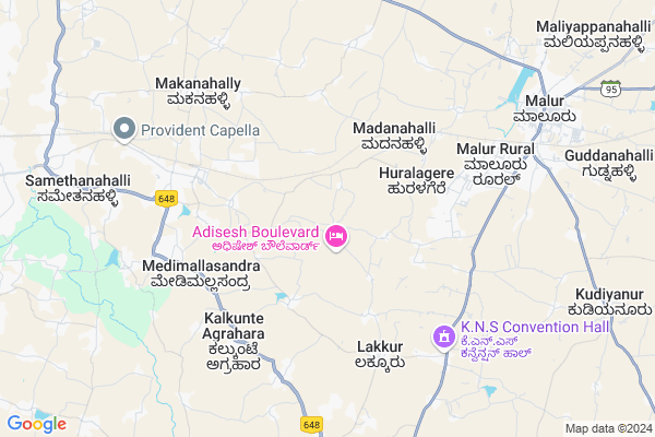
Marasandra Map
EDIT Map
Add Your House
 ..
..
Current Corona Virus Infected Patients Count in Kolar District
| City Name | District Name | Total Covid cases |
|---|
Locality Name :
Marasandra
( ಮಾರಸಂದ್ರ )
Taluk Name : Malur
District : Kolar
State : Karnataka
Division : Bangalore
Language : Kannada and Urdu, Telugu, Tamil
Current Time 11:57 AM
Date: Sunday , Apr 27,2025 (IST)
Time zone: IST (UTC+5:30)
Elevation / Altitude: 905 meters. Above Seal level
Telephone Code / Std Code: 08151
Assembly constituency : Malur assembly constituency
Assembly MLA : K.Y.Nanjegowda
Lok Sabha constituency : Kolar parliamentary constituency
Parliament MP : S. MUNISWAMY
Serpanch Name :
Pin Code : 563130
Post Office Name : Malur
Main Village Name : Marasandra
Alternate Village Name : Marasandra Plantation
Commodities Prices : Malur Market / Mandi
National Highways Reachable To Marasandra
Nationa High Way :NH44;NH48
Nationa High Way :NH648
Nationa High Way :NH44;NH48
Nationa High Way :NH648
About Marasandra
Correct below Info and add more info about MarasandraMarasandra is a small Village/hamlet in Malur Taluk in Kolar District of Karnataka State, India. It comes under Marasandra Panchayath. It belongs to Bangalore Division . It is located 40 KM towards west from District head quarters Kolar. 16 KM from Malur. 34 KM from State capital Bangalore
Marasandra Pin code is 563130 and postal head office is Malur .
Nosagere ( 6 KM ) , Jayamangala ( 8 KM ) , Chikkathirupathi ( 9 KM ) , Patalama Extension ( 9 KM ) , Madivala ( 9 KM ) are the nearby Villages to Marasandra. Marasandra is surrounded by Malur Taluk towards East , Hoskote Taluk towards North , Hosur Taluk towards South , Bangalore Taluk towards west .
Malur , Bangalore , Kolar , Vijayapura are the near by Cities to Marasandra.
This Place is in the border of the Kolar District and Bangalore Rural District. Bangalore Rural District Bangalore Rural is South towards this place .
Marasandra 2011 Census Details
Marasandra Local Language is Kannada. Marasandra Village Total population is 541 and number of houses are 140. Female Population is 48.8%. Village literacy rate is 71.3% and the Female Literacy rate is 29.0%.
Population
| Census Parameter | Census Data |
| Total Population | 541 |
| Total No of Houses | 140 |
| Female Population % | 48.8 % ( 264) |
| Total Literacy rate % | 71.3 % ( 386) |
| Female Literacy rate | 29.0 % ( 157) |
| Scheduled Tribes Population % | 0.0 % ( 0) |
| Scheduled Caste Population % | 24.4 % ( 132) |
| Working Population % | 27.0 % |
| Child(0 -6) Population by 2011 | 40 |
| Girl Child(0 -6) Population % by 2011 | 52.5 % ( 21) |
Marasandra Census More Deatils.
Politics in Marasandra
Bharatiya Janata Party , JD(S) , BJP , Indian National Congress (INC) , INC are the major political parties in this area.Polling Stations /Booths near Marasandra
1)Government Lower Primary School Maralahalli2)Government Higher Primary School Abbenahalli-1
3)Government Urdu Lower Primary School Abbenahalli-2
4)Government Lower Primary School Jagadenhalli.
5)Government High School Araleri-2
HOW TO REACH Marasandra
By Rail
Devangonthi Rail Way Station , Malur Rail Way Station are the very nearby railway stations to Marasandra. Varadapura Rail Way Station (near to Bangarapet) , Malur Rail Way Station (near to Malur) , Byatrayanhalli Rail Way Station (near to Malur) , Kolar Rail Way Station (near to Kolar) , Bangarapet Junction Rail Way Station (near to Bangarapet) are the Rail way stations reachable from near by towns.By Road
Malur , Bangarapet , Kolar are the nearby by towns to Marasandra having road connectivity to MarasandraColleges near Marasandra
Govt. Junior College,lakkur
Address :
Ananda Marga Polytechnic
Address : Veerappanagar, Kudiyanur Post, Malur Taluk, Kolar,
Schools in Marasandra
Glps Marasandra
Address : marasandra , malur , kolar , Karnataka . PIN- 563130 , Post - Malur
Govt Health Centers near Marasandra
1) Kalkunte Agrahara , , ,2) KUTHAGANAHALLI , SUBCENTRE KUTHAGANAHALLI , SARJAPURA TO KAMANAHALLI ROAD , NEAR BUSSTAND
3) Kattigenahally , , Kattigenahally ,
Sub Villages in Marasandra
Hospitals in Marasandra,Malur
Anil paradise
1001; Railway Feeder Rd; Patalama Extension; Malur; Karnataka 563130; India
9.0 KM distance Detail
more ..
Colleges in Marasandra,Malur
Government First Grade Degree College
Nehru Extension; Malur; Karnataka 563130; India
9.2 KM distance Detail
more ..
Schools in Marasandra,Malur
Jamia Daruttowheed Raheemabad
Raheemabad Hosut Manin Road; Kurandahalli Plantation; Karnataka 563160; India
6.1 KM distance Detail
Super Markets in Marasandra,Malur
Stone World Granites Marbles
Hosur Rd; railway station; Malur; Karnataka 563130; India
8.3 KM distance Detail
Local Parks in Marasandra,Malur
Eucalyptus Plantation (Forest Area)
ITPB Main Rd; Pattandur Agrahara; Whitefield; Bengaluru; Karnataka 560066; India
15.9 KM distance Detail
Police Stations near Marasandra,Malur
Malur POLICE Circle Inspector and Sub Inspector Office
Maruthi Extension; Malur; Karnataka 563130; India
9.6 KM distance Detail
Office of Asst. Commissioner of Police; Whitefield Sub division
117 & 118; Rd Number 3; EPIP Zone; Whitefield; Bengaluru; Karnataka 560066; India
18.1 KM distance Detail
Governement Offices near Marasandra,Malur
Acs Xerox
40; Whitefield Main Rd; Pattandur Agrahara; Whitefield; Bengaluru; Karnataka 560066; India
16.8 KM distance Detail
About Marasandra &
History
How to reach Marasandra
Tourist Places Near By Marasandra
Schools in Marasandra
Colleges in Marasandra
Temperature & weather of Marasandra
places in Marasandra
Marasandra photos
More Information
How to reach Marasandra
Tourist Places Near By Marasandra
Schools in Marasandra
Colleges in Marasandra
Temperature & weather of Marasandra
places in Marasandra
Marasandra photos
More Information
Village Talk
Post News or Events about this Village
Near Cities
Malur 9 KM near
Bangalore 25 KM near
Kolar 37 KM near
Vijayapura 40 KM near
Malur 9 KM near
Bangalore 25 KM near
Kolar 37 KM near
Vijayapura 40 KM near
Near By Taluks
Bangalore Rural 12 KM near
Malur 15 KM near
Hoskote 17 KM near
Hosur 29 KM near
Bangalore Rural 12 KM near
Malur 15 KM near
Hoskote 17 KM near
Hosur 29 KM near
Near By Air Ports
Bengaluru International Airport 34 KM near
Salem Airport 168 KM near
Mysore Airport 170 KM near
Tirupati Airport 219 KM near
Bengaluru International Airport 34 KM near
Salem Airport 168 KM near
Mysore Airport 170 KM near
Tirupati Airport 219 KM near
Near By Tourist Places
Bangalore 33 KM near
Nandi Hills 54 KM near
Savandurga 69 KM near
Shivagange 82 KM near
Hogenakkal 105 KM near
Bangalore 33 KM near
Nandi Hills 54 KM near
Savandurga 69 KM near
Shivagange 82 KM near
Hogenakkal 105 KM near
Near By Districts
Bangalore 32 KM near
Kolar 38 KM near
Bangalore Rural 39 KM near
Chikballapur 59 KM near
Bangalore 32 KM near
Kolar 38 KM near
Bangalore Rural 39 KM near
Chikballapur 59 KM near
Near By RailWay Station
Devangonthi Rail Way Station 5.3 KM near
Malur Rail Way Station 9 KM near
Whitefield Rail Way Station 13 KM near
Devangonthi Rail Way Station 5.3 KM near
Malur Rail Way Station 9 KM near
Whitefield Rail Way Station 13 KM near