| Home | City Bus | Maps | Villages | Cities | Rail | Tourist Places | School | College | Pin Codes | Corona Cases Count |
| Distance Calculator Bus Services IFSC Codes Trace Mobile Number Weather Search Place Trace IP Available Cash ATM/Banks Locate Polling Booth Report an Error contact People |
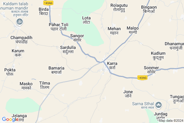
Bandu Map
EDIT Map
Add Your House
 ..
..
Current Corona Virus Infected Patients Count in Khunti District
| City Name | District Name | Total Covid cases |
|---|
Locality Name :
Bandu
( बंदु )
Block Name : Karra
District : Khunti
State : Jharkhand
Language : Hindi and Santali
Current Time 04:26 PM
Date: Wednesday , Feb 05,2025 (IST)
Time zone: IST (UTC+5:30)
Elevation / Altitude: 713 meters. Above Seal level
Telephone Code / Std Code: 06528
Assembly constituency : Khunti assembly constituency
Assembly MLA : NILKANTH SINGH MUNDA
Lok Sabha constituency : Khunti parliamentary constituency
Parliament MP : ARJUN MUNDA
Serpanch Name :
Main Village Name : Bandu
Commodities Prices : Khunti Market / Mandi
Bandu Live Weather
Temperature: 32.4 °C
few clouds
Humidity: 19%
Wind : 2.91 mt/sec towards NW
StationName : "Khunti"
observed on 1 Hours Back
Temperature: 32.4 °C
few clouds
Humidity: 19%
Wind : 2.91 mt/sec towards NW
StationName : "Khunti"
observed on 1 Hours Back
Bandu Weather Forecast for Next 5 days
06-02-2025
18.9°C to 32.0°C
few clouds, scattered clouds, clear sky
18.9°C to 32.0°C
few clouds, scattered clouds, clear sky
07-02-2025
17.0°C to 29.3°C
clear sky, few clouds
17.0°C to 29.3°C
clear sky, few clouds
08-02-2025
14.5°C to 29.4°C
clear sky
14.5°C to 29.4°C
clear sky
09-02-2025
12.8°C to 28.5°C
clear sky, few clouds
12.8°C to 28.5°C
clear sky, few clouds
10-02-2025
14.7°C to 30.5°C
clear sky
14.7°C to 30.5°C
clear sky
Rivers Near Bandu
Kanchi
Karo
Kanchi
Karo
About Bandu
Correct below Info and add more info about BanduBandu is a small Village/hamlet in Karra Block in Khunti District of Jharkhand State, India. It comes under Bandu Panchayath. It is located 20 KM towards west from District head quarters Khunti. 36 KM from State capital Ranchi
Bandu is surrounded by Lapung Block towards west , Torpa Block towards South , Bero Block towards North , Khunti Block towards East .
Khunti , Ranchi , Lohardaga , Gumla are the near by Cities to Bandu.
This Place is in the border of the Khunti District and Ranchi District. Ranchi District Lapung is west towards this place .
Bandu 2011 Census Details
Bandu Local Language is Hindi. Bandu Village Total population is 394 and number of houses are 74. Female Population is 48.5%. Village literacy rate is 42.4% and the Female Literacy rate is 17.5%.
Population
| Census Parameter | Census Data |
| Total Population | 394 |
| Total No of Houses | 74 |
| Female Population % | 48.5 % ( 191) |
| Total Literacy rate % | 42.4 % ( 167) |
| Female Literacy rate | 17.5 % ( 69) |
| Scheduled Tribes Population % | 99.0 % ( 390) |
| Scheduled Caste Population % | 0.0 % ( 0) |
| Working Population % | 33.2 % |
| Child(0 -6) Population by 2011 | 94 |
| Girl Child(0 -6) Population % by 2011 | 47.9 % ( 45) |
Bandu Census More Deatils.
Politics in Bandu
Bharatiya Janata Party , BJP , JMM , JKP , INC are the major political parties in this area.Polling Stations /Booths near Bandu
1)Community Building Sungi2)Priamry School Budhudih
3)Govt. Upgraded Middle School Sarigaon
4)Community Building Dandol
5)Primary School Lobodag
HOW TO REACH Bandu
By Rail
Karra Rail Way Station is the very nearby railway stations to Bandu.Pincodes near Bandu
835209 ( Karra ) , 835234 ( Govindpur (Ranchi) ) , 835303 ( Piskanagri )Colleges near Bandu
St Joseph Intermediate College,torpa
Address :
Birsa Collage Khunti
Address :
Schools near Bandu
Govt Health Centers near Bandu
1) HSC CHAMPADIH , HSC CHAMPADIH, NEAR - AKHRA , PANCHYAT - CHAMPADIH , AKHRA2) HSC NAWATOLI , HSC NAWATOLI, BERO ROAD , NAWATOLI , MS NAWATOLI
3) HSC KOASARA , HSC KOISARA , G + P - KOISARA, PANCHAYAT - KOISARA ,
Sub Villages in Bandu
Hospitals in Bandu,Karra
VISNU SANJIVINI
Tamar - Khunti - Kolebira Road; Gomharia; Jharkhand 835216; India
16.9 KM distance Detail
Raj Health Care & Research Centre
Karra Dhurwa Road; Odhma; Khunti; Lodhma; Near Masjid; Ranchi; Jharkhand 834004; India
17.0 KM distance Detail
more ..
Colleges in Bandu,Karra
Jharkhand Raksha Shakti University
Vill; Idri; Karra Rd; Khunti; Jharkhand 835210; India
17.0 KM distance Detail
Patel B.Ed College
Behind- Kumar Pharma; 1st Floor; Main Road; Hinoo Chowk; Lodhma; Ranchi; Jharkhand 834004; India
17.4 KM distance Detail
Maa Para Medical Institute
Near Shiv Mandir; Namkum Basti; Khunti-Ranchi Road; National Highway 23; Jharkhand 835210; India
20.6 KM distance Detail
Madrsa Madinatul-Uloom
Liyaqat Ali Ln; Jannat Ganar; Khunti; Jharkhand 835210; India
20.7 KM distance Detail
more ..
Police Stations near Bandu,Karra
Lodhma Police Station
Near Government School; Main Road; Kurse; Ranchi; Jharkhand 834004; India
17.6 KM distance Detail
About Bandu &
History
How to reach Bandu
Tourist Places Near By Bandu
Schools in Bandu
Colleges in Bandu
Temperature & weather of Bandu
places in Bandu
Bandu photos
More Information
How to reach Bandu
Tourist Places Near By Bandu
Schools in Bandu
Colleges in Bandu
Temperature & weather of Bandu
places in Bandu
Bandu photos
More Information
Village Talk
Post News or Events about this Village
Near Cities
Khunti 20 KM near
Ranchi 35 KM near
Lohardaga 62 KM near
Gumla 65 KM near
Khunti 20 KM near
Ranchi 35 KM near
Lohardaga 62 KM near
Gumla 65 KM near
Near By Taluks
Karra 0 KM near
Lapung 16 KM near
Torpa 23 KM near
Bero 24 KM near
Karra 0 KM near
Lapung 16 KM near
Torpa 23 KM near
Bero 24 KM near
Near By Air Ports
Ranchi Airport 33 KM near
Gaya Airport 202 KM near
Patna Airport 306 KM near
Bhubaneswar Airport 367 KM near
Ranchi Airport 33 KM near
Gaya Airport 202 KM near
Patna Airport 306 KM near
Bhubaneswar Airport 367 KM near
Near By Tourist Places
Chotanagpur 19 KM near
Ranchi 35 KM near
Dassam Falls 45 KM near
Lohardaga 61 KM near
Gumla 66 KM near
Chotanagpur 19 KM near
Ranchi 35 KM near
Dassam Falls 45 KM near
Lohardaga 61 KM near
Gumla 66 KM near
Near By Districts
Khunti 20 KM near
Ranchi 35 KM near
Lohardaga 61 KM near
Gumla 65 KM near
Khunti 20 KM near
Ranchi 35 KM near
Lohardaga 61 KM near
Gumla 65 KM near
Near By RailWay Station
Karra Rail Way Station 4.2 KM near
Hatia Rail Way Station 31 KM near
Ranchi Junction Rail Way Station 37 KM near
Karra Rail Way Station 4.2 KM near
Hatia Rail Way Station 31 KM near
Ranchi Junction Rail Way Station 37 KM near