| Home | City Bus | Maps | Villages | Cities | Rail | Tourist Places | School | College | Pin Codes | Corona Cases Count |
| Distance Calculator Bus Services IFSC Codes Trace Mobile Number Weather Search Place Trace IP Available Cash ATM/Banks Locate Polling Booth Report an Error contact People |
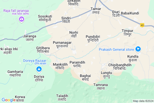
Kujiamba Map
EDIT Map
Add Your House
 ..
..
Current Corona Virus Infected Patients Count in Khunti District
| City Name | District Name | Total Covid cases |
|---|
Locality Name :
Kujiamba
( कुजियबा )
Block Name : Arki
District : Khunti
State : Jharkhand
Language : Hindi and Santali
Current Time 08:27 PM
Date: Monday , Apr 28,2025 (IST)
Time zone: IST (UTC+5:30)
Elevation / Altitude: 235 meters. Above Seal level
Telephone Code / Std Code: 06528
Assembly constituency : Tamar assembly constituency
Assembly MLA : VIKAS KUMAR MUNDA
Lok Sabha constituency : Khunti parliamentary constituency
Parliament MP : ARJUN MUNDA
Serpanch Name :
Pin Code : 835225
Post Office Name : Tamar
Main Village Name : Kujiamba
Commodities Prices : Khunti Market / Mandi
Kujiamba Live Weather
Temperature: 29.8 °C
overcast clouds
Humidity: 32%
Wind : 1.8 mt/sec towards SE
StationName : "BÅ«ndu"
observed on Now
Temperature: 29.8 °C
overcast clouds
Humidity: 32%
Wind : 1.8 mt/sec towards SE
StationName : "BÅ«ndu"
observed on Now
Kujiamba Weather Forecast for Next 5 days
29-04-2025
23.8°C to 29.6°C
overcast clouds, scattered clouds
23.8°C to 29.6°C
overcast clouds, scattered clouds
30-04-2025
22.1°C to 35.9°C
clear sky, few clouds, scattered clouds, light rain
22.1°C to 35.9°C
clear sky, few clouds, scattered clouds, light rain
01-05-2025
21.6°C to 39.1°C
clear sky, light rain, overcast clouds, broken clouds
21.6°C to 39.1°C
clear sky, light rain, overcast clouds, broken clouds
02-05-2025
22.5°C to 36.1°C
scattered clouds, clear sky, few clouds, light rain, overcast clouds
22.5°C to 36.1°C
scattered clouds, clear sky, few clouds, light rain, overcast clouds
03-05-2025
22.0°C to 36.5°C
few clouds, clear sky, broken clouds, scattered clouds
22.0°C to 36.5°C
few clouds, clear sky, broken clouds, scattered clouds
Rivers Near Kujiamba
Subarnarheka River
Chata River
Subarnarheka River
Chata River
About Kujiamba
Correct below Info and add more info about KujiambaKujiamba is a small Village/hamlet in Arki Block in Khunti District of Jharkhand State, India. It comes under Kujiamba Panchayath. It is located 42 KM towards East from District head quarters Khunti. 13 KM from Arki. 58 KM from State capital Ranchi
Kujiamba Pin code is 835225 and postal head office is Tamar .
Sosokuti ( 6 KM ) , Upar Balalong ( 10 KM ) , Arki ( 11 KM ) , Todang ( 15 KM ) , Sargeya ( 15 KM ) are the nearby Villages to Kujiamba. Kujiamba is surrounded by Arki Block towards west , Bundu Block towards North , Kuchai Block towards South , Sonahatu Block towards North .
Barughutu , Chakradharpur , Khunti , Chandil are the near by Cities to Kujiamba.
This Place is in the border of the Khunti District and Ranchi District. Ranchi District Tamar is East towards this place .
Kujiamba 2011 Census Details
Kujiamba Local Language is Hindi. Kujiamba Village Total population is 1231 and number of houses are 284. Female Population is 51.9%. Village literacy rate is 47.5% and the Female Literacy rate is 17.5%.
Population
| Census Parameter | Census Data |
| Total Population | 1231 |
| Total No of Houses | 284 |
| Female Population % | 51.9 % ( 639) |
| Total Literacy rate % | 47.5 % ( 585) |
| Female Literacy rate | 17.5 % ( 216) |
| Scheduled Tribes Population % | 7.2 % ( 89) |
| Scheduled Caste Population % | 0.0 % ( 0) |
| Working Population % | 72.5 % |
| Child(0 -6) Population by 2011 | 175 |
| Girl Child(0 -6) Population % by 2011 | 54.9 % ( 96) |
Kujiamba Census More Deatils.
Politics in Kujiamba
AJSU Party , JD(U) , Bharatiya Janata Party , AJSUP , JP , BJP , JMM , JKP are the major political parties in this area.Polling Stations /Booths near Kujiamba
1)Ps Kurunga2)Ra. Ps Prakhand Mukhyalay Tamar
3)Ra. Ms Manjhitoli (south Part)
4)Ms Jaranga
5)Upg. Ms Chalkad
HOW TO REACH Kujiamba
By Rail
There is no railway station near to Kujiamba in less than 10 km.Colleges near Kujiamba
St Joseph Intermediate College,torpa
Address :
Birsa Collage Khunti
Address :
Schools near Kujiamba
Govt Health Centers near Kujiamba
1) PHC PUNDIDIRI , , ,2) HSC PUNDIDIRI , hsc pundidiri , pundidri , tamar
3) HSC SINDRI , Vill-Sindri , Panchayat-Sindri , Near Panchayat Bhawan Sindri
Sub Villages in Kujiamba
Colleges in Kujiamba,Arki
F.Rights Education
Block; Tamar - Khunti - Kolebira Rd; Jharkhand 835225; India
9.5 KM distance Detail
more ..
Schools in Kujiamba,Arki
Gupta Hardware Sindri
Tamar - Khunti - Kolebira Rd; Sindri; Jharkhand 835210; India
5.7 KM distance Detail
Super Markets in Kujiamba,Arki
Local Parks in Kujiamba,Arki
Governement Offices near Kujiamba,Arki
About Kujiamba &
History
How to reach Kujiamba
Tourist Places Near By Kujiamba
Schools in Kujiamba
Colleges in Kujiamba
Temperature & weather of Kujiamba
places in Kujiamba
Kujiamba photos
More Information
How to reach Kujiamba
Tourist Places Near By Kujiamba
Schools in Kujiamba
Colleges in Kujiamba
Temperature & weather of Kujiamba
places in Kujiamba
Kujiamba photos
More Information
Village Talk
Post News or Events about this Village
Near Cities
Barughutu 14 KM near
Chakradharpur 40 KM near
Khunti 41 KM near
Chandil 49 KM near
Barughutu 14 KM near
Chakradharpur 40 KM near
Khunti 41 KM near
Chandil 49 KM near
Near By Taluks
Tamar 9 KM near
Arki 13 KM near
Kuchai 21 KM near
Bundu 21 KM near
Tamar 9 KM near
Arki 13 KM near
Kuchai 21 KM near
Bundu 21 KM near
Near By Air Ports
Ranchi Airport 52 KM near
Gaya Airport 231 KM near
Netaji Subhas Chandra Bose Airport 325 KM near
Patna Airport 328 KM near
Ranchi Airport 52 KM near
Gaya Airport 231 KM near
Netaji Subhas Chandra Bose Airport 325 KM near
Patna Airport 328 KM near
Near By Tourist Places
Dassam Falls 27 KM near
Seraikela 50 KM near
Ranchi 56 KM near
Jamshedpur 70 KM near
Chotanagpur 71 KM near
Dassam Falls 27 KM near
Seraikela 50 KM near
Ranchi 56 KM near
Jamshedpur 70 KM near
Chotanagpur 71 KM near
Near By Districts
Khunti 41 KM near
Saraikela Kharsawan 50 KM near
Ranchi 55 KM near
West Singhbhum 59 KM near
Khunti 41 KM near
Saraikela Kharsawan 50 KM near
Ranchi 55 KM near
West Singhbhum 59 KM near
Near By RailWay Station
Rajkharsawan Junction Rail Way Station 39 KM near
Chakradharpur Rail Way Station 40 KM near
Rajkharsawan Junction Rail Way Station 39 KM near
Chakradharpur Rail Way Station 40 KM near