| Home | City Bus | Maps | Villages | Cities | Rail | Tourist Places | School | College | Pin Codes | Corona Cases Count |
| Distance Calculator Bus Services IFSC Codes Trace Mobile Number Weather Search Place Trace IP Available Cash ATM/Banks Locate Polling Booth Report an Error contact People |
Kolluri
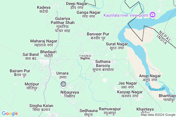
Kolluri Map
EDIT Map
Add Your House
 ..
..
Current Corona Virus Infected Patients Count in Kheri District
| City Name | District Name | Total Covid cases |
|---|
Locality Name :
Kolluri
( कोल्लुरी )
Block Name : Nighasan
District : Kheri
State : Uttar Pradesh
Division : Lucknow
Language : Hindi and Urdu, Awadhi
Current Time 04:51 AM
Date: Saturday , Apr 26,2025 (IST)
Time zone: IST (UTC+5:30)
Elevation / Altitude: 148 meters. Above Seal level
Telephone Code / Std Code: 05871
Assembly constituency : Nighasan assembly constituency
Assembly MLA : Shashank Verma
Lok Sabha constituency : Kheri parliamentary constituency
Parliament MP : Ajay Kumar
Serpanch Name :
Main Village Name : Kolluri
Commodities Prices : Tikonia Market / Mandi
Kolluri Live Weather
Temperature: 24.2 °C
clear sky
Humidity: 17%
Wind : 2.27 mt/sec towards NE
StationName : "ṬikÄ\u0081pur"
observed on Now
Temperature: 24.2 °C
clear sky
Humidity: 17%
Wind : 2.27 mt/sec towards NE
StationName : "ṬikÄ\u0081pur"
observed on Now
Kolluri Weather Forecast for Next 5 days
27-04-2025
23.8°C to 42.8°C
clear sky, scattered clouds, broken clouds, overcast clouds
23.8°C to 42.8°C
clear sky, scattered clouds, broken clouds, overcast clouds
28-04-2025
26.2°C to 41.4°C
overcast clouds, broken clouds, scattered clouds
26.2°C to 41.4°C
overcast clouds, broken clouds, scattered clouds
29-04-2025
25.3°C to 41.2°C
scattered clouds, broken clouds, clear sky
25.3°C to 41.2°C
scattered clouds, broken clouds, clear sky
30-04-2025
26.3°C to 39.5°C
broken clouds, clear sky, overcast clouds
26.3°C to 39.5°C
broken clouds, clear sky, overcast clouds
Rivers Near Kolluri
Budi Kulo
Mohana
Budi Kulo
Mohana
About Kolluri
Correct below Info and add more info about KolluriKolluri is a small Village/hamlet in Nighasan Block in Kheri District of Uttar Pradesh State, India. It comes under Kolluri Panchayath. It belongs to Lucknow Division . It is located 60 KM towards North from District head quarters Lakhimpur Kheri. 14 KM from Neghasan. 199 KM from State capital Lucknow
Banveer Pur ( 3 KM ) , Sahen Khera ( 3 KM ) , Surat Nagar ( 3 KM ) , Umara ( 4 KM ) , Khamareya ( 4 KM ) are the nearby Villages to Kolluri. Kolluri is surrounded by Ramia Behar Block towards South , Bijuwa Block towards west , Phoolbehar Block towards South , Palia Block towards west .
Palia Kalan , Lakhimpur , Kheri , Laharpur are the near by Cities to Kolluri.
Kolluri 2011 Census Details
Kolluri Local Language is Hindi. Kolluri Village Total population is 1549 and number of houses are 295. Female Population is 48.3%. Village literacy rate is 48.7% and the Female Literacy rate is 19.4%.
Population
| Census Parameter | Census Data |
| Total Population | 1549 |
| Total No of Houses | 295 |
| Female Population % | 48.3 % ( 748) |
| Total Literacy rate % | 48.7 % ( 754) |
| Female Literacy rate | 19.4 % ( 301) |
| Scheduled Tribes Population % | 3.5 % ( 54) |
| Scheduled Caste Population % | 3.7 % ( 58) |
| Working Population % | 29.6 % |
| Child(0 -6) Population by 2011 | 256 |
| Girl Child(0 -6) Population % by 2011 | 51.6 % ( 132) |
Kolluri Census More Deatils.
Politics in Kolluri
BJP , SP , BSP are the major political parties in this area.Polling Stations /Booths near Kolluri
1)Kaudiyala Ghat H/o Barsola Kalan2)Kaudiyala Ghat H/o Barsola Kalan
3)Kaudiyala Ghat H/o Barsola Kalan
4)Sukhhanpurwa H/o Rakehati
5)Suratnagar
HOW TO REACH Kolluri
By Rail
Tikunia Rail Way Station , Khairatiya Bandh Road Rail Way Station are the very nearby railway stations to Kolluri.Pincodes near Kolluri
262905 ( Singahi ) , 262906 ( Tikunia ) , 262907 ( Semra (Kheri) )Colleges near Kolluri
G.i.c Chedui Patia
Address :
Krishak Samaj Rahmaniya Jr High School Belrayan Kheri
Address : Near Chini Mills Gate Ke Samne Station Road Belrayan Kheri
Schools near Kolluri
Govt.girls H.s.sch.nighasan
Address : nighasan , nighasan , kheri , Uttar Pradesh . PIN- 262903 , Post - Nighasan
Satkupurwa
Address : adlabad , nighasan , kheri , Uttar Pradesh . PIN- 211403
Ups. Babpurwa
Address : adlabad , nighasan , kheri , Uttar Pradesh . PIN- 211403
Ups. Bhirampur
Address : adlabad , nighasan , kheri , Uttar Pradesh . PIN- 211403
Govt Health Centers near Kolluri
1) BANVEERPUR , , ,2) KHAMARIA KOILAR , , ,
3) NIBORIA , , ,
Sub Villages in Kolluri
Hospitals in Kolluri,Nighasan
PHC Singahi Nighasan Lakhimpur
Singahi Bhiraura; Uttar Pradesh 262905; India
12.7 KM distance Detail
more ..
Petrol Bunks in Kolluri,Nighasan
Kisan Sewa Filling Station Tikunia By Pass
Kolluri; Uttar Pradesh 262905; India
1.0 KM distance Detail
KISSAN SEWA FILLING STATION
TIKUNIA;NIGHASON RD;LAKHIM; Lakhimpur; Uttar Pradesh 262701; India
1.0 KM distance Detail
more ..
Colleges in Kolluri,Nighasan
Maharaja Agresen Inter College
Station Rd; Barsola Kalan; Uttar Pradesh 262906; India
1.5 KM distance Detail
Rajkiya Ashram Paddhatiye
Bela Parsuwa Rd; Bela Parsuwa; Uttar Pradesh 262906; India
18.0 KM distance Detail
more ..
Schools in Kolluri,Nighasan
Sri Guru Nanak Dev Shikh Academy
nighasan road; Suthana Barsola; Uttar Pradesh 262906; India
0.8 KM distance Detail
Electronic Shops in Kolluri,Nighasan
Varun Computer Gallery
Main Road Near Railwy Station U.P.; Tikunia; Tikunia Kheri; Uttar Pradesh 262906; India
0.4 KM distance Detail
Local Parks in Kolluri,Nighasan
Police Stations near Kolluri,Nighasan
Kotwali Tikunia
Tikunia Bypass Rd; Uttari Nighasan; Uttar Pradesh 262905; India
9.3 KM distance Detail
पुलिस चाैकी
271841; Girijapuri Rd; Katarneya Ghat Range; Uttar Pradesh 271855; India
22.2 KM distance Detail
About Kolluri &
History
How to reach Kolluri
Tourist Places Near By Kolluri
Schools in Kolluri
Colleges in Kolluri
Temperature & weather of Kolluri
places in Kolluri
Kolluri photos
More Information
How to reach Kolluri
Tourist Places Near By Kolluri
Schools in Kolluri
Colleges in Kolluri
Temperature & weather of Kolluri
places in Kolluri
Kolluri photos
More Information
Village Talk
Post News or Events about this Village
Near Cities
Palia Kalan 43 KM near
Lakhimpur 57 KM near
Kheri 58 KM near
Laharpur 83 KM near
Palia Kalan 43 KM near
Lakhimpur 57 KM near
Kheri 58 KM near
Laharpur 83 KM near
Near By Taluks
Nighasan 13 KM near
Ramia Behar 30 KM near
Bijuwa 45 KM near
Phoolbehar 47 KM near
Nighasan 13 KM near
Ramia Behar 30 KM near
Bijuwa 45 KM near
Phoolbehar 47 KM near
Near By Air Ports
Pantnagar Airport 182 KM near
Amausi Airport 201 KM near
Kanpur Airport 253 KM near
Gorakhpur Airport 340 KM near
Pantnagar Airport 182 KM near
Amausi Airport 201 KM near
Kanpur Airport 253 KM near
Gorakhpur Airport 340 KM near
Near By Tourist Places
Naimisharanya 105 KM near
Tanakpur 127 KM near
Khatima 128 KM near
Sravasti 152 KM near
Champawat 152 KM near
Naimisharanya 105 KM near
Tanakpur 127 KM near
Khatima 128 KM near
Sravasti 152 KM near
Champawat 152 KM near
Near By Districts
Kheri 57 KM near
Sitapur 106 KM near
Bahraich 121 KM near
Shahjahanpur 132 KM near
Kheri 57 KM near
Sitapur 106 KM near
Bahraich 121 KM near
Shahjahanpur 132 KM near
Near By RailWay Station
Tikunia Rail Way Station 1.4 KM near
Khairatiya Bandh Road Rail Way Station 6.0 KM near
Belrayan Rail Way Station 6.2 KM near
Sitapur Cantt. Rail Way Station 106 KM near
Roza Junction Rail Way Station 129 KM near
Tikunia Rail Way Station 1.4 KM near
Khairatiya Bandh Road Rail Way Station 6.0 KM near
Belrayan Rail Way Station 6.2 KM near
Sitapur Cantt. Rail Way Station 106 KM near
Roza Junction Rail Way Station 129 KM near