| Home | City Bus | Maps | Villages | Cities | Rail | Tourist Places | School | College | Pin Codes | Corona Cases Count |
| Distance Calculator Bus Services IFSC Codes Trace Mobile Number Weather Search Place Trace IP Available Cash ATM/Banks Locate Polling Booth Report an Error contact People |
Sambalpur
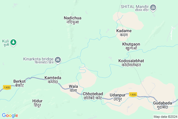
Sambalpur Map
EDIT Map
Add Your House
 ..
..
Current Corona Virus Infected Patients Count in Kanker District
| City Name | District Name | Total Covid cases |
|---|
Locality Name :
Sambalpur
( सम्बलपुर )
Tehsil Name : Koilebeda
District : Kanker
State : Chattisgarh
Language : Chhattisgarhi and Hindi, Gondi And Halbi
Current Time 12:39 PM
Date: Wednesday , Apr 30,2025 (IST)
Time zone: IST (UTC+5:30)
Telephone Code / Std Code: 07840
Assembly constituency : Antagarh assembly constituency
Assembly MLA : Vikram Usendi
Lok Sabha constituency : Kanker parliamentary constituency
Parliament MP : MOHAN MANDAVI
Serpanch Name :
Pin Code : 494665
Post Office Name : Antagarh
Main Village Name : Sambalpur
Commodities Prices : Pakhanjur Market / Mandi
Sambalpur Live Weather
Temperature: 37.6 °C
clear sky
Humidity: 25%
Wind : 4.5 mt/sec towards SW
StationName : "KÄ\u0081nker"
observed on 1 Hours Back
Temperature: 37.6 °C
clear sky
Humidity: 25%
Wind : 4.5 mt/sec towards SW
StationName : "KÄ\u0081nker"
observed on 1 Hours Back
Sambalpur Weather Forecast for Next 5 days
01-05-2025
27.3°C to 39.6°C
clear sky, few clouds, scattered clouds
27.3°C to 39.6°C
clear sky, few clouds, scattered clouds
02-05-2025
26.4°C to 40.8°C
scattered clouds, clear sky, few clouds
26.4°C to 40.8°C
scattered clouds, clear sky, few clouds
03-05-2025
25.8°C to 41.8°C
clear sky, scattered clouds, light rain
25.8°C to 41.8°C
clear sky, scattered clouds, light rain
04-05-2025
25.1°C to 41.1°C
clear sky, few clouds, scattered clouds, light rain
25.1°C to 41.1°C
clear sky, few clouds, scattered clouds, light rain
05-05-2025
26.2°C to 40.4°C
broken clouds, overcast clouds, few clouds, clear sky, light rain
26.2°C to 40.4°C
broken clouds, overcast clouds, few clouds, clear sky, light rain
Rivers Near Sambalpur
Kotri
Bandia
Kotri
Bandia
About Sambalpur
Correct below Info and add more info about SambalpurSambalpur is a small Village/hamlet in Koilebeda Tehsil in Kanker District of Chattisgarh State, India. It comes under Sambalpur Panchayath. It is located 79 KM towards west from District head quarters Kanker. 184 KM from State capital Raipur
Sambalpur Pin code is 494665 and postal head office is Antagarh .
Sambalpur is surrounded by Durgukondal Tehsil towards North , Antagarh Tehsil towards East , Bhanupratappur Tehsil towards North , Manpur (Td) Tehsil towards North .
Dalli-Rajhara , Kanker , Balod , Kondagaon are the near by Cities to Sambalpur.
Sambalpur 2011 Census Details
Sambalpur Local Language is Chhattisgarhi. Sambalpur Village Total population is 413 and number of houses are 88. Female Population is 46.5%. Village literacy rate is 38.0% and the Female Literacy rate is 10.4%.
Population
| Census Parameter | Census Data |
| Total Population | 413 |
| Total No of Houses | 88 |
| Female Population % | 46.5 % ( 192) |
| Total Literacy rate % | 38.0 % ( 157) |
| Female Literacy rate | 10.4 % ( 43) |
| Scheduled Tribes Population % | 74.8 % ( 309) |
| Scheduled Caste Population % | 1.0 % ( 4) |
| Working Population % | 54.7 % |
| Child(0 -6) Population by 2011 | 108 |
| Girl Child(0 -6) Population % by 2011 | 45.4 % ( 49) |
Sambalpur Census More Deatils.
Politics in Sambalpur
Bharatiya Janata Party , BJP , API , INC are the major political parties in this area.Polling Stations /Booths near Sambalpur
1)Kamta2)Kadhaikhodra
3)Kurenar
4)Kurushbodi (majh) 1
5)Rupnagar 2
HOW TO REACH Sambalpur
By Rail
There is no railway station near to Sambalpur in less than 10 km.Colleges near Sambalpur
Government Veer Gend Singh Collage,pakhanjore
Address : P.v.116,sangam Road,pakhanjore
Schools in Sambalpur
Ups Sambalpur
Address : sambalpur , koyalibeda , kanker , Chattisgarh . PIN- 494665 , Post - Antagarh
Govt Health Centers near Sambalpur
1) SHC Kamteda , , ,2) SHC Panidobir , , ,
3) SHC KodeSalhebhat , , ,
Sub Villages in Sambalpur
Electronic Shops in Sambalpur,Koilebeda
Super Markets in Sambalpur,Koilebeda
Local Parks in Sambalpur,Koilebeda
Police Stations near Sambalpur,Koilebeda
Governement Offices near Sambalpur,Koilebeda
About Sambalpur &
History
How to reach Sambalpur
Tourist Places Near By Sambalpur
Schools in Sambalpur
Colleges in Sambalpur
Temperature & weather of Sambalpur
places in Sambalpur
Sambalpur photos
More Information
How to reach Sambalpur
Tourist Places Near By Sambalpur
Schools in Sambalpur
Colleges in Sambalpur
Temperature & weather of Sambalpur
places in Sambalpur
Sambalpur photos
More Information
Village Talk
Post News or Events about this Village
Near Cities
Dalli-Rajhara 74 KM near
Kanker 75 KM near
Balod 97 KM near
Kondagaon 105 KM near
Dalli-Rajhara 74 KM near
Kanker 75 KM near
Balod 97 KM near
Kondagaon 105 KM near
Near By Taluks
Koilebeda 0 KM near
Durgukondal 28 KM near
Antagarh 34 KM near
Bhanupratappur 43 KM near
Koilebeda 0 KM near
Durgukondal 28 KM near
Antagarh 34 KM near
Bhanupratappur 43 KM near
Near By Air Ports
Raipur Airport 176 KM near
Sonegaon Airport 253 KM near
Jabalpur Airport 349 KM near
Rajahmundry Airport 377 KM near
Raipur Airport 176 KM near
Sonegaon Airport 253 KM near
Jabalpur Airport 349 KM near
Rajahmundry Airport 377 KM near
Near By Tourist Places
Kanker 76 KM near
Bhamragarh Wildlife Sanctuary 82 KM near
Dhamtari 115 KM near
Rajnandgaon 136 KM near
Dantewada 149 KM near
Kanker 76 KM near
Bhamragarh Wildlife Sanctuary 82 KM near
Dhamtari 115 KM near
Rajnandgaon 136 KM near
Dantewada 149 KM near
Near By Districts
Narayanpur 55 KM near
Kanker 75 KM near
Gadchiroli 107 KM near
Dhamtari 113 KM near
Narayanpur 55 KM near
Kanker 75 KM near
Gadchiroli 107 KM near
Dhamtari 113 KM near
Near By RailWay Station
Raj Nandgaon Rail Way Station 136 KM near
Dongargarh Rail Way Station 147 KM near
Raj Nandgaon Rail Way Station 136 KM near
Dongargarh Rail Way Station 147 KM near