| Home | City Bus | Maps | Villages | Cities | Rail | Tourist Places | School | College | Pin Codes | Corona Cases Count |
| Distance Calculator Bus Services IFSC Codes Trace Mobile Number Weather Search Place Trace IP Available Cash ATM/Banks Locate Polling Booth Report an Error contact People |
Dhordha
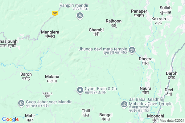
Dhordha Map
EDIT Map
Add Your House
 ..
..
Current Corona Virus Infected Patients Count in Kangra District
| City Name | District Name | Total Covid cases |
|---|---|---|
| Kangra | Kangra | 3 |
| Kangra District | Kangra | 2 |
Locality Name :
Dhordha
( धोरधा )
Tehsil Name : Nagrota Bagwan
District : Kangra
State : Himachal Pradesh
Language : Hindi and Kangri
Current Time 02:53 PM
Date: Friday , Apr 25,2025 (IST)
Time zone: IST (UTC+5:30)
Elevation / Altitude: 846 meters. Above Seal level
Telephone Code / Std Code: 01892
Assembly constituency : Nagrota assembly constituency
Assembly MLA : R.S. Bali
Lok Sabha constituency : Kangra parliamentary constituency
Parliament MP : Kishan Kapoor
Serpanch Name :
Main Village Name : Dhordha
Commodities Prices : Kangra(Nagrota Bagwan) Market / Mandi
Dhordha Live Weather
Temperature: 34.1 °C
scattered clouds
Humidity: 7%
Wind : 6.5 mt/sec towards W
StationName : "JawÄ\u0081la Mukhi"
observed on 1 Hours Back
Temperature: 34.1 °C
scattered clouds
Humidity: 7%
Wind : 6.5 mt/sec towards W
StationName : "JawÄ\u0081la Mukhi"
observed on 1 Hours Back
Dhordha Weather Forecast for Next 5 days
26-04-2025
21.7°C to 34.2°C
broken clouds, scattered clouds, few clouds, clear sky
21.7°C to 34.2°C
broken clouds, scattered clouds, few clouds, clear sky
27-04-2025
20.8°C to 36.2°C
clear sky
20.8°C to 36.2°C
clear sky
28-04-2025
21.6°C to 36.9°C
clear sky
21.6°C to 36.9°C
clear sky
29-04-2025
22.4°C to 37.5°C
clear sky
22.4°C to 37.5°C
clear sky
30-04-2025
23.1°C to 37.9°C
clear sky
23.1°C to 37.9°C
clear sky
National Highways Reachable To Dhordha
Nationa High Way :NH503
Nationa High Way :NH503
Rivers Near Dhordha
Buhal Khad
Ghoralatinu Nala
Buhal Khad
Ghoralatinu Nala
About Dhordha
Correct below Info and add more info about DhordhaDhordha is a small Village/hamlet in Nagrota Bagwan Tehsil in Kangra District of Himachal Pradesh State, India. It comes under Dhordha Panchayath. It is located 27 KM towards South from District head quarters Dharamsala. 11 KM from Nagrota Bagwan. 146 KM from State capital Shimla
Jalot ( 5 KM ) , Thill ( 6 KM ) , Aerla ( 6 KM ) , Danoa ( 7 KM ) , Sarotri ( 7 KM ) are the nearby Villages to Dhordha. Dhordha is surrounded by Kangra Tehsil towards west , Dehra Gopipur Tehsil towards South , Bhawarna Tehsil towards North , Gopalpur Tehsil towards North .
Dharamsala , Hamirpur , Mandi , Chamba are the near by Cities to Dhordha.
Dhordha 2011 Census Details
Dhordha Local Language is Hindi. Dhordha Village Total population is 29 and number of houses are 5. Female Population is 51.7%. Village literacy rate is 75.9% and the Female Literacy rate is 31.0%.
Population
| Census Parameter | Census Data |
| Total Population | 29 |
| Total No of Houses | 5 |
| Female Population % | 51.7 % ( 15) |
| Total Literacy rate % | 75.9 % ( 22) |
| Female Literacy rate | 31.0 % ( 9) |
| Scheduled Tribes Population % | 0.0 % ( 0) |
| Scheduled Caste Population % | 0.0 % ( 0) |
| Working Population % | 55.2 % |
| Child(0 -6) Population by 2011 | 4 |
| Girl Child(0 -6) Population % by 2011 | 75.0 % ( 3) |
Dhordha Census More Deatils.
Politics in Dhordha
BJP , INC are the major political parties in this area.Polling Stations /Booths near Dhordha
1)G.m.s. Sunehar2)G.m.s. Barai
3)G.p.s. Sanani
4)G.s.s.s Kothi Uprali
5)G.p.s. Chahri (w.w.)
HOW TO REACH Dhordha
By Rail
There is no railway station near to Dhordha in less than 10 km.Pincodes near Dhordha
176086 ( Khera ) , 176055 ( Thill ) , 176101 ( Dheera )Colleges near Dhordha
Maharan Sansar Chand Memorial Degree College Naun Thural
Address :
Satyam College Of Nursing
Address :
Govt College Lanj
Address :
Tahl Mata Mandir
Address :
Govt Arya Degree College Nurpur
Address :
Schools near Dhordha
Swarn Pub.s.s.s. N Bagwan
Address : nagrotabagwan , nagrota bagwan , kangra , Himachal Pradesh . PIN- 176047 , Post - Nagrota Bagwan
Himalyan Pub.s.s.sch. N Bagwan
Address : nagrotabagwan , nagrota bagwan , kangra , Himachal Pradesh . PIN- 176047 , Post - Nagrota Bagwan
Rainbow I.school N Bagwan
Address : nagrotabagwan , nagrota bagwan , kangra , Himachal Pradesh . PIN- 176047 , Post - Nagrota Bagwan
Green Pub.s.s.s N Bagwan
Address : nagrotabagwan , nagrota bagwan , kangra , Himachal Pradesh . PIN- 176047 , Post - Nagrota Bagwan
Govt Health Centers near Dhordha
1) Chauri PHC , VPO Chauri Tehsil Sujanpur Distt. Hamirpur H.P. , Chauri ,2) Utpur PHC , VPO Utpur Tehsil Tauni Devi Distt. Hamirpur H.P. , Utpur ,
3) Phahal SC , V.P.O. Phahal Tehsil Nadaun Distt. Hamirpur H.P. , Phahal ,
Sub Villages in Dhordha
Hospitals in Dhordha,Nagrota Bagwan
Mohinder singh Kapoor
Ghaneta; Himachal Pradesh 176060; Ghaneta; Himachal Pradesh 176060; India
9.9 KM distance Detail
more ..
Petrol Bunks in Dhordha,Nagrota Bagwan
HP PETROL PUMP - POOJA HP CENTER
Tehsil Baroh; Shimla; Himachal Pradesh 176054; India
10.9 KM distance Detail
Indian Oil Petrol Pump
Mandi - Pathankot Rd; Tarindi; Himachal Pradesh 176056; India
12.3 KM distance Detail
more ..
Colleges in Dhordha,Nagrota Bagwan
Government Industrial Training Institute
Baroh Rd; Chakban Sarotari; Himachal Pradesh 176037; India
7.8 KM distance Detail
Rajiv Gandhi Government Engineering College
Nagrota Bagwan Taluka; Kangra District; Masal; Himachal Pradesh 176047; India
10.0 KM distance Detail
Govt. College of Pharmacy Kangra; Nagrota Bagwan Distt. Kangra (Guest Classes at Govt. ITI Baroh) H.P. Estd. 2016
Matyari; Himachal Pradesh 176047; India
11.6 KM distance Detail
more ..
Schools in Dhordha,Nagrota Bagwan
Govt. Sr. Sec. School Saddun Bargran
Chadraun; Himachal Pradesh 176054; India
4.3 KM distance Detail
Super Markets in Dhordha,Nagrota Bagwan
Mahalakshmi Furniture & Steel Supplier
Kangra; Himachal Pradesh 176056; India
7.9 KM distance Detail
Local Parks in Dhordha,Nagrota Bagwan
Radha Soami Satsang Beas;parking Paror
Mahadev; Himachal Pradesh 176060; India
11.4 KM distance Detail
Children Park
National Highway 20; Nagrota Bagwan; Himachal Pradesh 176047; India
12.6 KM distance Detail
Police Stations near Dhordha,Nagrota Bagwan
Nagrota Bagwan Police Station
Nagrota Bagwan; Himachal Pradesh 176047; India
12.1 KM distance Detail
Traffic Police Post
Mandi - Pathankot Rd; Nagrota Bagwan; Himachal Pradesh 176047; India
12.7 KM distance Detail
About Dhordha &
History
How to reach Dhordha
Tourist Places Near By Dhordha
Schools in Dhordha
Colleges in Dhordha
Temperature & weather of Dhordha
places in Dhordha
Dhordha photos
More Information
How to reach Dhordha
Tourist Places Near By Dhordha
Schools in Dhordha
Colleges in Dhordha
Temperature & weather of Dhordha
places in Dhordha
Dhordha photos
More Information
Village Talk
Post News or Events about this Village
Near Cities
Dharamsala 26 KM near
Hamirpur 43 KM near
Mandi 69 KM near
Chamba 74 KM near
Dharamsala 26 KM near
Hamirpur 43 KM near
Mandi 69 KM near
Chamba 74 KM near
Near By Taluks
Nagrota Bagwan 10 KM near
Kangra 15 KM near
Bhawarna 16 KM near
Dehra Gopipur 16 KM near
Nagrota Bagwan 10 KM near
Kangra 15 KM near
Bhawarna 16 KM near
Dehra Gopipur 16 KM near
Near By Air Ports
Gaggal Airport 38 KM near
Bhuntar Airport 75 KM near
Pathankot Airport 83 KM near
Simla Airport 137 KM near
Gaggal Airport 38 KM near
Bhuntar Airport 75 KM near
Pathankot Airport 83 KM near
Simla Airport 137 KM near
Near By Tourist Places
Jawalaji 18 KM near
Palampur 20 KM near
Mcleodganj 29 KM near
Dharamsala 29 KM near
Bir 34 KM near
Jawalaji 18 KM near
Palampur 20 KM near
Mcleodganj 29 KM near
Dharamsala 29 KM near
Bir 34 KM near
Near By Districts
Kangra 25 KM near
Hamirpur 42 KM near
Mandi 68 KM near
Una 69 KM near
Kangra 25 KM near
Hamirpur 42 KM near
Mandi 68 KM near
Una 69 KM near
Near By RailWay Station
Nangal Dam Rail Way Station 79 KM near
Dasuya Rail Way Station 81 KM near
Nangal Dam Rail Way Station 79 KM near
Dasuya Rail Way Station 81 KM near