| Home | City Bus | Maps | Villages | Cities | Rail | Tourist Places | School | College | Pin Codes | Corona Cases Count |
| Distance Calculator Bus Services IFSC Codes Trace Mobile Number Weather Search Place Trace IP Available Cash ATM/Banks Locate Polling Booth Report an Error contact People |
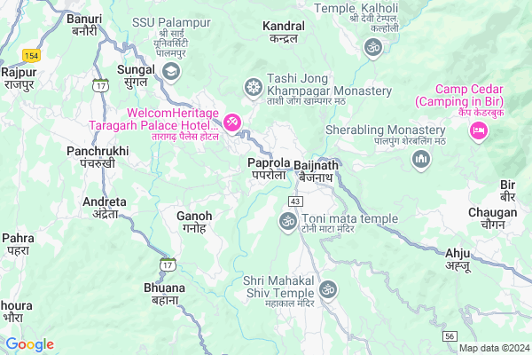
Paprola
Paprola Map
EDIT Map
Add Your House
 ..
..
Current Corona Virus Infected Patients Count in Kangra District
| City Name | District Name | Total Covid cases |
|---|---|---|
| Kangra | Kangra | 3 |
| Kangra District | Kangra | 2 |
Locality Name :
Paprola
( पपरोला )
Tehsil Name : Lambagaon
District : Kangra
State : Himachal Pradesh
Language : Hindi and Kangri
Current Time 12:57 PM
Date: Friday , Apr 25,2025 (IST)
Time zone: IST (UTC+5:30)
Elevation / Altitude: 1254 meters. Above Seal level
Telephone Code / Std Code: 01972
Assembly constituency : Baijnath assembly constituency
Assembly MLA : Kishori Lal
Lok Sabha constituency : Kangra parliamentary constituency
Parliament MP : Kishan Kapoor
Serpanch Name :
Pin Code : 176063
Post Office Name : Majherna
Main Village Name : Paprola
Commodities Prices : Kangra(Baijnath) Market / Mandi
Paprola Live Weather
Temperature: 26.2 °C
overcast clouds
Humidity: 17%
Wind : 4.14 mt/sec towards SW
StationName : "PÄ\u0081lampur"
observed on 49 Mins Back
Temperature: 26.2 °C
overcast clouds
Humidity: 17%
Wind : 4.14 mt/sec towards SW
StationName : "PÄ\u0081lampur"
observed on 49 Mins Back
Paprola Weather Forecast for Next 5 days
26-04-2025
16.9°C to 26.0°C
broken clouds, scattered clouds, clear sky
16.9°C to 26.0°C
broken clouds, scattered clouds, clear sky
27-04-2025
16.2°C to 28.3°C
clear sky, scattered clouds, few clouds
16.2°C to 28.3°C
clear sky, scattered clouds, few clouds
28-04-2025
17.7°C to 28.9°C
clear sky, broken clouds, scattered clouds
17.7°C to 28.9°C
clear sky, broken clouds, scattered clouds
29-04-2025
18.2°C to 30.1°C
clear sky
18.2°C to 30.1°C
clear sky
30-04-2025
19.1°C to 30.3°C
few clouds, clear sky
19.1°C to 30.3°C
few clouds, clear sky
National Highways Reachable To Paprola
Nationa High Way :NH154
Nationa High Way :NH3
Nationa High Way :NH154
Nationa High Way :NH3
Rivers Near Paprola
Phojal Nal
Gaj Khad
Phojal Nal
Gaj Khad
About Paprola
Correct below Info and add more info about PaprolaPaprola is a small Village/hamlet in Lambagaon Tehsil in Kangra District of Himachal Pradesh State, India. It comes under Paprola Panchayath. It is located 39 KM towards East from District head quarters Dharamsala. 20 KM from Lambagaon. 137 KM from State capital Shimla
Paprola Pin code is 176063 and postal head office is Majherna .
Baijnath ( 1 KM ) , Nauri Jhikli ( 1 KM ) , Majherna Khas ( 2 KM ) , Averi ( 3 KM ) , Sehal ( 4 KM ) are the nearby Villages to Paprola. Paprola is surrounded by Panchrukhi Tehsil towards west , Bhawarna Tehsil towards west , Chauntra Tehsil towards South , Lambagaon Tehsil towards South .
Dharamsala , Hamirpur , Mandi , Sundarnagar are the near by Cities to Paprola.
This Place is in the border of the Kangra District and Hamirpur District. Hamirpur District Tira Sujanpur is South towards this place .
Paprola 2011 Census Details
Paprola Local Language is Hindi. Paprola Village Total population is 257 and number of houses are 55. Female Population is 53.7%. Village literacy rate is 83.3% and the Female Literacy rate is 42.8%.
Population
| Census Parameter | Census Data |
| Total Population | 257 |
| Total No of Houses | 55 |
| Female Population % | 53.7 % ( 138) |
| Total Literacy rate % | 83.3 % ( 214) |
| Female Literacy rate | 42.8 % ( 110) |
| Scheduled Tribes Population % | 0.0 % ( 0) |
| Scheduled Caste Population % | 17.1 % ( 44) |
| Working Population % | 49.4 % |
| Child(0 -6) Population by 2011 | 26 |
| Girl Child(0 -6) Population % by 2011 | 57.7 % ( 15) |
Paprola Census More Deatils.
Politics in Paprola
BJP , INC are the major political parties in this area.Polling Stations /Booths near Paprola
1)G.p.s. (boys) Paprola (north Wing)2)G.p.s. (boys) Baijnath
3)Panchayat Ghar Chobin
4)G.s.s.s. (girls) Paprola (south Wing)
5)G.s.s..s. Sansal
HOW TO REACH Paprola
By Rail
Baijnath Mandir Rail Way Station , Baijnath Paprola Rail Way Station are the very nearby railway stations to Paprola.Colleges near Paprola
Maharan Sansar Chand Memorial Degree College Naun Thural
Address :
Schools in Paprola
Gps Paprola
Address : paprola , lambagaon , kangra , Himachal Pradesh . PIN- 176082 , Post - Alampur (Kangra)
Govt Health Centers near Paprola
1) Utpur PHC , VPO Utpur Tehsil Tauni Devi Distt. Hamirpur H.P. , Utpur ,2) Chauri PHC , VPO Chauri Tehsil Sujanpur Distt. Hamirpur H.P. , Chauri ,
3) Phahal SC , V.P.O. Phahal Tehsil Nadaun Distt. Hamirpur H.P. , Phahal ,
Sub Villages in Paprola
Hospitals in Paprola,Lambagaon
Rajiv Gandhi Government Ayurvedic Hospital
Panchrukhi-Paprola Road; Paprola; Himachal Pradesh 176125; India
0.3 KM distance Detail
Thyrocare lab Collection Centre
National Highway; 20; Panchrukhi-Paprola Rd; Kasba; Himachal Pradesh 176063; India
0.7 KM distance Detail
more ..
Petrol Bunks in Paprola,Lambagaon
Prakash Filling Station
Mandi - Pathankot Rd; Paprola; Himachal Pradesh 176063; India
1.0 KM distance Detail
HP Petrol Pump Krishna HP Centre
Baijnath; Shimla; Himachal Pradesh 176125; India
2.3 KM distance Detail
HP PETROL PUMP - PANCHRUKHI HP CENTRE
VPO Andretta Jaisinghpur Road Panchrukhi; Shimla; Himachal Pradesh 176103; India
6.5 KM distance Detail
more ..
Colleges in Paprola,Lambagaon
Rajiv Gandhi Government Post Graduate Ayurvedic College
Paprola - Panchrukhi Road;; Paprola; Himachal Pradesh 176115; India
0.3 KM distance Detail
Dhauladhar Industrial Training Institute
Near Electricity Office; Ganesh Bazar; Baijnath; Himachal Pradesh 176125; India
1.5 KM distance Detail
Pandit Sant Ram Government College
Neri - Bajnath Rd; Baijnath; Himachal Pradesh 176125; India
1.8 KM distance Detail
more ..
Schools in Paprola,Lambagaon
Anganwadi School
Panchrukhi - Paprola Rd; Kothi; Himachal Pradesh 176063; India
0.1 KM distance Detail
Government Middle School
Panchrukhi - Paprola Rd; Kasba Paprola; Himachal Pradesh 176063; India
0.3 KM distance Detail
Super Markets in Paprola,Lambagaon
KK General Store
Mandi-Pathankot Road; Paprola; Himachal Pradesh 176115; India
0.6 KM distance Detail
Frontier Stores
Mandi - Pathankot Rd; Paprola; Himachal Pradesh 176063; India
0.7 KM distance Detail
Police Stations near Paprola,Lambagaon
Police Help Cell
National Highway 20; Paprola; Himachal Pradesh 176063; India
0.6 KM distance Detail
Police Assistance Room
Chowin Chowk; Neri - Bajnath Rd; Baijnath; Himachal Pradesh 176125; India
1.4 KM distance Detail
Governement Offices near Paprola,Lambagaon
Gram Panchayat Office
Paprola-Utrala Rd; Paprola; Himachal Pradesh 176125; India
1.1 KM distance Detail
Nagar Panchayat Office
Sectrairt Building Top Floor; Baijnath; Himachal Pradesh 176125; India
1.5 KM distance Detail
About Paprola &
History
How to reach Paprola
Tourist Places Near By Paprola
Schools in Paprola
Colleges in Paprola
Temperature & weather of Paprola
places in Paprola
Paprola photos
More Information
How to reach Paprola
Tourist Places Near By Paprola
Schools in Paprola
Colleges in Paprola
Temperature & weather of Paprola
places in Paprola
Paprola photos
More Information
Village Talk
Post News or Events about this Village
Near Cities
Dharamsala 38 KM near
Hamirpur 47 KM near
Mandi 53 KM near
Sundarnagar 70 KM near
Dharamsala 38 KM near
Hamirpur 47 KM near
Mandi 53 KM near
Sundarnagar 70 KM near
Near By Taluks
Baijnath 4 KM near
Panchrukhi 4 KM near
Bhawarna 14 KM near
Chauntra 18 KM near
Baijnath 4 KM near
Panchrukhi 4 KM near
Bhawarna 14 KM near
Chauntra 18 KM near
Near By Air Ports
Gaggal Airport 49 KM near
Bhuntar Airport 50 KM near
Pathankot Airport 107 KM near
Simla Airport 128 KM near
Gaggal Airport 49 KM near
Bhuntar Airport 50 KM near
Pathankot Airport 107 KM near
Simla Airport 128 KM near
Near By Tourist Places
Bir 8 KM near
Palampur 11 KM near
Jawalaji 38 KM near
Mcleodganj 39 KM near
Dharamsala 40 KM near
Bir 8 KM near
Palampur 11 KM near
Jawalaji 38 KM near
Mcleodganj 39 KM near
Dharamsala 40 KM near
Near By Districts
Kangra 37 KM near
Hamirpur 46 KM near
Kullu 51 KM near
Mandi 53 KM near
Kangra 37 KM near
Hamirpur 46 KM near
Kullu 51 KM near
Mandi 53 KM near
Near By RailWay Station
Majhairan Himachal Rail Way Station 2.2 KM near
Baijnath Mandir Rail Way Station 2.4 KM near
Baijnath Paprola Rail Way Station 2.4 KM near
Nangal Dam Rail Way Station 88 KM near
Anandpur Sahib Rail Way Station 103 KM near
Majhairan Himachal Rail Way Station 2.2 KM near
Baijnath Mandir Rail Way Station 2.4 KM near
Baijnath Paprola Rail Way Station 2.4 KM near
Nangal Dam Rail Way Station 88 KM near
Anandpur Sahib Rail Way Station 103 KM near