| Home | City Bus | Maps | Villages | Cities | Rail | Tourist Places | School | College | Pin Codes | Corona Cases Count |
| Distance Calculator Bus Services IFSC Codes Trace Mobile Number Weather Search Place Trace IP Available Cash ATM/Banks Locate Polling Booth Report an Error contact People |
Dholta
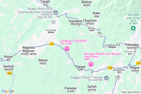
Dholta Map
EDIT Map
Add Your House
 ..
..
Current Corona Virus Infected Patients Count in Kangra District
| City Name | District Name | Total Covid cases |
|---|---|---|
| Kangra | Kangra | 3 |
| Kangra District | Kangra | 2 |
Locality Name :
Dholta
( ढोलता )
Tehsil Name : Bhawarna
District : Kangra
State : Himachal Pradesh
Language : Hindi and Kangri
Current Time 06:20 PM
Date: Thursday , Apr 24,2025 (IST)
Time zone: IST (UTC+5:30)
Elevation / Altitude: 1254 meters. Above Seal level
Telephone Code / Std Code: 01894
Assembly constituency : Sullah assembly constituency
Assembly MLA : Vipin Singh Parmar
Lok Sabha constituency : Kangra parliamentary constituency
Parliament MP : Kishan Kapoor
Serpanch Name :
Pin Code : 176058
Post Office Name : Rey
Main Village Name : Dholta
Commodities Prices : Kangra(Nagrota Bagwan) Market / Mandi
Dholta Live Weather
Temperature: 30.8 °C
clear sky
Humidity: 15%
Wind : 3.67 mt/sec towards SW
StationName : "KÄ\u0081ngar"
observed on 1 Hours Back
Temperature: 30.8 °C
clear sky
Humidity: 15%
Wind : 3.67 mt/sec towards SW
StationName : "KÄ\u0081ngar"
observed on 1 Hours Back
Dholta Weather Forecast for Next 5 days
25-04-2025
21.6°C to 32.1°C
clear sky, few clouds
21.6°C to 32.1°C
clear sky, few clouds
26-04-2025
21.1°C to 35.0°C
clear sky, scattered clouds
21.1°C to 35.0°C
clear sky, scattered clouds
27-04-2025
22.0°C to 36.7°C
clear sky, few clouds
22.0°C to 36.7°C
clear sky, few clouds
28-04-2025
22.2°C to 36.8°C
clear sky, few clouds, scattered clouds
22.2°C to 36.8°C
clear sky, few clouds, scattered clouds
29-04-2025
22.3°C to 36.4°C
clear sky
22.3°C to 36.4°C
clear sky
National Highways Reachable To Dholta
Nationa High Way :NH154
Nationa High Way :NH503
Nationa High Way :NH154
Nationa High Way :NH503
Rivers Near Dholta
Baleni Nala
Sat Nala
Baleni Nala
Sat Nala
About Dholta
Correct below Info and add more info about DholtaDholta is a small Village/hamlet in Bhawarna Tehsil in Kangra District of Himachal Pradesh State, India. It comes under Dholta Panchayath. It is located 18 KM towards East from District head quarters Dharamsala. 6 KM from Bhawarna. 153 KM from State capital Shimla
Dholta Pin code is 176058 and postal head office is Rey .
Malan ( 2 KM ) , Darati ( 3 KM ) , Arth Jhikli ( 3 KM ) , Paraur ( 3 KM ) , Chachian Khas ( 3 KM ) are the nearby Villages to Dholta. Dholta is surrounded by Bhawarna Tehsil towards East , Nagrota Bagwan Tehsil towards west , Panchrukhi Tehsil towards East , Kangra Tehsil towards west .
Dharamsala , Hamirpur , Chamba , Dalhousie are the near by Cities to Dholta.
This Place is in the border of the Kangra District and Hamirpur District. Hamirpur District Tira Sujanpur is South towards this place .
Dholta 2011 Census Details
Dholta Local Language is Hindi. Dholta Village Total population is 89 and number of houses are 19. Female Population is 53.9%. Village literacy rate is 64.0% and the Female Literacy rate is 30.3%.
Population
| Census Parameter | Census Data |
| Total Population | 89 |
| Total No of Houses | 19 |
| Female Population % | 53.9 % ( 48) |
| Total Literacy rate % | 64.0 % ( 57) |
| Female Literacy rate | 30.3 % ( 27) |
| Scheduled Tribes Population % | 29.2 % ( 26) |
| Scheduled Caste Population % | 21.3 % ( 19) |
| Working Population % | 24.7 % |
| Child(0 -6) Population by 2011 | 12 |
| Girl Child(0 -6) Population % by 2011 | 33.3 % ( 4) |
Dholta Census More Deatils.
Politics in Dholta
BJP , INC are the major political parties in this area.Polling Stations /Booths near Dholta
1)Government Primary School Devi2)Government Sr.sec.school Bhawarana (w.w.)
3)Panchayat Ghar Bhattun Samula
4)Government Primary School Ghadoral
5)Government Primary School Bairghatta
HOW TO REACH Dholta
By Rail
Chamunda Marg Rail Way Station , Paror Rail Way Station are the very nearby railway stations to Dholta.Colleges near Dholta
Maharan Sansar Chand Memorial Degree College Naun Thural
Address :
Satyam College Of Nursing
Address :
Govt College Lanj
Address :
Tahl Mata Mandir
Address :
Govt Arya Degree College Nurpur
Address :
Schools near Dholta
Aps Maranda
Address : banghiar , palampur , kangra , Himachal Pradesh . PIN- 175606
Ghs Sidhpur Sarkari
Address : sidhpur , palampur , kangra , Himachal Pradesh . PIN- 176064 , Post - Paraur
Gsss Boda
Address : boda , bhawarna , kangra , Himachal Pradesh . PIN- 176083 , Post - Bhawarna
Gsss Dheera
Address : dheera , bhawarna , kangra , Himachal Pradesh . PIN- 176101 , Post - Dheera
Govt Health Centers near Dholta
1) Chauri PHC , VPO Chauri Tehsil Sujanpur Distt. Hamirpur H.P. , Chauri ,2) Utpur PHC , VPO Utpur Tehsil Tauni Devi Distt. Hamirpur H.P. , Utpur ,
3) Phahal SC , V.P.O. Phahal Tehsil Nadaun Distt. Hamirpur H.P. , Phahal ,
Sub Villages in Dholta
Hospitals in Dholta,Bhawarna
Mela Mal Sood Rotary Eye Hospital
Palampur Rd; Maranda; Jhikli Ambwari; Himachal Pradesh 176047; India
2.5 KM distance Detail
Aayushman Hospital
Darang; Kangra; NH-20; Mandi Pathankot Road; Kharouth; Kharouth; Himachal Pradesh 176125; India
2.8 KM distance Detail
more ..
Petrol Bunks in Dholta,Bhawarna
Kripa Drishti HP Center
Mandi - Pathankot Rd; Jhikli Ambwari; Himachal Pradesh 176047; India
3.6 KM distance Detail
more ..
Colleges in Dholta,Bhawarna
CIHM; Gopalpur (Chamunda Institute for Hotel Management) 9816252652
Gopalpur; Himachal Pradesh 176059; India
4.4 KM distance Detail
Govt. Degree College
Mandi-Pathankot Rd; District Kangra; Nagrota Bagwan; Himachal Pradesh 176047; India
5.3 KM distance Detail
Rajiv Gandhi Government Engineering College
Nagrota Bagwan Taluka; Kangra District; Masal; Himachal Pradesh 176047; India
5.7 KM distance Detail
more ..
Schools in Dholta,Bhawarna
Government High School
Mandi - Pathankot Rd; Malan; Himachal Pradesh 176047; India
2.2 KM distance Detail
Electronic Shops in Dholta,Bhawarna
Hyundai Show Room
Palampur Rd; Jhikli Ambwari; Himachal Pradesh 176047; India
2.5 KM distance Detail
Local Parks in Dholta,Bhawarna
Late Captain Shailesh Rialch Memorial
NH154; Jhikli Ambwari; Himachal Pradesh 176047; India
2.9 KM distance Detail
Radha Soami Satsang Beas;parking Paror
Mahadev; Himachal Pradesh 176060; India
3.4 KM distance Detail
Police Stations near Dholta,Bhawarna
Traffic Police Post
Mandi - Pathankot Rd; Nagrota Bagwan; Himachal Pradesh 176047; India
7.0 KM distance Detail
Railway Police Force Post Palampur
Maranda; Bag Uparla; Himachal Pradesh 176102; India
9.2 KM distance Detail
Governement Offices near Dholta,Bhawarna
Gram Panchayat Office
Mandi - Pathankot Rd; Hatwas; Kir Chamba; Himachal Pradesh 176047; India
4.6 KM distance Detail
About Dholta &
History
How to reach Dholta
Tourist Places Near By Dholta
Schools in Dholta
Colleges in Dholta
Temperature & weather of Dholta
places in Dholta
Dholta photos
More Information
How to reach Dholta
Tourist Places Near By Dholta
Schools in Dholta
Colleges in Dholta
Temperature & weather of Dholta
places in Dholta
Dholta photos
More Information
Village Talk
Post News or Events about this Village
Near Cities
Dharamsala 18 KM near
Hamirpur 54 KM near
Chamba 65 KM near
Dalhousie 71 KM near
Dharamsala 18 KM near
Hamirpur 54 KM near
Chamba 65 KM near
Dalhousie 71 KM near
Near By Taluks
Gopalpur 4 KM near
Bhawarna 6 KM near
Nagrota Bagwan 8 KM near
Panchrukhi 16 KM near
Gopalpur 4 KM near
Bhawarna 6 KM near
Nagrota Bagwan 8 KM near
Panchrukhi 16 KM near
Near By Air Ports
Gaggal Airport 29 KM near
Bhuntar Airport 71 KM near
Pathankot Airport 86 KM near
Simla Airport 144 KM near
Gaggal Airport 29 KM near
Bhuntar Airport 71 KM near
Pathankot Airport 86 KM near
Simla Airport 144 KM near
Near By Tourist Places
Palampur 10 KM near
Mcleodganj 20 KM near
Dharamsala 20 KM near
Bir 29 KM near
Jawalaji 31 KM near
Palampur 10 KM near
Mcleodganj 20 KM near
Dharamsala 20 KM near
Bir 29 KM near
Jawalaji 31 KM near
Near By Districts
Kangra 17 KM near
Hamirpur 53 KM near
Chamba 64 KM near
Mandi 72 KM near
Kangra 17 KM near
Hamirpur 53 KM near
Chamba 64 KM near
Mandi 72 KM near
Near By RailWay Station
Chamunda Marg Rail Way Station 2.0 KM near
Paror Rail Way Station 4.4 KM near
Nagrota Rail Way Station 5.7 KM near
Pathankot Junction Rail Way Station 86 KM near
Mukerian Rail Way Station 89 KM near
Chamunda Marg Rail Way Station 2.0 KM near
Paror Rail Way Station 4.4 KM near
Nagrota Rail Way Station 5.7 KM near
Pathankot Junction Rail Way Station 86 KM near
Mukerian Rail Way Station 89 KM near