| Home | City Bus | Maps | Villages | Cities | Rail | Tourist Places | School | College | Pin Codes | Corona Cases Count |
| Distance Calculator Bus Services IFSC Codes Trace Mobile Number Weather Search Place Trace IP Available Cash ATM/Banks Locate Polling Booth Report an Error contact People |
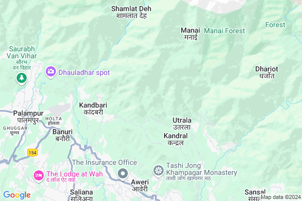
Karot
Karot Map
EDIT Map
Add Your House
 ..
..
Current Corona Virus Infected Patients Count in Kangra District
| City Name | District Name | Total Covid cases |
|---|---|---|
| Kangra | Kangra | 3 |
| Kangra District | Kangra | 2 |
Locality Name :
Karot
( करोत )
Tehsil Name : Baijnath
District : Kangra
State : Himachal Pradesh
Language : Hindi and Kangri
Current Time 12:33 PM
Date: Friday , Apr 25,2025 (IST)
Time zone: IST (UTC+5:30)
Elevation / Altitude: 1042 meters. Above Seal level
Telephone Code / Std Code: 01894
Assembly constituency : Palampur assembly constituency
Assembly MLA : Ashish Butail
Lok Sabha constituency : Kangra parliamentary constituency
Parliament MP : Kishan Kapoor
Serpanch Name :
Pin Code : 176115
Post Office Name : Paprola
Main Village Name : Karot
Commodities Prices : Kangra(Baijnath) Market / Mandi
Karot Live Weather
Temperature: 26.2 °C
overcast clouds
Humidity: 17%
Wind : 4.14 mt/sec towards SW
StationName : "PÄ\u0081lampur"
observed on 25 Mins Back
Temperature: 26.2 °C
overcast clouds
Humidity: 17%
Wind : 4.14 mt/sec towards SW
StationName : "PÄ\u0081lampur"
observed on 25 Mins Back
Karot Weather Forecast for Next 5 days
26-04-2025
16.9°C to 26.0°C
broken clouds, scattered clouds, clear sky
16.9°C to 26.0°C
broken clouds, scattered clouds, clear sky
27-04-2025
16.2°C to 28.3°C
clear sky, scattered clouds, few clouds
16.2°C to 28.3°C
clear sky, scattered clouds, few clouds
28-04-2025
17.7°C to 28.9°C
clear sky, broken clouds, scattered clouds
17.7°C to 28.9°C
clear sky, broken clouds, scattered clouds
29-04-2025
18.2°C to 30.1°C
clear sky
18.2°C to 30.1°C
clear sky
30-04-2025
19.1°C to 30.3°C
few clouds, clear sky
19.1°C to 30.3°C
few clouds, clear sky
National Highways Reachable To Karot
Nationa High Way :NH3
Nationa High Way :NH503
Nationa High Way :NH3
Nationa High Way :NH503
Rivers Near Karot
Manjhi Khad
Binwa Khadd
Manjhi Khad
Binwa Khadd
About Karot
Correct below Info and add more info about KarotKarot is a small Village/hamlet in Baijnath Tehsil in Kangra District of Himachal Pradesh State, India. It comes under Karot Panchayath. It is located 34 KM towards East from District head quarters Dharamsala. 8 KM from Baijnath. 145 KM from State capital Shimla
Karot Pin code is 176115 and postal head office is Paprola .
Nanahar ( 4 KM ) , Padiar Khar ( 5 KM ) , Nain ( 5 KM ) , Manai ( 5 KM ) , Chandpur ( 6 KM ) are the nearby Villages to Karot. Karot is surrounded by Panchrukhi Tehsil towards South , Bhawarna Tehsil towards west , Gopalpur Tehsil towards west , Lambagaon Tehsil towards South .
Dharamsala , Hamirpur , Mandi , Keylong are the near by Cities to Karot.
This Place is in the border of the Kangra District and Mandi District. Mandi District Chauntra is South towards this place .
Karot 2011 Census Details
Karot Local Language is Hindi. Karot Village Total population is 175 and number of houses are 43. Female Population is 47.4%. Village literacy rate is 63.4% and the Female Literacy rate is 24.6%.
Population
| Census Parameter | Census Data |
| Total Population | 175 |
| Total No of Houses | 43 |
| Female Population % | 47.4 % ( 83) |
| Total Literacy rate % | 63.4 % ( 111) |
| Female Literacy rate | 24.6 % ( 43) |
| Scheduled Tribes Population % | 17.1 % ( 30) |
| Scheduled Caste Population % | 0.0 % ( 0) |
| Working Population % | 53.7 % |
| Child(0 -6) Population by 2011 | 20 |
| Girl Child(0 -6) Population % by 2011 | 50.0 % ( 10) |
Karot Census More Deatils.
Politics in Karot
BJP , INC are the major political parties in this area.Polling Stations /Booths near Karot
1)G.p.s. Kharati2)G.m.s. Gadiyara At Dharot
3)G.s.s.s. Jia
4)G.p.s. Pantehar
5)G.p.s. Bharmat Upper (n.w)
HOW TO REACH Karot
By Rail
Majhairan Himachal Rail Way Station , Baijnath Paprola Rail Way Station are the very nearby railway stations to Karot.Colleges near Karot
Pandit Sant Ram Govt Degree College
Address :
Schools in Karot
Gps Karot
Address : karot , baijnath , kangra , Himachal Pradesh . PIN- 176115 , Post - Paprola
Govt Health Centers near Karot
1) Utpur PHC , VPO Utpur Tehsil Tauni Devi Distt. Hamirpur H.P. , Utpur ,2) Chauri PHC , VPO Chauri Tehsil Sujanpur Distt. Hamirpur H.P. , Chauri ,
3) Phahal SC , V.P.O. Phahal Tehsil Nadaun Distt. Hamirpur H.P. , Phahal ,
Sub Villages in Karot
Hospitals in Karot,Baijnath
Health Sub Center
Sungal; Kangra; NH-20; Mandi Pathankot Road; Banuri; Banuri; Himachal Pradesh 176125; India
5.9 KM distance Detail
Primary Health Centre
Mandi - Pathankot Rd; Sungal; Himachal Pradesh 176081; India
5.9 KM distance Detail
more ..
Petrol Bunks in Karot,Baijnath
Indian oil corporation
Bridge; Mandi-Pathankot Rd; Sarsawa; Himachal Pradesh 176081; India
5.1 KM distance Detail
Vikram Batra Filling Station
Housing Board Colony; Holta; Palampur; Himachal Pradesh 176062; India
8.0 KM distance Detail
Prakash Filling Station
Mandi - Pathankot Rd; Paprola; Himachal Pradesh 176063; India
8.2 KM distance Detail
HP Petrol Pump Krishna HP Centre
Baijnath; Shimla; Himachal Pradesh 176125; India
9.2 KM distance Detail
more ..
Colleges in Karot,Baijnath
Sai School of Engineering & Technology
Sungal; Palampur; Himachal Pradesh 176061; India
5.9 KM distance Detail
Rotary Industrial Training Institute
National Highway 20; Sungal; Himachal Pradesh 176081; India
6.0 KM distance Detail
Dr GC Negi College of Veterinary and Animal Sciences
NH154; Holta; Palampur; Himachal Pradesh 176062; India
7.0 KM distance Detail
more ..
Electronic Shops in Karot,Baijnath
Amit Communication
176081 GHS Tharu; NH154; Jalbimbi; Himachal Pradesh 176047; India
8.0 KM distance Detail
Ambalika Incorporation
near state bank of India; Paprola; Himachal Pradesh; India
8.2 KM distance Detail
Local Parks in Karot,Baijnath
Tea Husbandry and Agro Forestry Palampur
SH 17; Housing Board Colony; Holta; Palampur; Himachal Pradesh 176061; India
7.9 KM distance Detail
Fruit child and display gardens and great Flower Center
Holta; Palampur; Himachal Pradesh 176061; India
8.1 KM distance Detail
Police Stations near Karot,Baijnath
Police Help Cell
National Highway 20; Paprola; Himachal Pradesh 176063; India
8.9 KM distance Detail
Police Assistance Room
Palampur - Dharamshala Rd; Berachah; Palampur; Himachal Pradesh 176061; India
9.3 KM distance Detail
Traffic Police Office
126; Palampur - Dharamshala Rd; Shastri Nagar; Palampur - Dharamshala Rd; Shastri Nagar; Berachah; Palampur; Himachal Pradesh 176061; India
9.3 KM distance Detail
Governement Offices near Karot,Baijnath
Office of Labour Inspector Palampur
Lohna; पालमपुर; हिमाचल प्रदेश 176061; India
8.9 KM distance Detail
About Karot &
History
How to reach Karot
Tourist Places Near By Karot
Schools in Karot
Colleges in Karot
Temperature & weather of Karot
places in Karot
Karot photos
More Information
How to reach Karot
Tourist Places Near By Karot
Schools in Karot
Colleges in Karot
Temperature & weather of Karot
places in Karot
Karot photos
More Information
Village Talk
Post News or Events about this Village
Near Cities
Dharamsala 34 KM near
Hamirpur 55 KM near
Mandi 61 KM near
Keylong 70 KM near
Dharamsala 34 KM near
Hamirpur 55 KM near
Mandi 61 KM near
Keylong 70 KM near
Near By Taluks
Baijnath 8 KM near
Panchrukhi 9 KM near
Bhawarna 12 KM near
Gopalpur 17 KM near
Baijnath 8 KM near
Panchrukhi 9 KM near
Bhawarna 12 KM near
Gopalpur 17 KM near
Near By Air Ports
Gaggal Airport 43 KM near
Bhuntar Airport 53 KM near
Pathankot Airport 104 KM near
Simla Airport 137 KM near
Gaggal Airport 43 KM near
Bhuntar Airport 53 KM near
Pathankot Airport 104 KM near
Simla Airport 137 KM near
Near By Tourist Places
Palampur 8 KM near
Bir 12 KM near
Mcleodganj 34 KM near
Dharamsala 34 KM near
Jawalaji 43 KM near
Palampur 8 KM near
Bir 12 KM near
Mcleodganj 34 KM near
Dharamsala 34 KM near
Jawalaji 43 KM near
Near By Districts
Kangra 33 KM near
Hamirpur 54 KM near
Kullu 55 KM near
Mandi 61 KM near
Kangra 33 KM near
Hamirpur 54 KM near
Kullu 55 KM near
Mandi 61 KM near
Near By RailWay Station
Nangal Dam Rail Way Station 96 KM near
Pathankot Junction Rail Way Station 104 KM near
Nangal Dam Rail Way Station 96 KM near
Pathankot Junction Rail Way Station 104 KM near