| Home | City Bus | Maps | Villages | Cities | Rail | Tourist Places | School | College | Pin Codes | Corona Cases Count |
| Distance Calculator Bus Services IFSC Codes Trace Mobile Number Weather Search Place Trace IP Available Cash ATM/Banks Locate Polling Booth Report an Error contact People |
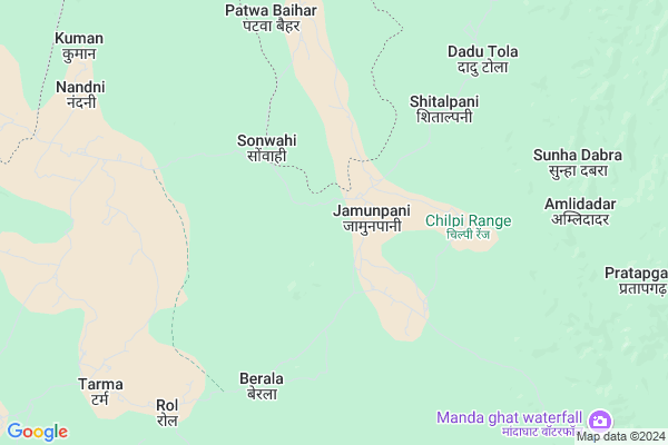
Nagwahi
Nagwahi Map
EDIT Map
Add Your House
 ..
..
Current Corona Virus Infected Patients Count in Kabirdham District
| City Name | District Name | Total Covid cases |
|---|
Locality Name :
Nagwahi
( नागवाही )
Tehsil Name : Bodla
District : Kabirdham
State : Chattisgarh
Language : Chhattisgarhi and Hindi, Agariya
Current Time 05:33 PM
Date: Monday , Apr 28,2025 (IST)
Time zone: IST (UTC+5:30)
Elevation / Altitude: 325 meters. Above Seal level
Telephone Code / Std Code: 07740
Assembly constituency : Kawardha assembly constituency
Assembly MLA : Vijay Sharma
Lok Sabha constituency : Rajnandgaon parliamentary constituency
Parliament MP : SANTOSH PANDEY
Serpanch Name :
Pin Code : 491995
Post Office Name : Kawardha
Main Village Name : Nagwahi
Commodities Prices : Kawardha Market / Mandi
Nagwahi Live Weather
Temperature: 35.0 °C
broken clouds
Humidity: 13%
Wind : 4.17 mt/sec towards NW
StationName : "Kawardha"
observed on Now
Temperature: 35.0 °C
broken clouds
Humidity: 13%
Wind : 4.17 mt/sec towards NW
StationName : "Kawardha"
observed on Now
Nagwahi Weather Forecast for Next 5 days
29-04-2025
22.5°C to 32.5°C
scattered clouds, clear sky
22.5°C to 32.5°C
scattered clouds, clear sky
30-04-2025
21.4°C to 38.9°C
clear sky, broken clouds
21.4°C to 38.9°C
clear sky, broken clouds
01-05-2025
23.2°C to 40.1°C
broken clouds, clear sky, scattered clouds, few clouds
23.2°C to 40.1°C
broken clouds, clear sky, scattered clouds, few clouds
02-05-2025
21.3°C to 39.3°C
clear sky
21.3°C to 39.3°C
clear sky
03-05-2025
20.8°C to 40.3°C
clear sky, few clouds, scattered clouds, broken clouds, light rain, overcast clouds
20.8°C to 40.3°C
clear sky, few clouds, scattered clouds, broken clouds, light rain, overcast clouds
Rivers Near Nagwahi
Baniar
Tannor
Baniar
Tannor
About Nagwahi
Correct below Info and add more info about NagwahiNagwahi is a small Village/hamlet in Bodla Tehsil in Kabirdham District of Chattisgarh State, India. It comes under Nagwahi Panchayath. It is located 28 KM towards west from District head quarters Kawardha. 29 KM from Bodla. 128 KM from State capital Raipur
Nagwahi Pin code is 491995 and postal head office is Kawardha .
Kisungarh ( 17 KM ) are the nearby Villages to Nagwahi. Nagwahi is surrounded by Birsa Tehsil towards west , Kabirdham Tehsil towards East , S.Lohara Tehsil towards South , Kawardha Tehsil towards East .
Kawardha , Malajkhand , Bemetra , Mungeli are the near by Cities to Nagwahi.
Nagwahi 2011 Census Details
Nagwahi Local Language is Chhattisgarhi. Nagwahi Village Total population is 619 and number of houses are 145. Female Population is 50.4%. Village literacy rate is 55.1% and the Female Literacy rate is 21.8%.
Population
| Census Parameter | Census Data |
| Total Population | 619 |
| Total No of Houses | 145 |
| Female Population % | 50.4 % ( 312) |
| Total Literacy rate % | 55.1 % ( 341) |
| Female Literacy rate | 21.8 % ( 135) |
| Scheduled Tribes Population % | 71.7 % ( 444) |
| Scheduled Caste Population % | 0.0 % ( 0) |
| Working Population % | 54.1 % |
| Child(0 -6) Population by 2011 | 117 |
| Girl Child(0 -6) Population % by 2011 | 56.4 % ( 66) |
Nagwahi Census More Deatils.
Politics in Nagwahi
Bharatiya Janata Party , BJP , INC are the major political parties in this area.Polling Stations /Booths near Nagwahi
1)Jhalka2)Boda
3)Mudgusri
4)Jamuniya
5)Shambhupipar
HOW TO REACH Nagwahi
By Rail
There is no railway station near to Nagwahi in less than 10 km.Colleges near Nagwahi
Government Swami Vivekanand Collage Bodla
Address :
Schools near Nagwahi
Ms.aamapani (ssa)
Address : aamapani , bodla , kawardha , Chattisgarh . PIN- 491995 , Post - Kawardha
Govt.m.s.sarenda(s.s.a)
Address : sarenda , bodla , kawardha , Chattisgarh . PIN- 491995 , Post - Kawardha
Ms Sarvati Gyandeep Mandir
Address : bodla , bodla , kawardha , Chattisgarh . PIN- 491995 , Post - Kawardha
Kanya Ms Bodla
Address : bodla , bodla , kawardha , Chattisgarh . PIN- 491995 , Post - Kawardha
Govt Health Centers near Nagwahi
1) SHC Jhalmala , , ,2) CHC Jhalmala , , ,
3) SHC Samnapur , , ,
Sub Villages in Nagwahi
Schools in Nagwahi,Bodla
Electronic Shops in Nagwahi,Bodla
Super Markets in Nagwahi,Bodla
Local Parks in Nagwahi,Bodla
Police Stations near Nagwahi,Bodla
Governement Offices near Nagwahi,Bodla
About Nagwahi &
History
How to reach Nagwahi
Tourist Places Near By Nagwahi
Schools in Nagwahi
Colleges in Nagwahi
Temperature & weather of Nagwahi
places in Nagwahi
Nagwahi photos
More Information
How to reach Nagwahi
Tourist Places Near By Nagwahi
Schools in Nagwahi
Colleges in Nagwahi
Temperature & weather of Nagwahi
places in Nagwahi
Nagwahi photos
More Information
Village Talk
Post News or Events about this Village
Near Cities
Kawardha 31 KM near
Malajkhand 32 KM near
Bemetra 75 KM near
Mungeli 80 KM near
Kawardha 31 KM near
Malajkhand 32 KM near
Bemetra 75 KM near
Mungeli 80 KM near
Near By Taluks
Birsa 27 KM near
Bodla 28 KM near
Kabirdham 31 KM near
S.Lohara 35 KM near
Birsa 27 KM near
Bodla 28 KM near
Kabirdham 31 KM near
S.Lohara 35 KM near
Near By Air Ports
Raipur Airport 137 KM near
Jabalpur Airport 145 KM near
Sonegaon Airport 253 KM near
Khajuraho Airport 367 KM near
Raipur Airport 137 KM near
Jabalpur Airport 145 KM near
Sonegaon Airport 253 KM near
Khajuraho Airport 367 KM near
Near By Tourist Places
Kawardha 28 KM near
Kanha National park 52 KM near
Durg 111 KM near
Bhilai 112 KM near
Rajnandgaon 117 KM near
Kawardha 28 KM near
Kanha National park 52 KM near
Durg 111 KM near
Bhilai 112 KM near
Rajnandgaon 117 KM near
Near By Districts
Kabirdham 27 KM near
Balaghat 96 KM near
Mandla 99 KM near
Durg 111 KM near
Kabirdham 27 KM near
Balaghat 96 KM near
Mandla 99 KM near
Durg 111 KM near
Near By RailWay Station
Dongargarh Rail Way Station 109 KM near
Durg Junction Rail Way Station 110 KM near
Dongargarh Rail Way Station 109 KM near
Durg Junction Rail Way Station 110 KM near