| Home | City Bus | Maps | Villages | Cities | Rail | Tourist Places | School | College | Pin Codes | Corona Cases Count |
| Distance Calculator Bus Services IFSC Codes Trace Mobile Number Weather Search Place Trace IP Available Cash ATM/Banks Locate Polling Booth Report an Error contact People |
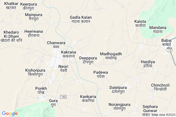
Deeppura
Deeppura Map
EDIT Map
Add Your House
 ..
..
Current Corona Virus Infected Patients Count in Jhunjhunu District
| City Name | District Name | Total Covid cases |
|---|---|---|
| Jhunjhunu District | Jhunjhunu | 36 |
| Jhunjhunu | Jhunjhunu | 6 |
Locality Name :
Deeppura
( दीपपुरा )
Tehsil Name : Udaipurwati
District : Jhunjhunu
State : Rajasthan
Division : Jaipur
Language : Hindi and Rajasthani
Current Time 07:30 AM
Date: Saturday , Apr 26,2025 (IST)
Time zone: IST (UTC+5:30)
Elevation / Altitude: 386 meters. Above Seal level
Telephone Code / Std Code: 01594
Assembly constituency : Khetri assembly constituency
Assembly MLA : Dharmpal
Lok Sabha constituency : Jhunjhunu parliamentary constituency
Parliament MP : NARENDRA KUMAR
Serpanch Name :
Pin Code : 333053
Post Office Name : Ponkh
Main Village Name : Deeppura
Commodities Prices : Jhunjhunu Market / Mandi
National Highways Reachable To Deeppura
Nationa High Way :NH148B
Nationa High Way :NH 148B
Nationa High Way :NH148B
Nationa High Way :NH 148B
Rivers Near Deeppura
Sota
Sota
About Deeppura
Correct below Info and add more info about DeeppuraDeeppura is a small Village/hamlet in Udaipurwati Tehsil in Jhunjhunu District of Rajasthan State, India. It comes under Deeppura Panchayath. It belongs to Jaipur Division . It is located 45 KM towards South from District head quarters Jhunjhunu. 11 KM from Udaipurwati. 124 KM from State capital Jaipur
Deeppura Pin code is 333053 and postal head office is Ponkh .
Chanwara ( 4 KM ) , Kankariya ( 4 KM ) , Dalelpura ( 5 KM ) , Guda ( 6 KM ) , Madhogarh ( 6 KM ) are the nearby Villages to Deeppura. Deeppura is surrounded by Khetri Tehsil towards North , Neem Ka Thana Tehsil towards East , Nawalgarh Tehsil towards west , Khandela Tehsil towards South .
Udaipurwati , Neem-Ka-Thana , Nawalgarh , Jhunjhunu are the near by Cities to Deeppura.
This Place is in the border of the Jhunjhunu District and Sikar District. Sikar District Khandela is South towards this place .
Deeppura 2011 Census Details
Deeppura Local Language is Hindi. Deeppura Village Total population is 3573 and number of houses are 585. Female Population is 47.8%. Village literacy rate is 58.9% and the Female Literacy rate is 22.3%.
Population
| Census Parameter | Census Data |
| Total Population | 3573 |
| Total No of Houses | 585 |
| Female Population % | 47.8 % ( 1707) |
| Total Literacy rate % | 58.9 % ( 2105) |
| Female Literacy rate | 22.3 % ( 797) |
| Scheduled Tribes Population % | 2.7 % ( 98) |
| Scheduled Caste Population % | 4.3 % ( 152) |
| Working Population % | 58.5 % |
| Child(0 -6) Population by 2011 | 549 |
| Girl Child(0 -6) Population % by 2011 | 45.7 % ( 251) |
Deeppura Census More Deatils.
Politics in Deeppura
BJP , BSP , INC are the major political parties in this area.Polling Stations /Booths near Deeppura
1)Govt. Ups Bandha Ki Dhani2)Shahid Bhagwan Singh Govt. Sr. Sec. School Papurana (west Wing Ka Right Wing)
3)Govt. Ups Badwala (ajay Nagar) (left Wing)
4)Govt. Ups Babai (right Wing )
5)Govt. Girls Ups Nangliya
HOW TO REACH Deeppura
By Rail
There is no railway station near to Deeppura in less than 10 km.Colleges near Deeppura
Shri Shraddhanath Pg College Todi,gudha Gorji Ka
Address :
Tagore College Gudha Gorji
Address :
Rajasthan College Of Nursing, Gudha Gorji
Address :
Mansa P.g. Girls College, Udaipur Wati
Address :
Tagore Pg College Gudha Gorji
Address : In Front Of The Tagore School Gudha Gorji Sh 37 Main Hathway Jhunjhunu Road
Schools near Deeppura
National Public School
Address : NATIONAL PUBLIC SCHOOL VPO-KED,TEH-UDAIPURWATI DIST JHUNJHUNU
Saraswati Senior Secondary School
Address : Mainpura udaipurwati jhunjhunu 333053
Sunrise Public School, Tal Mandawara
Address : SPS, Tal Infront of Petrol Pump, Mandawara, Udaipurwati,Jhunjhunu,333302
B.g.p.s
Address : todi road
Govt Health Centers near Deeppura
1) Padewa , Sc Padewa , ,2) Madhogarh , Sc Madhogarh , ,
3) NOTIONAL Chanwra , , ,
Sub Villages in Deeppura
Petrol Bunks in Deeppura,Udaipurwati
HP Petrol Pump
Gudha Gorji Ka Road; Chanwara Chofulya; Rajasthan 333053; India
5.9 KM distance Detail
more ..
Schools in Deeppura,Udaipurwati
Government Senior Secondary School Kakarana
Kakrana Road; Kakrana; Rajasthan 333053; India
2.8 KM distance Detail
Electronic Shops in Deeppura,Udaipurwati
लक्ष्य वेल्डिंग वर्क शॉप / सरदारा राम
Gura - Kankaria Rd; Hindusingh wali; Gura; Rajasthan 333053; India
3.3 KM distance Detail
Super Markets in Deeppura,Udaipurwati
Djराकेश remex music center
Kishorpura Rd; Kishorpura; Rajasthan 333053; India
5.0 KM distance Detail
About Deeppura &
History
How to reach Deeppura
Tourist Places Near By Deeppura
Schools in Deeppura
Colleges in Deeppura
Temperature & weather of Deeppura
places in Deeppura
Deeppura photos
More Information
How to reach Deeppura
Tourist Places Near By Deeppura
Schools in Deeppura
Colleges in Deeppura
Temperature & weather of Deeppura
places in Deeppura
Deeppura photos
More Information
Village Talk
Post News or Events about this Village
Near Cities
Udaipurwati 27 KM near
Neem-Ka-Thana 35 KM near
Nawalgarh 36 KM near
Jhunjhunu 43 KM near
Udaipurwati 27 KM near
Neem-Ka-Thana 35 KM near
Nawalgarh 36 KM near
Jhunjhunu 43 KM near
Near By Taluks
Udaipurwati 11 KM near
Khetri 20 KM near
Neem Ka Thana 30 KM near
Nawalgarh 37 KM near
Udaipurwati 11 KM near
Khetri 20 KM near
Neem Ka Thana 30 KM near
Nawalgarh 37 KM near
Near By Air Ports
Sanganeer Airport 131 KM near
Indira Gandhi International Airport 178 KM near
Surat Gujarat Airport 261 KM near
Kheria Airport 268 KM near
Sanganeer Airport 131 KM near
Indira Gandhi International Airport 178 KM near
Surat Gujarat Airport 261 KM near
Kheria Airport 268 KM near
Near By Tourist Places
Shekhawati 43 KM near
Jhunjhunu 43 KM near
Nawalgarh 44 KM near
Narnaul 52 KM near
Mandawa 61 KM near
Shekhawati 43 KM near
Jhunjhunu 43 KM near
Nawalgarh 44 KM near
Narnaul 52 KM near
Mandawa 61 KM near
Near By Districts
Jhunjhunu 43 KM near
Mahendragarh 52 KM near
Sikar 65 KM near
Churu 93 KM near
Jhunjhunu 43 KM near
Mahendragarh 52 KM near
Sikar 65 KM near
Churu 93 KM near
Near By RailWay Station
Loharu Junction Rail Way Station 70 KM near
Mahendragarh Rail Way Station 73 KM near
Loharu Junction Rail Way Station 70 KM near
Mahendragarh Rail Way Station 73 KM near