| Home | City Bus | Maps | Villages | Cities | Rail | Tourist Places | School | College | Pin Codes | Corona Cases Count |
| Distance Calculator Bus Services IFSC Codes Trace Mobile Number Weather Search Place Trace IP Available Cash ATM/Banks Locate Polling Booth Report an Error contact People |
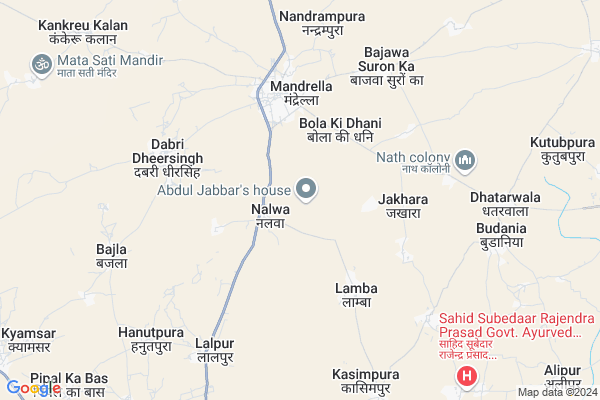
Nalwa Map
EDIT Map
Add Your House
 ..
..
Current Corona Virus Infected Patients Count in Jhunjhunu District
| City Name | District Name | Total Covid cases |
|---|---|---|
| Jhunjhunu District | Jhunjhunu | 36 |
| Jhunjhunu | Jhunjhunu | 6 |
Locality Name :
Nalwa
( नलवा )
Tehsil Name : Chirawa
District : Jhunjhunu
State : Rajasthan
Division : Jaipur
Language : Hindi and Rajasthani
Current Time 11:22 AM
Date: Monday , Apr 28,2025 (IST)
Time zone: IST (UTC+5:30)
Elevation / Altitude: 313 meters. Above Seal level
Telephone Code / Std Code: 01596
Assembly constituency : Pilani assembly constituency
Assembly MLA : Pitram Singh Kala
Lok Sabha constituency : Jhunjhunu parliamentary constituency
Parliament MP : NARENDRA KUMAR
Serpanch Name :
Pin Code : 333025
Post Office Name : Mandrella
Main Village Name : Nalwa
Commodities Prices : Jhunjhunu Market / Mandi
Nalwa Live Weather
Temperature: 40.0 °C
clear sky
Humidity: 6%
Wind : 3.19 mt/sec towards W
StationName : "Bagar"
observed on Now
Temperature: 40.0 °C
clear sky
Humidity: 6%
Wind : 3.19 mt/sec towards W
StationName : "Bagar"
observed on Now
Nalwa Weather Forecast for Next 5 days
29-04-2025
29.4°C to 41.7°C
clear sky
29.4°C to 41.7°C
clear sky
30-04-2025
26.9°C to 42.7°C
clear sky
26.9°C to 42.7°C
clear sky
01-05-2025
29.5°C to 44.4°C
clear sky, scattered clouds
29.5°C to 44.4°C
clear sky, scattered clouds
02-05-2025
28.9°C to 43.7°C
scattered clouds, clear sky, light rain, overcast clouds
28.9°C to 43.7°C
scattered clouds, clear sky, light rain, overcast clouds
03-05-2025
28.7°C to 41.1°C
light rain, overcast clouds, broken clouds, scattered clouds
28.7°C to 41.1°C
light rain, overcast clouds, broken clouds, scattered clouds
National Highways Reachable To Nalwa
Nationa High Way :NH152D
Nationa High Way :NH52
Nationa High Way :NH152D
Nationa High Way :NH52
About Nalwa
Correct below Info and add more info about NalwaNalwa is a small Village/hamlet in Chirawa Tehsil in Jhunjhunu District of Rajasthan State, India. It comes under Nalwa Panchayath. It belongs to Jaipur Division . It is located 19 KM towards North from District head quarters Jhunjhunu. 16 KM from Chirawa. 182 KM from State capital Jaipur
Nalwa Pin code is 333025 and postal head office is Mandrella .
Mandrella ( 4 KM ) , Dabri Dheersingh ( 5 KM ) , Kasimpura ( 7 KM ) , Budania ( 8 KM ) , Dhatarwala ( 8 KM ) are the nearby Villages to Nalwa. Nalwa is surrounded by Pilani Tehsil towards East , Alsisar Tehsil towards west , Jhunjhunun Tehsil towards South , Surajgarh Tehsil towards East .
Jhunjhunu , Pilani , Rajgarh (Churu , Mandawa are the near by Cities to Nalwa.
Nalwa 2011 Census Details
Nalwa Local Language is Hindi. Nalwa Village Total population is 1412 and number of houses are 240. Female Population is 49.4%. Village literacy rate is 60.8% and the Female Literacy rate is 24.3%.
Population
| Census Parameter | Census Data |
| Total Population | 1412 |
| Total No of Houses | 240 |
| Female Population % | 49.4 % ( 697) |
| Total Literacy rate % | 60.8 % ( 859) |
| Female Literacy rate | 24.3 % ( 343) |
| Scheduled Tribes Population % | 5.6 % ( 79) |
| Scheduled Caste Population % | 21.6 % ( 305) |
| Working Population % | 59.8 % |
| Child(0 -6) Population by 2011 | 179 |
| Girl Child(0 -6) Population % by 2011 | 46.4 % ( 83) |
Nalwa Census More Deatils.
Politics in Nalwa
BJP , INC are the major political parties in this area.Polling Stations /Booths near Nalwa
1)Govt. Primary School Bhoja Ka Bas2)Govt. Upper Primary School Shyalu Khurd
3)Govt. Secondary School Kazi
4)Govt. Primary School Bas Gokal
5)Govt. Primary School Bishanpura- Ii
HOW TO REACH Nalwa
By Rail
There is no railway station near to Nalwa in less than 10 km.Colleges near Nalwa
Shishu Vidhya Mandir Mahavidhyalaya Budaniya
Address :
Chirawa College, Chirawa
Address :
Satyam Nursing College
Address : Satyam Nursing College Chanana,chirawa,jhunjhunu-raj
Government College Kithana
Address : Kithana
Chirawa Vidya Niketan Kanya Mahavidyalaya
Address : Chirawa Vidya Niketan Kanya Mahavidyalaya, Chirawa
Schools near Nalwa
Swami Vivekanand Academy Kithana
Address : Near Ghardana road Kithana
Chainpura
Address : Govt.prim.school Chainpura
Kithana Public School
Address : Ward NO 11
Shiv Memorial Gramin Public School,jhunjhunu,rajasthan
Address :
Govt Health Centers near Nalwa
1) Nalwa , , , NEAR GOVT MIDDLE SCHOOL NALWA2) Govindpura , , , NEAR GOVT MIDDLE SCHOOL GOVINDPURA
3) Lamba , , , NEAR VILLAGE GRAM PANCHAYAT LAMBA
Sub Villages in Nalwa
Hospitals in Nalwa,Chirawa
Primary Health Care Center(PHC)
Dabri Dham Rd; Dabri Dheersingh; Rajasthan 333025; India
6.0 KM distance Detail
राजकीय आयुर्वेदिक औषधालय घुमनसर खुर्द
Ghumansar Khurd; Rajasthan 333023; India
6.9 KM distance Detail
more ..
Petrol Bunks in Nalwa,Chirawa
indian oil jakhoria filling station jakhora
Mandrella-Chirawa; Jakhora; Rajasthan 333025; India
4.8 KM distance Detail
more ..
Colleges in Nalwa,Chirawa
Seth N.M.T. Govt. Girls College
Bagar Road; Jhunjhunu; Rajasthan 333023; India
10.6 KM distance Detail
Shivonkar Maheshwari Technical Institute
Jhunjhunu Road; Bagar; Rajasthan 333023; India
10.8 KM distance Detail
vijay Mahila Mahavidyalaya
Pilani Rd; Surya Nagar; Ghumansar Kalan; Rajasthan 333035; India
13.0 KM distance Detail
more ..
Schools in Nalwa,Chirawa
Dhattarwal Pvt ITI; Lamba
Bagar - Mandrella Rd; Lamba; Rajasthan 333023; India
3.6 KM distance Detail
Government High Pvt. School Jakdha
जाखड़ा जिला; Jhunjhunu; Rajasthan 333025; India
4.1 KM distance Detail
Rajkiya High Secondary Sanskrit School Lamba
गांव लाम्बा जिला (बस स्टैंड केपास) झुंझुनू; Lamba; Rajasthan 333023; India
4.1 KM distance Detail
Local Parks in Nalwa,Chirawa
Shaheed Maniram Bijarniya Memorial Place Lamba
रा. मा. विद्यालय के सामने लाम्बा; Lamba; Rajasthan 333023; India
4.7 KM distance Detail
Gyan Vihar Park
Kyamsar Rd; Gyan Vihar-I; Harinagar; Pilani; Rajasthan 33301; India
19.3 KM distance Detail
Police Stations near Nalwa,Chirawa
Police Station Kotwali Jhunjhunu
Fauz Ka Mohalla; Jhunjhunu; Rajasthan 333001; India
20.3 KM distance Detail
Governement Offices near Nalwa,Chirawa
Panchayat Samiti Office Alsisar
Panchayat Samiti; SH 41; Alsisar; Rajasthan 331025; India
17.6 KM distance Detail
About Nalwa &
History
How to reach Nalwa
Tourist Places Near By Nalwa
Schools in Nalwa
Colleges in Nalwa
Temperature & weather of Nalwa
places in Nalwa
Nalwa photos
More Information
How to reach Nalwa
Tourist Places Near By Nalwa
Schools in Nalwa
Colleges in Nalwa
Temperature & weather of Nalwa
places in Nalwa
Nalwa photos
More Information
Village Talk
Post News or Events about this Village
Near Cities
Jhunjhunu 19 KM near
Pilani 22 KM near
Rajgarh (Churu 24 KM near
Mandawa 42 KM near
Jhunjhunu 19 KM near
Pilani 22 KM near
Rajgarh (Churu 24 KM near
Mandawa 42 KM near
Near By Taluks
Chirawa 15 KM near
Pilani 19 KM near
Alsisar 20 KM near
Jhunjhunun 23 KM near
Chirawa 15 KM near
Pilani 19 KM near
Alsisar 20 KM near
Jhunjhunun 23 KM near
Near By Air Ports
Indira Gandhi International Airport 185 KM near
Sanganeer Airport 186 KM near
Surat Gujarat Airport 209 KM near
Muzaffarnagar Airport 282 KM near
Indira Gandhi International Airport 185 KM near
Sanganeer Airport 186 KM near
Surat Gujarat Airport 209 KM near
Muzaffarnagar Airport 282 KM near
Near By Tourist Places
Jhunjhunu 19 KM near
Mandawa 42 KM near
Churu 51 KM near
Shekhawati 55 KM near
Nawalgarh 56 KM near
Jhunjhunu 19 KM near
Mandawa 42 KM near
Churu 51 KM near
Shekhawati 55 KM near
Nawalgarh 56 KM near
Near By Districts
Jhunjhunu 19 KM near
Churu 51 KM near
Mahendragarh 79 KM near
Sikar 89 KM near
Jhunjhunu 19 KM near
Churu 51 KM near
Mahendragarh 79 KM near
Sikar 89 KM near
Near By RailWay Station
Loharu Junction Rail Way Station 43 KM near
Sadulpur Junction Rail Way Station 44 KM near
Loharu Junction Rail Way Station 43 KM near
Sadulpur Junction Rail Way Station 44 KM near