| Home | City Bus | Maps | Villages | Cities | Rail | Tourist Places | School | College | Pin Codes | Corona Cases Count |
| Distance Calculator Bus Services IFSC Codes Trace Mobile Number Weather Search Place Trace IP Available Cash ATM/Banks Locate Polling Booth Report an Error contact People |
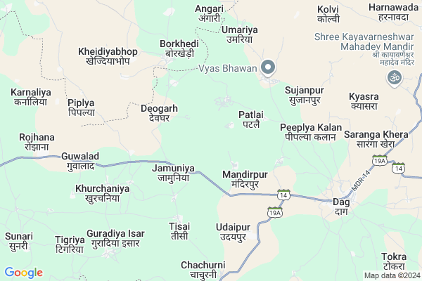
Sarwar Map
EDIT Map
Add Your House
 ..
..
Current Corona Virus Infected Patients Count in Jhalawar District
| City Name | District Name | Total Covid cases |
|---|---|---|
| Jhalawar District | Jhalawar | 30 |
Locality Name :
Sarwar
( सर्वर )
Tehsil Name : Dag
District : Jhalawar
State : Rajasthan
Division : Kota
Language : Hindi and Rajasthani
Current Time 06:50 AM
Date: Saturday , Apr 26,2025 (IST)
Time zone: IST (UTC+5:30)
Elevation / Altitude: 426 meters. Above Seal level
Telephone Code / Std Code: 07435
Assembly constituency : Dag assembly constituency
Assembly MLA : Kaluram
Lok Sabha constituency : Jhalawar-Baran parliamentary constituency
Parliament MP : DUSHYANT SINGH
Serpanch Name :
Main Village Name : Sarwar
Commodities Prices : Suvasra Market / Mandi
Sarwar Live Weather
Temperature: 27.0 °C
clear sky
Humidity: 20%
Wind : 4.05 mt/sec towards W
StationName : "ShÄ\u0081mgarh"
observed on 42 Mins Back
Temperature: 27.0 °C
clear sky
Humidity: 20%
Wind : 4.05 mt/sec towards W
StationName : "ShÄ\u0081mgarh"
observed on 42 Mins Back
Sarwar Weather Forecast for Next 5 days
27-04-2025
28.5°C to 39.4°C
clear sky
28.5°C to 39.4°C
clear sky
28-04-2025
26.6°C to 40.3°C
clear sky
26.6°C to 40.3°C
clear sky
29-04-2025
27.3°C to 41.7°C
clear sky, few clouds, broken clouds
27.3°C to 41.7°C
clear sky, few clouds, broken clouds
30-04-2025
28.9°C to 42.8°C
scattered clouds, clear sky, few clouds, broken clouds
28.9°C to 42.8°C
scattered clouds, clear sky, few clouds, broken clouds
01-05-2025
28.7°C to 42.8°C
scattered clouds, clear sky, broken clouds
28.7°C to 42.8°C
scattered clouds, clear sky, broken clouds
Rivers Near Sarwar
Bhatan Nadi
Chambal River :चम्बल
Bhatan Nadi
Chambal River :चम्बल
About Sarwar
Correct below Info and add more info about SarwarSarwar is a small Village/hamlet in Dag Tehsil in Jhalawar District of Rajasthan State, India. It comes under Sarwar Panchayath. It belongs to Kota Division . It is located 95 KM towards South from District head quarters Jhalawar. 385 KM from State capital Jaipur
Sarwar is surrounded by Barod Tehsil towards South , Alot Tehsil towards west , Sitamau Tehsil towards west , Garoth Tehsil towards North .
Shamgarh , Mahidpur , Mandsaur , Tarana are the near by Cities to Sarwar.
This Place is in the border of the Jhalawar District and Shajapur District. Shajapur District Barod is South towards this place . It is near to the Madhya Pradesh State Border.
Sarwar 2011 Census Details
Sarwar Local Language is Hindi. Sarwar Village Total population is 1695 and number of houses are 338. Female Population is 49.7%. Village literacy rate is 35.7% and the Female Literacy rate is 13.0%.
Population
| Census Parameter | Census Data |
| Total Population | 1695 |
| Total No of Houses | 338 |
| Female Population % | 49.7 % ( 843) |
| Total Literacy rate % | 35.7 % ( 605) |
| Female Literacy rate | 13.0 % ( 220) |
| Scheduled Tribes Population % | 0.0 % ( 0) |
| Scheduled Caste Population % | 33.3 % ( 565) |
| Working Population % | 34.5 % |
| Child(0 -6) Population by 2011 | 257 |
| Girl Child(0 -6) Population % by 2011 | 48.6 % ( 125) |
Sarwar Census More Deatils.
Politics in Sarwar
BJP , INC are the major political parties in this area.Polling Stations /Booths near Sarwar
1)Govt. U. P.sch. Mishroli (right Side)2)Govt. P.sch. Lakhakhedi Umath
3)Govt. U.p.sch. Bardiya
4)Govt. U.p.sch. Dhabala (gangdhar)
5)Govt. U.p.sch. Vishniya
HOW TO REACH Sarwar
By Rail
There is no railway station near to Sarwar in less than 10 km.Pincodes near Sarwar
326516 ( Gangdhar ) , 326514 ( Dag ) , 326515 ( Chaumahla )Colleges near Sarwar
Government Birla College
Address :
Dharmraj Bairwa
Address : Khanpur
Jhalawar Medical College Hospital
Address : Jhalawar Medical College Hospital, Jhalawar
Government P. G. College Of Jhalawar
Address : Government P. G. College Of Jhalawar - 326001
Government Engg. College,jhalawar
Address : Teh.-jhalrapatan,dist.-jhalawar.
Schools near Sarwar
Saraswati Gyan Mandir, Pagariya
Address : pagariya1 , dag , jhalawar , Rajasthan . PIN- 326512 , Post - Pach Pahar
Maa Saraswati Convet Kundala
Address : kundla , dag , jhalawar , Rajasthan . PIN- 326515 , Post - Chaumahla
Madarsa Fazal Memorial Sch.
Address : kolvi u mandi rajendrapura , dag , jhalawar , Rajasthan . PIN- 326515 , Post - Chaumahla
Saraswati Vidya Mandir Bani
Address : bani1 , dag , jhalawar , Rajasthan . PIN- 326512 , Post - Pach Pahar
Govt Health Centers near Sarwar
1) Soopa , , Village + Post - Soopa, Teh. - Bayana ,2) Blakhen , Blakhen Sub Center Building , near govindgarh , near govindgarh
3) Padasli , Padasli , Padasli ,
Sub Villages in Sarwar
Hospitals in Sarwar,Dag
Sarkari Hospital
Anand Dham Ghasoi Road; Antraliya; Madhya Pradesh 458888; India
15.0 KM distance Detail
more ..
Petrol Bunks in Sarwar,Dag
Agarwal Traders Bpcl Petrol Pump
Chaumahla; Sitamu Road; Near choti kalisindh River; tehsil Gangadhar; Malhar Ganj; Rajasthan 326515; India
18.4 KM distance Detail
more ..
Colleges in Sarwar,Dag
Swami Vivekanand Polytechnic College
Dug Road; Jhalawar; Rajasthan 326001; India
19.1 KM distance Detail
more ..
Electronic Shops in Sarwar,Dag
तिरुपति बालाजी एग्रो कृषि यंत्र सुवासरा
Suwasra; Madhya Pradesh 458888; India
14.6 KM distance Detail
Police Stations near Sarwar,Dag
Police Station Gangdhar; Jhalawar; Rajasthan
Dug To Chowmahala To Sitamau Rd; Gol Kheri; Rajasthan 326515; India
19.1 KM distance Detail
Governement Offices near Sarwar,Dag
Gram Panchyat Office Dag
Dag; Jhalawar; SH-19A; Jhalawar Road; Jhalawar; Jhalawar; Rajasthan 326033; India
12.1 KM distance Detail
Atal Seva Kendra
Dag; Jhalawar; SH-19A; Jhalawar Road; Jhalawar; Jhalawar; Rajasthan 326033; India
12.1 KM distance Detail
Atal Seva Kendra
Harnavada; Jhalawar; SH-19A; Jhalawar Road; Jhalawar; Jhalawar; Rajasthan 326033; India
19.6 KM distance Detail
About Sarwar &
History
How to reach Sarwar
Tourist Places Near By Sarwar
Schools in Sarwar
Colleges in Sarwar
Temperature & weather of Sarwar
places in Sarwar
Sarwar photos
More Information
How to reach Sarwar
Tourist Places Near By Sarwar
Schools in Sarwar
Colleges in Sarwar
Temperature & weather of Sarwar
places in Sarwar
Sarwar photos
More Information
Village Talk
Post News or Events about this Village
Near Cities
Shamgarh 31 KM near
Mahidpur 58 KM near
Mandsaur 80 KM near
Tarana 83 KM near
Shamgarh 31 KM near
Mahidpur 58 KM near
Mandsaur 80 KM near
Tarana 83 KM near
Near By Taluks
Dag 0 KM near
Barod 29 KM near
Alot 42 KM near
Sitamau 43 KM near
Dag 0 KM near
Barod 29 KM near
Alot 42 KM near
Sitamau 43 KM near
Near By Air Ports
Indore Airport 153 KM near
Bhopal Airport 198 KM near
Dabok Airport 228 KM near
Vadodara Airport 356 KM near
Indore Airport 153 KM near
Bhopal Airport 198 KM near
Dabok Airport 228 KM near
Vadodara Airport 356 KM near
Near By Tourist Places
Jhalawar 77 KM near
Ujjain 97 KM near
Ratlam 113 KM near
Neemuch 119 KM near
Kota 151 KM near
Jhalawar 77 KM near
Ujjain 97 KM near
Ratlam 113 KM near
Neemuch 119 KM near
Kota 151 KM near
Near By Districts
Mandsaur 82 KM near
Shajapur 87 KM near
Jhalawar 91 KM near
Ujjain 98 KM near
Mandsaur 82 KM near
Shajapur 87 KM near
Jhalawar 91 KM near
Ujjain 98 KM near
Near By RailWay Station
Chau Mahla Rail Way Station 19 KM near
Suwasra Rail Way Station 19 KM near
Chau Mahla Rail Way Station 19 KM near
Suwasra Rail Way Station 19 KM near