| Home | City Bus | Maps | Villages | Cities | Rail | Tourist Places | School | College | Pin Codes | Corona Cases Count |
| Distance Calculator Bus Services IFSC Codes Trace Mobile Number Weather Search Place Trace IP Available Cash ATM/Banks Locate Polling Booth Report an Error contact People |
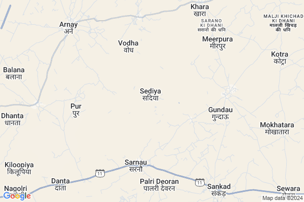
Sediya Map
EDIT Map
Add Your House
 ..
..
Current Corona Virus Infected Patients Count in Jalore District
| City Name | District Name | Total Covid cases |
|---|
Locality Name :
Sediya
( सेड़िया )
Tehsil Name : Sanchore
District : Jalore
State : Rajasthan
Division : Jodhpur
Language : Hindi and Rajasthani
Current Time 05:52 AM
Date: Saturday , Apr 26,2025 (IST)
Time zone: IST (UTC+5:30)
Elevation / Altitude: 213 meters. Above Seal level
Telephone Code / Std Code: 02979
Assembly constituency : Raniwara assembly constituency
Assembly MLA : Ratan Devasi
Lok Sabha constituency : Jalore parliamentary constituency
Parliament MP : Devaji Patel
Serpanch Name :
Pin Code : 343040
Post Office Name : Raniwara
Main Village Name : Sediya
Commodities Prices : Sanchor Market / Mandi
Sediya Live Weather
Temperature: 24.6 °C
clear sky
Humidity: 73%
Wind : 2.93 mt/sec towards SW
StationName : "SÄ\u0081nchor"
observed on Now
Temperature: 24.6 °C
clear sky
Humidity: 73%
Wind : 2.93 mt/sec towards SW
StationName : "SÄ\u0081nchor"
observed on Now
Sediya Weather Forecast for Next 5 days
27-04-2025
26.3°C to 41.5°C
clear sky
26.3°C to 41.5°C
clear sky
28-04-2025
24.8°C to 43.7°C
clear sky
24.8°C to 43.7°C
clear sky
29-04-2025
25.5°C to 43.4°C
clear sky
25.5°C to 43.4°C
clear sky
30-04-2025
25.2°C to 43.8°C
clear sky, few clouds, scattered clouds
25.2°C to 43.8°C
clear sky, few clouds, scattered clouds
01-05-2025
25.5°C to 42.0°C
clear sky, few clouds
25.5°C to 42.0°C
clear sky, few clouds
Rivers Near Sediya
Luni :लूनी
Bargaon Nadi
Luni :लूनी
Bargaon Nadi
About Sediya
Correct below Info and add more info about SediyaSediya is a small Village/hamlet in Sanchore Tehsil in Jalore District of Rajasthan State, India. It comes under Sediya Panchayath. It belongs to Jodhpur Division . It is located 105 KM towards west from District head quarters Jalore. 22 KM from Sanchore. 528 KM from State capital Jaipur
Sediya Pin code is 343040 and postal head office is Raniwara .
Pur ( 6 KM ) , Khara ( 8 KM ) , Sankad ( 9 KM ) , Danta ( 10 KM ) , Kodka ( 11 KM ) are the nearby Villages to Sediya. Sediya is surrounded by Dhanera Tehsil towards South , Bhinmal Tehsil towards North , Raniwara Tehsil towards East , Tharad Tehsil towards South .
Sanchore , Bhinmal , Tharad , Deesa are the near by Cities to Sediya.
Sediya 2011 Census Details
Sediya Local Language is Hindi. Sediya Village Total population is 1822 and number of houses are 298. Female Population is 48.6%. Village literacy rate is 42.2% and the Female Literacy rate is 14.4%.
Population
| Census Parameter | Census Data |
| Total Population | 1822 |
| Total No of Houses | 298 |
| Female Population % | 48.6 % ( 886) |
| Total Literacy rate % | 42.2 % ( 768) |
| Female Literacy rate | 14.4 % ( 263) |
| Scheduled Tribes Population % | 27.4 % ( 499) |
| Scheduled Caste Population % | 1.5 % ( 28) |
| Working Population % | 39.8 % |
| Child(0 -6) Population by 2011 | 321 |
| Girl Child(0 -6) Population % by 2011 | 46.1 % ( 148) |
Sediya Census More Deatils.
Politics in Sediya
Bharatiya Janata Party , BJP , INC are the major political parties in this area.Polling Stations /Booths near Sediya
1)Government Senior Secondary School Kuda2)Government Upper Primary School Pahadpura
3)Government Secondary School Right Room Dantlawas
4)Government Secondary School Left Room Dantlawas
5)Government Secondary School Left Room Vandhar
HOW TO REACH Sediya
By Rail
There is no railway station near to Sediya in less than 10 km.Colleges near Sediya
Sohan Lal Khilery
Address :
Bharat Computer & It Service Center, Bhadruna
Address :
Ramesh Choudhary
Address : Choudhary Ka Vas Hadecha
sanchore Raj
Ramdev Private Industrial Training Institute, Sanchore
Address : Gopal Plaza, Shivnath Pura, Sanchore
Schools in Sediya
G.u.p.s. Sediya
Address : sediya , sanchore , jalor , Rajasthan . PIN- 343041 , Post - Sanchore
Govt Health Centers near Sediya
1) Gundau , Gundau , Gundau , Gundau2) Meerpura , Meerpura , Meerpura , Meerpura
3) NOTIONAL Arnai , PHC Arnai , PHC Arnai , PHC Arnai
Sub Villages in Sediya
Hospitals in Sediya,Sanchore
Sarswati medical and General Store
Khara - Sankad Rd; Khara; Rajasthan 343030; India
8.8 KM distance Detail
more ..
Colleges in Sediya,Sanchore
sarano ki dhani school
Jaisalmer - Barmer - Sanchore - Radhanpur Road; Dedva; Rajasthan 343041; India
21.3 KM distance Detail
narpat saran
sahu and dahukiyo ki; Hemaguda; B. Dhani Road; Sanchore; Rajasthan 343041; India
21.3 KM distance Detail
more ..
Governement Offices near Sediya,Sanchore
Atal Seva Center
Jalore; SH-11; Jalore Road; Sanchore; Sanchore; Rajasthan 343041; India
15.6 KM distance Detail
Atal Seva Centre
Jalore; NH-15; Jalore Road; Sanchore; Sanchore; Rajasthan 343041; India
19.9 KM distance Detail
About Sediya &
History
How to reach Sediya
Tourist Places Near By Sediya
Schools in Sediya
Colleges in Sediya
Temperature & weather of Sediya
places in Sediya
Sediya photos
More Information
How to reach Sediya
Tourist Places Near By Sediya
Schools in Sediya
Colleges in Sediya
Temperature & weather of Sediya
places in Sediya
Sediya photos
More Information
Village Talk
Post News or Events about this Village
Near Cities
Sanchore 22 KM near
Bhinmal 41 KM near
Tharad 64 KM near
Deesa 75 KM near
Sanchore 22 KM near
Bhinmal 41 KM near
Tharad 64 KM near
Deesa 75 KM near
Near By Taluks
Sanchore 21 KM near
Dhanera 35 KM near
Bhinmal 36 KM near
Raniwara 41 KM near
Sanchore 21 KM near
Dhanera 35 KM near
Bhinmal 36 KM near
Raniwara 41 KM near
Near By Air Ports
Jodhpur Airport 218 KM near
Dabok Airport 221 KM near
Ahmedabad Airport 231 KM near
Jaisalmer Airport 286 KM near
Jodhpur Airport 218 KM near
Dabok Airport 221 KM near
Ahmedabad Airport 231 KM near
Jaisalmer Airport 286 KM near
Near By Tourist Places
Mount Abu 90 KM near
Banaskantha 97 KM near
Jalore 99 KM near
Ambaji 118 KM near
Danta Ambaji 119 KM near
Mount Abu 90 KM near
Banaskantha 97 KM near
Jalore 99 KM near
Ambaji 118 KM near
Danta Ambaji 119 KM near
Near By Districts
Banas Kantha 96 KM near
Jalore 100 KM near
Sirohi 102 KM near
Patan 122 KM near
Banas Kantha 96 KM near
Jalore 100 KM near
Sirohi 102 KM near
Patan 122 KM near
Near By RailWay Station
Disa Rail Way Station 77 KM near
Bhildi Junction Rail Way Station 78 KM near
Disa Rail Way Station 77 KM near
Bhildi Junction Rail Way Station 78 KM near