| Home | City Bus | Maps | Villages | Cities | Rail | Tourist Places | School | College | Pin Codes | Corona Cases Count |
| Distance Calculator Bus Services IFSC Codes Trace Mobile Number Weather Search Place Trace IP Available Cash ATM/Banks Locate Polling Booth Report an Error contact People |
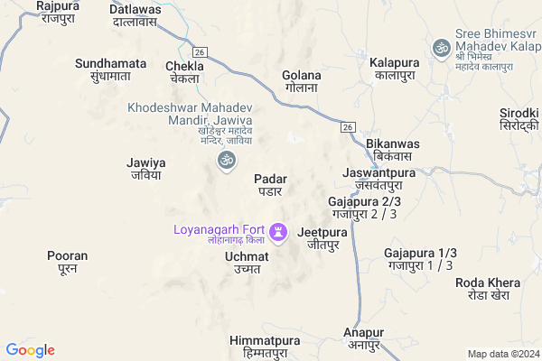
Padar
Padar Map
EDIT Map
Add Your House
 ..
..
Current Corona Virus Infected Patients Count in Jalore District
| City Name | District Name | Total Covid cases |
|---|
Locality Name :
Padar
( पदर )
Tehsil Name : Jaswantpura
District : Jalore
State : Rajasthan
Division : Jodhpur
Language : Hindi and Rajasthani
Current Time 05:55 AM
Date: Saturday , Apr 26,2025 (IST)
Time zone: IST (UTC+5:30)
Elevation / Altitude: 245 meters. Above Seal level
Telephone Code / Std Code: 02975
Assembly constituency : Raniwara assembly constituency
Assembly MLA : Ratan Devasi
Lok Sabha constituency : Jalore parliamentary constituency
Parliament MP : Devaji Patel
Serpanch Name :
Pin Code : 307515
Post Office Name : Jaswantpura
Main Village Name : Padar
Commodities Prices : Bheenmal(Ranlwada) Market / Mandi
Padar Live Weather
Temperature: 23.7 °C
clear sky
Humidity: 64%
Wind : 2.95 mt/sec towards SW
StationName : "BhÄ«nmÄ\u0081l"
observed on Now
Temperature: 23.7 °C
clear sky
Humidity: 64%
Wind : 2.95 mt/sec towards SW
StationName : "BhÄ«nmÄ\u0081l"
observed on Now
Padar Weather Forecast for Next 5 days
27-04-2025
25.1°C to 38.8°C
clear sky
25.1°C to 38.8°C
clear sky
28-04-2025
23.2°C to 41.3°C
clear sky
23.2°C to 41.3°C
clear sky
29-04-2025
24.0°C to 41.3°C
clear sky
24.0°C to 41.3°C
clear sky
30-04-2025
23.5°C to 41.7°C
clear sky, few clouds
23.5°C to 41.7°C
clear sky, few clouds
01-05-2025
23.9°C to 40.5°C
clear sky
23.9°C to 40.5°C
clear sky
Rivers Near Padar
Khari
Rel Nadi
Khari
Rel Nadi
About Padar
Correct below Info and add more info about PadarPadar is a small Village/hamlet in Jaswantpura Tehsil in Jalore District of Rajasthan State, India. It comes under Padar Panchayath. It belongs to Jodhpur Division . It is located 75 KM towards South from District head quarters Jalore. 19 KM from Jaswantpura. 483 KM from State capital Jaipur
Padar Pin code is 307515 and postal head office is Jaswantpura .
Pooran ( 9 KM ) , Rajikawas ( 10 KM ) , Dantlawas ( 11 KM ) , Panseri ( 12 KM ) , Paoli ( 13 KM ) are the nearby Villages to Padar. Padar is surrounded by Raniwara Tehsil towards North , Reodar Tehsil towards South , Sirohi Tehsil towards East , Mount Abu Tehsil towards East .
Bhinmal , Mount Abu , Sirohi , Jalore are the near by Cities to Padar.
Padar 2011 Census Details
Padar Local Language is Hindi. Padar Village Total population is 763 and number of houses are 111. Female Population is 49.1%. Village literacy rate is 34.5% and the Female Literacy rate is 9.2%.
Population
| Census Parameter | Census Data |
| Total Population | 763 |
| Total No of Houses | 111 |
| Female Population % | 49.1 % ( 375) |
| Total Literacy rate % | 34.5 % ( 263) |
| Female Literacy rate | 9.2 % ( 70) |
| Scheduled Tribes Population % | 28.4 % ( 217) |
| Scheduled Caste Population % | 12.3 % ( 94) |
| Working Population % | 30.7 % |
| Child(0 -6) Population by 2011 | 137 |
| Girl Child(0 -6) Population % by 2011 | 49.6 % ( 68) |
Padar Census More Deatils.
Politics in Padar
Bharatiya Janata Party , BJP , INC are the major political parties in this area.Polling Stations /Booths near Padar
1)Government Umaji Okhaji Senior Secondary School Right Room Malwara2)Government Upper Primary School Left Room Golana
3)Government Upper Primary School Fedani
4)Government Primary School Bikanwas
5)Government Senior Secondary School Right Room
HOW TO REACH Padar
By Rail
There is no railway station near to Padar in less than 10 km.Colleges near Padar
Aapeshwar College Ramseen Tehsil Jaswantpura
Address : Main Road Ramseen
Schools in Padar
Govt.p.s.padar
Address : padar , jaswantpura , jalor , Rajasthan . PIN- 307515 , Post - Jaswantpura
Govt Health Centers near Padar
1) Raji Ka Bas , , , Inside Villege2) Jaswantpura , 158 , 1369 , Near Forest office jaswantpura
3) NOTIONAL Jaswantpura , , Jaswantpura , Inside Villege
Sub Villages in Padar
Hospitals in Padar,Jaswantpura
Aradhna Hospital
Badgaon Chaurastha; Mandar Road; District Jalore; Tehsil Raniwara; Badgaon; Rajasthan 342802; India
16.2 KM distance Detail
more ..
Colleges in Padar,Jaswantpura
Sundhamata Institute For Higher Studies
Sundha Mata Rd; Rajasthan 343049; India
10.8 KM distance Detail
Saraswati Vidhya Mandir Sr. Sec. School And HM College Malwara
RJ SH 31; Tejawas; Rajasthan 343039; India
19.1 KM distance Detail
more ..
Schools in Padar,Jaswantpura
Mutha Rugnathmal Vanaji Senior Secondary School Nimbaj
Nimbaj; Rajasthan 307514; India
9.1 KM distance Detail
Super Markets in Padar,Jaswantpura
अर्बुदा जनरल स्टोर
Kalandri - Sildar Rd; Mer Mandwara; Rajasthan 307802; India
16.2 KM distance Detail
Local Parks in Padar,Jaswantpura
Sundha Mata Wildlife Senctuary
Hill; Nilkantha Mahadev Road; Panseri; Rajasthan 343049; India
8.6 KM distance Detail
Police Stations near Padar,Jaswantpura
Governement Offices near Padar,Jaswantpura
About Padar &
History
How to reach Padar
Tourist Places Near By Padar
Schools in Padar
Colleges in Padar
Temperature & weather of Padar
places in Padar
Padar photos
More Information
How to reach Padar
Tourist Places Near By Padar
Schools in Padar
Colleges in Padar
Temperature & weather of Padar
places in Padar
Padar photos
More Information
Village Talk
Post News or Events about this Village
Near Cities
Bhinmal 31 KM near
Mount Abu 41 KM near
Sirohi 49 KM near
Jalore 68 KM near
Bhinmal 31 KM near
Mount Abu 41 KM near
Sirohi 49 KM near
Jalore 68 KM near
Near By Taluks
Jaswantpura 18 KM near
Raniwara 22 KM near
Reodar 26 KM near
Sirohi 34 KM near
Jaswantpura 18 KM near
Raniwara 22 KM near
Reodar 26 KM near
Sirohi 34 KM near
Near By Air Ports
Dabok Airport 167 KM near
Jodhpur Airport 195 KM near
Ahmedabad Airport 217 KM near
Jaisalmer Airport 313 KM near
Dabok Airport 167 KM near
Jodhpur Airport 195 KM near
Ahmedabad Airport 217 KM near
Jaisalmer Airport 313 KM near
Near By Tourist Places
Mount Abu 41 KM near
Jalore 71 KM near
Sirohi 73 KM near
Ambaji 75 KM near
Banaskantha 78 KM near
Mount Abu 41 KM near
Jalore 71 KM near
Sirohi 73 KM near
Ambaji 75 KM near
Banaskantha 78 KM near
Near By Districts
Sirohi 50 KM near
Jalore 72 KM near
Banas Kantha 77 KM near
Patan 123 KM near
Sirohi 50 KM near
Jalore 72 KM near
Banas Kantha 77 KM near
Patan 123 KM near
Near By RailWay Station
Abu Road Rail Way Station 57 KM near
Sirohi Road Rail Way Station 70 KM near
Abu Road Rail Way Station 57 KM near
Sirohi Road Rail Way Station 70 KM near