| Home | City Bus | Maps | Villages | Cities | Rail | Tourist Places | School | College | Pin Codes | Corona Cases Count |
| Distance Calculator Bus Services IFSC Codes Trace Mobile Number Weather Search Place Trace IP Available Cash ATM/Banks Locate Polling Booth Report an Error contact People |
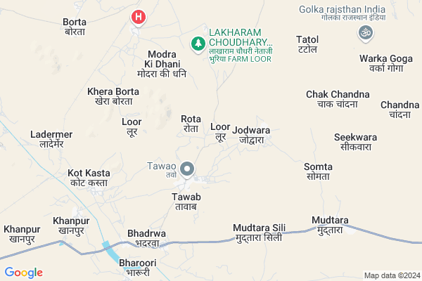
Loor
Loor Map
EDIT Map
Add Your House
 ..
..
Current Corona Virus Infected Patients Count in Jalore District
| City Name | District Name | Total Covid cases |
|---|
Locality Name :
Loor
( लूर )
Tehsil Name : Jaswantpura
District : Jalore
State : Rajasthan
Division : Jodhpur
Language : Hindi and Rajasthani
Current Time 09:57 AM
Date: Thursday , Apr 24,2025 (IST)
Time zone: IST (UTC+5:30)
Elevation / Altitude: 245 meters. Above Seal level
Telephone Code / Std Code: 02975
Assembly constituency : Bhinmal assembly constituency
Assembly MLA : Samarjit Singh
Lok Sabha constituency : Jalore parliamentary constituency
Parliament MP : Devaji Patel
Serpanch Name :
Pin Code : 307803
Post Office Name : Ramseen
Main Village Name : Loor
Commodities Prices : Bhinmal Market / Mandi
Rivers Near Loor
Khari
Rel Nadi
Khari
Rel Nadi
About Loor
Correct below Info and add more info about LoorLoor is a small Village/hamlet in Jaswantpura Tehsil in Jalore District of Rajasthan State, India. It comes under Loor Panchayath. It belongs to Jodhpur Division . It is located 43 KM towards South from District head quarters Jalore. 15 KM from Jaswantpura. 464 KM from State capital Jaipur
Loor Pin code is 307803 and postal head office is Ramseen .
Seekwara ( 7 KM ) , Kot Kasta ( 7 KM ) , Thoor ( 9 KM ) , Khanpur ( 9 KM ) , Basra Dhanji ( 9 KM ) are the nearby Villages to Loor. Loor is surrounded by Raniwara Tehsil towards west , Sayla Tehsil towards North , Jalore Tehsil towards North , Bhinmal Tehsil towards west .
Bhinmal , Jalore , Sirohi , Mount Abu are the near by Cities to Loor.
Loor 2011 Census Details
Loor Local Language is Hindi. Loor Village Total population is 1544 and number of houses are 300. Female Population is 53.2%. Village literacy rate is 39.5% and the Female Literacy rate is 14.1%.
Population
| Census Parameter | Census Data |
| Total Population | 1544 |
| Total No of Houses | 300 |
| Female Population % | 53.2 % ( 822) |
| Total Literacy rate % | 39.5 % ( 610) |
| Female Literacy rate | 14.1 % ( 218) |
| Scheduled Tribes Population % | 12.6 % ( 195) |
| Scheduled Caste Population % | 43.4 % ( 670) |
| Working Population % | 61.0 % |
| Child(0 -6) Population by 2011 | 296 |
| Girl Child(0 -6) Population % by 2011 | 52.7 % ( 156) |
Loor Census More Deatils.
Politics in Loor
Bharatiya Janata Party , BJP , INC are the major political parties in this area.Polling Stations /Booths near Loor
1)Government Upper Primary School Betarna2)Government Primary School Bhilo Ka Goliya Ramseen Left Room
3)Government Secondary School Ledarmer Right Room
4)Government Secondary School Rah
5)Government Senior Secondary School Bhalni Room No. 03
HOW TO REACH Loor
By Rail
Bheempura Rail Way Station , Ledarmer Rail Way Station are the very nearby railway stations to Loor.Colleges near Loor
Aapeshwar College Ramseen Tehsil Jaswantpura
Address : Main Road Ramseen
Schools in Loor
Govt.u.p.s.loor
Address : loor , jaswantpura , jalor , Rajasthan . PIN- 343029 , Post - Bhinmal Sadar Bazar
Govt Health Centers near Loor
1) Loor , Loor , Loor , inside village2) Kheda Borta , Khera Borta , Khera Borta , Rajasthan
3) Tatol , , ,
Sub Villages in Loor
Petrol Bunks in Loor,Jaswantpura
Reliance Petroleum
KHASRA NO 2216 ADMEASURING 2.07 HECTARE; Bhinmal - Jalore Road; RJ SH 31; RHS VILLAGE; JAILORE; Jalore; Rajasthan 343001; India
15.7 KM distance Detail
Pardeep Service Center Indian Oil Petrol Pump
Bheenmaal; Jalore; SH-31; Jalore Road; Bhinmal; Bhinmal; Rajasthan 343029; India
16.1 KM distance Detail
more ..
Colleges in Loor,Jaswantpura
Sudarshan College Bhinmal
Shrimal Nagar Rd; Shrimal Nagar; Bhinmal; Rajasthan 343029; India
17.7 KM distance Detail
S G Polytechnic College
Ramseen Road; Bhinmal; Jalore; Rajasthan 343029; India
19.7 KM distance Detail
Lord Shiva Girls Teacher's Training College
Bhinmal; Near Mahaveer Nagar; Jalor; Rajasthan 343029; India
19.7 KM distance Detail
more ..
Governement Offices near Loor,Jaswantpura
Riddhi Siddhi Finance
shop no. r 25 kherawat market; Bhinmal; Rajasthan; India
18.6 KM distance Detail
R. Choudhary & Associate (C. A. Office)
Plazza; Gudamalani - Bagora - Sayala - Jalor - Bhinmal Road; RJ SH 16; Shankar Nagar; India
18.9 KM distance Detail
Atal Seva Center
Bhinmal - Jalore Rd; Dhanraj Nagar; Bhinmal; Rajasthan 343029; India
19.0 KM distance Detail
About Loor &
History
How to reach Loor
Tourist Places Near By Loor
Schools in Loor
Colleges in Loor
Temperature & weather of Loor
places in Loor
Loor photos
More Information
How to reach Loor
Tourist Places Near By Loor
Schools in Loor
Colleges in Loor
Temperature & weather of Loor
places in Loor
Loor photos
More Information
Village Talk
Post News or Events about this Village
Near Cities
Bhinmal 19 KM near
Jalore 39 KM near
Sirohi 52 KM near
Mount Abu 66 KM near
Bhinmal 19 KM near
Jalore 39 KM near
Sirohi 52 KM near
Mount Abu 66 KM near
Near By Taluks
Jaswantpura 14 KM near
Raniwara 21 KM near
Sayla 33 KM near
Bhinmal 37 KM near
Jaswantpura 14 KM near
Raniwara 21 KM near
Sayla 33 KM near
Bhinmal 37 KM near
Near By Air Ports
Jodhpur Airport 165 KM near
Dabok Airport 175 KM near
Ahmedabad Airport 249 KM near
Jaisalmer Airport 287 KM near
Jodhpur Airport 165 KM near
Dabok Airport 175 KM near
Ahmedabad Airport 249 KM near
Jaisalmer Airport 287 KM near
Near By Tourist Places
Jalore 41 KM near
Mount Abu 66 KM near
Sirohi 77 KM near
Ambaji 102 KM near
Banaskantha 110 KM near
Jalore 41 KM near
Mount Abu 66 KM near
Sirohi 77 KM near
Ambaji 102 KM near
Banaskantha 110 KM near
Near By Districts
Jalore 42 KM near
Sirohi 53 KM near
Banas Kantha 110 KM near
Pali 134 KM near
Jalore 42 KM near
Sirohi 53 KM near
Banas Kantha 110 KM near
Pali 134 KM near
Near By RailWay Station
Ledarmer Rail Way Station 8.5 KM near
Bheempura Rail Way Station 8.7 KM near
Sirohi Road Rail Way Station 77 KM near
Jawai Bandh Rail Way Station 82 KM near
Ledarmer Rail Way Station 8.5 KM near
Bheempura Rail Way Station 8.7 KM near
Sirohi Road Rail Way Station 77 KM near
Jawai Bandh Rail Way Station 82 KM near