| Home | City Bus | Maps | Villages | Cities | Rail | Tourist Places | School | College | Pin Codes | Corona Cases Count |
| Distance Calculator Bus Services IFSC Codes Trace Mobile Number Weather Search Place Trace IP Available Cash ATM/Banks Locate Polling Booth Report an Error contact People |
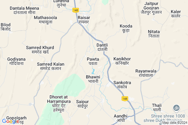
Pawta
Pawta Map
EDIT Map
Add Your House
 ..
..
Current Corona Virus Infected Patients Count in Jaipur District
| City Name | District Name | Total Covid cases |
|---|---|---|
| Jaipur District | Jaipur | 783 |
| Ramganj | Jaipur | 15 |
| Jaipur | Jaipur | 7 |
| Shastrinagar | Jaipur | 2 |
| Ghat Gate | Jaipur | 1 |
Locality Name :
Pawta
( पावटा )
Tehsil Name : Jamwa Ramgarh
District : Jaipur
State : Rajasthan
Division : Jaipur
Language : English and Hindi, Rajasthani
Current Time 01:24 PM
Date: Sunday , Apr 27,2025 (IST)
Time zone: IST (UTC+5:30)
Elevation / Altitude: 351 meters. Above Seal level
Telephone Code / Std Code: 01426
Assembly constituency : Jamwa Ramgarh assembly constituency
Assembly MLA : Mahendra Pal Meena
Lok Sabha constituency : Jaipur Rural parliamentary constituency
Parliament MP : COL. RAJYAVARDHAN RATHORE
Serpanch Name :
Pin Code : 303109
Post Office Name : Jamwaramgarh
Main Village Name : Pawta
Commodities Prices : Jaipur(Bassi) Market / Mandi
Pawta Live Weather
Temperature: 39.7 °C
clear sky
Humidity: 6%
Wind : 4.24 mt/sec towards N
StationName : "Jaipur district"
observed on Now
Temperature: 39.7 °C
clear sky
Humidity: 6%
Wind : 4.24 mt/sec towards N
StationName : "Jaipur district"
observed on Now
Pawta Weather Forecast for Next 5 days
28-04-2025
28.2°C to 39.9°C
clear sky
28.2°C to 39.9°C
clear sky
29-04-2025
26.4°C to 42.1°C
clear sky
26.4°C to 42.1°C
clear sky
30-04-2025
28.1°C to 42.5°C
clear sky
28.1°C to 42.5°C
clear sky
01-05-2025
27.6°C to 44.1°C
clear sky, few clouds
27.6°C to 44.1°C
clear sky, few clouds
02-05-2025
28.3°C to 42.4°C
few clouds, broken clouds, light rain, overcast clouds
28.3°C to 42.4°C
few clouds, broken clouds, light rain, overcast clouds
National Highways Reachable To Pawta
Nationa High Way :NH48
Nationa High Way :NH21
Nationa High Way :NH48
Nationa High Way :NH21
About Pawta
Correct below Info and add more info about PawtaPawta is a small Village/hamlet in Jamwa Ramgarh Tehsil in Jaipur District of Rajasthan State, India. It comes under Pawta Panchayath. It belongs to Jaipur Division . It is located 47 KM towards East from District head quarters Jaipur. 10 KM from Jamwa Ramgarh. 44 KM from State capital Jaipur
Pawta Pin code is 303109 and postal head office is Jamwaramgarh .
Samred Kallan ( 4 KM ) , Raisar ( 5 KM ) , Mathasoola ( 8 KM ) , Andhi ( 8 KM ) , Manhagi ( 8 KM ) are the nearby Villages to Pawta. Pawta is surrounded by Thanagazi Tehsil towards North , Bassi Tehsil towards South , Dausa Tehsil towards South , Amber Tehsil towards west .
Jaipur , Bandikui , Rajgarh (Alwar) , Reengus are the near by Cities to Pawta.
Pawta 2011 Census Details
Pawta Local Language is English. Pawta Village Total population is 934 and number of houses are 177. Female Population is 48.1%. Village literacy rate is 36.7% and the Female Literacy rate is 9.7%.
Population
| Census Parameter | Census Data |
| Total Population | 934 |
| Total No of Houses | 177 |
| Female Population % | 48.1 % ( 449) |
| Total Literacy rate % | 36.7 % ( 343) |
| Female Literacy rate | 9.7 % ( 91) |
| Scheduled Tribes Population % | 22.3 % ( 208) |
| Scheduled Caste Population % | 0.0 % ( 0) |
| Working Population % | 44.9 % |
| Child(0 -6) Population by 2011 | 190 |
| Girl Child(0 -6) Population % by 2011 | 52.6 % ( 100) |
Pawta Census More Deatils.
Politics in Pawta
BJP , BSP , INC are the major political parties in this area.Polling Stations /Booths near Pawta
1)Government Sanskrit Upper Primary School Nangalbela2)Government Upper Primary School Nabhawala
3)Government Upper Primary School Kela Ka Was Front Part
4)Government Upper Primary School Koliwada
5)Government Secondary School Behlod Right Part
HOW TO REACH Pawta
By Rail
There is no railway station near to Pawta in less than 10 km.Colleges near Pawta
Shree Minesh P G College Jamwa Ramgarh
Address :
Shri Minesh P. G .college
Address :
Aadarsh Mahayidyalaya, Andhi
Address :
Arya College Of Eng. & Technology
Address :
Jaipur Institute For Integrated Learning In Management
Address : A-3, “aashirwad”, Bhawani Singh Marg,jaipur , Raja
Schools near Pawta
Love-kus Acadmy
Address : BUS STAND DHULARAWJI
Nehru Jyoti Senior Secondary School Natata
Address : Main bus stand natata
Santosh Public Sec. School
Address : NEAR PATHAN BABA MANDIR NATATA JAIPUR
Govt Primery School Rasawala
Address : Rasawala
Govt Health Centers near Pawta
1) Mehangi , SubCentre , mehangi ,2) Basna , prathmik swasthaya kendra , Basna ,
3) Basna , prathmik swasthaya kendra , Basna ,
Sub Villages in Pawta
Hospitals in Pawta,Jamwa Ramgarh
Dr. Bangali Clinic
Patalwas; Jaipur; NH-11A; Alwar Jaipur Road; Andhi; Aandhi; Rajasthan 303001; India
3.1 KM distance Detail
more ..
Petrol Bunks in Pawta,Jamwa Ramgarh
Anand Filling Station-Indian Oil Petrol Pump
Raaisar; Jaipur; NH-11A; Dausa Road; Andhi; Andhi; Rajasthan 303109; India
5.5 KM distance Detail
Indian Oil Petrol Pump
Aandhi Jaipur Road; SH55; Jaipur; Tholai; Rajasthan 303001; India
8.7 KM distance Detail
more ..
Colleges in Pawta,Jamwa Ramgarh
Gera Brothers Institute Of Technology (G-bit)
T-80; 3rd Floor; Raisar Plaza; Indira Bazar; Indira Bazar; Jaipur; Rajasthan 302001; India
5.4 KM distance Detail
Aadarsh Mahavidyalaya
11; Jaipur Rd; Mission Compound; Hathroi; Aandhi; Rajasthan 303001; India
8.5 KM distance Detail
more ..
Schools in Pawta,Jamwa Ramgarh
Government Primary School
Daatali; Jaipur; NH-11A; Dausa Road; Andhi; Andhi; Rajasthan 303301; India
2.2 KM distance Detail
Electronic Shops in Pawta,Jamwa Ramgarh
Lakshay Computer Education
Vpo Raiser Jamwaramgarh; Jaipur; Rajasthan 303109; India
2.5 KM distance Detail
Compaq Computers & Peripherals
T-43; Raisar Plaza; Indira Bazar; Indira Bazar; Jaipur; Rajasthan 302001; India
5.4 KM distance Detail
Super Markets in Pawta,Jamwa Ramgarh
Shree Maruti Jewellers Andhi.gorav.kumaer.9694421838
RJ SH 55; Aandhi; Rajasthan 303001; India
8.2 KM distance Detail
Local Parks in Pawta,Jamwa Ramgarh
bargoti bhagh(Raisar)
suraj sharma village lunetha post mathesula te jamwaramgarh; Alwar - Jaipur Rd; Rajasthan 303109; India
6.5 KM distance Detail
Police Stations near Pawta,Jamwa Ramgarh
Police station; Andhi
VPO- Teh- Jamwaramgarh Dist- 303001; Aandhi; Rajasthan; India
8.6 KM distance Detail
Police Chowki;Achrol.
Link Rd; Mysore House/Achrol House Colony; Jaipur; Rajasthan 302017; India
19.9 KM distance Detail
Governement Offices near Pawta,Jamwa Ramgarh
Atal Seva Center
Raaisar; Jaipur; NH-11A; Dausa Road; Andhi; Andhi; Rajasthan 303109; India
5.4 KM distance Detail
About Pawta &
History
How to reach Pawta
Tourist Places Near By Pawta
Schools in Pawta
Colleges in Pawta
Temperature & weather of Pawta
places in Pawta
Pawta photos
More Information
How to reach Pawta
Tourist Places Near By Pawta
Schools in Pawta
Colleges in Pawta
Temperature & weather of Pawta
places in Pawta
Pawta photos
More Information
Village Talk
Post News or Events about this Village
Near Cities
Jaipur 41 KM near
Bandikui 49 KM near
Rajgarh (Alwar) 56 KM near
Reengus 69 KM near
Jaipur 41 KM near
Bandikui 49 KM near
Rajgarh (Alwar) 56 KM near
Reengus 69 KM near
Near By Taluks
Jamwa Ramgarh 10 KM near
Thanagazi 33 KM near
Bassi 37 KM near
Dausa 38 KM near
Jamwa Ramgarh 10 KM near
Thanagazi 33 KM near
Bassi 37 KM near
Dausa 38 KM near
Near By Air Ports
Sanganeer Airport 51 KM near
Kheria Airport 203 KM near
Indira Gandhi International Airport 209 KM near
Gwalior Airport 254 KM near
Sanganeer Airport 51 KM near
Kheria Airport 203 KM near
Indira Gandhi International Airport 209 KM near
Gwalior Airport 254 KM near
Near By Tourist Places
Jamwa Ramgarh 17 KM near
Samode 37 KM near
Galta 38 KM near
Jantar Mantar 41 KM near
Sariska 44 KM near
Jamwa Ramgarh 17 KM near
Samode 37 KM near
Galta 38 KM near
Jantar Mantar 41 KM near
Sariska 44 KM near
Near By Districts
Dausa 36 KM near
Jaipur 45 KM near
Alwar 77 KM near
Mahendragarh 116 KM near
Dausa 36 KM near
Jaipur 45 KM near
Alwar 77 KM near
Mahendragarh 116 KM near
Near By RailWay Station
Dausa Rail Way Station 34 KM near
Jaipur Junction Rail Way Station 44 KM near
Dausa Rail Way Station 34 KM near
Jaipur Junction Rail Way Station 44 KM near