| Home | City Bus | Maps | Villages | Cities | Rail | Tourist Places | School | College | Pin Codes | Corona Cases Count |
| Distance Calculator Bus Services IFSC Codes Trace Mobile Number Weather Search Place Trace IP Available Cash ATM/Banks Locate Polling Booth Report an Error contact People |
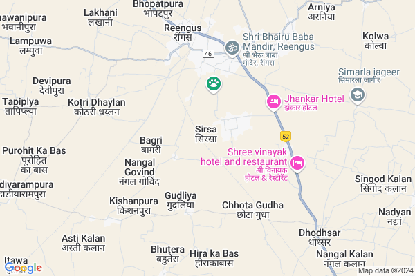
Sirsa
Sirsa Map
EDIT Map
Add Your House
 ..
..
Current Corona Virus Infected Patients Count in Jaipur District
| City Name | District Name | Total Covid cases |
|---|---|---|
| Jaipur District | Jaipur | 783 |
| Ramganj | Jaipur | 15 |
| Jaipur | Jaipur | 7 |
| Shastrinagar | Jaipur | 2 |
| Ghat Gate | Jaipur | 1 |
Locality Name :
Sirsa
( सिरसा )
Tehsil Name : Govindgarh
District : Jaipur
State : Rajasthan
Division : Jaipur
Language : English and Hindi, Rajasthani
Current Time 05:27 PM
Date: Friday , Apr 25,2025 (IST)
Time zone: IST (UTC+5:30)
Elevation / Altitude: 462 meters. Above Seal level
Telephone Code / Std Code: 01575
Assembly constituency : Chomu assembly constituency
Assembly MLA : Dr. Shikha Meel Barala
Lok Sabha constituency : Sikar parliamentary constituency
Parliament MP : Sumedhanand Saraswati
Serpanch Name :
Main Village Name : Sirsa
Commodities Prices : Sri Madhopur Market / Mandi
National Highways Reachable To Sirsa
Nationa High Way :NH48
Nationa High Way :NH48
Rivers Near Sirsa
Banganga
Mendha
Banganga
Mendha
About Sirsa
Correct below Info and add more info about SirsaSirsa is a small Village/hamlet in Govindgarh Tehsil in Jaipur District of Rajasthan State, India. It comes under Sirsa Panchayath. It belongs to Jaipur Division . It is located 61 KM towards North from District head quarters Jaipur. 16 KM from Govind Garh. 60 KM from State capital Jaipur
Dhodsar ( 8 KM ) , Nangal Kalan ( 10 KM ) , Singod Klan ( 10 KM ) , Aalisar ( 10 KM ) , Singod Khurd ( 12 KM ) are the nearby Villages to Sirsa. Sirsa is surrounded by Govindgarh Tehsil towards South , Khandela Tehsil towards North , Shahpura Tehsil towards East , Danta Ramgarh Tehsil towards west .
Reengus , Sri Madhopur , Udaipurwati , Jaipur are the near by Cities to Sirsa.
Sirsa 2011 Census Details
Sirsa Local Language is English. Sirsa Village Total population is 1710 and number of houses are 229. Female Population is 46.5%. Village literacy rate is 66.4% and the Female Literacy rate is 23.6%.
Population
| Census Parameter | Census Data |
| Total Population | 1710 |
| Total No of Houses | 229 |
| Female Population % | 46.5 % ( 796) |
| Total Literacy rate % | 66.4 % ( 1135) |
| Female Literacy rate | 23.6 % ( 404) |
| Scheduled Tribes Population % | 0.0 % ( 0) |
| Scheduled Caste Population % | 4.6 % ( 79) |
| Working Population % | 46.7 % |
| Child(0 -6) Population by 2011 | 177 |
| Girl Child(0 -6) Population % by 2011 | 39.0 % ( 69) |
Sirsa Census More Deatils.
Politics in Sirsa
BJP , INC are the major political parties in this area.Polling Stations /Booths near Sirsa
1)Govt. Upper Primary School Bagada Bridge - 242)Govt. Sec. School Mandabhinda Room No. 1 - 67
3)Govt. Sec. School Dhobali Left Side Area Room No. 11 - 34
4)Govt. Sec. School Chithwadi Left Side Area Room No. 3 - 171
5)Govt. Upper Primary School Shimbhupura Left Side Area Room No. 6 - 109
HOW TO REACH Sirsa
By Rail
Chhota Gudha Rail Way Station , Ringas Junction Rail Way Station are the very nearby railway stations to Sirsa.Pincodes near Sirsa
332603 ( Mahroli ) , 303712 ( Govindgarh (Jaipur) ) , 332404 ( Ringas Town )Colleges near Sirsa
Mahatma Jyotiba Fule College Of Veterinary & Animal Science
Address :
Bright Moon Grils Collage
Address :
Vedant College
Address :
Ganpati Mahila Mahavidyalaya
Address : Near Petrolpump,chomu Road Khejroli
Radha Sawmi College
Address : Petrol Pump Khejroli
Schools near Sirsa
ॐ शिवम् कम्पुटर प्रशिक्षण केंद्र घिनोई
Address : मेन बाज़ार रामनगर घिनोई
Tejal Shikshan Sansthan Bai Ka Bas
Address : BAI KA BAS TH CHOMU JAIPUR 303801
Gurukul Public School Hastera Road Alisar
Address : Hastera Road Alisar
Rajputana
Address : Behind mama bhanja hotel
Govt Health Centers near Sirsa
1) Reengus , CHC Reengus , ,2) Gudha , SC Gudha , ,
3) Jaitusar , Sc Jaitusar , ,
Sub Villages in Sirsa
Petrol Bunks in Sirsa,Govindgarh
Sahid Petrol Filling Station
Jaipur - Jhunjhunu Bypass Rd; Parasrampura; Rajasthan 332404; India
4.1 KM distance Detail
more ..
Colleges in Sirsa,Govindgarh
Poddar Management And Training Institute (RSLDC)
Sikar Rd; Reengus; Rajasthan 332404; India
5.1 KM distance Detail
more ..
Electronic Shops in Sirsa,Govindgarh
Vinayak E-nitra & Photo Studio
RD Complex; U-3; ; Sector 3; Avas Vikas Colony; Sikandra; Agra; Rajasthan 282004; India
4.4 KM distance Detail
Super Markets in Sirsa,Govindgarh
Shri Krishna Steel And Iron Furniture From Renwal Road Ringas Rajasthan
; Reengus; Rajasthan 332404; India
3.7 KM distance Detail
Jai Shree Shyam Transport Company Reengus Ms.Rajendra Lora
Sikar; Rajasthan 332603; India
4.8 KM distance Detail
Police Stations near Sirsa,Govindgarh
Railway Station Circle; Reengus
3; Sikar Rd; Reengus; Rajasthan 332603; India
6.2 KM distance Detail
About Sirsa &
History
How to reach Sirsa
Tourist Places Near By Sirsa
Schools in Sirsa
Colleges in Sirsa
Temperature & weather of Sirsa
places in Sirsa
Sirsa photos
More Information
How to reach Sirsa
Tourist Places Near By Sirsa
Schools in Sirsa
Colleges in Sirsa
Temperature & weather of Sirsa
places in Sirsa
Sirsa photos
More Information
Village Talk
Post News or Events about this Village
Near Cities
Reengus 2 KM near
Sri Madhopur 14 KM near
Udaipurwati 52 KM near
Jaipur 58 KM near
Reengus 2 KM near
Sri Madhopur 14 KM near
Udaipurwati 52 KM near
Jaipur 58 KM near
Near By Taluks
Sri Madhopur 13 KM near
Govindgarh 16 KM near
Khandela 28 KM near
Shahpura 37 KM near
Sri Madhopur 13 KM near
Govindgarh 16 KM near
Khandela 28 KM near
Shahpura 37 KM near
Near By Air Ports
Sanganeer Airport 68 KM near
Indira Gandhi International Airport 227 KM near
Kheria Airport 265 KM near
Surat Gujarat Airport 305 KM near
Sanganeer Airport 68 KM near
Indira Gandhi International Airport 227 KM near
Kheria Airport 265 KM near
Surat Gujarat Airport 305 KM near
Near By Tourist Places
Samode 30 KM near
Jantar Mantar 57 KM near
Jaipur 58 KM near
Sikar 58 KM near
Galta 60 KM near
Samode 30 KM near
Jantar Mantar 57 KM near
Jaipur 58 KM near
Sikar 58 KM near
Galta 60 KM near
Near By Districts
Sikar 56 KM near
Jaipur 59 KM near
Jhunjhunu 101 KM near
Dausa 101 KM near
Sikar 56 KM near
Jaipur 59 KM near
Jhunjhunu 101 KM near
Dausa 101 KM near
Near By RailWay Station
Chhota Gudha Rail Way Station 3.9 KM near
Ringas Junction Rail Way Station 5.6 KM near
Kishan Manpura Rail Way Station 8.5 KM near
Kanakpura Rail Way Station 52 KM near
Asalpur Jobner Rail Way Station 55 KM near
Chhota Gudha Rail Way Station 3.9 KM near
Ringas Junction Rail Way Station 5.6 KM near
Kishan Manpura Rail Way Station 8.5 KM near
Kanakpura Rail Way Station 52 KM near
Asalpur Jobner Rail Way Station 55 KM near