| Home | City Bus | Maps | Villages | Cities | Rail | Tourist Places | School | College | Pin Codes | Corona Cases Count |
| Distance Calculator Bus Services IFSC Codes Trace Mobile Number Weather Search Place Trace IP Available Cash ATM/Banks Locate Polling Booth Report an Error contact People |
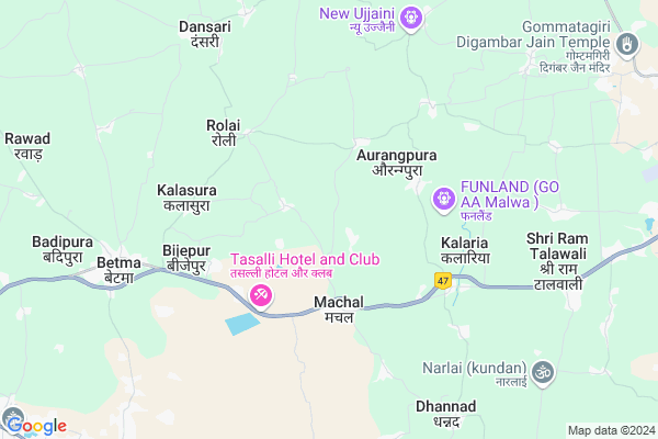
Rayatpura
Rayatpura Map
EDIT Map
Add Your House
 ..
..
Current Corona Virus Infected Patients Count in Indore District
| City Name | District Name | Total Covid cases |
|---|---|---|
| Indore District | Indore | 1167 |
| Indore | Indore | 9 |
Locality Name :
Rayatpura
( रायतपुरा )
Tehsil Name : Depalpur
District : Indore
State : Madhya Pradesh
Division : Indore
Language : Hindi and Urdu
Current Time 03:28 PM
Date: Tuesday , Apr 29,2025 (IST)
Time zone: IST (UTC+5:30)
Elevation / Altitude: 497 meters. Above Seal level
Telephone Code / Std Code: 07322
Assembly constituency : Depalpur assembly constituency
Assembly MLA : Manoj Nirbhay Singh Patel
Lok Sabha constituency : Indore parliamentary constituency
Parliament MP : SHANKAR LALWANI
Serpanch Name :
Pin Code : 453001
Post Office Name : Betma
Main Village Name : Rayatpura
Commodities Prices : Gautampura Market / Mandi
Rayatpura Live Weather
Temperature: 41.1 °C
few clouds
Humidity: 13%
Wind : 6.17 mt/sec towards W
StationName : "Betma"
observed on 2 Hours Back
Temperature: 41.1 °C
few clouds
Humidity: 13%
Wind : 6.17 mt/sec towards W
StationName : "Betma"
observed on 2 Hours Back
Rayatpura Weather Forecast for Next 5 days
30-04-2025
30.1°C to 41.1°C
few clouds, scattered clouds
30.1°C to 41.1°C
few clouds, scattered clouds
01-05-2025
28.0°C to 40.9°C
scattered clouds, clear sky
28.0°C to 40.9°C
scattered clouds, clear sky
02-05-2025
28.5°C to 41.3°C
clear sky
28.5°C to 41.3°C
clear sky
03-05-2025
27.5°C to 40.8°C
clear sky
27.5°C to 40.8°C
clear sky
04-05-2025
26.3°C to 40.4°C
clear sky
26.3°C to 40.4°C
clear sky
National Highways Reachable To Rayatpura
Nationa High Way :NH52
Nationa High Way :NH52
Rivers Near Rayatpura
Gambhir
Mahi
Gambhir
Mahi
About Rayatpura
Correct below Info and add more info about RayatpuraRayatpura is a small Village/hamlet in Depalpur Tehsil in Indore District of Madhya Pradesh State, India. It comes under Rayatpura Panchayath. It belongs to Indore Division . It is located 22 KM towards west from District head quarters Indore. 20 KM from Depalpur. 219 KM from State capital Bhopal
Rayatpura Pin code is 453001 and postal head office is Betma .
Machal ( 3 KM ) , Galonda ( 3 KM ) , Kalaria ( 4 KM ) , Rolai ( 5 KM ) , Borsi ( 5 KM ) are the nearby Villages to Rayatpura. Rayatpura is surrounded by Depalpur Tehsil towards North , Indore Tehsil towards East , Mhow Tehsil towards South , Sanwer Tehsil towards North .
Pithampur , Rau , Mhowgaon , Mhow Cantonment are the near by Cities to Rayatpura.
Rayatpura 2011 Census Details
Rayatpura Local Language is Hindi. Rayatpura Village Total population is 1429 and number of houses are 259. Female Population is 49.9%. Village literacy rate is 54.1% and the Female Literacy rate is 21.9%.
Population
| Census Parameter | Census Data |
| Total Population | 1429 |
| Total No of Houses | 259 |
| Female Population % | 49.9 % ( 713) |
| Total Literacy rate % | 54.1 % ( 773) |
| Female Literacy rate | 21.9 % ( 313) |
| Scheduled Tribes Population % | 6.1 % ( 87) |
| Scheduled Caste Population % | 12.2 % ( 174) |
| Working Population % | 50.2 % |
| Child(0 -6) Population by 2011 | 201 |
| Girl Child(0 -6) Population % by 2011 | 51.7 % ( 104) |
Rayatpura Census More Deatils.
Politics in Rayatpura
Bharatiya Janata Party , BJP , INC are the major political parties in this area.Polling Stations /Booths near Rayatpura
1)Pitavali2)Kungara
3)Mirjapur
4)Borasi
5)Limbodapar
HOW TO REACH Rayatpura
By Rail
There is no railway station near to Rayatpura in less than 10 km.Colleges near Rayatpura
Truba College Of Engineering & Technology, Indore
Address : Kailod Kartal Bypass Road, Indore, Madhya Pradesh
Mgm Medical College
Address : Agra Bombay Road Indore-452001
Schools near Rayatpura
Saraswati Gyan Mandir Vidhyalay
Address : chander , depalpur , indore , Madhya Pradesh . PIN- 123456
Star Mekars Public School
Address : rawad , depalpur , indore , Madhya Pradesh . PIN- 453001 , Post - Betma
Brit Futher Public School
Address : depalpur , depalpur , indore , Madhya Pradesh . PIN- 453115 , Post - Depalpur
New Adarsh Sikcha Niketan
Address : gokulpur , depalpur , indore , Madhya Pradesh . PIN- 453115 , Post - Depalpur
Govt Health Centers near Rayatpura
1) SHC Machal , SHC Machal , Machal ,2) SHC Dharawara , SHC Dharawara , Dharawara ,
3) SHC Kalariya , SHC Kalariya , Kalariya ,
Sub Villages in Rayatpura
Hospitals in Rayatpura,Depalpur
Choudhary Hospital
Betma Bypass Rd; Kushwah Mohalla; Betma; Madhya Pradesh 453001; India
7.9 KM distance Detail
more ..
Petrol Bunks in Rayatpura,Depalpur
HP PETROL PUMP - KHANDELWAL FILLING STATION
Hpcl Retail Outlet Road Machal; Indore; Madhya Pradesh 453001; India
4.5 KM distance Detail
Indian Oil Petrole Pump
Indore - Dhar Rd; Kalaria; Madhya Pradesh 453332; India
6.7 KM distance Detail
Khandelwal Filling Station
Kachahari Rd; Kushwah Mohalla; Betma; Madhya Pradesh 453001; India
8.0 KM distance Detail
more ..
Colleges in Rayatpura,Depalpur
Choithram College Indore
Nh59 dhar road; Indore; Madhya Pradesh 452001; India
3.8 KM distance Detail
Science classes betma
Dhar road betma; National Highway 59; Betma; Madhya Pradesh 453001; India
8.4 KM distance Detail
more ..
Local Parks in Rayatpura,Depalpur
Keshar Vatika
Depalpur Rd; Kushwah Mohalla; Betma; Madhya Pradesh 453001; India
8.3 KM distance Detail
Police Stations near Rayatpura,Depalpur
Betma Police Station
National Highway 59; Kushwah Mohalla; Betma; Madhya Pradesh 453001; India
8.3 KM distance Detail
Governement Offices near Rayatpura,Depalpur
Saral Logistic System Pvt Ltd
Mhow Neemach Road; Sec 3 Pithampur;Dhar; Pithampur; Madhya Pradesh 454774; India
11.3 KM distance Detail
Nadia Transportation Company
Patel Colony; Pithampur; Madhya Pradesh 454774; India
12.7 KM distance Detail
About Rayatpura &
History
How to reach Rayatpura
Tourist Places Near By Rayatpura
Schools in Rayatpura
Colleges in Rayatpura
Temperature & weather of Rayatpura
places in Rayatpura
Rayatpura photos
More Information
How to reach Rayatpura
Tourist Places Near By Rayatpura
Schools in Rayatpura
Colleges in Rayatpura
Temperature & weather of Rayatpura
places in Rayatpura
Rayatpura photos
More Information
Village Talk
Post News or Events about this Village
Near Cities
Pithampur 10 KM near
Rau 17 KM near
Mhowgaon 17 KM near
Mhow Cantonment 20 KM near
Pithampur 10 KM near
Rau 17 KM near
Mhowgaon 17 KM near
Mhow Cantonment 20 KM near
Near By Taluks
Rau 17 KM near
Depalpur 18 KM near
Indore 21 KM near
Mhow 27 KM near
Rau 17 KM near
Depalpur 18 KM near
Indore 21 KM near
Mhow 27 KM near
Near By Air Ports
Indore Airport 15 KM near
Bhopal Airport 203 KM near
Vadodara Airport 287 KM near
Dabok Airport 314 KM near
Indore Airport 15 KM near
Bhopal Airport 203 KM near
Vadodara Airport 287 KM near
Dabok Airport 314 KM near
Near By Tourist Places
Indore 20 KM near
Ujjain 60 KM near
Maheshwar 66 KM near
Omkareshwar 77 KM near
Ratlam 103 KM near
Indore 20 KM near
Ujjain 60 KM near
Maheshwar 66 KM near
Omkareshwar 77 KM near
Ratlam 103 KM near
Near By Districts
Indore 21 KM near
Dhar 44 KM near
Dewas 53 KM near
Ujjain 60 KM near
Indore 21 KM near
Dhar 44 KM near
Dewas 53 KM near
Ujjain 60 KM near
Near By RailWay Station
Indore Junction Rail Way Station 21 KM near
Dewas Junction Rail Way Station 54 KM near
Indore Junction Rail Way Station 21 KM near
Dewas Junction Rail Way Station 54 KM near