| Home | City Bus | Maps | Villages | Cities | Rail | Tourist Places | School | College | Pin Codes | Corona Cases Count |
| Distance Calculator Bus Services IFSC Codes Trace Mobile Number Weather Search Place Trace IP Available Cash ATM/Banks Locate Polling Booth Report an Error contact People |
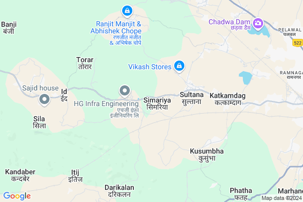
Simariya
Simariya Map
EDIT Map
Add Your House
 ..
..
Current Corona Virus Infected Patients Count in Hazaribagh District
| City Name | District Name | Total Covid cases |
|---|---|---|
| Hazaribagh District | Hazaribagh | 3 |
Locality Name :
Simariya
( सिमरिया )
Block Name : Katkamsandi
District : Hazaribagh
State : Jharkhand
Language : Hindi and Santali
Current Time 11:07 AM
Date: Tuesday , Apr 29,2025 (IST)
Time zone: IST (UTC+5:30)
Elevation / Altitude: 397 meters. Above Seal level
Telephone Code / Std Code: 06546
Assembly constituency : Hazaribagh assembly constituency
Assembly MLA : Manish Jaiswal
Lok Sabha constituency : Hazaribagh parliamentary constituency
Parliament MP : JAYANT SINHA
Serpanch Name :
Pin Code : 825302
Post Office Name : College More
Main Village Name : Simariya
Commodities Prices : Khunti Market / Mandi
Rivers Near Simariya
Mohana
Jhikia Nadi
Mohana
Jhikia Nadi
About Simariya
Correct below Info and add more info about SimariyaSimariya is a small Village/hamlet in Katkamsandi Block in Hazaribagh District of Jharkhand State, India. It comes under Simariya Panchayath. It is located 14 KM towards west from District head quarters Hazaribagh. 9 KM from Katkamsandi. 82 KM from State capital Ranchi
Simariya Pin code is 825302 and postal head office is College More .
Kusumbha ( 5 KM ) , Pasai ( 8 KM ) , Masratu ( 9 KM ) , Gadokhar ( 9 KM ) , Dhengura ( 10 KM ) are the nearby Villages to Simariya. Simariya is surrounded by Hazaribagh Block towards East , Barkagaon Block towards South , Sadar Block towards East , Keredari Block towards west .
Hazaribag , Patratu , Saunda , Churi are the near by Cities to Simariya.
This Place is in the border of the Hazaribagh District and Chatra District. Chatra District Pathalgada is west towards this place .
Demographics of Simariya
Hindi is the Local Language here.Politics in Simariya
Bharatiya Janata Party , BJP , INC are the major political parties in this area.Polling Stations /Booths near Simariya
1)P.s. Banadag West Part2)Up. M.s. Adra East Part
3)Union Library Lepo Road West Part
4)Up.m.s. Sultana Girls Urdu East Part
5)Up.m.s. Sirsi
HOW TO REACH Simariya
By Rail
There is no railway station near to Simariya in less than 10 km.Colleges near Simariya
Sariya College Suriya
Address :
Kisan Mazdoor Inter Science College
Address :
Karnpura College ,barkagaon
Address :
Bharat International Collage Bic
Address : Chouparan Hazaribag Jharkhrand
Bishnugarh Inter College Bishnugarh
Address :
Schools near Simariya
Jm Angel Public School
Address : Katkamsandi road Romi hazaribagh
Banadag High School, Banadag,hazaribag
Address : Village :-Banadag,
post office :- Sultana
Block:- Katkamdag
Police station:- Katkamdag(op)
Dist. :- Hazaribag
Pin:- 825319
Banadag High School, Banadag,hazaribag
Address : Village :-Banadag,
post office :- Sultana,
Block:- Katkamdag,
Police station:- Katkamdag(op),
Dist. :- Hazaribag,
Pin:- 825319
Urdu Middle School Khutra
Address : Urdu Middle school khutra, pabra, katkamsandi, hazaribag 825301
Govt Health Centers near Simariya
1) PHC SULTANA , Health sub sultna , Sonadavr Mohalla , Devi mandp2) HSC SULTANA , CHC Sultana , sultana , Davi Mandp
3) HSC KUSUMBHA , Helth sab center , Kusumbha , 0
Sub Villages in Simariya
Petrol Bunks in Simariya,Katkamsandi
Ramnagar Petrol pump
Rd Number 4; Jagdish Colony; Hazaribagh; Jharkhand 825301; India
12.2 KM distance Detail
more ..
Colleges in Simariya,Katkamsandi
Ram Lakhan Singh Colleg Jhumari Talaya
हजारीबाग मार्ग; Tota Bari Road; Vasuki Nagar; Ranchi; Jharkhand 834001; India
12.4 KM distance Detail
Iact Computer Education (BABA FARID INTER COLLEGE)
Hazaribagh; Khirgaon; Muslim Mohalla; Hazaribagh; Jharkhand 825301; India
13.4 KM distance Detail
Jajnery Institute of Technology (JIT)
opp- Vishal Mega Mart Pugmil Road; Mandai Rd; Hazaribagh; Jharkhand 825301; India
13.7 KM distance Detail
more ..
Schools in Simariya,Katkamsandi
international public school sultana hazaribagh
Adra Road; Sultana; Jharkhand 825302; India
2.8 KM distance Detail
Super Markets in Simariya,Katkamsandi
sahu Kirana & Stationary Shop
Hazaribagh - Katkamsandi Rd; Kachanpur; Jharkhand 825319; India
10.4 KM distance Detail
Police Stations near Simariya,Katkamsandi
Okni Police Station
Azad Nagar; Hashmiya Colony; Pugmil; Hazaribagh; Jharkhand 825301; India
13.3 KM distance Detail
Lohsinghna Police Station
Lohsingna Rd; Azad Nagar; Hashmiya Colony; Pugmil; Hazaribagh; Jharkhand 825301; India
13.3 KM distance Detail
Governement Offices near Simariya,Katkamsandi
Hazaribag Town Hall
Guru Gobind Singh Rd; NawabGanj; Hazaribagh; Jharkhand 825301; India
14.4 KM distance Detail
About Simariya &
History
How to reach Simariya
Tourist Places Near By Simariya
Schools in Simariya
Colleges in Simariya
Temperature & weather of Simariya
places in Simariya
Simariya photos
More Information
How to reach Simariya
Tourist Places Near By Simariya
Schools in Simariya
Colleges in Simariya
Temperature & weather of Simariya
places in Simariya
Simariya photos
More Information
Village Talk
Post News or Events about this Village
Near Cities
Hazaribag 12 KM near
Patratu 41 KM near
Saunda 41 KM near
Churi 43 KM near
Hazaribag 12 KM near
Patratu 41 KM near
Saunda 41 KM near
Churi 43 KM near
Near By Taluks
Katkamsandi 9 KM near
Hazaribagh 16 KM near
Barkagaon 17 KM near
Sadar 19 KM near
Katkamsandi 9 KM near
Hazaribagh 16 KM near
Barkagaon 17 KM near
Sadar 19 KM near
Near By Air Ports
Ranchi Airport 82 KM near
Gaya Airport 101 KM near
Patna Airport 201 KM near
Varanasi Airport 326 KM near
Ranchi Airport 82 KM near
Gaya Airport 101 KM near
Patna Airport 201 KM near
Varanasi Airport 326 KM near
Near By Tourist Places
Chatra 50 KM near
Koderma 64 KM near
Jhumri telaiya 65 KM near
Hazaribagh 77 KM near
Ranchi 79 KM near
Chatra 50 KM near
Koderma 64 KM near
Jhumri telaiya 65 KM near
Hazaribagh 77 KM near
Ranchi 79 KM near
Near By Districts
Hazaribagh 14 KM near
Chatra 49 KM near
Ramgarh 53 KM near
Koderma 73 KM near
Hazaribagh 14 KM near
Chatra 49 KM near
Ramgarh 53 KM near
Koderma 73 KM near
Near By RailWay Station
Patratu Rail Way Station 39 KM near
Ray Rail Way Station 40 KM near
Patratu Rail Way Station 39 KM near
Ray Rail Way Station 40 KM near