| Home | City Bus | Maps | Villages | Cities | Rail | Tourist Places | School | College | Pin Codes | Corona Cases Count |
| Distance Calculator Bus Services IFSC Codes Trace Mobile Number Weather Search Place Trace IP Available Cash ATM/Banks Locate Polling Booth Report an Error contact People |
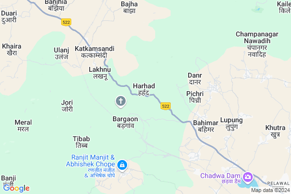
Harhad
Harhad Map
EDIT Map
Add Your House
 ..
..
Current Corona Virus Infected Patients Count in Hazaribagh District
| City Name | District Name | Total Covid cases |
|---|---|---|
| Hazaribagh District | Hazaribagh | 3 |
Locality Name :
Harhad
( हरहद )
Block Name : Katkamsandi
District : Hazaribagh
State : Jharkhand
Language : Hindi and Santali
Current Time 10:56 AM
Date: Friday , Apr 25,2025 (IST)
Time zone: IST (UTC+5:30)
Elevation / Altitude: 397 meters. Above Seal level
Telephone Code / Std Code: 06546
Assembly constituency : Hazaribagh assembly constituency
Assembly MLA : Manish Jaiswal
Lok Sabha constituency : Hazaribagh parliamentary constituency
Parliament MP : JAYANT SINHA
Serpanch Name :
Pin Code : 825319
Post Office Name : Reformatory School
Main Village Name : Harhad
Commodities Prices : Khunti Market / Mandi
Harhad Live Weather
Temperature: 38.2 °C
clear sky
Humidity: 4%
Wind : 4.04 mt/sec towards W
StationName : "Hazaribagh"
observed on 1 Hours Back
Temperature: 38.2 °C
clear sky
Humidity: 4%
Wind : 4.04 mt/sec towards W
StationName : "Hazaribagh"
observed on 1 Hours Back
Harhad Weather Forecast for Next 5 days
26-04-2025
27.3°C to 40.6°C
clear sky
27.3°C to 40.6°C
clear sky
27-04-2025
27.3°C to 42.6°C
clear sky, few clouds, scattered clouds, broken clouds
27.3°C to 42.6°C
clear sky, few clouds, scattered clouds, broken clouds
28-04-2025
24.7°C to 37.8°C
few clouds, overcast clouds, broken clouds
24.7°C to 37.8°C
few clouds, overcast clouds, broken clouds
29-04-2025
21.6°C to 35.5°C
overcast clouds, light rain, broken clouds, scattered clouds
21.6°C to 35.5°C
overcast clouds, light rain, broken clouds, scattered clouds
30-04-2025
20.9°C to 32.0°C
few clouds, broken clouds, overcast clouds, moderate rain
20.9°C to 32.0°C
few clouds, broken clouds, overcast clouds, moderate rain
Rivers Near Harhad
Mohana
Jhikia Nadi
Mohana
Jhikia Nadi
About Harhad
Correct below Info and add more info about HarhadHarhad is a small Village/hamlet in Katkamsandi Block in Hazaribagh District of Jharkhand State, India. It comes under Harhad Panchayath. It is located 19 KM towards west from District head quarters Hazaribagh. 6 KM from Katkamsandi. 96 KM from State capital Ranchi
Harhad Pin code is 825319 and postal head office is Reformatory School .
Lupung ( 7 KM ) , Champanagar Nawadih ( 10 KM ) , Khutra ( 11 KM ) , Gadokhar ( 12 KM ) , Shahpur ( 13 KM ) are the nearby Villages to Harhad. Harhad is surrounded by Padma Block towards East , Pathalgada Block towards west , Hazaribagh Block towards East , Sadar Block towards East .
Hazaribag , Chatra , Saunda , Jhumri Tilaiya are the near by Cities to Harhad.
This Place is in the border of the Hazaribagh District and Chatra District. Chatra District Pathalgada is west towards this place .
Harhad 2011 Census Details
Harhad Local Language is Hindi. Harhad Village Total population is 332 and number of houses are 68. Female Population is 47.0%. Village literacy rate is 54.5% and the Female Literacy rate is 20.5%.
Population
| Census Parameter | Census Data |
| Total Population | 332 |
| Total No of Houses | 68 |
| Female Population % | 47.0 % ( 156) |
| Total Literacy rate % | 54.5 % ( 181) |
| Female Literacy rate | 20.5 % ( 68) |
| Scheduled Tribes Population % | 9.9 % ( 33) |
| Scheduled Caste Population % | 3.6 % ( 12) |
| Working Population % | 30.7 % |
| Child(0 -6) Population by 2011 | 60 |
| Girl Child(0 -6) Population % by 2011 | 40.0 % ( 24) |
Harhad Census More Deatils.
Politics in Harhad
Bharatiya Janata Party , BJP , INC are the major political parties in this area.Polling Stations /Booths near Harhad
1)Up. M.s. Khutra West Part2)Up.m.s. Sultana Girls Urdu West Part
3)Munka Bagicha Dharamshala S.part
4)P.s. Hathamerhi West Part
5)P.s. Kud
HOW TO REACH Harhad
By Rail
There is no railway station near to Harhad in less than 10 km.Colleges near Harhad
Sariya College Suriya
Address :
Kisan Mazdoor Inter Science College
Address :
Karnpura College ,barkagaon
Address :
Bharat International Collage Bic
Address : Chouparan Hazaribag Jharkhrand
Bishnugarh Inter College Bishnugarh
Address :
Schools near Harhad
Jm Angel Public School
Address : Katkamsandi road Romi hazaribagh
Banadag High School, Banadag,hazaribag
Address : Village :-Banadag,
post office :- Sultana
Block:- Katkamdag
Police station:- Katkamdag(op)
Dist. :- Hazaribag
Pin:- 825319
Banadag High School, Banadag,hazaribag
Address : Village :-Banadag,
post office :- Sultana,
Block:- Katkamdag,
Police station:- Katkamdag(op),
Dist. :- Hazaribag,
Pin:- 825319
Urdu Middle School Khutra
Address : Urdu Middle school khutra, pabra, katkamsandi, hazaribag 825301
Govt Health Centers near Harhad
1) HSC HARHAD , Health Sub center Harhad , Harhad , Middle school Harhad2) HSC Hathkauna , Helth sab Hathkauna , Hathkauna , pramriy school Hathkauna
3) HSC DANDH , Health sub Dandh , Hatkaona , 0
Sub Villages in Harhad
Hospitals in Harhad,Katkamsandi
White Circle Hospital
825301; Hashmiya Colony; Pugmil; Hazaribagh; Jharkhand 825301; India
15.9 KM distance Detail
more ..
Petrol Bunks in Harhad,Katkamsandi
Car Care ; Car Washing Solution
Jhanda Chowk Bari Bazar; Subhash Marg; Bara Bazar; Matwari; Hazaribagh; Jharkhand 825301; India
14.8 KM distance Detail
Hazaribagh Fuel Station
Hazaribagh; Hashmiya Colony; Pugmil; Hazaribagh; Jharkhand 825301; India
15.8 KM distance Detail
Indian Petrol Pump
Hashmiya Colony; Pugmil; Hazaribagh; Jharkhand 825301; India
15.8 KM distance Detail
more ..
Colleges in Harhad,Katkamsandi
Ram Lakhan Singh Colleg Jhumari Talaya
हजारीबाग मार्ग; Tota Bari Road; Vasuki Nagar; Ranchi; Jharkhand 834001; India
15.9 KM distance Detail
Jajnery Institute of Technology (JIT)
opp- Vishal Mega Mart Pugmil Road; Mandai Rd; Hazaribagh; Jharkhand 825301; India
16.6 KM distance Detail
more ..
Schools in Harhad,Katkamsandi
BM. GURUVANSH HIGH SCHOOL .MAIN ROAD;LUPUNG;HAZARIBAGH
Lupung; Jharkhand 825319; India
8.0 KM distance Detail
Electronic Shops in Harhad,Katkamsandi
punam Mobile& Studio;Csc Centre
Hazaribagh - Katkamsandi Rd; Kachanpur; Jharkhand 825319; India
9.0 KM distance Detail
Super Markets in Harhad,Katkamsandi
sahu Kirana & Stationary Shop
Hazaribagh - Katkamsandi Rd; Kachanpur; Jharkhand 825319; India
9.1 KM distance Detail
Police Stations near Harhad,Katkamsandi
Okni Police Station
Azad Nagar; Hashmiya Colony; Pugmil; Hazaribagh; Jharkhand 825301; India
16.4 KM distance Detail
Lohsinghna Police Station
Lohsingna Rd; Azad Nagar; Hashmiya Colony; Pugmil; Hazaribagh; Jharkhand 825301; India
16.4 KM distance Detail
About Harhad &
History
How to reach Harhad
Tourist Places Near By Harhad
Schools in Harhad
Colleges in Harhad
Temperature & weather of Harhad
places in Harhad
Harhad photos
More Information
How to reach Harhad
Tourist Places Near By Harhad
Schools in Harhad
Colleges in Harhad
Temperature & weather of Harhad
places in Harhad
Harhad photos
More Information
Village Talk
Post News or Events about this Village
Near Cities
Hazaribag 17 KM near
Chatra 44 KM near
Saunda 53 KM near
Jhumri Tilaiya 53 KM near
Hazaribag 17 KM near
Chatra 44 KM near
Saunda 53 KM near
Jhumri Tilaiya 53 KM near
Near By Taluks
Katkamsandi 5 KM near
Padma 19 KM near
Hazaribagh 19 KM near
Pathalgada 20 KM near
Katkamsandi 5 KM near
Padma 19 KM near
Hazaribagh 19 KM near
Pathalgada 20 KM near
Near By Air Ports
Gaya Airport 89 KM near
Ranchi Airport 95 KM near
Patna Airport 189 KM near
Varanasi Airport 319 KM near
Gaya Airport 89 KM near
Ranchi Airport 95 KM near
Patna Airport 189 KM near
Varanasi Airport 319 KM near
Near By Tourist Places
Chatra 44 KM near
Koderma 54 KM near
Jhumri telaiya 55 KM near
Hazaribagh 74 KM near
Bodh Gaya 82 KM near
Chatra 44 KM near
Koderma 54 KM near
Jhumri telaiya 55 KM near
Hazaribagh 74 KM near
Bodh Gaya 82 KM near
Near By Districts
Hazaribagh 18 KM near
Chatra 44 KM near
Koderma 63 KM near
Ramgarh 64 KM near
Hazaribagh 18 KM near
Chatra 44 KM near
Koderma 63 KM near
Ramgarh 64 KM near
Near By RailWay Station
Ray Rail Way Station 51 KM near
Patratu Rail Way Station 51 KM near
Ray Rail Way Station 51 KM near
Patratu Rail Way Station 51 KM near